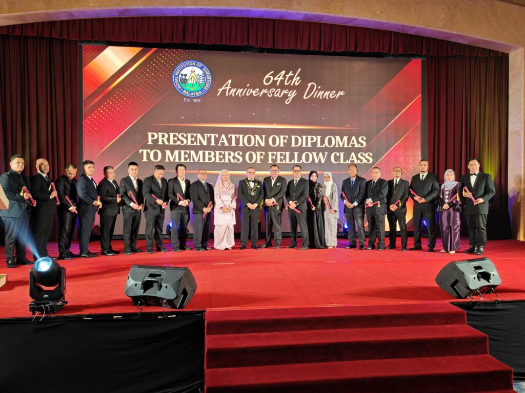
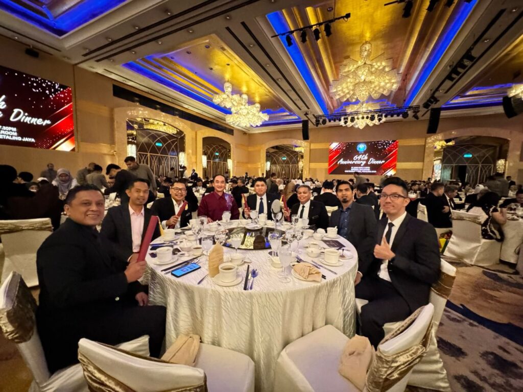
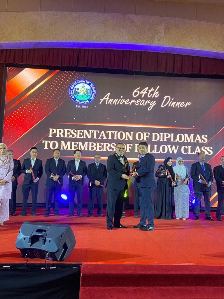
21 JUNE 2025 | Royal Institution of Surveyors Malaysia 64th Anniversary Dinner, marking another milestone in the institution’s rich history. This evening was made even more memorable with the elevation of members to Fellow status, which make a significant testament to my professional contributions and active involvement within the surveying community. A sincere gratitude to RISM Johor Branch for the strong support and recommendation in uplifting my membership. Congratulations to all newly elevated Fellows members. Events like this reinforce our unity and dedication to advancing the profession.
Together, we celebrate. Together, we grow!
Posted inUncategorized|Comments Off on 64TH RISM ANNIVERSARY DINNER 2025
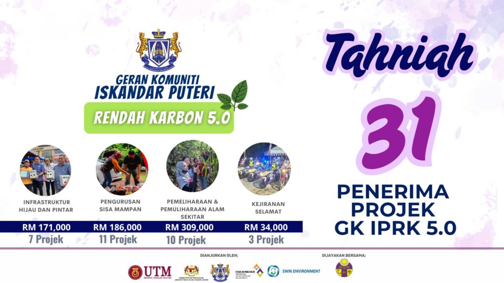
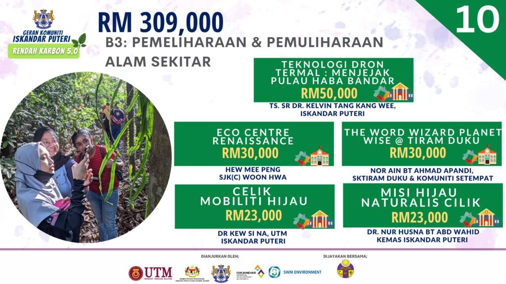
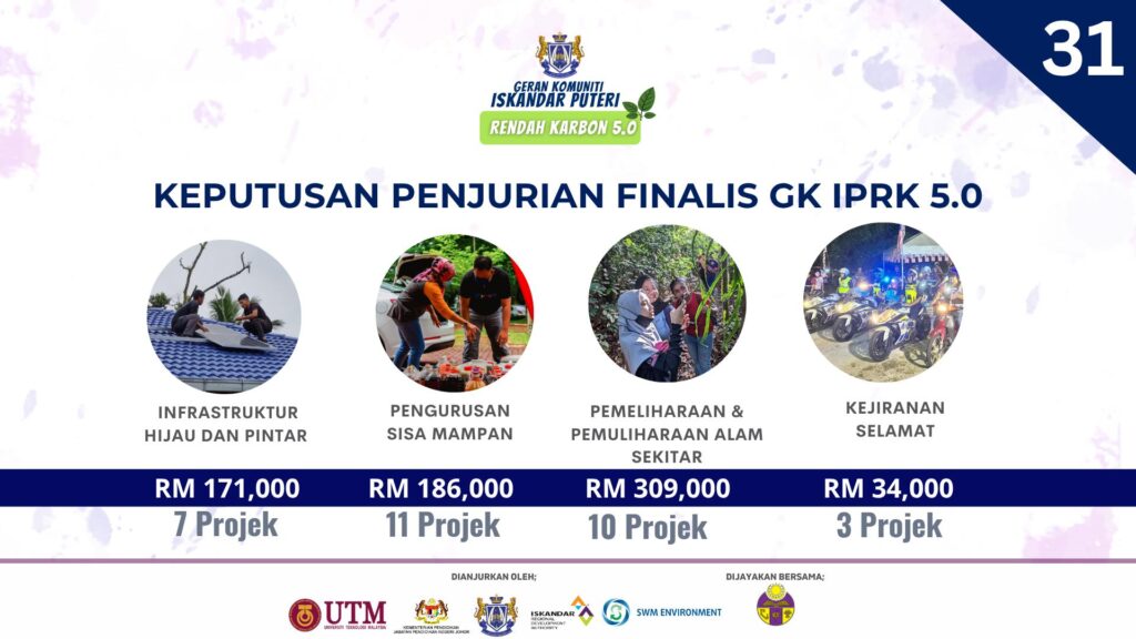
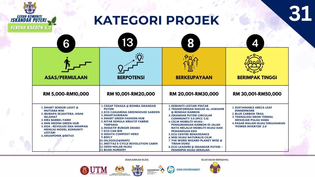
Tahniah diucapkan kepada kesemua 31 penerima Geran Iskandar Puteri Rendah Karbon 5.0 (GK IPRK5.0)
Pihak penganjur Majlis Bandaraya Iskandar Puteri (MBIP) dengan kerjasama Universiti Teknologi Malaysia (UTM), Iskandar Regional Development Authority (IRDA), Jabatan Pendidikan Negeri Johor (JPNJ), SWM Environment dan Puspanita Johor merakamkan setinggi-tinggi tahniah kepada 31 ketua projek yang berjaya menerusi
Bidang keutamaan:
Infrakstruktur Hijau dan Pintar
Pengurusan Sisa yang Mampan
Pemeliharaan dan Pemuliharaan Alam Sekitar
Kejiranan Selamat
Fokus Projek merentas bidang keutamaan
Pertanian dan Sekuriti Makanan
Adaptasi dan Mitigasi Iklim
Pendidikan dan Kesedaran
Semoga dengan penawaran geran ini, kesejahteraan penduduk di Iskandar Puteri tercapai melalui segala usaha yang dijalankan bersama komuniti dapat dilaksanakan secara dinamik, inklusif dan holistik