Hydrography is the science that measures and describes the physical features of the navigable portion of the Earth’s surface and adjoining coastal areas. Hydrographic surveyors study these bodies of water to see how the “seabed” looks like. Determining the seabed topography and monitoring any seafloor changes are considered a necessity in producing hydrographic plans and nautical charts to support marine navigation, management of environmental protection, exploration and exploitation of marine resources, marine construction and engineering as well as the marine science and oceanographic research activities.
The increasing interest and high growing demands for accurate and high-resolution bathymetric measurements have increased extensively, especially in the shallow near-shore coastal regions which are normally embraced with intensive anthropogenic activities. Erosion lead by unmonitored sedimentation in the coastal and shallow water area can increase the risk of flash flooding and damage to coastal defences.
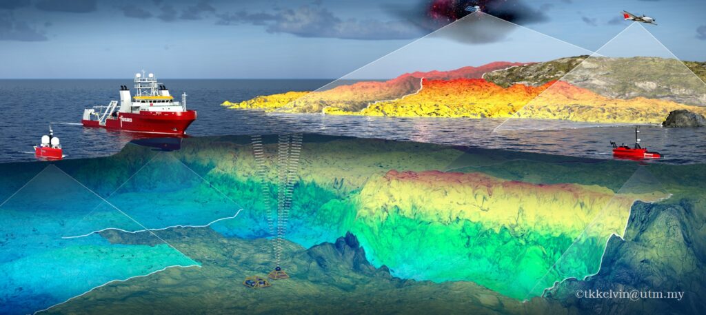
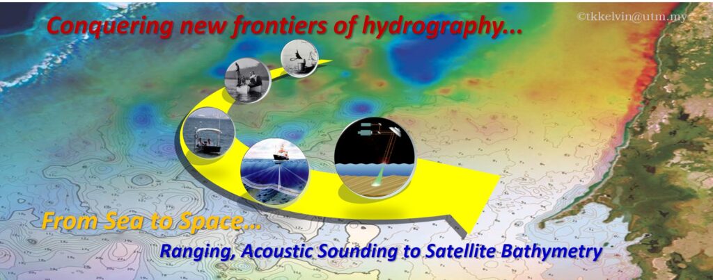
Contemporary science and technology are continuously developing with many methods of studying the sea and to map the seabed comprehensively. Traditionally, hydrographic surveyors use pre-measured lead lines, sounding pole and wire drag to retrieve a single point’s depth at once. To date, acoustic hydrographic surveys such as single beam echo sounding system (SBES), multi-transducer sweep system and multibeam echo sounding system (MBES) are generally utilised by hydrographers around the globe to deliver profoundly bathymetric data. Nonetheless they are constrained by mobilization difficulties, small survey coverage and exhaustive operational costs over the shallow water regions. Significant changes within a short period may not practical to be attempted using those timely consuming and labour intensive vessel-based approaches.
Today, the ability of electromagnetic spectrum to penetrate water column has brought in new revolution the hydrographic surveying. With the GIS & remote Sensing technique, it allows us to unlock the secrets of our seabed with our naked eyes, and gain meaningful information out from the sensed imagery. For instance, satellite-derived bathymetry (SDB) has become more and more popular due to its broad spatial coverage and flexibility. Also, it does not require extensive amount of effort, time and money when it comes to the near shore and coastal region. The fundamental principle of SDB is estimates the water depth of the designated pixel values of the satellite images.
The possibility of using remote sensing technology in bathymetric surveying has been addressed as early as the late 1960s. Since then, numerous studies have been carried out on demonstrating the feasibility of using remotely-sensed data in bathymetry. Throughout the past two decades, numerous studies have been carried out on demonstrating the feasibility of using remotely-sensed data in near shore bathymetry mapping. Due to high efficiency, large coverage and not being limited by the spatial regulation, SDB has become one of the important sources to acquire geospatial information including bathymetric depths.
Literaturely, the visible electromagnetic spectrum (EMR), can penetrate up to 15 meters in clear water. Today, SDB has proven itself not only as a beneficial reconnaissance tool for near-shore bathymetric mapping; but also being utilised as an alternative source of data by some remarkable hydrographic offices (e.g. SHOM, NOAA, UKHO, etc.) in assisting their nautical chart production.
About kelvin
Kelvin Kang Wee, TANG received his B. Eng. (Geomatic) (Hons.) from Universiti Teknologi Malaysia (UTM) and Master of Remote Sensing & GIS from Universiti Putra Malaysia (UPM). He completed his Ph.D (Hydrography) from UTM in April 2021. Apparently, he is a Senior Lecturer in the Faculty of Built Environment and Surveying, UTM. His area of interest is in marine positioning, hydrographic surveying, hydrospatial management and imagery-derive bathymetry using satellite remote sensing approach.