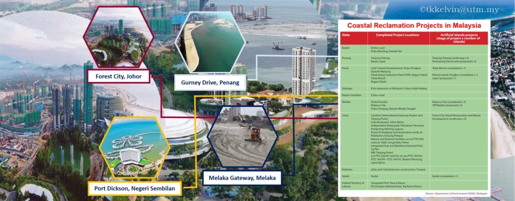
Over the past 20 years, the rapid development activities run not limited in mainland, but also go off towards the extremely versatile and vulnerable coastal region. Land reclamation has been used for centuries to create new, usable land from the sea, lakes and rivers, to provide extra space that can be put to economic use. The simplest method of land reclamation involves simply filling the area with large amounts of heavy rock and/or cement, then filling with clay and soil until the desired height is reached.
Reclamation has gobbled up swaths of the sea along Malaysia’s coastal belts, creating a man-made landscape of homes. Conversely, these mega commercial and residential developments also brought in harmful impacts to our environment, for example coastal morphology, hydro-oceanography, mangrove and coral reefs deterioration, etc.
Hence, it is vital for our respective government bodies to monitor the land accretion and abrasion due to these intense man-made activities. Likewise, repetitive bathymetric survey is required to obtain the new bathymetric depths and then update into hydrospatial database. However, sorry to say, today most of these uplifted features are not yet been updated in neither in our topographic maps nor navigation charts. These outdated information may post potential hazards to the fisherman, mariners or any other maritime users.