
QINGDAO, 14 Nov 2025 – The Steering Committee for Malaysia’s FIG/IHO/ICA Hydrography Programmes from Universiti Teknologi Malaysia (UTM) undertook a courtesy visit to the Shandong University of Science and Technology (SDUST) in China. The visit was arranged in conjunction with the FIG/IHO/ICA Intersessional Meeting and Stakeholder Workshop held in Qingdao, China, from 9 to 14 November 2025. The purpose of this reciprocal visit was to strengthen bilateral ties in research collaboration and student mobility following SDUST’s visit to UTM the previous year.
The UTM delegation was led by Associate Professor Sr Dr. Ami Hassan Md Din, Chairman of the Steering Committee. The delegation also included seven (7) committee members from the Department of Geoinformation, Faculty of Built Environment and Surveying (FABU), which comprised Prof. LSr Dr. Mohd Razali Mahmud, Sr Dr. Khairulnizam M. Idris, Sr Dr. Muhammad Imzan Hassan, Sr Dr. Mohd Farid Mohd Ariff, Sr Dr. Abd Wahid Rasib, Sr Dr. Mohammad Hanif Hamden and Sr Dr. Kelvin Tang Kang Wee.
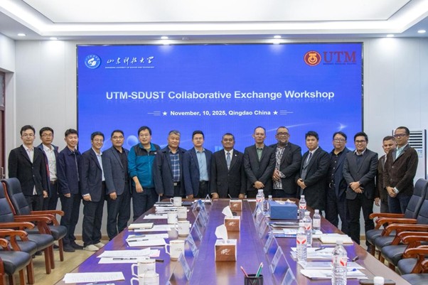
This visit facilitated strategic dialogue not only between UTM and SDUST but also created valuable connections with wider international academic and professional communities. Serving as a dynamic platform for fostering cooperation, it enabled participants to share cutting-edge developments in geospatial technology while strengthening professional networks in hydrographic surveying and geomatics. Through these interactions, attendees gained deep insights into advanced innovations across hydrographic surveying, remote sensing, and marine geodesy applications, while simultaneously developing a stronger framework for future research collaborative initiatives.
Beyond the collaborative discussions between SDUST and UTM, our delegation was also invited to conduct a technical visit to the Qingdao Tidal Benchmark Station. This historic well, situated within Guanxiang Shan Park, serves as the foundation for China’s National Vertical Datum 1985 (1985 National Height Datum), where the mean sea level (MSL) observed at this station serves as the zero-elevation reference point for the entire national height system. Every elevation recorded in surveying and mapping across China is ultimately referenced to this official reference point located along Qingdao’s coastline. This unique visit successfully blended appreciation for traditional scientific precision with visions of future technological advancement, reflecting the continuity between scholarly heritage and innovation that underpins today’s geospatial field.
This program was significantly enriched by a visit to the Qingdao Naval Museum, located along the city’s picturesque coastline, which provided a comprehensive look into China’s naval heritage through its display of warships, submarines, and maritime artifacts that trace the evolution of the nation’s sea power. This experience not only offered an engaging opportunity for maritime and history enthusiasts but also delivered a crucial professional context, highlighting the strategic importance of hydrographic surveying and precise maritime positioning in supporting naval operations, ensuring safe navigation, and maintaining maritime security, thereby creating a direct connection between historical naval development and modern geospatial applications.
The program was further enhanced by two (2) technical visits focused on hydrographic and geospatial fields to establish collaboration with the local industry. First, the UTM delegation attended a technology update session and sea trial organized by Beijing Hydro-Tech Marine Technology Co. Ltd. Participants were introduced to live demonstrations of Multibeam Echo Sounder (MBES) and Side Scan Sonar (SSS) systems aboard the Hydro-Tech research vessel. This hands-on experience provided deep insights into the practical applications of cutting-edge hydrographic surveying technology.
Furthermore, a second, highly substantive technical visit was meticulously arranged to Qingdao Yuehai Information Services Limited, a specialized firm at the forefront of marine data solutions. The session provided the delegation with an immersive deep-dive into state-of-the-art geospatial technologies, encompassing sophisticated marine geographic information systems (GIS) and the architecture of large-scale marine databases. This collaborative engagement is poised to serve as a critical catalyst, marking a definitive stride in fortifying bilateral cooperation and fostering pioneering innovation in the interconnected fields of marine administration and hydrospatial domain.
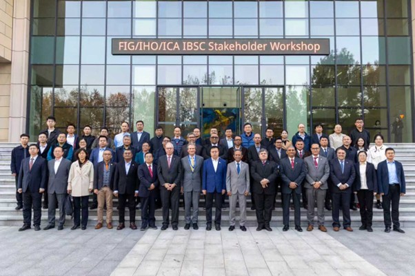
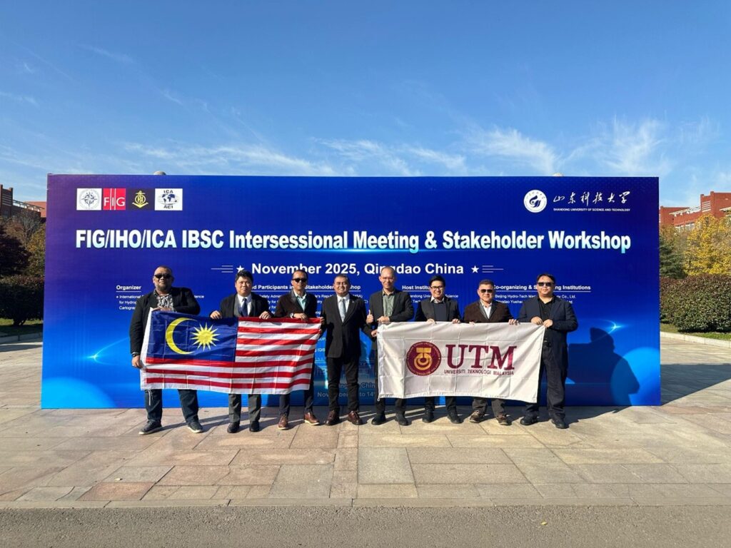
The summit of the visit was the landmark FIG/IHO/ICA IBSC Intersessional Meeting & Stakeholder Workshop 2025. This inaugural international meeting was hosted by the International Board on Standards of Competence for Hydrographic Surveyors and Nautical Cartographers (IBSC) at SDUST’s Qingdao campus, successfully convening twelve (12) prominent local and international institutions and government agencies. These included the China Maritime Safety Administration (MSA), the Chinese Society of Geodesy, Photogrammetry and Cartography (CSGPC), the Chinese Society for Oceanography (CSO), the Chinese Society of Oceanology and Limnology (CSOL), the First Institute of Oceanography, Ministry of Natural Resources (FIO), Universiti Teknologi Malaysia (UTM), Institut Teknologi Bandung (ITB) from Indonesia, Ocean University of China (OUC), China University of Petroleum (UPC), Dalian Maritime University (DMU), Qingdao Institute of Surveying and Mapping (QISM) and the host, SDUST. This gathering served as an invaluable platform for connecting with global academic and industry stakeholders to chart the future direction of hydrographic surveying education and the standard of competency. Furthermore, it represented a significant stride forward in advancing professional standards and capacity building for the field.
Overall, the visit successfully established an excellent platform for knowledge exchange, professional networking, and developing stronger collaborative projects in hydrographic surveying and geomatics between UTM and its valued partner, Shandong University of Science and Technology (SDUST) in China. This collaboration represents not an ending, but it’s rather the exciting launch of a new chapter, where UTM will engage in more dynamic and innovative partnerships worldwide. These efforts have established a solid foundation for UTM to emerge as an acknowledged leader in marine administration and the hydrospatial domain, extending its influence beyond Southeast Asia to the global stage.
