
Tides are the rise and fall of sea levels caused by gravitational forces exerted by the Moon and Sun, by Earth’s rotation and by centrifugal force caused by Earth’s progression around the Earth-Moon barycenter.
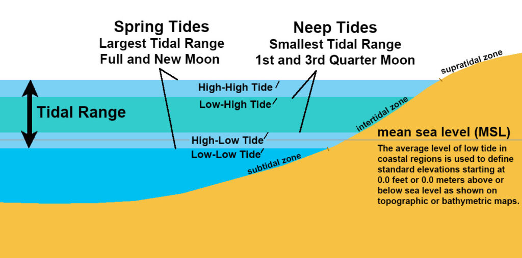
Tidal range is the difference in height between high tide and low tide. Tidal range variation depends on time and location. It can vary based on the type of tide pattern at a location. Diurnal tides have one high tide and one low tide per day, while semidiurnal tides have two high tides and two low tides each day, roughly of equal height. Mixed tides are a combination of diurnal and semidiurnal patterns, resulting in unequal high and low tides.
Larger tidal range occur during spring tides (spring range), when the gravitational forces of both the Moon and Sun are aligned (at syzygy), reinforcing each other in the same direction (new moon) or in opposite directions (full moon). The largest annual tidal range can be expected around the time of the equinox if it coincides with a spring tide. Spring tides occur at the second and fourth (last) quarters of the lunar phases.
By contrast, during neap tides, when the Moon and Sun’s gravitational force vectors act in quadrature (making a right angle to the Earth’s orbit), the difference between high and low tides (neap range) is smallest. Neap tides occur at the first and third quarters of the lunar phases.
A tide gauge is an instrument used to measure and record the changes in sea level over time, particularly the rise and fall of tides in oceans, seas, and other bodies of water. Tide gauges are crucial tools for monitoring tidal patterns, studying coastal processes, assessing sea level changes, and providing data for navigation, environmental research, and disaster management. In Malaysia, these tidal data observation and prediction for coastal areas are conducted by Department of Survey and Mapping Malaysia (JUPEM) and National Hydrographic Centre (PHN).
