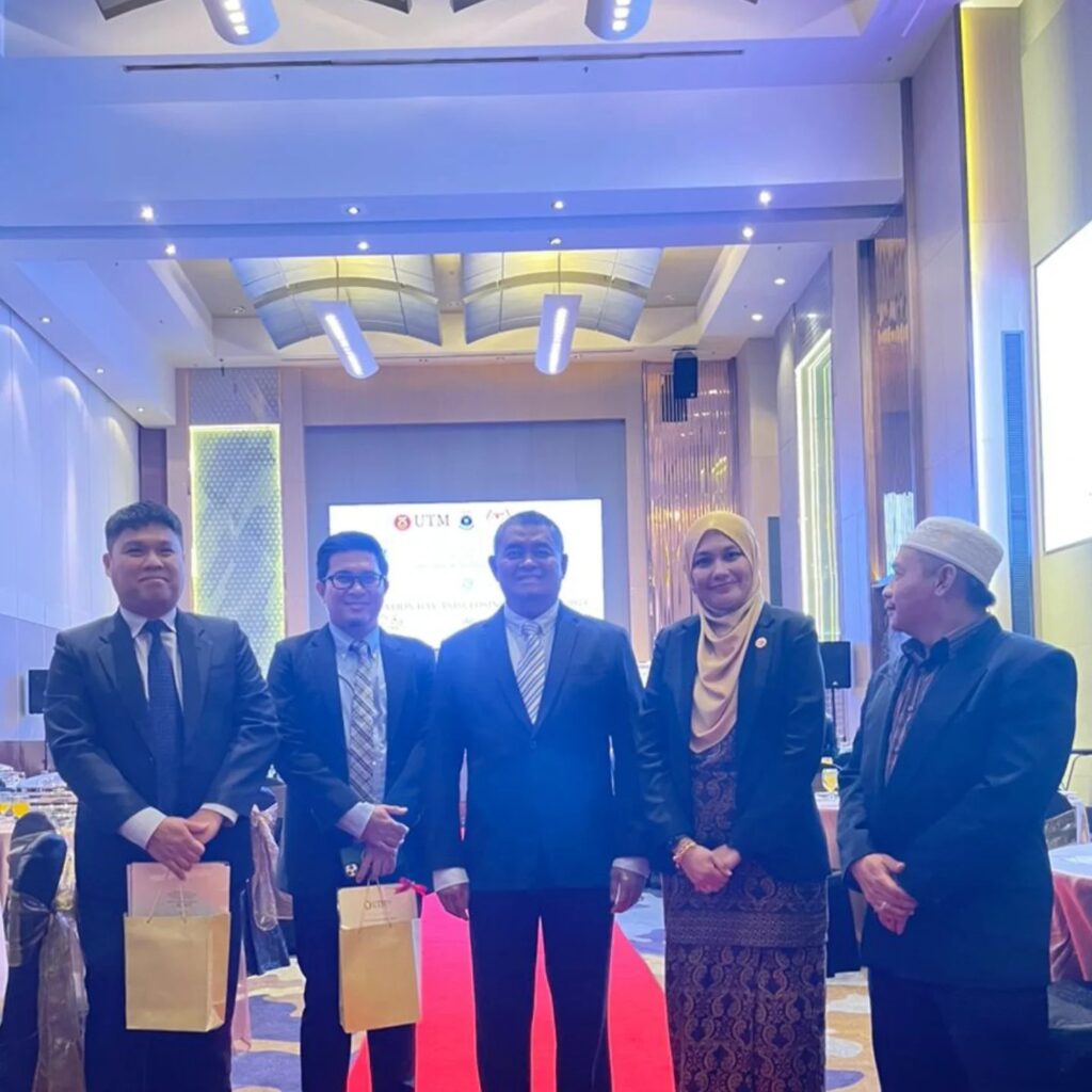
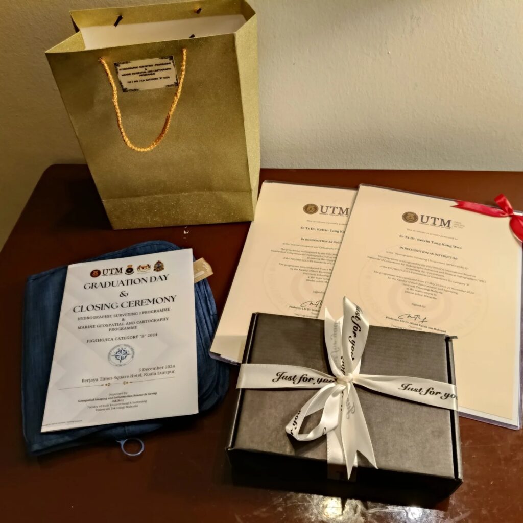
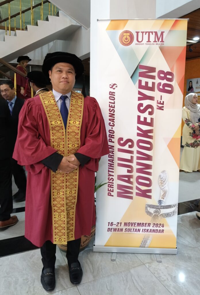
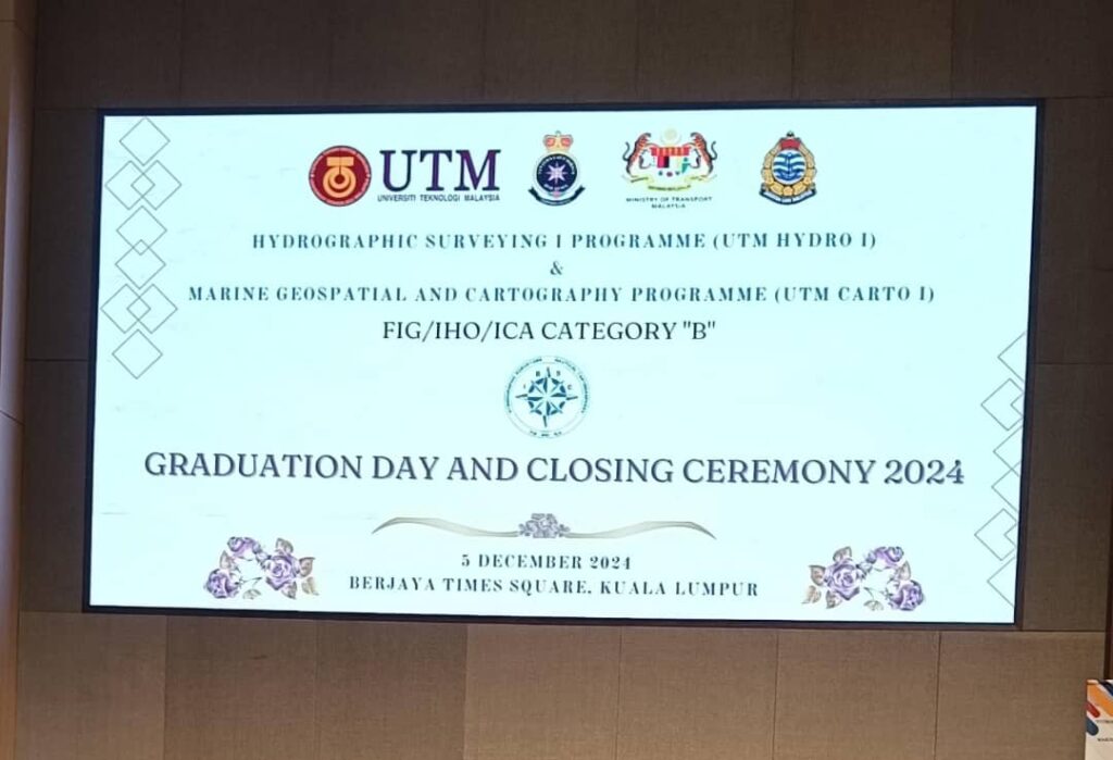
What is Geomatics Engineering @UTM?

Geomatics Engineering is an academic discipline that concerns on acquisition, analysis, and interpretation of mainly geospatial data, relating to the Earth, its physical features and the built environment. It comprises tools and techniques of measuring, managing, presenting and analyzing geospatial data from diverse sources with well-defined characteristics on accuracy and continuity; and in the form of digital format. Geospatial data are obtained from a wide range of technologically advanced tools like total station, Global Positioning System (GPS) / Global Navigation Satellite System (GNSS) equipment, digital aerial imagery (form both satellite and airborne), Terrestrial Laser Scanner (TLS), Unmanned Aerial Vehicle (UAV), echo sounder and Ground Penetrating Radar (GPR). These data are processed and manipulated by using a computer and the latest software. Also included in the area of geospatial are computer-based Geographic Information Systems (GIS) and remote sensing for monitoring the environment. is an academic discipline that concerns on acquisition, analysis, and interpretation of mainly geospatial data, relating to the Earth, its physical features and the built environment. It comprises tools and techniques of measuring, managing, presenting and analyzing geospatial data from diverse sources with well-defined characteristics on accuracy and continuity; and in the form of digital format. Geospatial data are obtained from a wide range of technologically advanced tools like total station, Global Positioning System (GPS) / Global Navigation Satellite System (GNSS) equipment, digital aerial imagery (form both satellite and airborne), Terrestrial Laser Scanner (TLS), Unmanned Aerial Vehicle (UAV), echo sounder and Ground Penetrating Radar (GPR). These data are processed and manipulated by using a computer and the latest software. Also included in the area of geospatial are computer-based Geographic Information Systems (GIS) and remote sensing for monitoring the environment.

Apa itu Kejuruteraan Geomatik @UTM?

Kejuruteraan Geomatik merupakan satu disiplin akademik yang berkaitan dengan pengumpulan,  analisis, dan pentafsiran data geospatial, berkaitan dengan bumi, ciri-ciri fizikalnya dan alam persekitaran. Ia merangkumi peralatan-peralatan dan teknik-teknik pengukuran, pengurusan, persembahan  dan analisis data geospatial daripada pelbagai sumber dengan ciri-ciri khusus secara tepat dan menyeluruh; dalam bentuk digital. Data geospatial boleh diperolehi daripada pelbagai peralatan teknologi baru yang canggih seperti Global Positioning System (GPS) / Global Navigation Satellite System (GNSS), imej penderiaan jauh digital (daripada satelit dan pesawat udara), Terrestrial Laser Scanner (TLS), Unmanned Aerial Vehicle (UAV), sistem pemerum gema and Ground Penetrating Radar (GPR). Data-data tersebut diproses dan dimanipulasi dengan menggunakan komputer dan perisian terkini. Ia turut termasuk Sistem Maklumat Geografi (GIS) yang berasaskan komputer dan sistem penderiaan jauh untuk memantau perubahan alam sekitar.

Posted in Uncategorized | Tagged , , , , | Comments Off on What is Geomatics Engineering @UTM?

50 Years – Bachelor of Geomatics Engineering @UTM

Bachelor of Geomatics Engineering with Honours is one of the oldest programme in UTM. It was first introduced in the early 1970s. Prior to 1994, the programme was known as Bachelor of Surveying (Land). This bachelor programme strives to deliver a quality educational experience via emerging geomatics technologies towards providing a significant contribution to the needs of the surveying and Geomatics Engineering profession nationwide.

50 Tahun – Sarjana Muda Kejuruteraan Geomatik @UTM

Sarjana Muda Kejuruteraan Geomatik dengan Kepujian merupakan salah satu program yang tertua di UTM. Ia telah mula diperkenalkan pada awal 1970-an. Sebelum tahun 1994, program ini dikenali sebagai Sarjana Muda Ukur (Tanah). Program sarjana muda ini bermatlamat menyampaikan pendidikan berkualiti melalui pendedahan teknologi geomatik yang baru ke arah memberikan sumbangan penting kepada profesion ukur dan kejuruteraan geomatik di seluruh negara. 

Posted in Uncategorized | Tagged , , , , | Comments Off on 50 Years – Bachelor of Geomatics Engineering @UTM

Lighthouse Day – August 7th

Happy Lighthouse day! The main purpose of a lighthouse is as a navigation aid notifying mariners of dangerous shallows, rocky coast, and important locations by using bright lights and/or fog horns. The messages are simple: “STAY AWAY”, “DANGER”, “BEWARE!”, or “COME THIS WAY!” Today, lighthouses still guide mariners however lighted navigational aids, buoys, radar beacons, and other aids to navigation are also used to aid with navigation.

Posted in Uncategorized | Tagged , , , | Comments Off on Lighthouse Day – August 7th