Drone and their services
Drone or Unmanned Aerial Vehicle (UAV) is an emerging technology that built flying robots that can be remote-controlled or flown autonomously using software-controlled flight plans in their embedded onboard computers. In addition, commercial drone services support industries, such as agriculture, construction, search and rescue, package delivery, industrial inspection, land surveying, aerial videography, and traffic management. Drone service providers are focused on ensuring their drones match customers’ needs, so the abilities required may vary in different markets. Thus, drones may be equipped with a range of high-definition or thermal cameras, selected sensors, custom-made gadgets, or piloting-related software for Ground Control System (GSC), analyzing captured data and real-time checking for compliance. Although commercial drones are gaining popularity, the development of their services still varies widely across industries and regional communities.

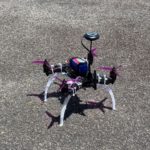

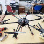
Automated Aircraft Inspection Drone (AID)
Drone technology has reached a great level of reliability, efficiency, and a new level of affordability. However, the implementation of this technology is very different from one case to another depending on the expected functionalities and capabilities. This project aims to set-up a Proof of Concept (POC) of an automated aircraft maintenance system using a drone, ‘Internet of Things’ (IoT)-connected equipment, and augmented reality technology as an innovative maintenance tool for aircraft inspection inside a hangar. Automated Aircraft Inspection Drone (AID) is an integrated system that demonstrates a functioning autonomous drone, flying and photographing landed aircraft using camera, and relay all the images back to dashboard system, which further integrates with aircraft technical documentation and aircraft in-service data collected earlier. During analysis, the inspection software localizes and measure visual damage on the aircraft’s surface by comparing it with the aircraft’s digital mock-up using machine learning. By the end of this project, a comprehensive report will be provided, a full-scale product together with the demonstration of a drone, artificial intelligence, and augmented reality device for aircraft maintenance.
Panic button, perimeter surveillance and follow me mode
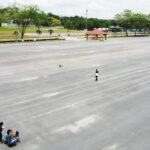
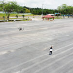
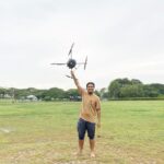
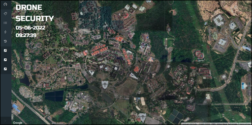
The deployment of IoT on campus can revolutionize drone technology for a comprehensive campus security and surveillance system. Existing security systems consist of the usage of CCTV and guard patrolling for surveillance which only covers the accessible areas but not the whole campus perimeter as total. Therefore, in this project, an IoT-based drone technology is produced. The cloud database management system for the drone comprises a web-browser for live-monitoring, control, and configuration while providing complete visibility of uploaded data in real-time for instant activities reports and logs. Other possible features are auto return to launching pad, first aid kit transporter, emergency responder (panic button), and perimeter patrolling with geofencing for authorized users. The drone will be equipped with a free carbon emission propulsion system and low-noise electric motors with a maximum range of coverage up to 10 km and it can be deployed in a very confined area.
Drone navigation using 3g and customized dashboard
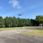
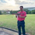
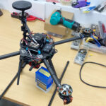
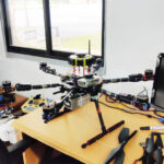
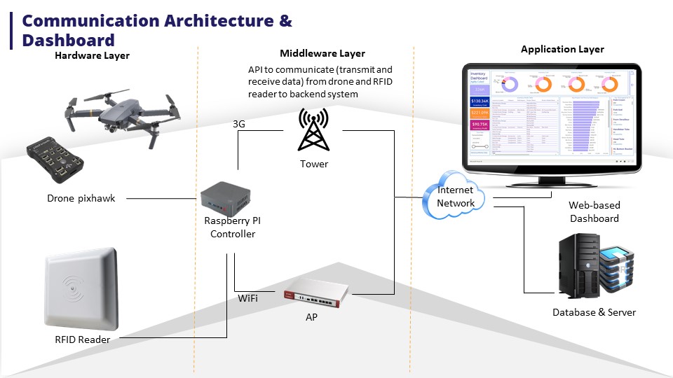
Almost all the UAVs are radio-controlled aircraft, whereby, the UAV is controlled remotely by an operator on the ground using a radio transmitter. The transmitter communicates with a receiver in the aircraft that sends signals to servomechanisms which move the control surfaces based on the position of joysticks. The maximum distance of most civilian UAVs is less than 5 miles, unless you have a bigger antenna. As an alternative, a 3G/4G network connection seems to eliminate the problem of distance. I use a companion computer to control Pixhawk directly, and the companion computer gets feedback and data from it. As the companion computer is a wholly functional computer, the data it receives can be stored locally or sent to a server through 3G/4G LTE dongle.
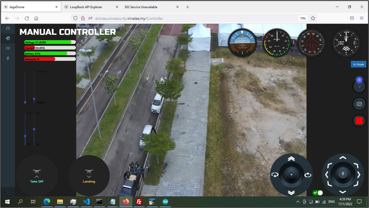
As a drone operator, you require detailed knowledge about mission planning, real-time insight on flights and regulatory compliance. Our Drone web dashboard seamlessly connects you and your organization to the aircraft and the data it gathers. Pilots can use our web dashboard to plan their flights and control their drones in the field and managers can maintain an overview of their operation from the web dashboard. With the mission monitoring operations managers can set up teams and keep track of all their drones and pilots. They can gain a comprehensive insight into how many hours their drones and batteries have flown if they require maintenance and export all required data. Once you start your operation, video footage is automatically displayed on the dashboard. During the flight, the operator and operation manager will be able to track your drone in real-time through the location in maps and video footage. Our drones can be controlled directly from the web dashboard, so once you are on the ground all data about your drone and batteries is automatically saved in the logbook. Plan and prepare your flights efficiently and legally with our flight planner route. When you are ready to fly you can set up a flight plan within a couple of seconds. Select the area that you are going to fly in and name your flight. Add notes, permissions forms, checklists, or other documents and select the pilot, observer, and payload operator from your team. You can also automatically connect to your drone or select your drone from the library.

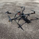
SARDrone with Real-time aerial image stitching solution
The drones provide easy access to aerial data of a large area, especially during natural disasters, which gives the rescue team the ability to expedite the process of finding the affected person, where every second counts. The SARDrone and its integrated dashboard come as a cloud solution that connects ground pilots with a web-based dashboard that aggregates all that data, making sharing of data easy among different agencies (fire, police, and EMS), and providing a command centre to manage all the drones. During a mission, this waterproof SARDrone can quickly perform a perimeter check and find people in distress with AI features like object detection.
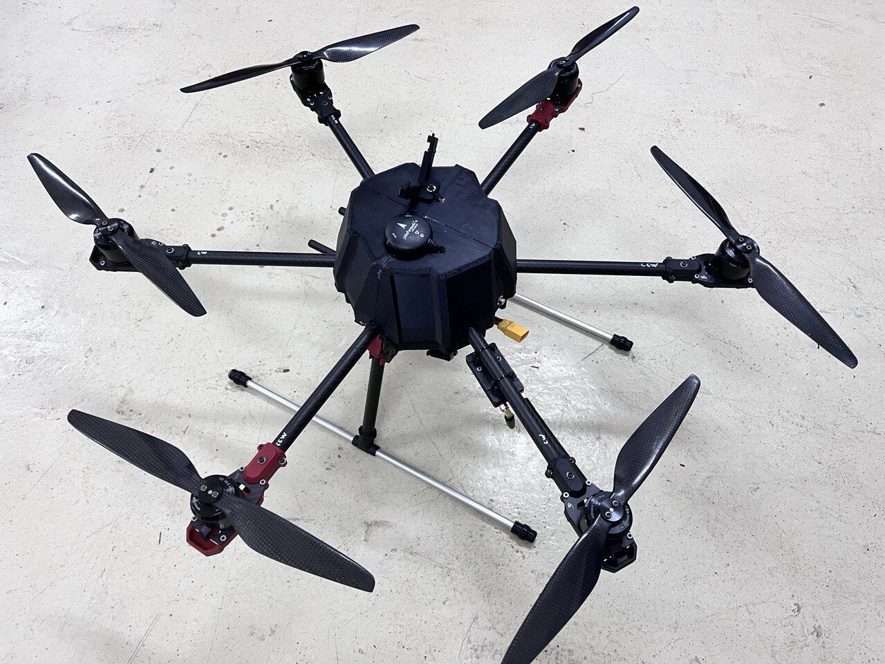
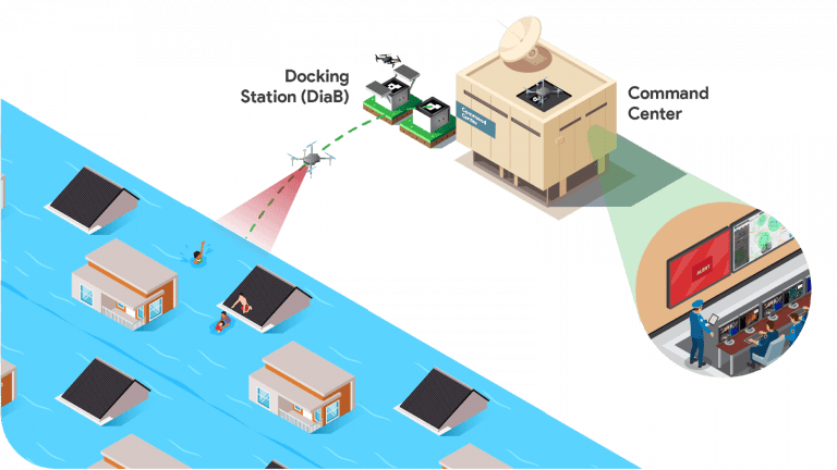
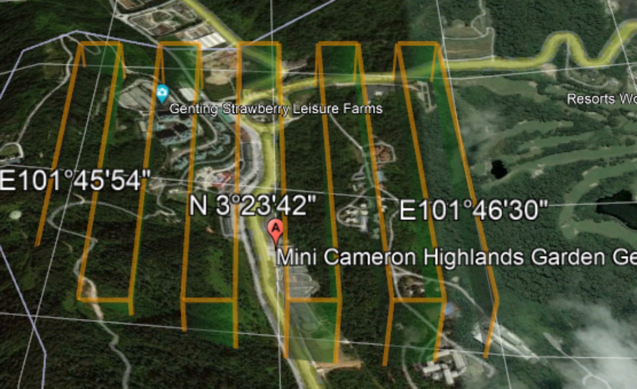
Image mosaicing is a process of combining several sets of images that have overlapping areas with the adjacent frame into a single and broader image known as panorama. It is an important tool for reconnaissance and surveillance, especially during disasters such as floods, landslides, earthquakes, and road accidents. However, this conventional method of offline image mosaicing takes relatively long processing and computation time. Therefore, the ideas springing up that there is a need for real-time image mosaicing for immediate rescue missions which requires the elimination of the lengthy post-processing procedures. The volatile processing time is relying on the number of images, size of the area, precession level, and computer processing capability. This study proposed an algorithm with faster computation speed and high quality of the stitched images by using an elevation model to identify the optimum flight altitude and cruising speed of the multicopter.
Drone for Warehouse Inventory Management System
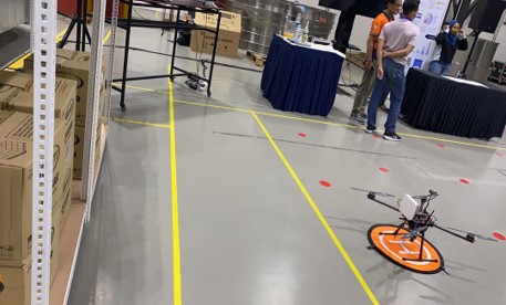
Drone technology has reached a great level of reliability, efficiency, and a new level of affordability. However, implementing this technology varies from one case to another depending on the expected functionalities and capabilities. This project aims to set up a Proof of Concept (POC) of automated warehouse inventory management using drone technology. The POC is a system of autonomous drones, flying and scanning inventories in a racking complex using RFID tags, and relay all the information back to the standalone dashboard system.
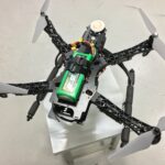
Flying Mak Kiah – Airborne Disinfector
Flying Mak Kiah – Airborne Disinfector is an indoor drone with C-band ultraviolet (UVC) lights, proposed specifically to combat the spread of the COVID-19 (SARS-CoV-2) virus with a relatively high rate of disinfection. By using the latest drone technologies, this airborne disinfector can fly stably inside buildings or confined rooms to sterilize the affected areas, thereby reducing exposure of frontline workers to infections. This airborne disinfector does not use GPS or external sensors, allowing them to operate stably in spaces other drones cannot go – including small and narrowed spaces. It autonomously flies to the affected spaces and it illuminates in all directions using optically intense 265 NM LED UVC lights.
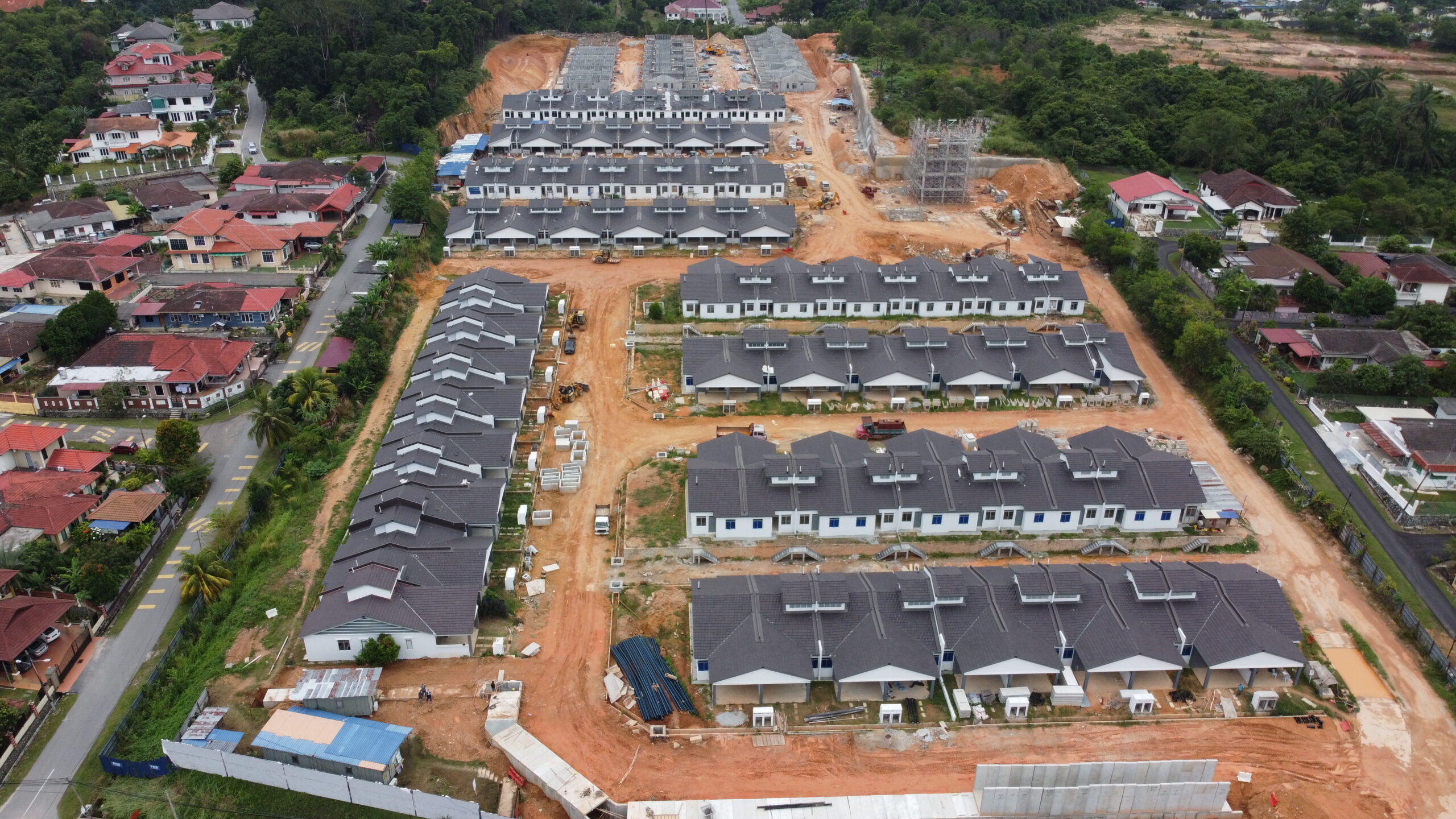
InfraDrone – Drone to map construction progress
Construction is a multifaceted industry with so many moving parts, accountability, progress tracking, and highly accurate data. This industry requires faster, more economical, and higher-resolution surveying tools or methods without sacrificing accuracy. According to the study, commercial drones—or Unmanned Aerial Vehicles (UAVs)—are key to this. Drone applications in the construction industry can provide your business with accurate, up-to-date information on your site’s progress and productivity, and information you can use to ensure high-quality work and minimize operational risks and costs. Drones are equipped with downward-facing sensors, such as RGB, multispectral, thermal, or LIDAR, and they can capture a great deal of aerial data in a short time to monitor areas across long distances, such as vegetation rows, buildings, roads, and railroads. This project also provides a method to speed up the process of map generation by using a revised real-time image stitching algorithm.

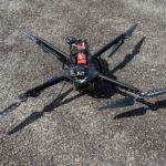
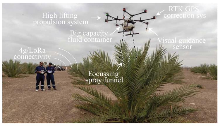
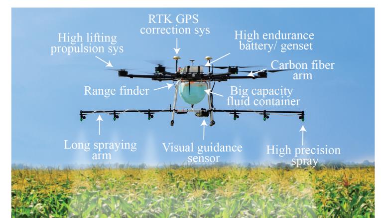
Automated Drone for High Precision Agriculture (TaniDrone)
The TaniDrone is a standalone system that demonstrates a functioning autonomous drone, fly spraying pesticide on crop using an efficient spraying mechanism and transfer the data back to a standalone dashboard system. The TanoDrone technology will comprise a high-definition camera, real-time kinematics (RTK), an efficient spraying mechanism and a wireless data transmission system to ensure effective pesticide spraying. The multispectral image from the high-definition camera with artificial intelligence will be used to locate the spraying mechanism on the shoot of the plant. Whereas, RTK will assist the drone to manoeuvre to the young oil palm location.
- Drone development, flight data, telemetry and path planning.
- Evaluating drone performance at the plantation
- Path planning of drone using RTK validation and verification
- Training of young oil palm shoot detection using artificial intelligence associated with high definition camera
- Testing the efficiency of spot spraying mechanism using artificial intelligence
- Testing on plantation using efficient spraying mechanism
- Setting up the dashboard and integrating drone information (battery level, number of plants covered) into the dashboard and also data of sprayed plants.
- Evaluation of total cycle time of drone pesticide spraying versus human pesticide spraying.
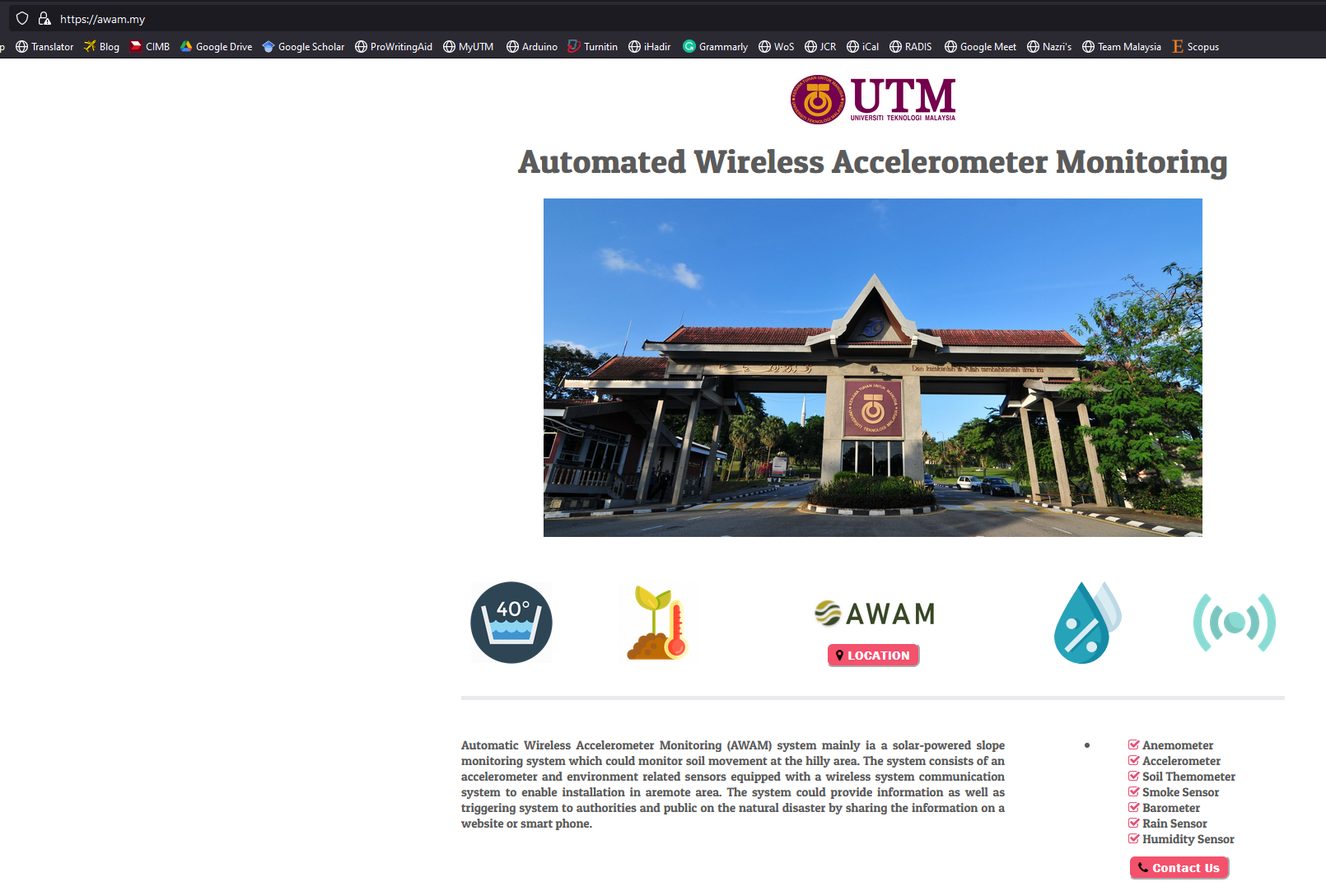
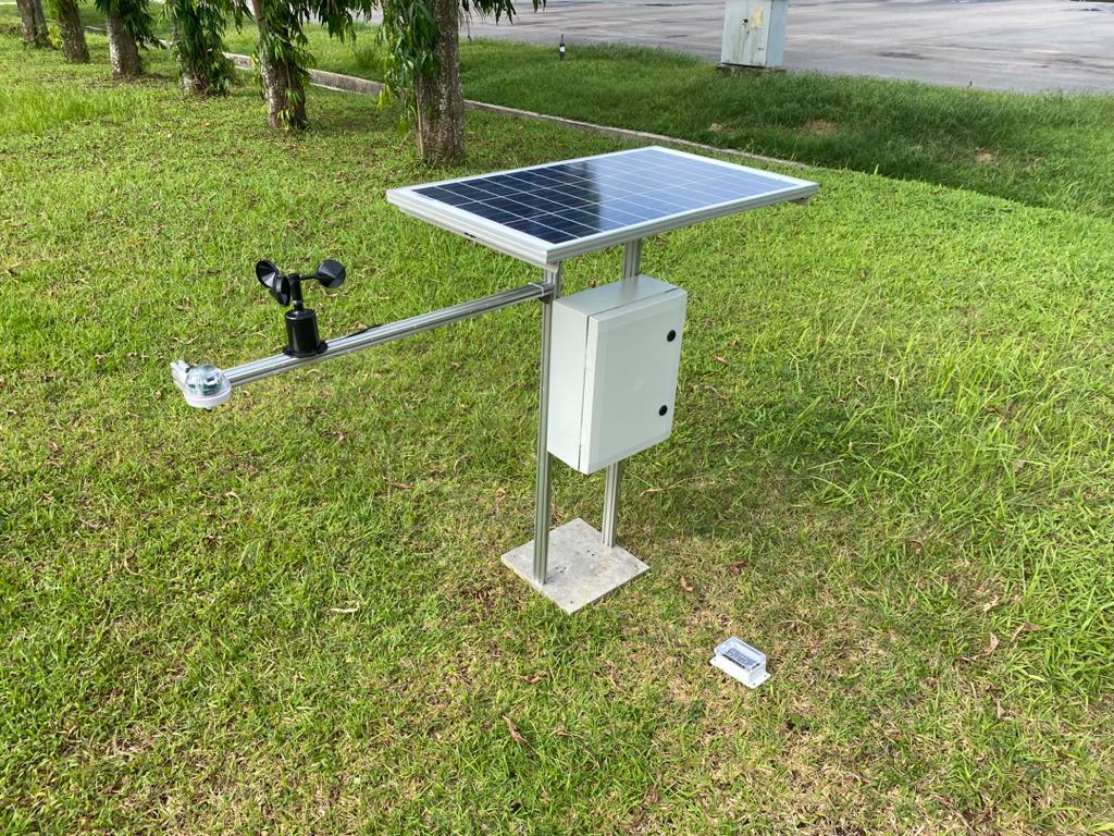
Real-time environmental and slope monitoring system
Slope stability is a major problem in geotechnical engineering where disasters involving loss of life and property can do occur. Therefore, we invented a new solution for slope and environmental monitoring system especially at the hilly area. This system is capable of observing the slope in continuous monitoring mode which allows monitoring of every type of displacement at the slope. The system consists of an accelerometer device equipped with a wireless system to receive and record the movement within 500m distance. The movement data will be analysed and transmitted to a developed warning system and displayed on a website/smart phone to provide an earlier warning prior to the failure. A solar system is used to provide a power supply to the system. In addition, the system can promote many benefits compared with the existed slope monitoring system as lower price, lower power consumption, wireless data acquisition system and customizable with addon sensor namely rain sensor, pH sensor, humidity sensor, soil temperature sensor, barometer etc. (see the website https://awam.my/)