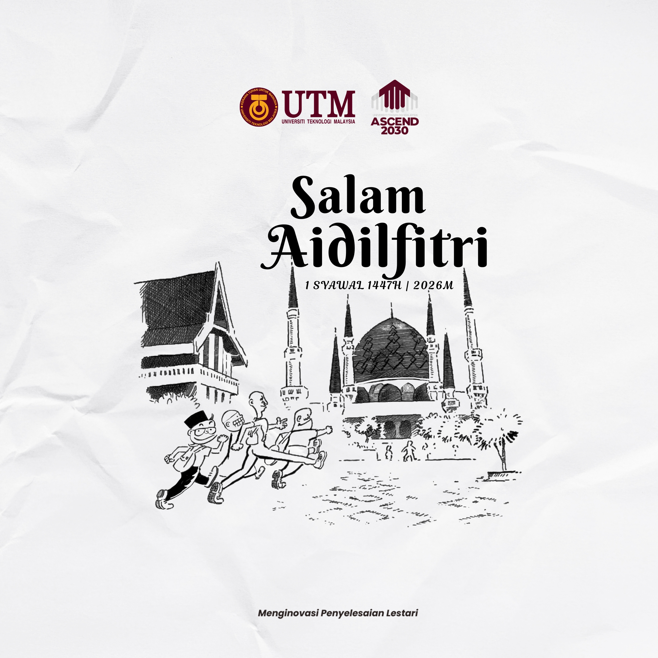
Eid Mubarak 1447 Hijriah to all my Muslim friends!
May this Syawal bring joy and may our last Ramadhan is better than previous one
Regards
Zakri and Family~
Eid Mubarak 1447 Hijriah to all my Muslim friends!
May this Syawal bring joy and may our last Ramadhan is better than previous one
Regards
Zakri and Family~
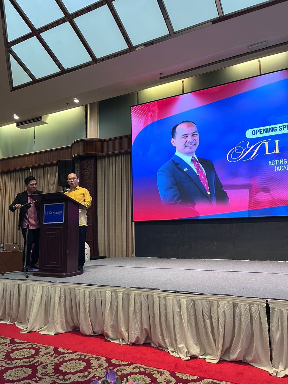
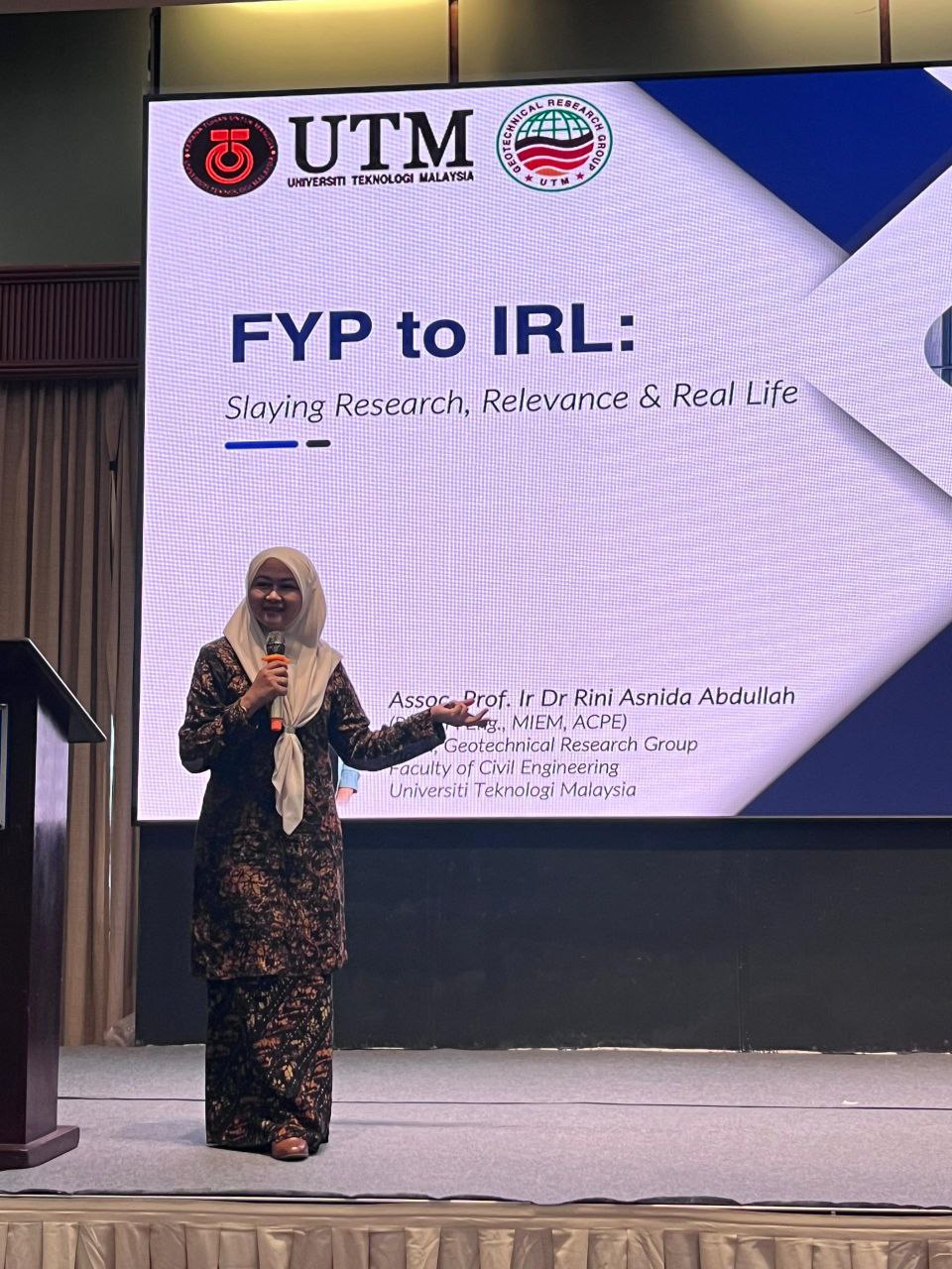
I’m honoured to be selected again as a committee for IURC 2025, as a publication unit. IURC is a platform for final year students from UTM to presents their works from Final Year Project. IURC is program under School of Undergraduate Studies, Universiti Teknologi Malaysia.
IURC2025 aims to introduce a conference environment to undergraduate students for them to present their Final Year Project. These small steps hopefully will help them learn and become one of their achievements.
This year IURC2025 was held in Senai, Johor.
#iurc hashtag#iurc2024

Greetings,
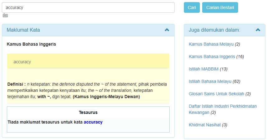
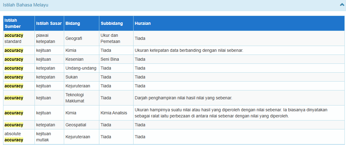
I’ve become a members of Multi-Lingual Glossary of Terms (MLGT) for geospatial terms almost 10 years now. Previously, we only want to translate the terms used in geospatial fields, especially terms in ISO documents, and published it on Geolexica website (Geolexica)
With current development, this committee now collaborate with Dewan Bahasa dan Pustaka (DBP). Dewan Bahasa dan Pustaka (DBP) is a government agency in Malaysia responsible for developing and promoting the Malay language and literature. It sets language standards, publishes books and dictionaries, creates terminology for various fields, and ensures correct use of Malay in public spaces, media, and official documents. DBP also supports literary development, conducts research, and organises educational programmes to encourage the proper use and appreciation of the national language.
With the involvement of DBP, MLGT also wants to publish the committee’s work on DBP’s website, and today, I’m proud to announce our translation was published on PRPM website.
So next time you’re using PRPM for some term usage, try to click “Istilah Bahasa Melayu” on the right site, and try to scroll down and find the terms with Bidang: Geospatial!
I’m truly grateful for this development! Next, we will try to have the definition for each term also be published, and maybe a book on the geospatial glossary in the future!
#geospatial #multilingualglossaryofterms #mlgt #standard #ISO #glosarigeospatial
Assalamu’alaykum and Greetings
Universiti Teknologi Malaysia akan memulakan kuliah semester 2 bagi sesi 2024/2025 pada 17 Mac 2025.
Selamat kembali dan semoga terus berusaha untuk mendapat manfaat dari pengajian anda!
We are thrilled to announce that we has recently published a chapter in book titled:
“Comparing Food Tourism Hotspots Before and After MCO 3.0 Lifted via Data Mining in Johor Bahru, Malaysia”
This research delves into the dynamic realm of food tourism, exploring the impacts of the lifting of MCO 3.0 on Johor Bahru’s culinary landscape. Through meticulous data mining techniques, we has unearthed fascinating insights into the transformations undergone by food hotspots in the wake of regulatory changes.
Link: https://link.springer.com/chapter/10.1007/978-3-031-50848-6_11
Last month, I’ve been given opportunity to talk about affordable housing and sustainability, and because I’ve got some research on assessing the spatial indicators for sustainability of affordable housing, I’ve share my insight on this topic.
Feel free to read a bit in the link below:
https://www.starproperty.my/news/affordable-and-sustainable-housing-can-they-co-exist-/122941
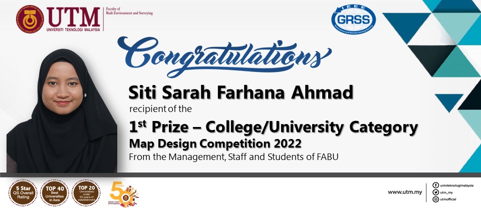
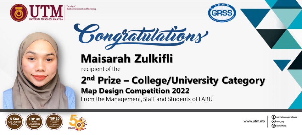
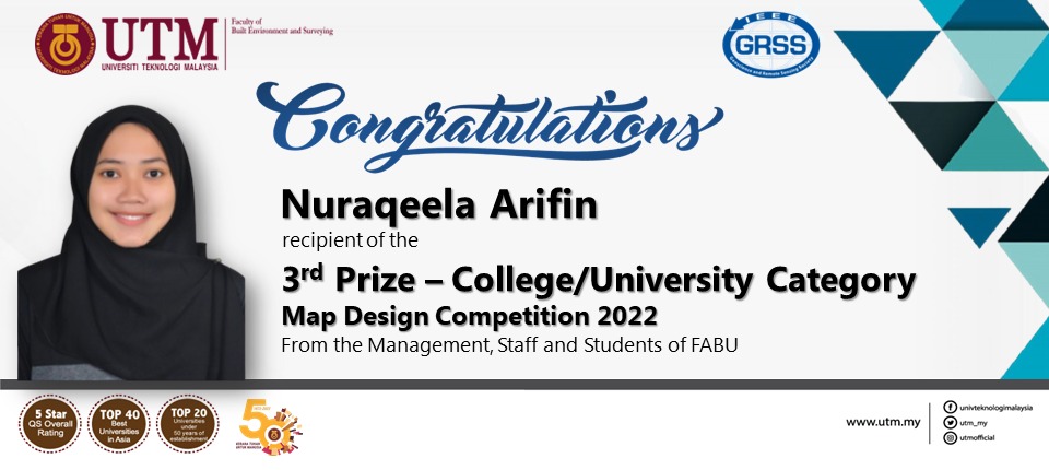
Tahniah diucapkan kepada 3 pelajar daripada Geoinformasi yang memenangi pertandingan di IGARSS 2022.
Pertandingan ini iaitu Map Design Competition telah dianjurkan oleh GeoScience and Remote Sensing Society (GRSS), IEEE dengan kerjasama International Geoscience and Remote Sensing Symposium (IGARSS). Simposium ini telah berlangsung pada 17 sehingga 22 Julai 2022, bertempat di KLCC.
Pertandingan ini telah dimenangi oleh Siti Sarah Farhana Ahmad, pelajar Sarjana Sains (Remote Sensing) dengan petanya bertajuk “Global Coronavirus First Lockdown Map”, diikuti pemenang kedua Maisarah Zulkifli, dan tempat ketiga dimenangi oleh Nuraqeela Ariffin. Kedua-dua pelajar ini adalah pelajar Sarjana Muda Sains (Geoinformatik) dengan kepujian di Fakulti Alam Bina dan Ukur (FABU), UTM. Tahniah buat ketiga-tiga pemenang!
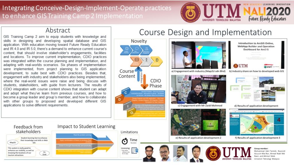
So, this year, i’m participating again in NALI 2020. NALI stand for New Academia Learning Innovation, which means the improvement, enhancement of so-called “traditional-teaching” method into new and innovative teaching methods.
This year, i’ve submitted my paper, and hopefully, i can gain new knowledge this time.
this time around, NALI2020, along with other conferences, done virtually. And we need to submit the poster, and also the video presentation.
Here my poster and video presentation. i’m sorry the video not very creative.
Regards
Assalamu’alaykum
Ok, last 2 weeks, my friend, Dr Nurul Hana invited me to involve in one of her small project, to produce a simple newspaper article, about the World Soil Day. And after brain-storming, and get some ideas, we come out with some simple article. I put a little bit of GIS background and how GIS can help in managing land and soil information. and Praise to God, Alhamdulillah, my first ever newspaper article was published!
you can read in the link below. and owh, it’s in Malay.
regard
New Academia Learning Innovation (NALI) 2020, is an symposium for lecturers, and teachers to share their initiative in improving, and integrating new learning technique in their T&L.
It start today (7 December 2020), until Thursday (10 Dec 2020)
This year, NALI 2020 going Virtual. so, you can enjoy the exhibition, keynote and others in their website
