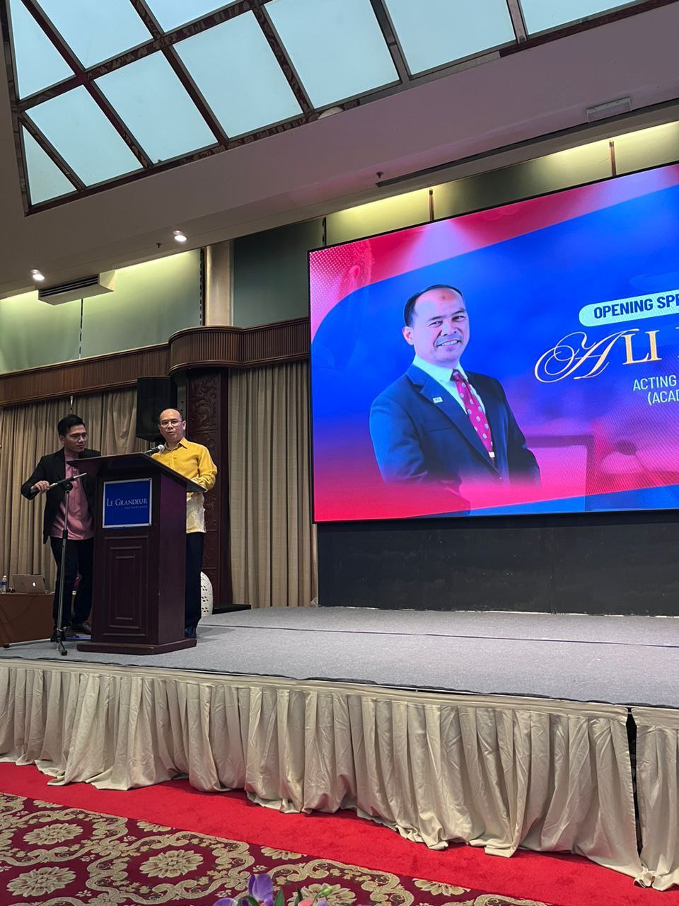
I’m honoured to be selected again as a committee for IURC 2025, as a publication unit. IURC is a platform for final year students from UTM to presents their works from Final Year Project. IURC is program under School of Undergraduate Studies, Universiti Teknologi Malaysia.
IURC2025 aims to introduce a conference environment to undergraduate students for them to present their Final Year Project. These small steps hopefully will help them learn and become one of their achievements.
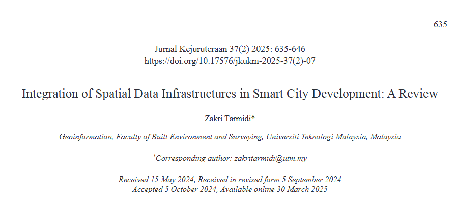
This is my second journal publication of 2025, and it’s indexed in the Web of Science!
The paper was written in 2024, with all the commitment and hurdles faced along the way. One of my colleagues once told me, “Whatever happens, try to write your own paper every year to polish your knowledge and improve your writing skills.” Taking up that challenge, I’ve committed to publishing a paper annually in my own niche.
Feel free to read my latest publication! This paper reviews the integration of Spatial Data Infrastructure (SDI) in Smart City development. With the growing demand for various types of up-to-date data in Smart Cities, spatial data has become increasingly crucial. An integrated approach—especially regarding infrastructure—is essential. This paper discusses previous studies on SDI implementation in Smart City initiatives, highlights current limitations, and suggests future directions for better integration.
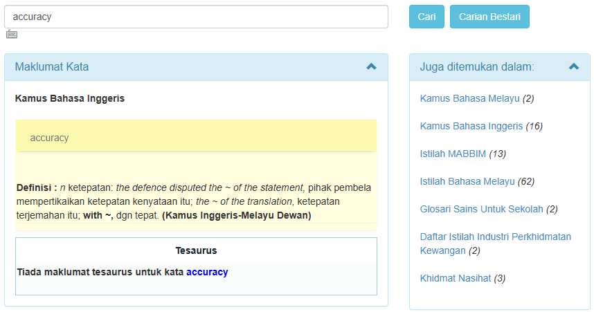
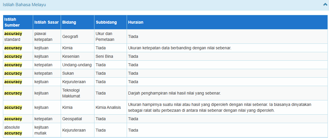
I’ve become a members of Multi-Lingual Glossary of Terms (MLGT) for geospatial terms almost 10 years now. Previously, we only want to translate the terms used in geospatial fields, especially terms in ISO documents, and published it on Geolexica website (Geolexica)
With current development, this committee now collaborate with Dewan Bahasa dan Pustaka (DBP). Dewan Bahasa dan Pustaka (DBP) is a government agency in Malaysia responsible for developing and promoting the Malay language and literature. It sets language standards, publishes books and dictionaries, creates terminology for various fields, and ensures correct use of Malay in public spaces, media, and official documents. DBP also supports literary development, conducts research, and organises educational programmes to encourage the proper use and appreciation of the national language.
With the involvement of DBP, MLGT also wants to publish the committee’s work on DBP’s website, and today, I’m proud to announce our translation was published on PRPM website.
So next time you’re using PRPM for some term usage, try to click “Istilah Bahasa Melayu” on the right site, and try to scroll down and find the terms with Bidang: Geospatial!
I’m truly grateful for this development! Next, we will try to have the definition for each term also be published, and maybe a book on the geospatial glossary in the future!
Honoured to contribute as part of the working group for the review of MS1759: Geographic Information — Feature Catalogue.
Earlier this year, I had the opportunity to participate in a review workshop held in February 2025, organised under the Department of Standards Malaysia. The session brought together experts and practitioners to refine and strengthen this important national standard.
I hope this small contribution helps support the geospatial community in Malaysia — and benefits the wider public through improved geospatial data practices and interoperability.
Thank you to the organisers and fellow working group members for the meaningful discussions and collaboration.
I’m pleased to share that one of my writings has been published in the recently released book “Best Practices of Research-Led Teaching” by UTM CDeX, launched in early 2025.
My chapter, titled “GIS and RS Applications,” highlights how I incorporate a research-tutored approach in the classroom — guiding students through real research content and methods to develop deeper understanding and skills in geospatial analysis.
This work reflects my continued commitment to bridging research and teaching — ensuring students are not only learning about research, but actively learning through it.
Thank you to UTM CDeX for the opportunity, and to all colleagues and students who have contributed to this meaningful journey.
Last year in October 2024, I took part in NALI 2024 (New Academia Learning Innovation) — an initiative by Universiti Teknologi Malaysia that celebrates innovative practices in teaching and learning.
I’m grateful to share that the project I submitted was awarded a Silver Medal. The work, titled “Heutagogy and Peer Assessment Approach in Improving Student Achievement,” reflects my ongoing commitment to student-centered and self-determined learning strategies in geoinformatics education.
Throughout the judging process, I gained many new insights — especially on areas for improvement in both implementation and the way the paper was written and presented. It was a valuable learning experience that will certainly inform my future teaching practices and research.
Thank you to the organisers, fellow educators, and especially my students for being part of this meaningful journey. I look forward to exploring more ways to enhance learning experiences.
Geographic Information Systems (GIS) can be effectively used to support business analysis and expansion strategies — including identifying existing outlet patterns and exploring potential locations for new franchises.
This was my old publication in 2023, where I analyzed the spatial distribution patterns of three major fast-food restaurant chains in Malaysia. The study identifies hotspot areas and assesses the probability of opening new franchise locations.
Feel free to explore the paper for more insights and detailed findings. Your thoughts and feedback are most welcome!
— Title: Analysing Spatial Pattern of the Three Major Fast-Food Chain Restaurants in Johor Bahru Johor, Malaysia
I am honored to share that I have been appointed as one of the panel members for the curriculum review of the Diploma Teknologi Geospatial program at Universiti Teknologi MARA (UiTM).
I am truly excited for the opportunity to contribute my knowledge and experience toward strengthening and enhancing the program, ensuring it remains relevant to current industry trends and future geospatial advancements.
Thank you to UiTM for the trust and confidence. Looking forward to working together with distinguished colleagues and experts in shaping the future of geospatial education in Malaysia!
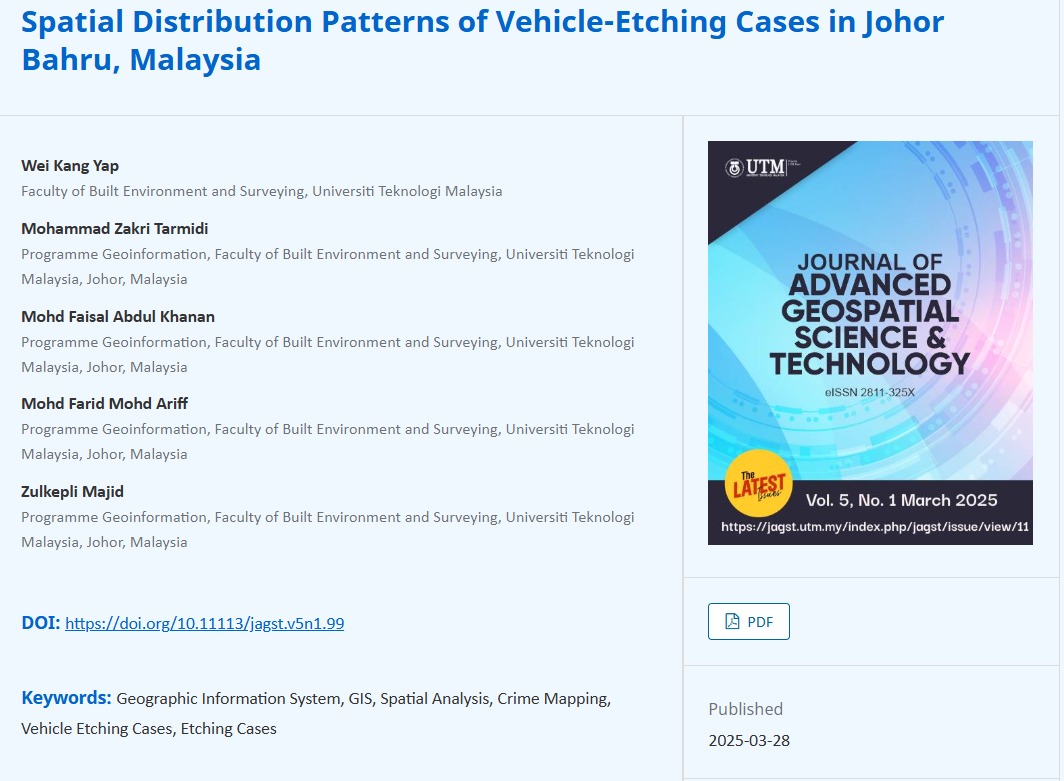
Another publication by one of my students: “Spatial Distribution Patterns of Vehicle-Etching Cases in Johor Bahru, Malaysia.”
This paper explores how spatial statistical analysis was used to identify the distribution patterns of vehicle-etching cases within the Johor Bahru District.
The research applied Geographic Information Systems (GIS) to map out these incidents and uncover whether there were any noticeable trends or “hotspots” across the city — and the results showed that these acts of vandalism aren’t as random as they might seem.
If you’re curious about the methodology, findings, or want to collaborate on something similar, feel free to dive into the full paper or reach out.