Call for Application: UTM Postdoctoral Fellowship Scheme

Dear Potential Postdoctoral Researchers,

I am extending this invitation to a highly esteemed postdoctoral candidate who may be interested in working with us on a topic related to sea level rise over the Asian sea from a satellite radar altimeter.

Project Summary

This project aims to measure the sea level rise (SLR) over the marginal seas of the South China Sea (SCS) by considering vertical land motion (VLM). The SLR from anthropogenic climate change is an increasing concern for the international community and especially for coastal States (i.e., China, Malaysia, Taiwan, Indo-China, Indonesia etc). The prospect of whole islands disappearing under rising waters raises serious questions as to the impact upon maritime jurisdiction and the ability of the United Nations Convention on the Law of the Sea to deal with the inundation of large areas of territory.

This project comprises two main sub-projects. The sub-project 1 aims to provide the VLM that could significantly contribute to the local SLR. The land movements from INSAR and Global Navigation Satellite Systems (GNSS) observations have played an important role in addressing the VLM nearshore. The sub-project 2 aims to estimate the SLR using the long time series datasets (since 1992). The input from sub-project 1 (VLM) is considered in the SLR estimation to account for the relative SLR.

Feel free to contact me for further details.

Nurul Hazrina Idris (Assoc. Prof. Dr)

Email: nurulhazrina@nurulhazrina

***************************************************************************
UTM Postdoctoral Fellowship Scheme 2024 : Call for Application.

We are looking for potential candidates to fill in our Postdoctoral Fellow positions in Universiti Teknologi Malaysia starting 1st January 2024 and 1st July 2024. Those who meet our criteria as Principal Investigators together with potential Postdoctoral Fellows are welcome to apply starting from 15 October 2023 until 30 November 2023.

Log on to our *website, https://rmc.utm.my/download-research-funding/  or contact RMC Postdoctoral Fellowship Secretariat at our hotline number : +6017 446 4080 (Whatsapp is available) for more information about the grant.

*Information is under ‘Research University Grant (GUP 2024)*

Immediate Vacancy Available for Master/PhD Position With Monthly Stipend

Immediate Vacancy Available for Master/PhD Position With Monthly Stipend (for Malaysian only); without monthly stipend (for International, but could benefit from the research facilities)

Project Title: Forecasting the Lake Water Level Variations using Satellite-based and Deep Learning Technique

Candidate with the following criteria is invited to apply:

  • Currently hold a Bachelor or Master degree in Civil, Environmental, Coastal, Marine, Computer, Big Data Engineering/GIS/Remote Sensing/Geomatics. Any other related area can be considered.
  • Positivity, team working and self-driven/discipline is a must. Good writing skills in English.
  • The candidate is expected for reasonable multi-tasking due to the provision of a monthly stipend of RM1800/RM2000 (Master/Ph.D.), includes, but not limited to field data collection and analysis, traveling, and academic paper published in reputable journals.
  • A candidate is expected to register as Full-Time Student in UTM Johor Bahru. A candidate is responsible for the cost of the tuition fees.
  • Intake commenced from October 2021 for 2 years (extension is possible depending on available funds).
  • Skills required: Basic programming and any Digital Image Processing Software.

Benefits:

  • Monthly stipend of RM1800/RM2000 (Master/PhD);
  • Workstation with conducive working space in our laboratory;
  • Facilities related to the research activities (e.g. data, a field trip for data collection, etc);

Interested candidate is invited to email your resume to nurulhazrina@utm.my

Assoc. Prof. Dr. Nurul Hazrina Idris

Head of Tropical Map Research Group

Fellow Member of Geospatial and Digital Earth Centre (INSTeG)
Faculty of Built Environment and Surveying, Universiti Teknologi Malaysia, Johor Bahru

Abstract

For sustainable dam management, information such as lake levels is essential to understand the impact of climate change and extreme weather. Lake level is a key hydrological parameter, which is sensitive to both regional and climate variations, human disturbances and lake bathymetry changes. Water-level changes in lakes were traditionally derived from gauge data. While gauging stations can provide accurate water-level observations,
only limited gauged water-level measurements are available in remote areas, particularly in Temenggor Lake.
Temenggor Lake; located at Royal Belum Forest, is the second-largest dam in Malaysia supplying water for domestic use since 1999. Under the tropical climate conditions, the reservoir area is affected by the seasonal climate condition resulting in declining dam water level during the hot season, and flooding during the wet season. The technology of satellite altimetry has been widely used for monitoring inland waters for more than 30 years,
however, such study has yet to be conducted in Malaysia due to its’ relatively small size of lakes/rivers. Taking advantage of the recent and advanced technology of Synthetic Aperture Radar (SAR) altimetry, the proposed project will exploit the high resolution and accurate lake level data from the Sentinel-3A satellite for forecasting the lake levels, which can help to evaluate the impact of climate change on regional water resources. This project is
related to the United Nation Sustainable Development Goals (SDGs) which are goal 6: Clean Water and
Sanitation, goal 11: Sustainable Cities and Communities, and goal 14: Life below Water.

Syukur alhamdulillah

Three Rising Stars from FABU Bag Gold and Silver Awards at MNNF Network Research & Innovation Poster Competition Series 1/2021”

“FABU Receives APN Grant for Capacity Building Development Programme 2020”

Call for paper: Journal of Advanced Geospatial Science and Technology

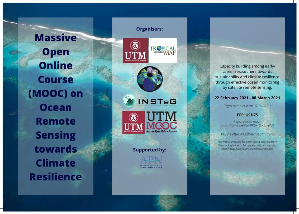
Massive Open Online Course (MOOC) on Ocean Remote Sensing for Climate Resilience: Call for registration

Call for Registration: Massive Open Online Course on Ocean Remote Sensing on Climate Resilience 2021.

Register open until 15 January 2021. Click link to register:

https://forms.gle/VawA9Qwn2hoLvqCc9

Immediate Vacancy Available for Master/PhD Position With Monthly Stipend

Immediate Vacancy Available for Master/PhD Position With Monthly Stipend 

Project Title: MACHINE LEARNING FOR COASTAL VULNERABILITY ASSESSMENT

Candidate with the following criteria is invited to apply:

  • Currently hold a Bachelor or Master degree of Civil, Environmental, Coastal, Marine, Computer, Big Data Engineering/GIS/Remote Sensing/Geomatics. Any other related area can be considered.
  • Positivity, team working and self-driven/discipline is a must. Good writing skills in English.
  • Candidate is expected for reasonable multi-tasking due to provision of monthly stipend of RM1800/RM2000 (Master/PHD), includes, but not limited to field data collection and analysis, traveling and academic paper publication in reputable journals.
  • Candidate is expected to register as Full Time Student in UTM Johor Bahru. Candidate is responsible to the cost of tuition fee.
  • Intake commenced from February 2021 for 2.5 years (extension is possible depending on available funds).
  • Skills required: Basic programming and any Digital Image Processing Software.

Benefits:

  • Monthly stipend of RM1800/Rm2000 (Master/PhD);
  • Workstation with conducive working space in our laboratory;
  • Facilities related to the research activities (e.g. data, field trip for data collection, etc);

Interested candidate is invited to email your resume to nurulhazrina@utm.my

Dr. Nurul Hazrina Idris

Head of Tropical Map Research Group

Associate Fellow Member of Geospatial and Digital Earth Centre (INSTeG)
Faculty of Built Environment and Surveying, Universiti Teknologi Malaysia, Johor Bahru

[CALL FOR PAPERS] 15TH PAN OCEAN REMOTE SENSING CONFERENCE 20-22 SEPTEMBER 2020

[TRAVEL SUPPORT FOR STUDENTS AND NON-STUDENTS] 15th Pan Ocean Remote Sensing Conference 2020

Greetings from UTM!

CALL FOR APPLICATION FOR TRAVEL SUPPORT FUNDING DURING 15TH PAN OCEAN REMOTE SENSING CONFERENCE (PORSEC2020) (http://www.geoinfo.utm.my/porsec)

We are delighted to invite you to submit the application for partial travel support funding for attending the 15th Pan Ocean Remote Sensing Conference (PORSEC2020) from 20-22 September 2020 in Johor Bahru, Malaysia.

Three (3) categories are available:
1) Students from developing nations (International Participants only) attending BOTH tutorial and conference;
2) Students from developing nations (International Participants only) presenting/attending conference; and
3) International speakers presenting/attending conference.

For further information, kindly visit our website https://www.geoinfo.utm.my/porsec/registration.php#supportfunding

We would like to seek your kind assistance to disseminate about the opportunity among your colleagues, researchers and students.

Kind regards,

Dr. Nurul Hazrina Idris

Chair of LOC PORSEC2020