BREAKING BOUNDARIES: A DEEP DIVE INTO 3D CITY MODELLING TOPOLOGY RULES IN GIS APPLICATIONS
Thrilled to share insights from our groundbreaking research: “Topology Models and Rules: A 3D Spatial Database Approach”. Our study delves into the intricate world of topological information, crucial for complex spatial analysis, particularly in describing the containment, adjacency, and connectivity of objects within a 3D space.
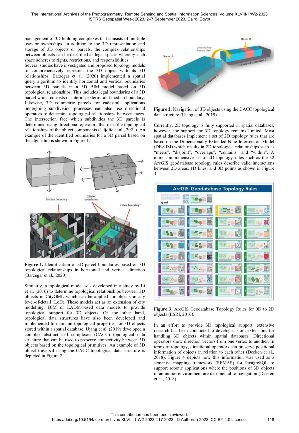
Traditionally, spatial databases have leaned on 2D topology mechanisms, often falling short in handling the intricacies of 3D topology functions. Our experiments, conducted within ArcGIS and Oracle spatial database, unveil the limitations of existing topology rules and models. Notably, while 2D geodatabase topology rules in ArcGIS effectively determine relationships between 2D multi-surfaces, they struggle with 3D objects.
Enter the 36-Intersection Model (36IM), the hero of our study. This innovative model, describing intersections from 0D to 3D, introduces a paradigm shift in handling topological relationships within Oracle. Our experiments showcase how 36IM topology rules bridge the gap, providing insights into dimensions of intersections and supporting the maintenance of topological information without breaking down 3D objects.
Curious to dive deeper into the world of 3D GIS, spatial databases, and the nuances of topology models? Explore our full paper for a comprehensive understanding of how 3D topology rules reshape the landscape of spatial data management. Elevate your knowledge and stay ahead in the evolving realm of GIS and 3D spatial databases!
Link: https://isprs-archives.copernicus.org/articles/XLVIII-1-W2-2023/117/2023/isprs-archives-XLVIII-1-W2-2023-117-2023.pdf
