WHAT IS GIS?
Ever had to explain GIS to someone? Use this: https://www.esri.com/en-us/what-is-gis/overview?utm_campaign=feed&utm_medium=referral&utm_source=later-linkinbio
WHAT IS GIS?
Ever had to explain GIS to someone? Use this: https://www.esri.com/en-us/what-is-gis/overview?utm_campaign=feed&utm_medium=referral&utm_source=later-linkinbio
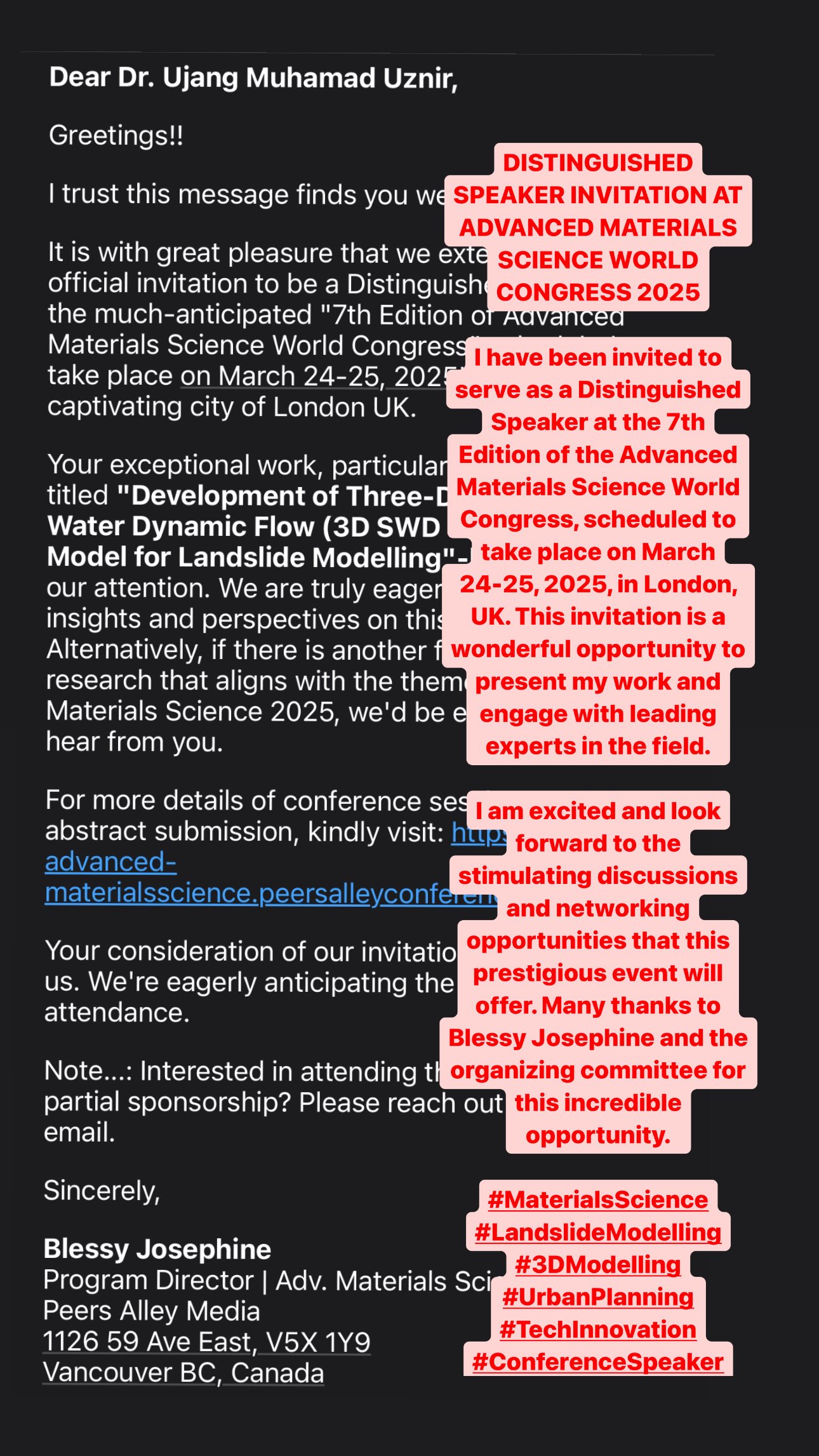
DISTINGUISHED SPEAKER INVITATION AT ADVANCED MATERIALS SCIENCE WORLD CONGRESS 2025
I have been invited to serve as a Distinguished Speaker at the 7th Edition of the Advanced Materials Science World Congress, scheduled to take place on March 24-25, 2025, in London, UK. This invitation is a wonderful opportunity to present my work and engage with leading experts in the field.
The requested the focus of my lecture will be on my recent research titled “Development of Three-Dimensional Soil Water Dynamic Flow (3D SWD FLOW) Data Model for Landslide Modelling”. The research basically explores the innovative methods for predicting and managing landslides, contributing to safer and more resilient urban environments.
I am excited and look forward to the stimulating discussions and networking opportunities that this prestigious event will offer. Many thanks to Blessy Josephine and the organizing committee for this incredible opportunity.
#MaterialsScience #LandslideModelling #3DModelling #UrbanPlanning #TechInnovation #ConferenceSpeaker

TRANSFORMING ASSET MANAGEMENT WITH GRAPH DATABASES
Our research, “Unleashing the Potential of Graph Database in Smart Asset Management: Enhancing Predictive Maintenance in Industry 4.0” explores into how graph databases can revolutionize predictive maintenance for smarter asset management.
In the era of Industry 4.0, managing massive amounts of data from various sources is a challenge. Our study highlights how graph databases, with their flexibility and scalability, can handle this complexity, making data more accessible and useful for predictive maintenance.
We explore the use of graph databases to store and analyze asset information, showcasing their ability to handle complex relationships and vast data volumes. This approach enhances predictive maintenance by providing more accurate and timely insights.
By integrating advanced technologies like big data, IoT, and AI, we pave the way for smarter, more efficient asset management. Our research demonstrates the potential of graph databases to support the dynamic needs of modern industries.
Discover more about how we’re pushing the boundaries of smart asset management: https://doi.org/10.1007/978-3-031-53824-7_2
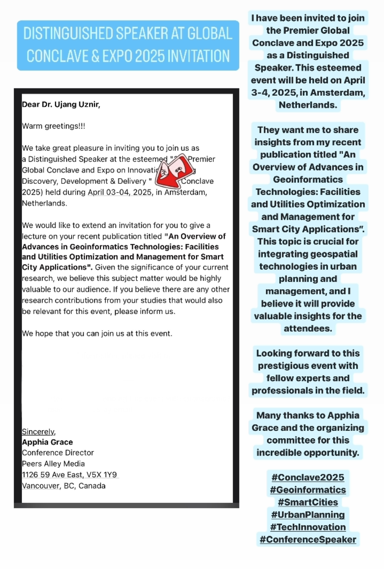
DISTINGUISHED SPEAKER AT GLOBAL CONCLAVE & EXPO 2025 INVITATION
I have been invited to join the Premier Global Conclave and Expo 2025 as a Distinguished Speaker. This esteemed event will be held on April 3-4, 2025, in Amsterdam, Netherlands.
They want me to share insights from my recent publication titled “An Overview of Advances in Geoinformatics Technologies: Facilities and Utilities Optimization and Management for Smart City Applications”. This topic is crucial for integrating geospatial technologies in urban planning and management, and I believe it will provide valuable insights for the attendees.
Looking forward to this prestigious event with fellow experts and professionals in the field.
Many thanks to Apphia Grace and the organizing committee for this incredible opportunity.
#Conclave2025 #Geoinformatics #SmartCities #UrbanPlanning #TechInnovation #ConferenceSpeaker

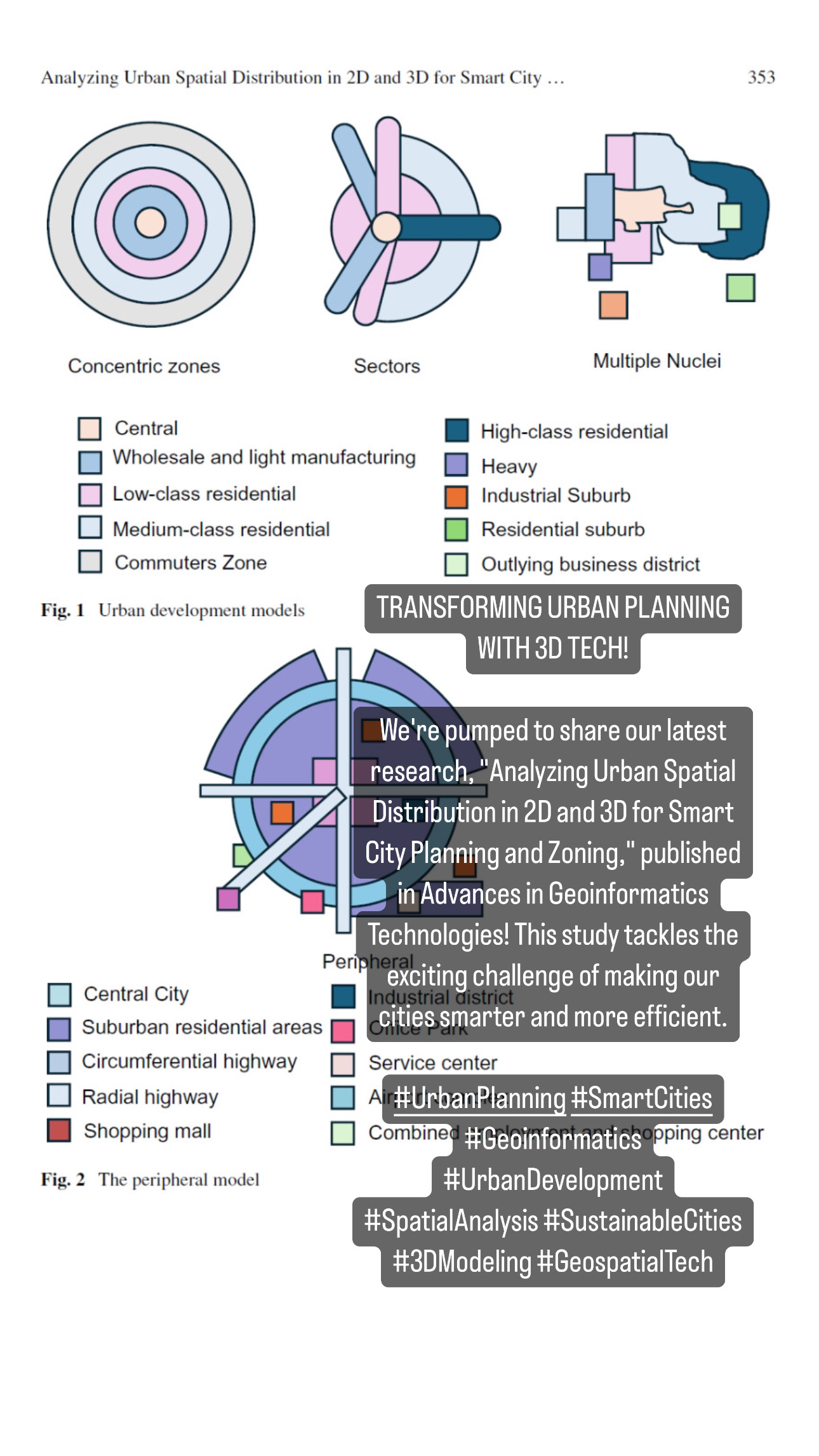
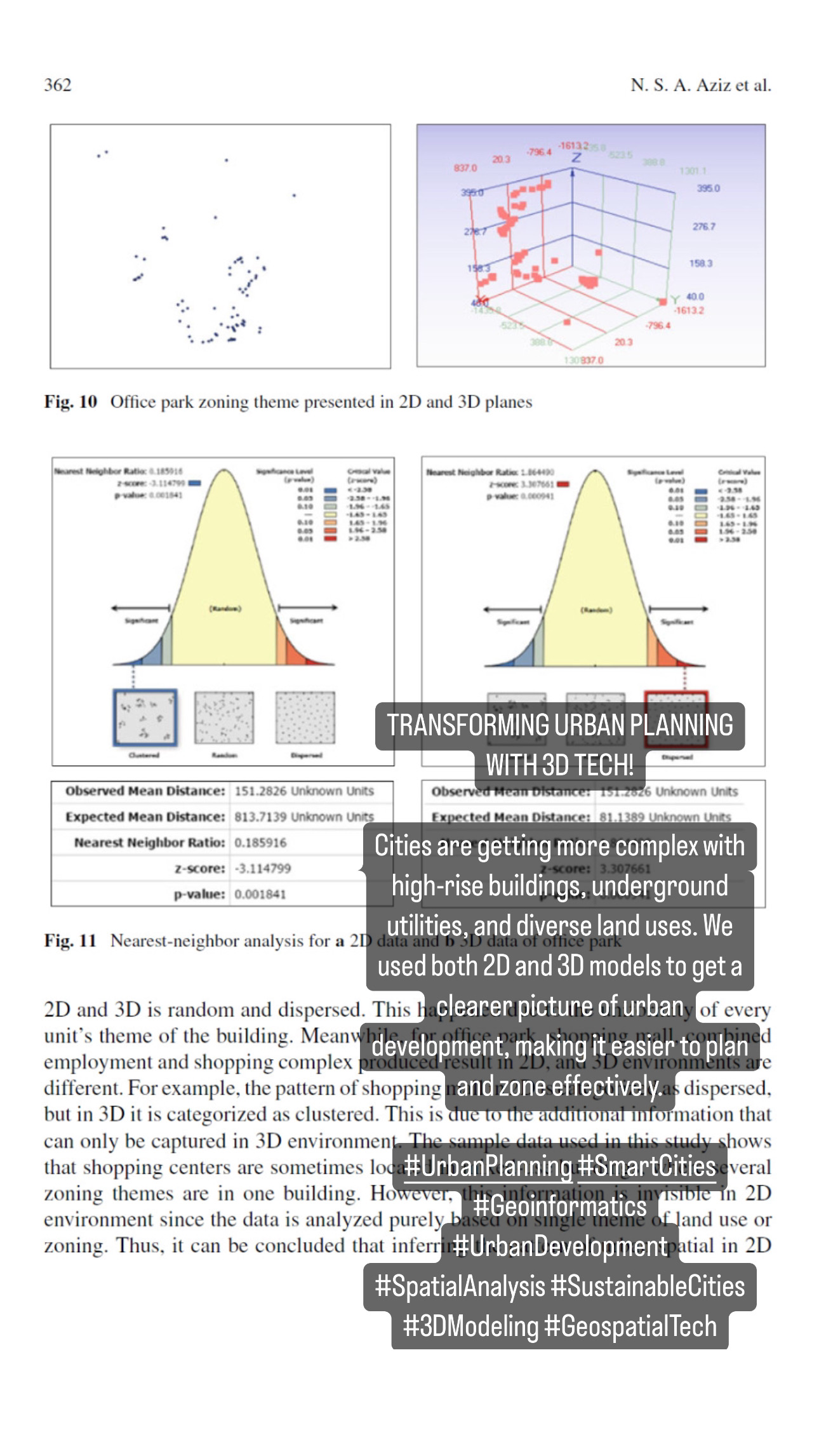
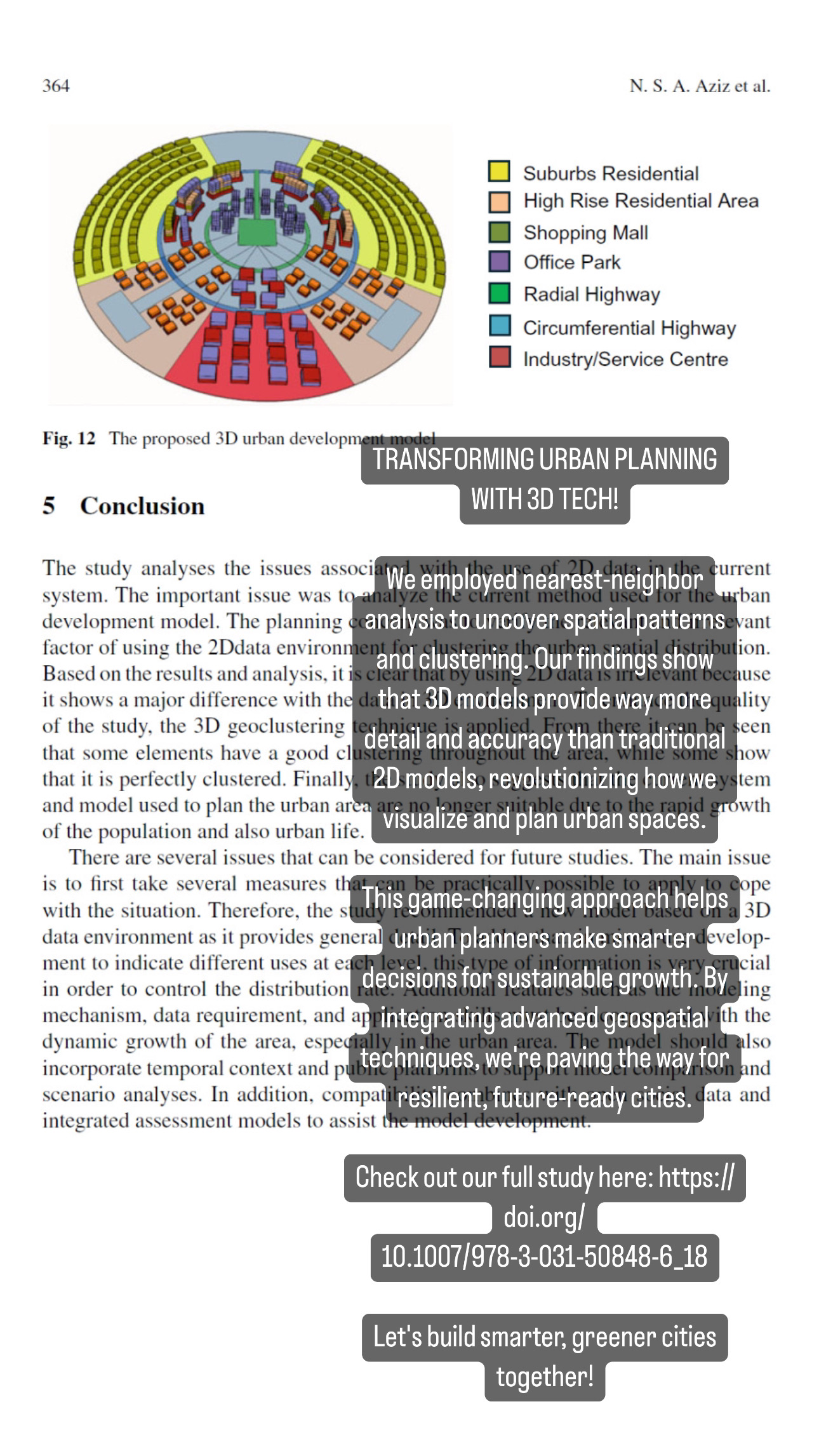
TRANSFORMING URBAN PLANNING WITH 3D TECH!
We’re pumped to share our latest research, “Analyzing Urban Spatial Distribution in 2D and 3D for Smart City Planning and Zoning,” published in Advances in Geoinformatics Technologies! This study tackles the exciting challenge of making our cities smarter and more efficient.
Cities are getting more complex with high-rise buildings, underground utilities, and diverse land uses. We used both 2D and 3D models to get a clearer picture of urban development, making it easier to plan and zone effectively.
We employed nearest-neighbor analysis to uncover spatial patterns and clustering. Our findings show that 3D models provide way more detail and accuracy than traditional 2D models, revolutionizing how we visualize and plan urban spaces.
This game-changing approach helps urban planners make smarter decisions for sustainable growth. By integrating advanced geospatial techniques, we’re paving the way for resilient, future-ready cities.
Check out our full study here: https://doi.org/10.1007/978-3-031-50848-6_18
Let’s build smarter, greener cities together!
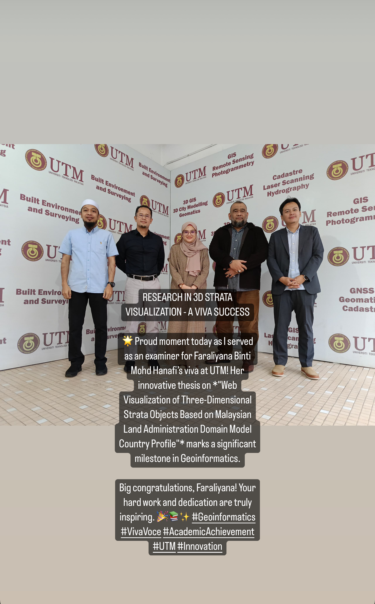
RESEARCH IN 3D STRATA VISUALIZATION – A VIVA SUCCESS
Delighted to served as an examiner for Faraliyana Binti Mohd Hanafi’s viva session at Universiti Teknologi Malaysia today. Her thesis, “Web Visualization of Three-Dimensional Strata Objects Based on Malaysian Land Administration Domain Model Country Profile,” showcases her dedication and innovative approach in Geoinformatics.
Congratulations to Faraliyana on this achievement. It was an honor to witness such a contribution to the field. Her work is sure to inspire future advancements in 3D visualization and land administration.
3D TREE MODELLING FOR LESS NOISE
Announcing our latest publication, “Improving Traffic-noise-mitigation Strategies with LiDAR-based 3D Tree-canopy Analysis,” in Geomatics and Environmental Engineering journal (Vol. 18, No. 3, 2024)! This groundbreaking study explores how trees can be our green heroes, reducing traffic noise naturally.
Our team used cutting-edge LiDAR technology to create 3D models of tree canopies. We analyzed how trees’ leaves and structures absorb traffic noise.
We developed a new equation to measure noise reduction, integrating it with existing models. Our findings show that trees can reduce traffic noise by 1 to 3 dB(A).
LiDAR-based 3D visualizations provide accurate data for better urban planning. Tree belts and dense planting schemes are particularly effective in noise mitigation.
Our discoveries pave the way for greener, quieter urban spaces. Imagine strolling down a city street with less noise and more peace—thanks to thoughtful tree planting!
The full study here: https://doi.org/10.7494/geom.2024.18.3.81.
Join us in celebrating the power of nature and technology to improve urban living. Let’s make our cities not just smarter, but also greener and more serene!
#UrbanInnovation #TrafficNoise #LiDAR #TreeCanopy #GreenCities #SustainableLiving #EnvironmentalScience #UrbanForestry #HealthierCities #NatureBasedSolutions
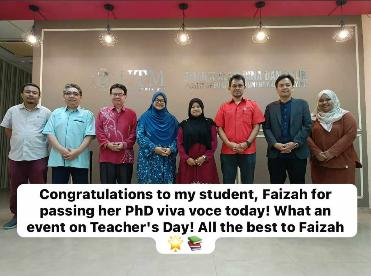
ACKNOWLEDGING DEDICATION: FAIZAH’S PHD VIVA VOCE
Today, we celebrate a significant milestone as my student, Faizah, completes her PhD viva voce in Geoinformatics. Her thesis on integrating GIS and BIM in building construction projects highlights her dedication and hard work.
Panel Members:
– Chairman: Prof. Sr Dr. Hishamuddin bin Mohd Ali
– Asst. Chairman: Dr. Suzanna binti Azmy
– External Examiner: Assoc. Prof. Sr Dr. Ts. Khairul Nizam bin Maulud (UKM)
– Internal Examiner: Prof. Sr Dr. Kherun binti Ali
– Main Supervisor: Assoc. Prof. Sr Dr. Muhamad Uznir bin Ujang
– Co. Supervisor: Prof. Dr. Zulkepi bin Majid
Thank you to the panel for their support and guidance. Congratulations to Faizah for her perseverance and commitment. Wishing her the best in her future endeavors.
#PhDSuccess #Geoinformatics #AcademicJourney #TeachersDay
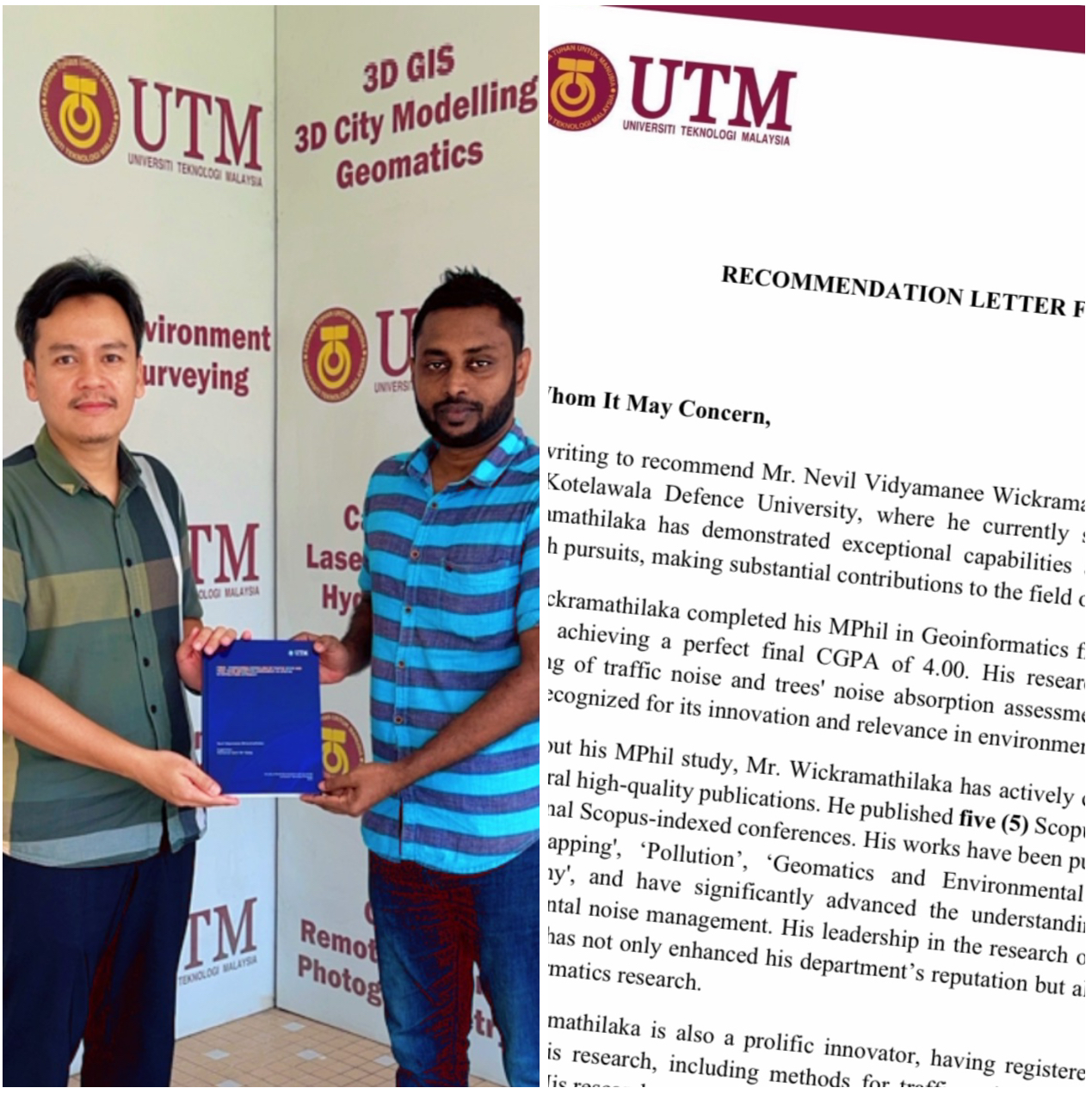
FROM MPHIL TO PROMOTION – NEVIL’S INSPIRING STORY
I am thrilled to share a moment of pride and achievement as my supervisee, Nevil Wickramathilaka, reaches a significant milestone in his career. After completing his MPhil in Geoinformatics at Universiti Teknologi Malaysia with a perfect CGPA of 4.00, Nevil has not only excelled academically but has also made remarkable contributions to the field.
His dedication over the past two (2) years has been truly inspirational. Nevil has published five (5) journal articles in renowned Scopus/WoS indexed journals, presented his innovative research at four (4) international conferences, received two (2) prestigious awards, and registered three (3) intellectual properties related to his groundbreaking work in traffic noise visualization and noise absorption assessment via spatial interpolation.
Today, I had the honor of writing a recommendation letter for his promotion at John Kotelawala Defence University, which reflects his hard work and potential. His promotion comes with a well-deserved salary increase of around 150%.
“Success is no accident. It is hard work, perseverance, learning, studying, sacrifice, and most of all, love of what you are doing or learning to do.” — Pele
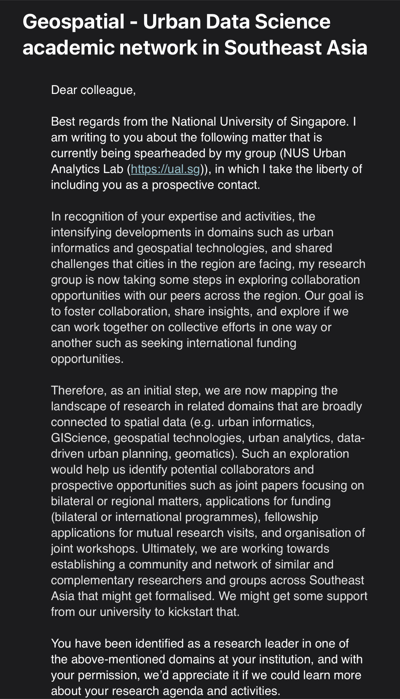
EXCITING INVITATION FROM THE NATIONAL UNIVERSITY OF SINGAPORE (NUS)
Delighted to announce an exhilarating opportunity from the National University of Singapore (NUS)! The NUS Urban Analytics Lab has graciously invited me to explore collaboration avenues in geospatial and urban data science within Southeast Asia.
Being recognized as a research leader in these domains is truly humbling, and I am eager to contribute to this joint venture. Together, our combined expertise and varied perspectives hold the potential to drive meaningful change in our communities and propel urban data science forward.
Excited about the prospect of partnering with NUS and esteemed institutions across Southeast Asia, let’s embark on this collaborative journey and ignite innovation!
#NUS #UrbanAnalytics #DataScience #Collaboration #SoutheastAsia #Innovation