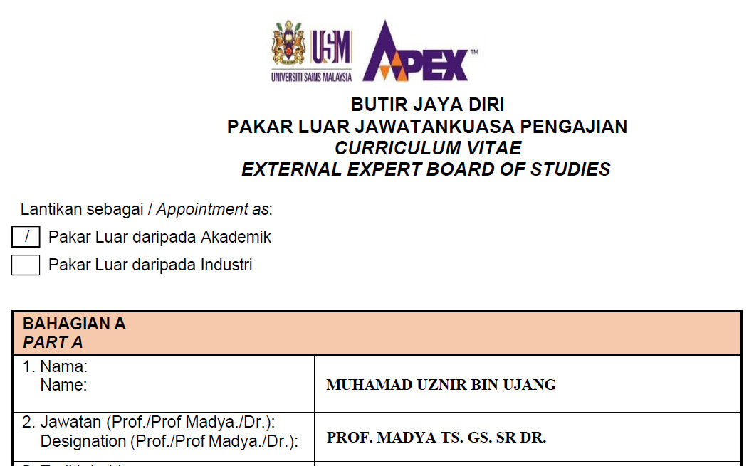
Feeling anxious when being appointed as an External Expert for the Board of Studies at Universiti Sains Malaysia (USM). An APEX university with higher ranking than UTM.
It’s truly a privilege to support the advancement of geospatial education and to collaborate with one of Malaysia’s leading academic institutions.
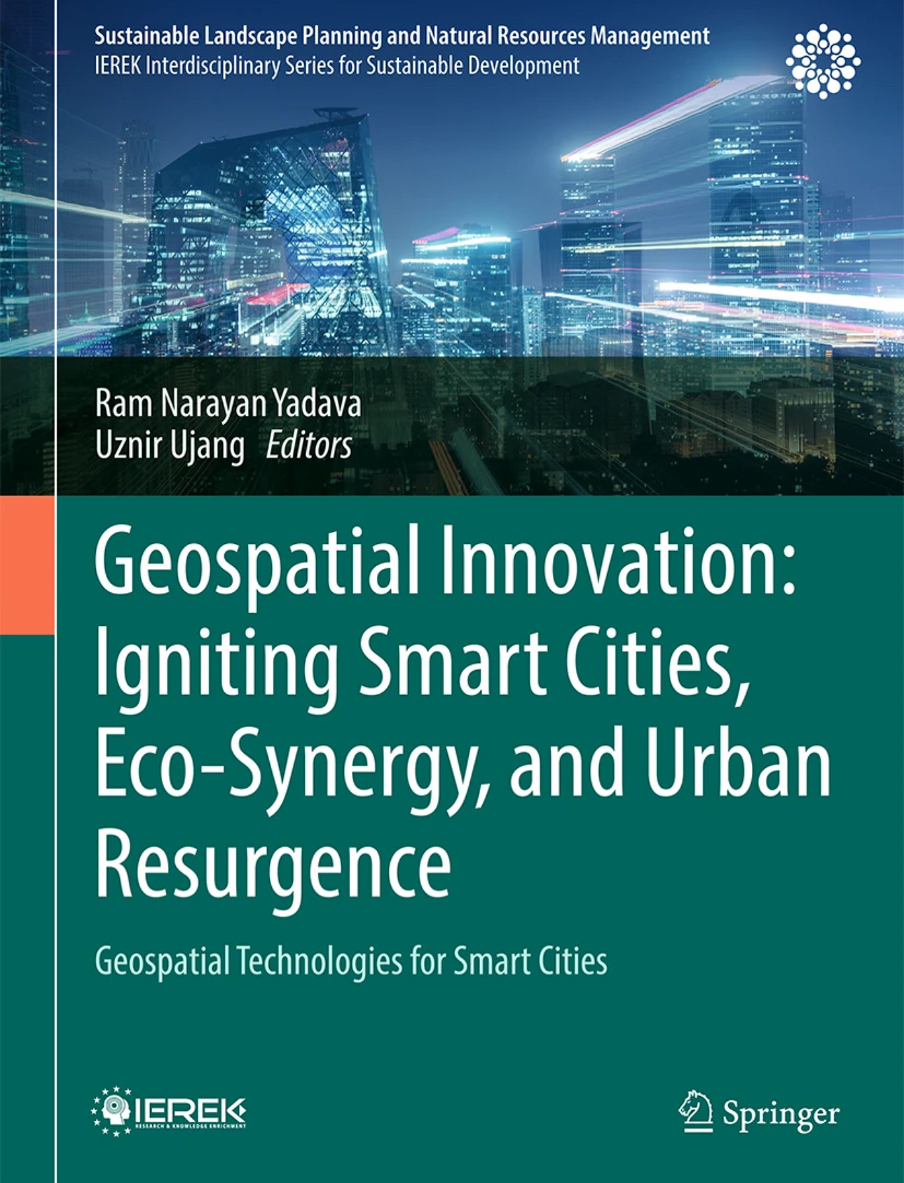
GEOSPATIAL INNOVATION: IGNITING SMART CITIES, ECO-SYNERGY, AND URBAN RESURGENCE
This book is expected to be available on October, 2025 by Springer.
This is a collaborative effort exploring how 3D City Modelling, digital twins, remote sensing, and AI can contribute to building smarter, more resilient, and sustainable cities.
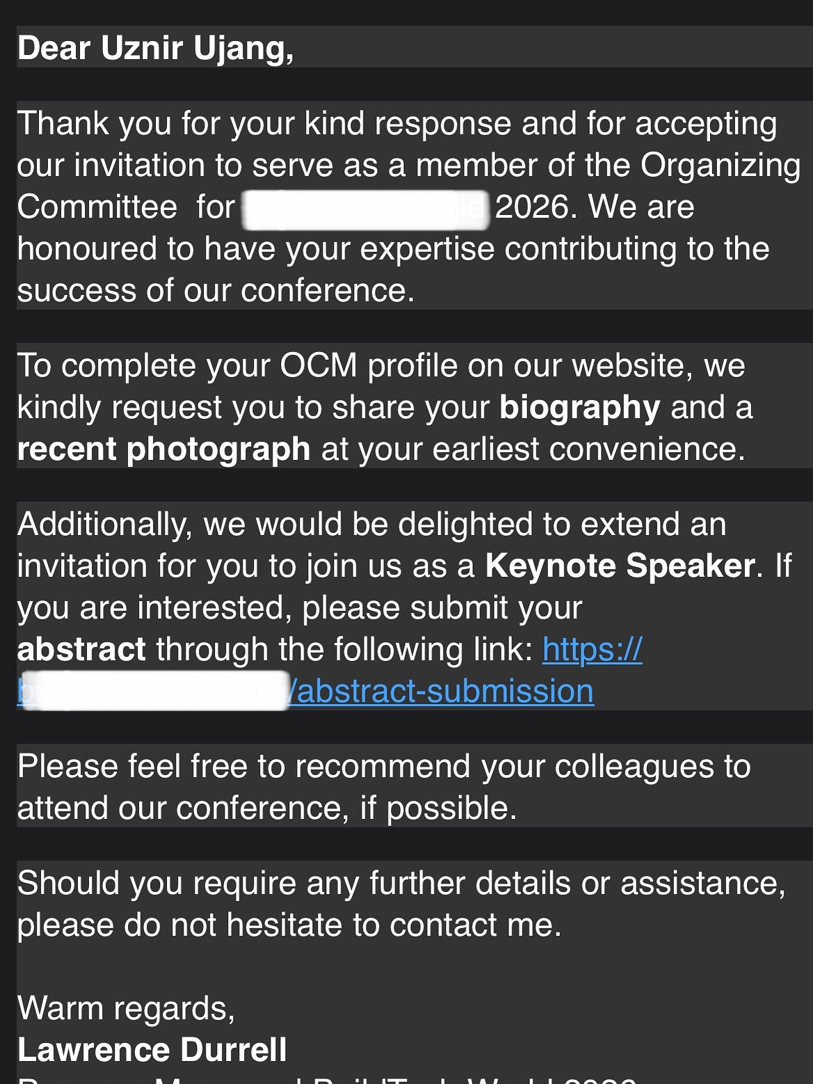
I will be traveling to Barcelona in March 2026 to deliver a keynote speech. But with the Iran-Israel conflict, I’ve been reflecting on more than just travel plans. Global tensions serve as a reminder of how interconnected our world is and how quickly uncertainty can affect even the most meaningful commitments.
I remain hopeful that the conference will proceed as planned. More importantly, I hope for peace, understanding, and stability for everyone across all affected regions.
Let us continue to support each other and stay informed during these uncertain times.
“Peace is not merely a distant goal that we seek, but a means by which we arrive at that goal.” – Martin Luther King Jr.
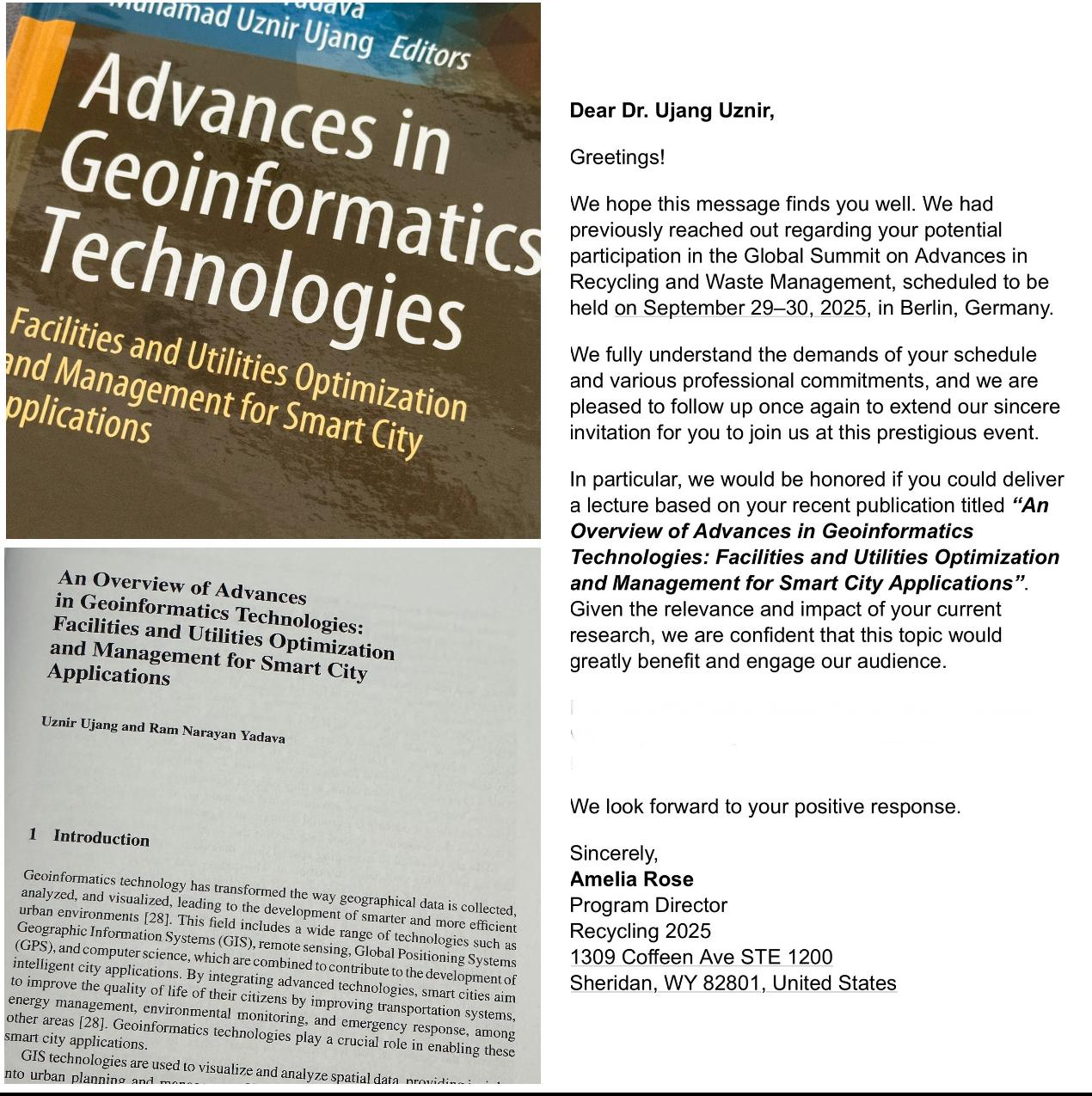
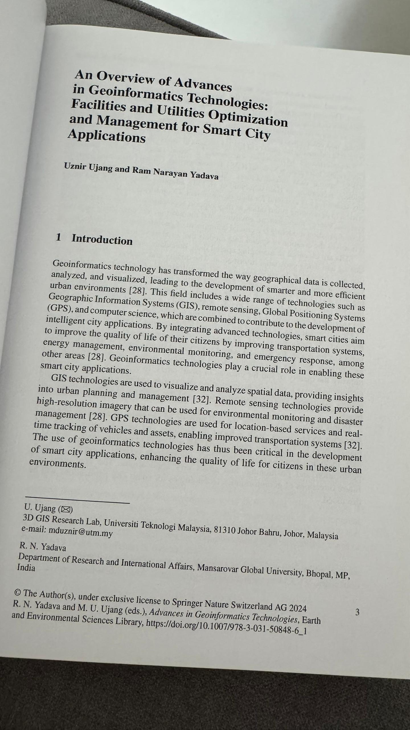
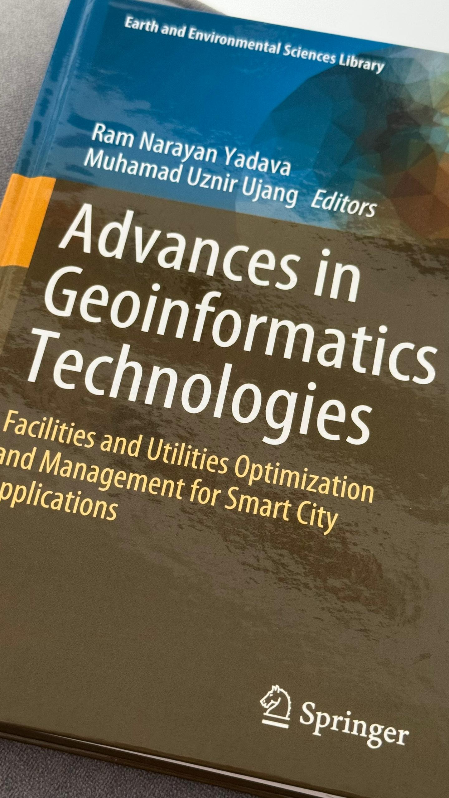
Besides writing journal papers, I enjoy working on books and book chapters. One example is this chapter I wrote titled “An Overview of Advances in Geoinformatics Technologies: Facilities and Utilities Optimization and Management for Smart City Applications”.
I enjoy this kind of writing because it helps raise awareness and spark new ideas about what’s possible in our geospatial science field.
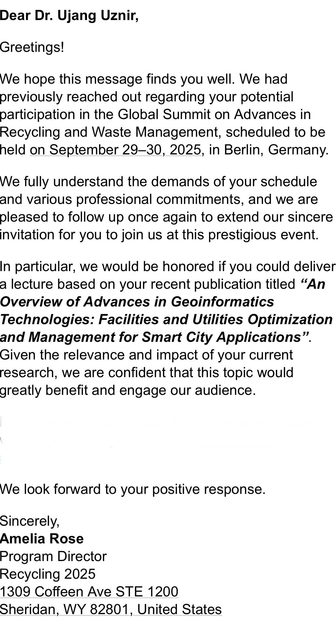
Today, I’m excited that I’ve been invited to give a talk about this chapter at the Global Summit on Advances in Recycling and Waste Management in Berlin, Germany, this September 29–30, 2025.
I’m happy to know that the book has contributed to the community. I hope the session will offer something valuable and inspiring to those attending!
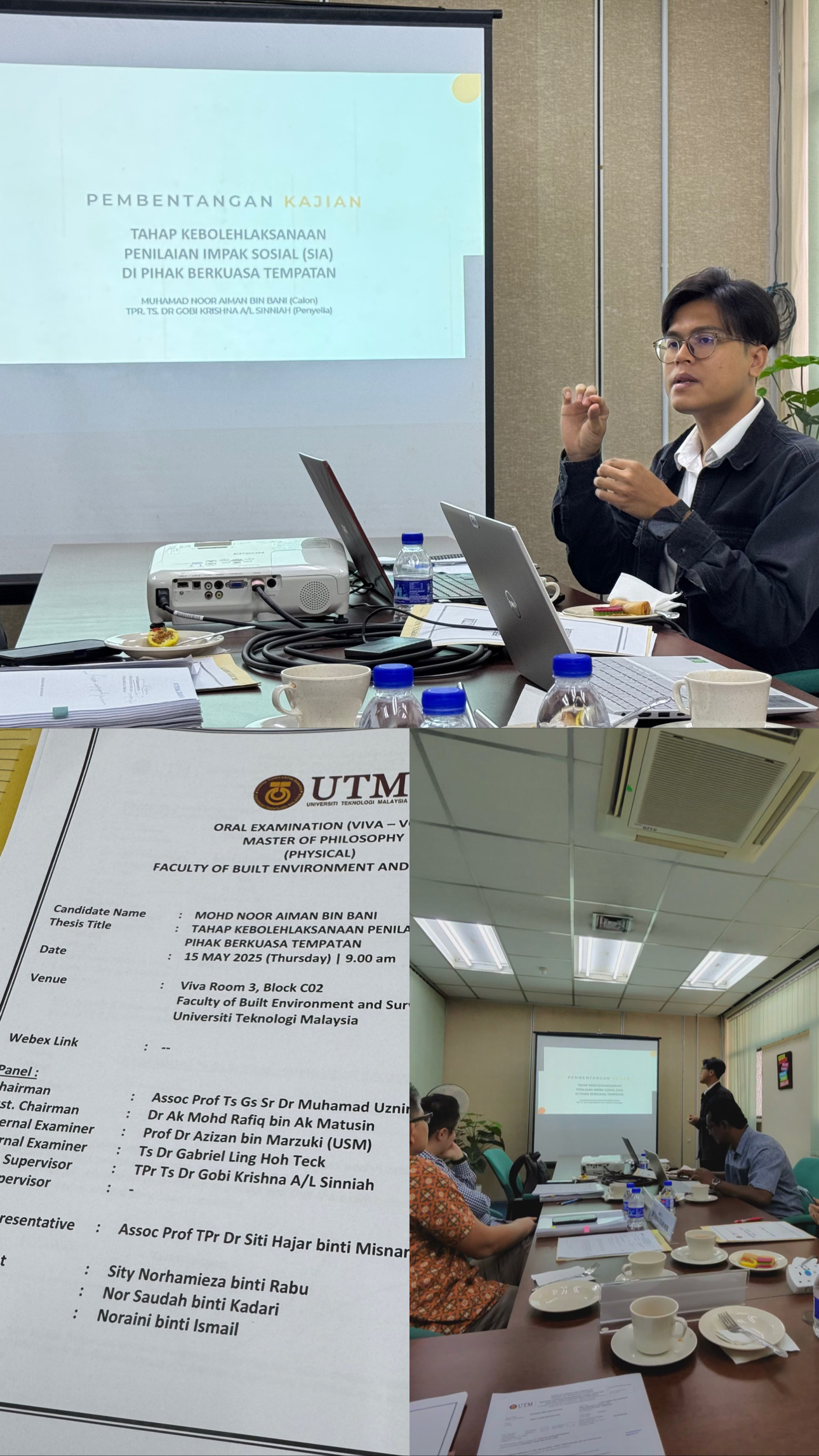
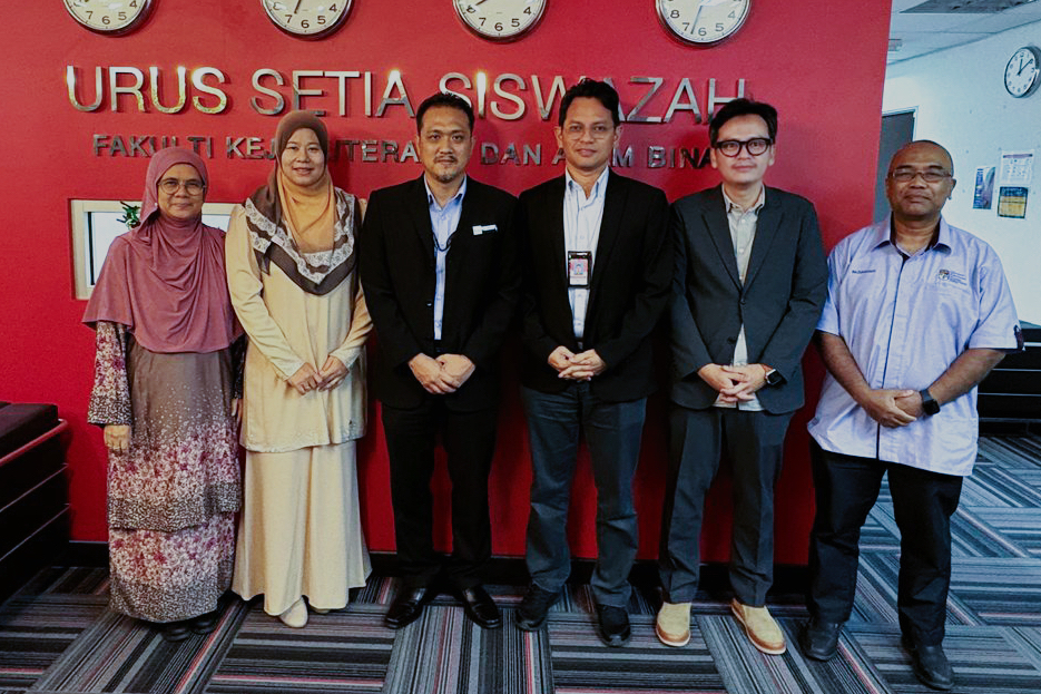
INVITATION AS CHAIRMAN FOR TOWN PLANNING MPhil VIVA VOCE – MUHAMAD NOOR AIMAN BIN BANI
Congratulations to Muhamad Noor Aiman bin Bani for successfully completing his Master of Philosophy (MPhil) Viva Voce. The thesis topic is “Tahap Kebolehaksanaan Penilaian Impak Sosial (SIA) di Pihak Berkuasa Tempatan.”
The panel members involved in this session were:
• Chairman: Assoc. Prof. Ts. Gs. Sr. Dr. Muhamad Uznir Bin Ujang
• Assistant Chairman: Dr. Ak Mohd Rafiq bin Ak Matusin
• Internal Examiner: Ts. Dr. Gabriel Ling Hoh Teck
• External Examiner: Prof. Dr. Azizan bin Marzuki (Universiti Sains Malaysia – USM)
• Main Supervisor: TPr Ts. Dr. Gobi Krishna A/L Sinniah
Congratulations once again to the student, supervisor, and all committee members for making this session successful!
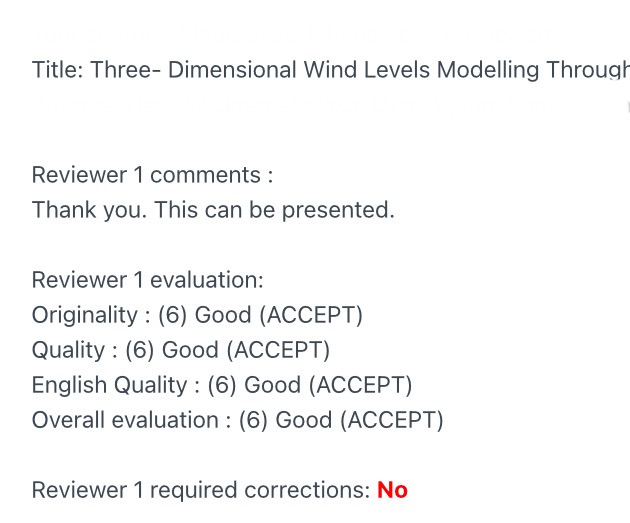
Sharing a small but meaningful success story. A paper by my former postgraduate student has been accepted for presentation.
He is the kind of person who truly shows what learning looks like: staying humble, staying curious, asking questions, welcoming suggestions, even asking for corrections when needed, and always ready to brainstorm and refine ideas together. Before the submission, we discussed, shared thoughts openly, and turned ideas into a real and solid piece of work.
And the result? You can see it yourself. A total knockout.
This reminds me that it is not just talent that makes a difference. It is attitude, hard work, and the willingness to grow that truly set people apart. Congratulations. This success is fully earned.
As for me, I have always believed in giving advice sincerely but never forcing it. I will say it once. Whether you choose to listen or not is entirely up to you. We are all responsible for our own paths. I do not gain or lose anything either way. For those who choose to listen and grow, the rewards are theirs to reap.
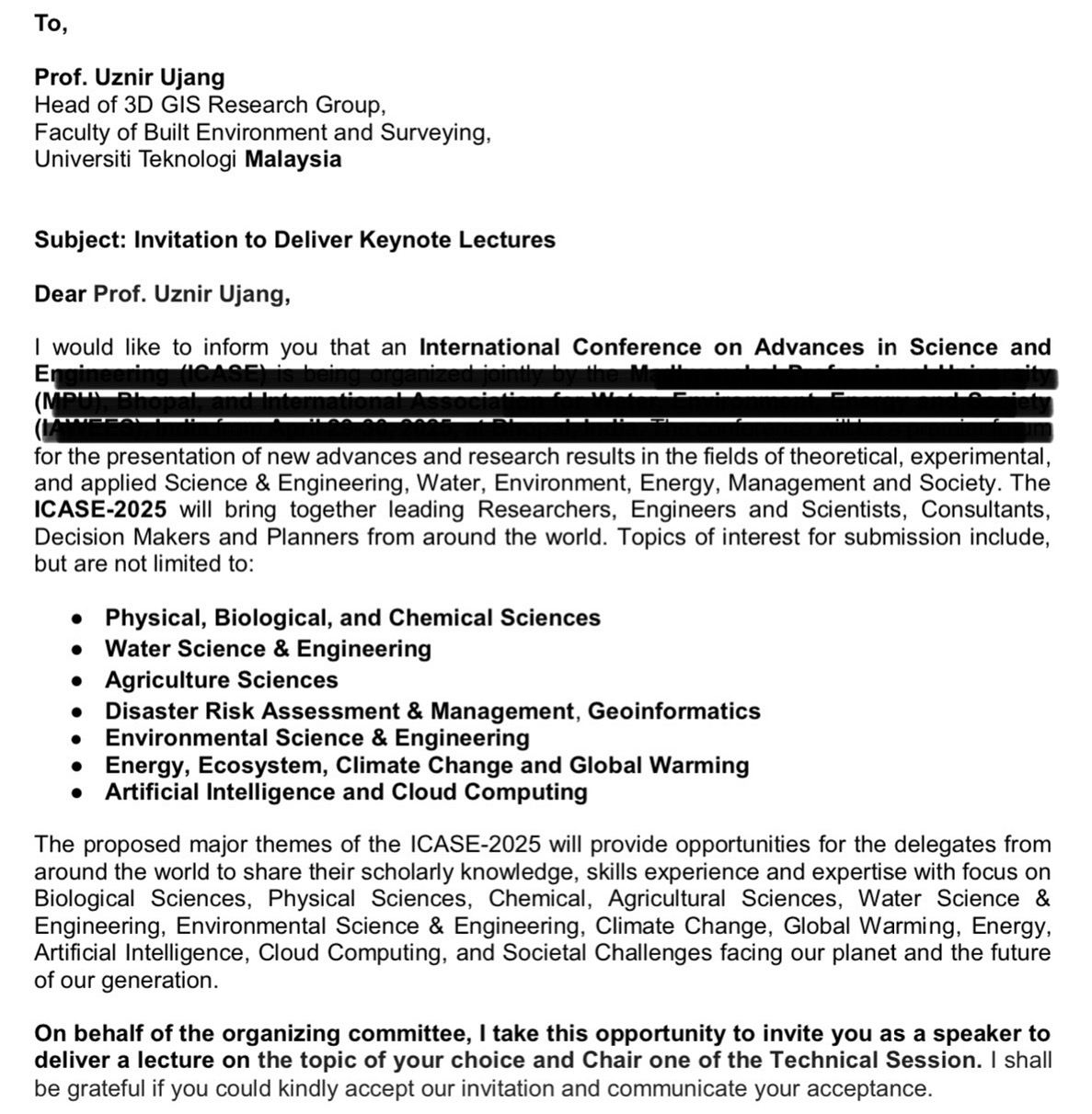
Still riding the energy from my recent keynote at ICWEES 2025, I’ve just been invited again, this time by ICASE-2025, to deliver the same keynote talk at a different international conference.
Third keynote talk this year.
Grateful beyond words to see my work resonating across different fields, from geoinformatics to environmental science, smart cities, AI, and beyond.
Thank you once again to all the organizers, peers, and communities that continue to open new doors and believe in this mission.
Let’s keep pushing boundaries, challenging ideas, and building the future together!
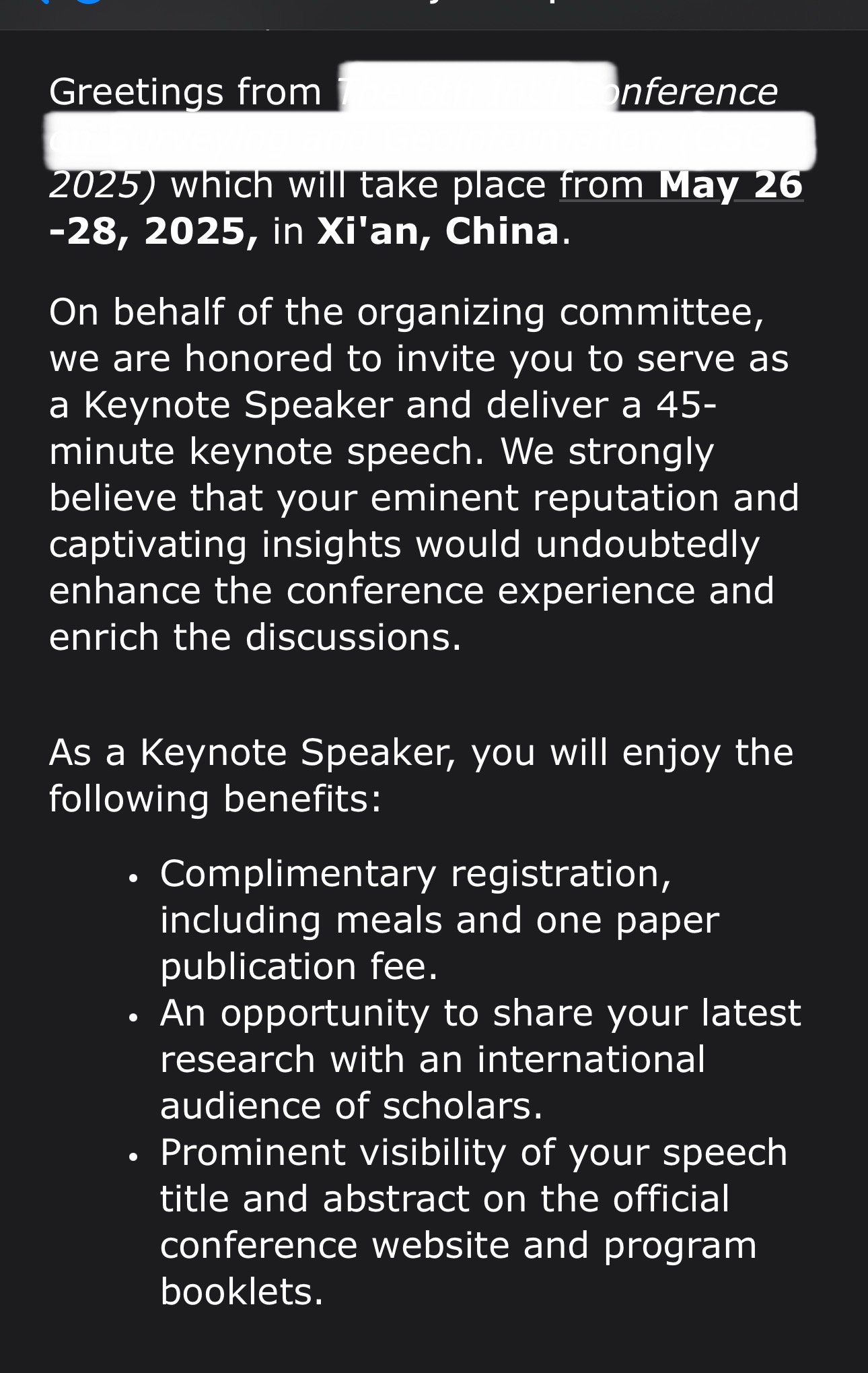
I haven’t even delivered my keynote for this month’s conference yet. And the next invitation has already landed. This month conference is over 3,200 km from Skudai. And next month? Even farther, nearly 4,300 km to Xi’an, China. From South Asia to East Asia. Whatever it is, I am grateful for the trust given to share ideas across borders. Thanks!
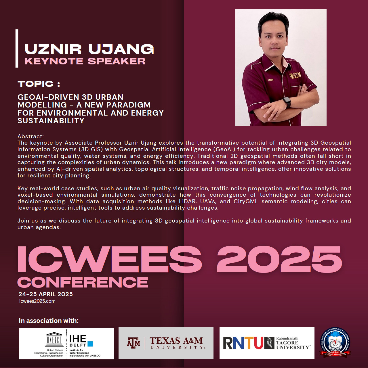
The keynote by Associate Professor Uznir Ujang explores the transformative potential of integrating 3D Geospatial Information Systems (3D GIS) with Geospatial Artificial Intelligence (GeoAI) for tackling urban challenges related to environmental quality, water systems, and energy efficiency. Traditional 2D geospatial methods often fall short in capturing the complexities of urban dynamics. This talk introduces a new paradigm where advanced 3D city models, enhanced by AI-driven spatial analytics, topological structures, and temporal intelligence, offer innovative solutions for resilient city planning.
Key real-world case studies, such as urban air quality visualization, traffic noise propagation, wind flow analysis, and voxel-based environmental simulations, demonstrate how this convergence of technologies can revolutionize decision-making. With data acquisition methods like LiDAR, UAVs, and CityGML semantic modeling, cities can leverage precise, intelligent tools to address sustainability challenges.
Join us as we discuss the future of integrating 3D geospatial intelligence into global sustainability frameworks and urban agendas.
Warm congratulations to Abdullah bin Ahmad (P127080) from the Department of Civil Engineering, UKM, for successfully completing his Master of Science viva voce! He is a senior engineer at the Public Works Department (JKR).
His thesis focused on a highly relevant topic: GeoBIM Data Structure for Sewer System, which I believe is a crucial area in advancing infrastructure management through geospatial and BIM integration. From my view, the nation needs more awareness on the importance of GeoBIM. It is good to have more research like Abdullah’s.
The session was held on 14 April 2025 (Monday), at 9:30 a.m. at the Faculty of Engineering and Built Environment, UKM Bangi.
I was honored to serve as the External Examiner, representing Universiti Teknologi Malaysia (UTM).
The viva panel included:
Chairperson: Prof. Ir. Dr. Siti Rozaimah Sheikh Abdullah (JKKP, FKAB)
Internal Examiner: Sr. Ts. Dr. Noraini Hamzah (JKA, FKAB)
Main Supervisor: Lt. Kol. Bersekutu (PA) Prof. Madya Ts. Gs. Sr. Dr. Khairul Nizam Abdul Maulud (JKA, FKAB)
Thank you to Universiti Kebangsaan Malaysia (UKM) for the trust and opportunity. It’s always a privilege to contribute to academic quality and support innovative research through external examiner roles.
Wishing the candidate every success in future research and practice!