TRANSFORMING URBAN PLANNING WITH 3D TECH!
We’re pumped to share our latest research, “Analyzing Urban Spatial Distribution in 2D and 3D for Smart City Planning and Zoning,” published in Advances in Geoinformatics Technologies! This study tackles the exciting challenge of making our cities smarter and more efficient.
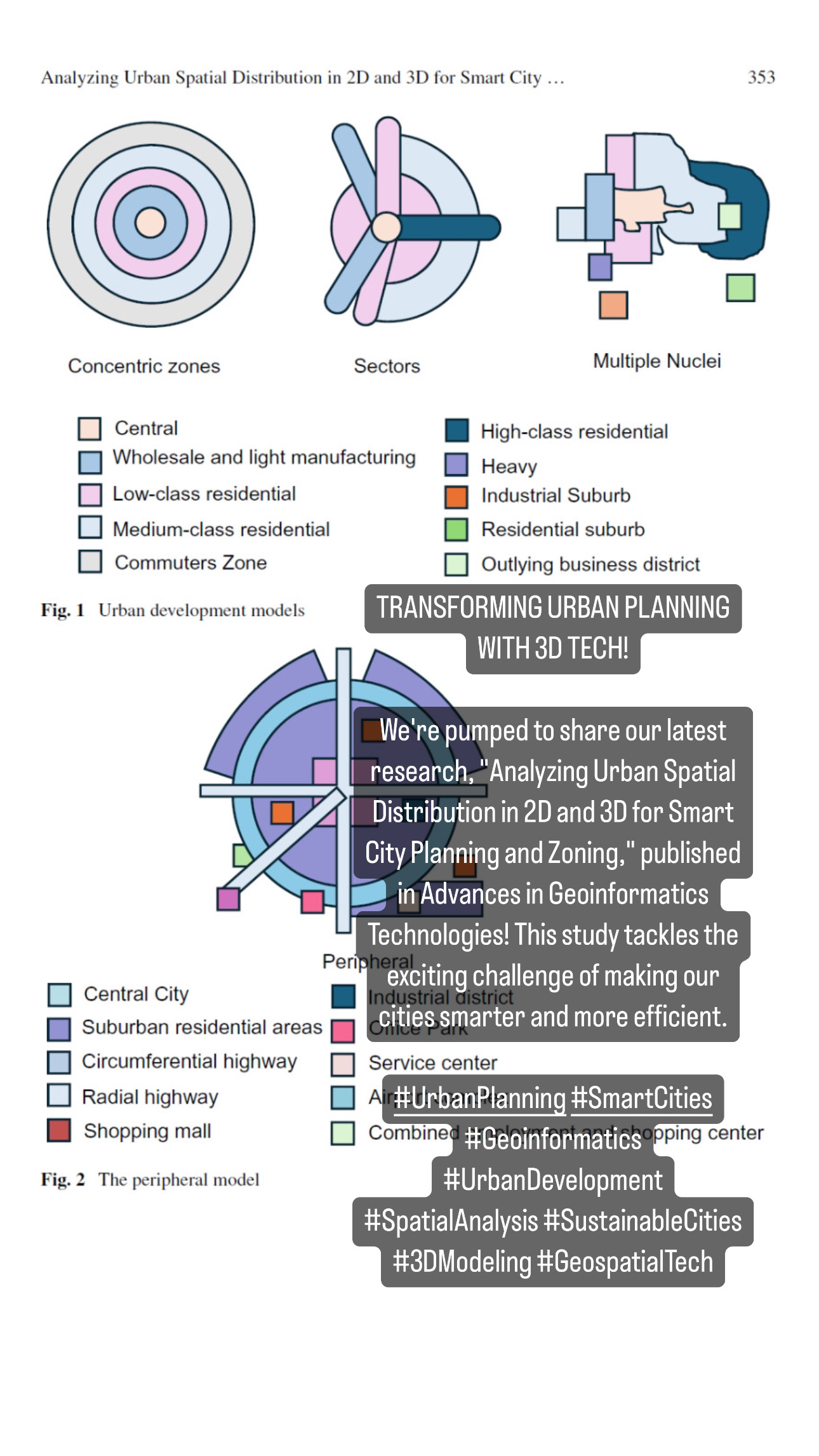
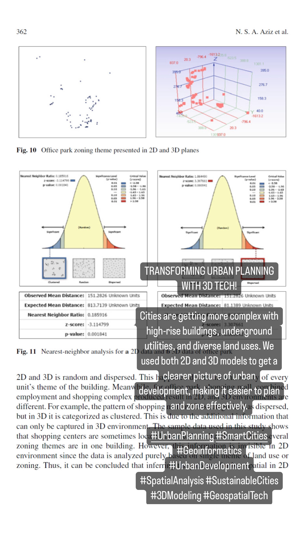
Cities are getting more complex with high-rise buildings, underground utilities, and diverse land uses. We used both 2D and 3D models to get a clearer picture of urban development, making it easier to plan and zone effectively.
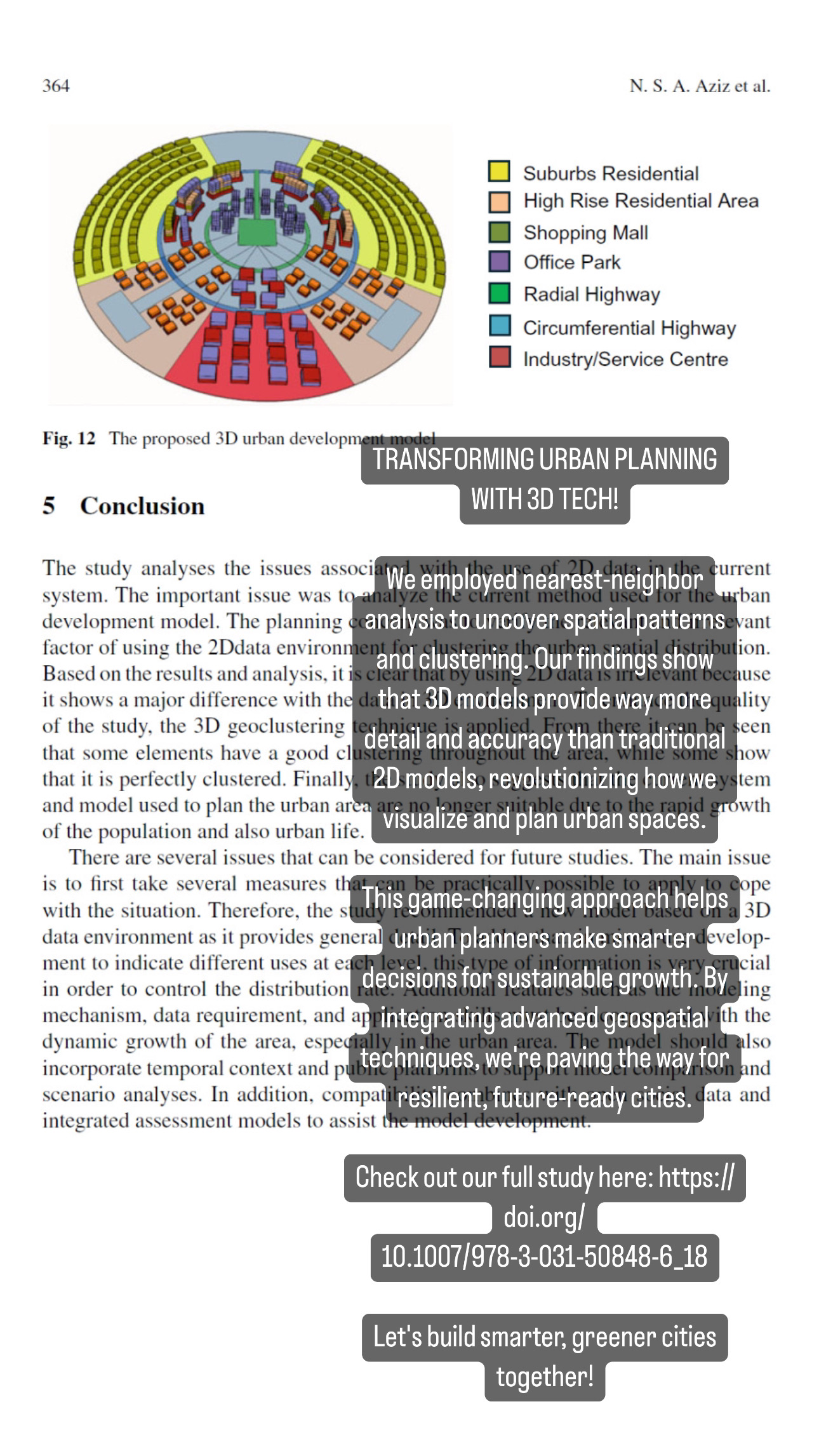
We employed nearest-neighbor analysis to uncover spatial patterns and clustering. Our findings show that 3D models provide way more detail and accuracy than traditional 2D models, revolutionizing how we visualize and plan urban spaces.
This game-changing approach helps urban planners make smarter decisions for sustainable growth. By integrating advanced geospatial techniques, we’re paving the way for resilient, future-ready cities.
Check out our full study here: https://doi.org/10.1007/978-3-031-50848-6_18
Let’s build smarter, greener cities together!
#UrbanPlanning #SmartCities #Geoinformatics #UrbanDevelopment #SpatialAnalysis #SustainableCities #3DModeling #GeospatialTech