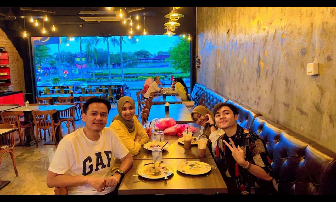
Having a dinner with these two young lads. Thank you Aprillia Rahmi Utami for coming. And farewell Nikolas Angi Putra! Have a safe trip back to Bandung.
* Nikolas is a student from Universitas Pendidikan Indonesia. May he has a wonderful experience in learning GIS at UTM and unforgettable moments with campus life here in Johor Bahru, Malaysia.
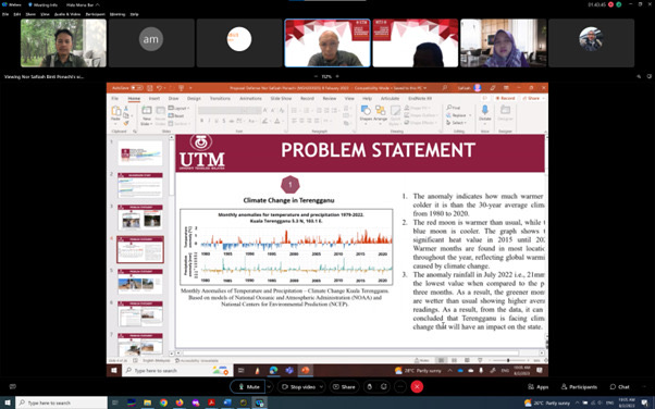
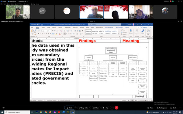
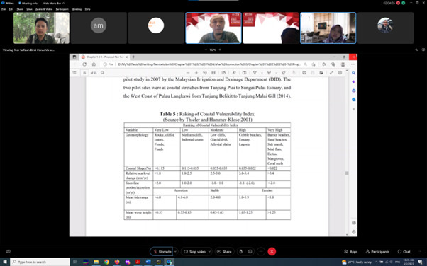
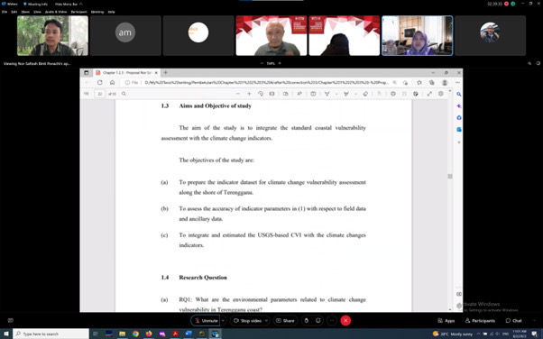
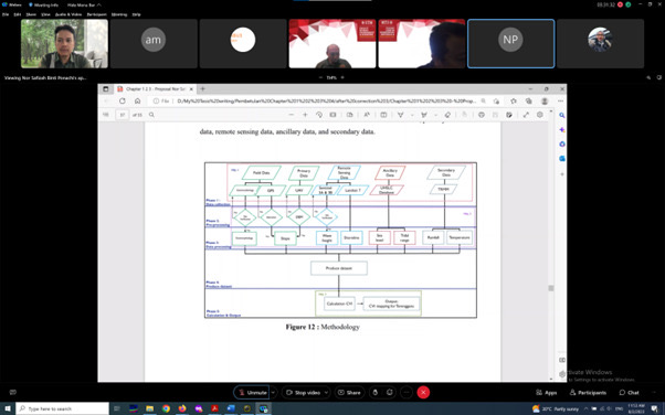
Congratulations to Nor Safizah Ponachi on your MPhil proposal defense. Your determination signifies in the output you produced in the findings. Keep it up!
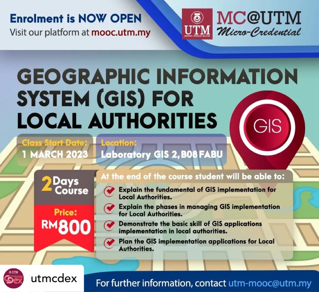
I am delighted to announce our latest course, Geographic Information System (GIS) for Local Authorities.
GIS is a geographic information system, which is an important part of Geo-spatial technology. It has wide applications in local authorities areas.
You are expected to learn the basic knowledge of GIS and the basics of GIS implementation in local authorities. Participants can also put their newfound knowledge to use right away by implementing GIS applications in local authorities.
If you are interested to join the course, register here:
This year in 2022, I manage to get 8 blended learning awards from UTM. I would like to say a thousand thanks to UTM for giving me this recognition.
This directly give enthusiasm to the staff at the university to provide the best for lectures, labs and knowledge delivery to all students studying at UTM. Many thanks UTM!
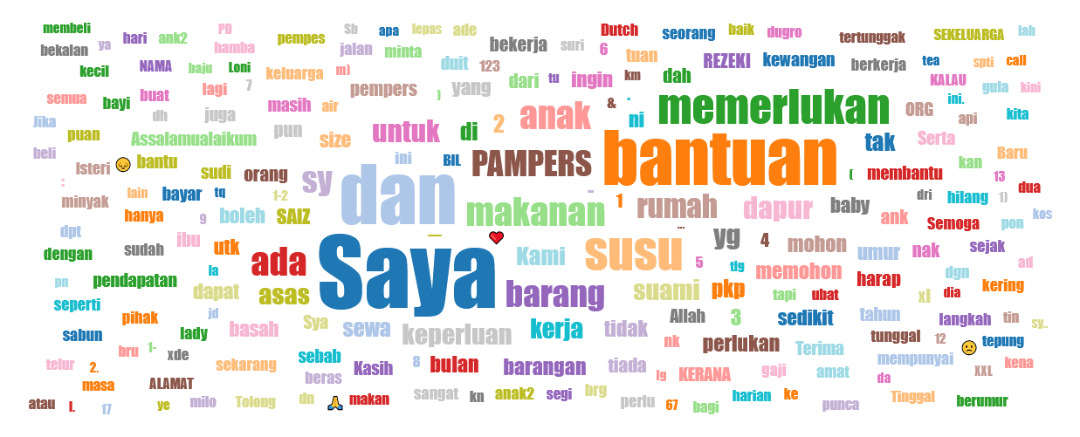
Word cloud is a novelty visual representation of text data, typically used to depict tags/keyword metadata. This format is useful for quickly perceiving the most prominent terms to determine its relative prominence. Bigger term means greater weight.
To date, the Word Cloud generated from the myBantu form shows some of the most frequently used words. The frequently used words are:
I (Saya)
Help (Bantuan)
Requires (Memerlukan)
Milk (Susu)
Diapers (Pampers)
Kids (Anak)
Food (Makanan)
Home (Rumah)
I hope this generated Word cloud can be used as a reference for those who want to help. Thank you Malaysians for the kindness.
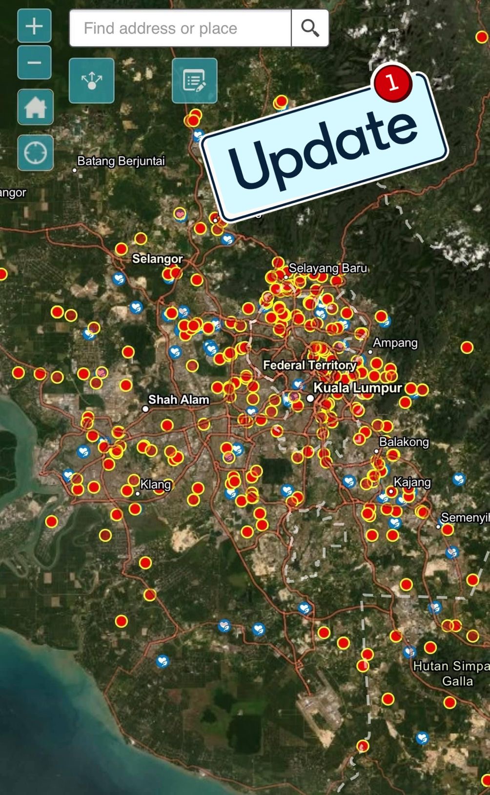
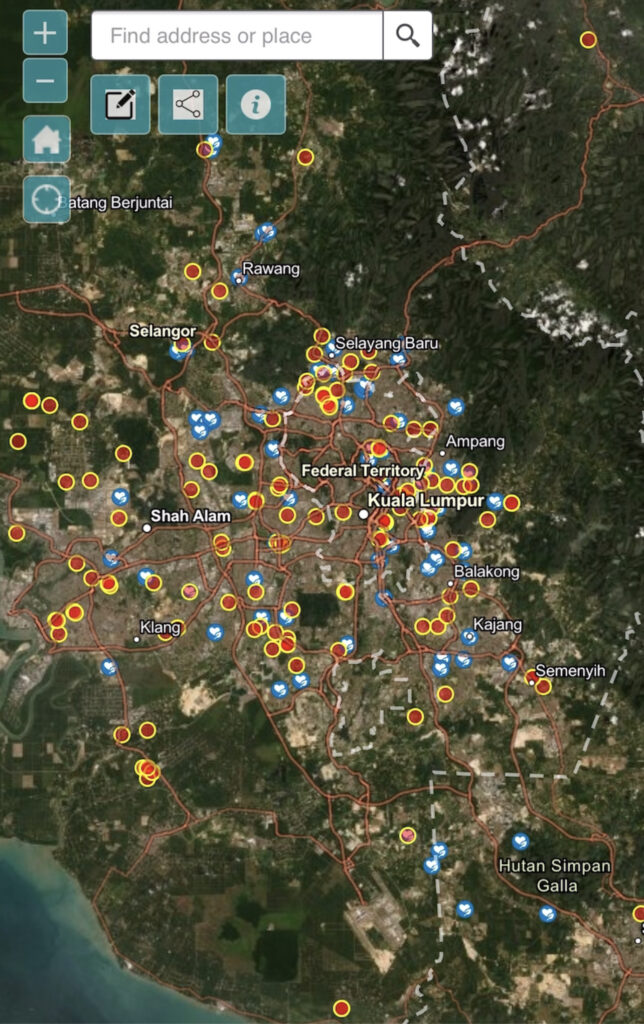
As usual, in addition to data checking done daily, data cleanup is done periodically. Data cleanup is done to prevent repeated/overlapping assistance from occurring.
Based on this week’s myBantu map, almost half (47%) of the locations that need help managed to receive help. Especially in the northern part of the Peninsula and in Sabah and Sarawak. Thank you Malaysians who care, provide assistance to those in need.
However, this week’s myBantu map also recorded a higher increase in daily reports compared to the previous week. Hopefully this report will decrease and more Malaysians can be helped.
Since this information can be updated by users, hopefully locations that have received help or “suspicious” can be edited or deleted. Only the locals will be able to do the verification.
To Malaysians who need help, you can fill out the form at this link https://arcg.is/1mK5zn0.
To those who want to donate, click here https://bit.ly/3qH04qu to view the myBantu map.
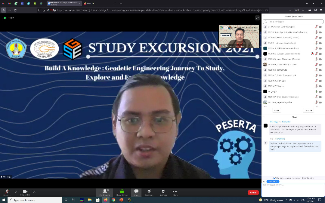
I was so excited with the involvement of students from the Geodesy program at the Malang National Institute of Technology, Indonesia. Everything went smooth with the lecture.
After the lecture, the questions from the students of the Geodesy program were very astonishing. Among the questions are:
Can GIS be applied in the field of Epidemiology?
What is the accuracy of the data required for a GIS system?
Can GIS help in crime analysis works?
How is geodesy handy in GIS?
Is it possible that GIS can be used at the national level?
Can GIS be used for forestry?
What about GIS with air traffic control management?
The answer is yes. I explain by showing real examples that happens in Malaysia as well as my own experience of involvement in those areas.
Thank you to the excellent students from the institute who asked these questions. The names of the students were Jose, Alexandra, Rashid, Aninda, and Gose (sorry I can’t remember the rest).
Keep on going learning new knowledge. Hopefully we have the opportunity to meet here in UTM.
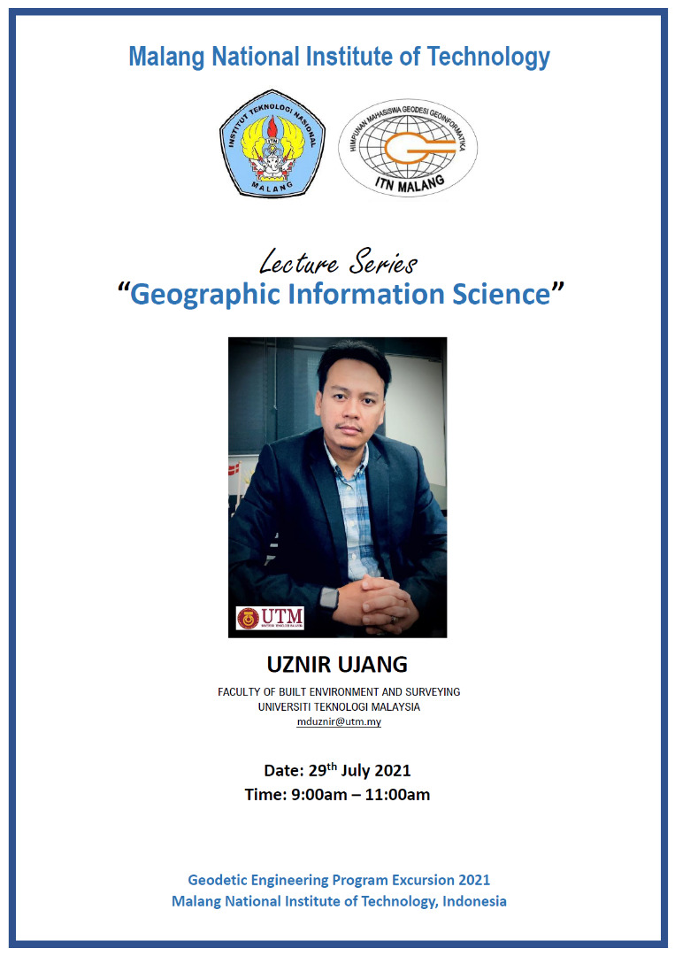
MALANG NATIONAL INSTITUTE OF TECHNOLOGY, INDONESIA – LECTURE SERIES
Sharing an info. I have been invited to deliver a lecture series on Geographic Information Science (GIS) at Malang National Institute of Technology, Indonesia.
The interesting thing about the pandemic is that we don’t need a passport or air tickets to travel. Everything is virtual.
Thank you to the organizing committee for inviting and giving me the opportunity to share some of the knowledge I have to the geodesy students there.
“Sharing is good, and with digital technology, sharing is easy.” – Richard Stallman
myBantu map have recorded thousands of data that have been submitted by individuals in need. But it is believed that there are locations that received assistance but is not been edited (updated).
Therefore, the myBantu map will go through a data updating process to avoid duplication of assistance. Since this update process is done in batches, there is a possibility that there will be locations marked as “received assistance”, but it is otherwise. Double check is needed.
Individual who are in needs, make yourself visible by filling out the myBantu form https://arcg.is/1mK5zn0
NGO or individuals who wish to give a hand, you may refer to the myBantu map https://bit.ly/3qH04qu
Based on the myBantu map, more and more locations have been assisted and the number of myBantu red dot locations is decreasing. Thank you to the caring citizens of Malaysian.
Undoubtedly there are still new locations (that need help) added every day. And this myBantu map is updated in real time.
For those who need help with basic needs, you can fill out this form https://arcg.is/1mK5zn0.
For those who want to help, do check out the myBantu map here https://bit.ly/3qH04qu.