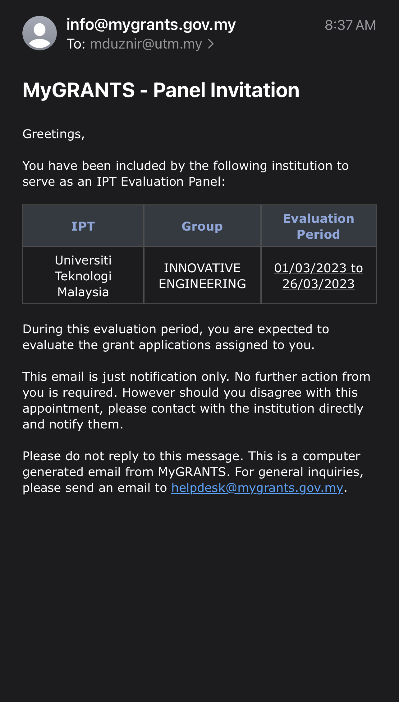
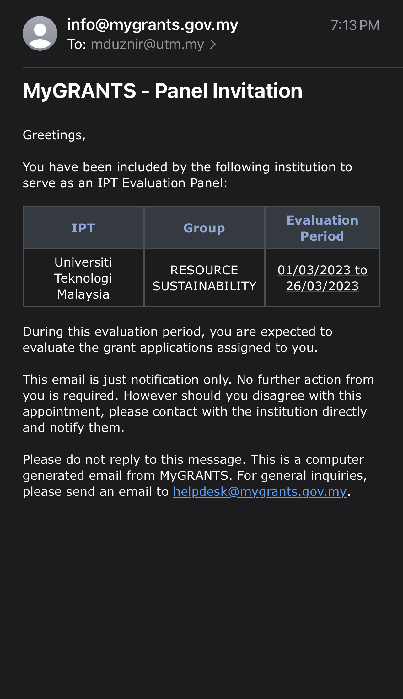
I’m honored to share that I’ve been appointed as a panel reviewer for the Fundamental Research Grant Scheme (FRGS). It’s quite a transition from being an applicant myself, but now I have the privilege of evaluating research grant proposals in the Technology and Engineering domain, as well as the Natural and Cultural Heritage domain. It’s truly rewarding to shift gears and help other applicants in their research endeavors. Looking forward to the journey ahead! #FRGS #ResearchReview #Technology #Engineering #Heritage
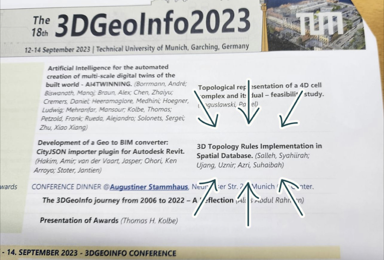
I am pleased to announce our participation in the 3D Geoinfo 2023 conference, where we will be showcasing our research in the field of 3D topology, which aligns with my area of expertise. Regrettably, due to my prior commitments as the chair of another conference this weekend, I am unable to attend the event in Technical University of Munich in person. However, we have diligently prepared a pre-recorded presentation to share our research findings. We extend our sincere gratitude to the organizers of 3D Geoinfo 2023 for this valuable opportunity.
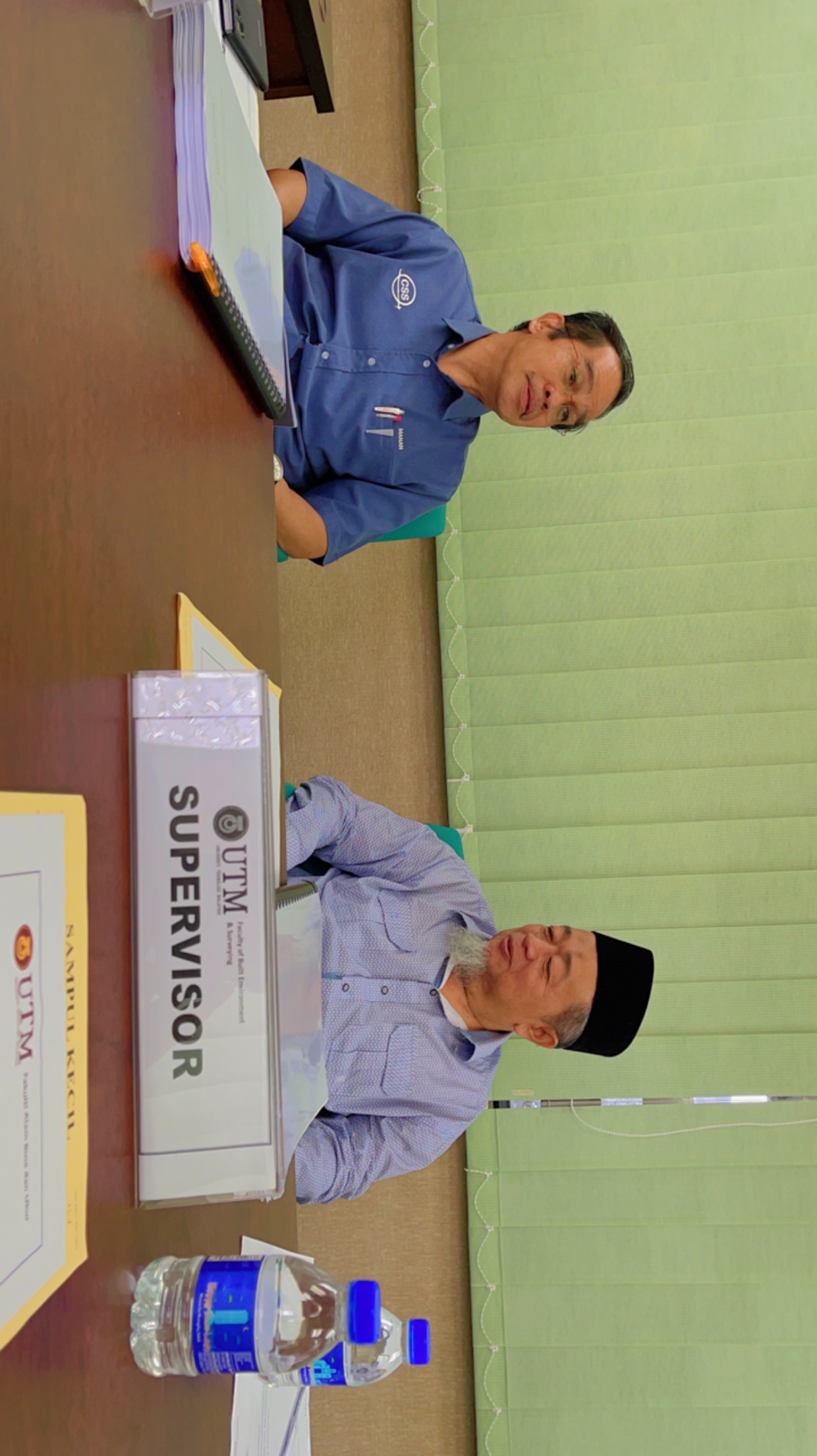
As academics, we often face challenging decisions, and in this case, I find myself having to forgo two significant academic engagements: 3D Geoinfo 2023 in Germany and a keynote talk in Nice, Paris . If not, I can travel directly from ISPRS Geospatial Week 2023 conference in Egypt which I attended few days ago, and fly directly to Europe. Nevertheless, I recognized that unforeseen circumstances can arise, and my current focus is on the organizing conference that I am chairing on September 17th and 18th, 2023.
Today, I have a scheduled appointment with the Deputy Vice Chancellor of UTM in the afternoon for the conference officiation ceremony, and we remain dedicated to ensuring its success. We appreciate your well-wishes and support as we navigate these academic responsibilities. All the best for 3D Geoinfo 2023 conference as well!
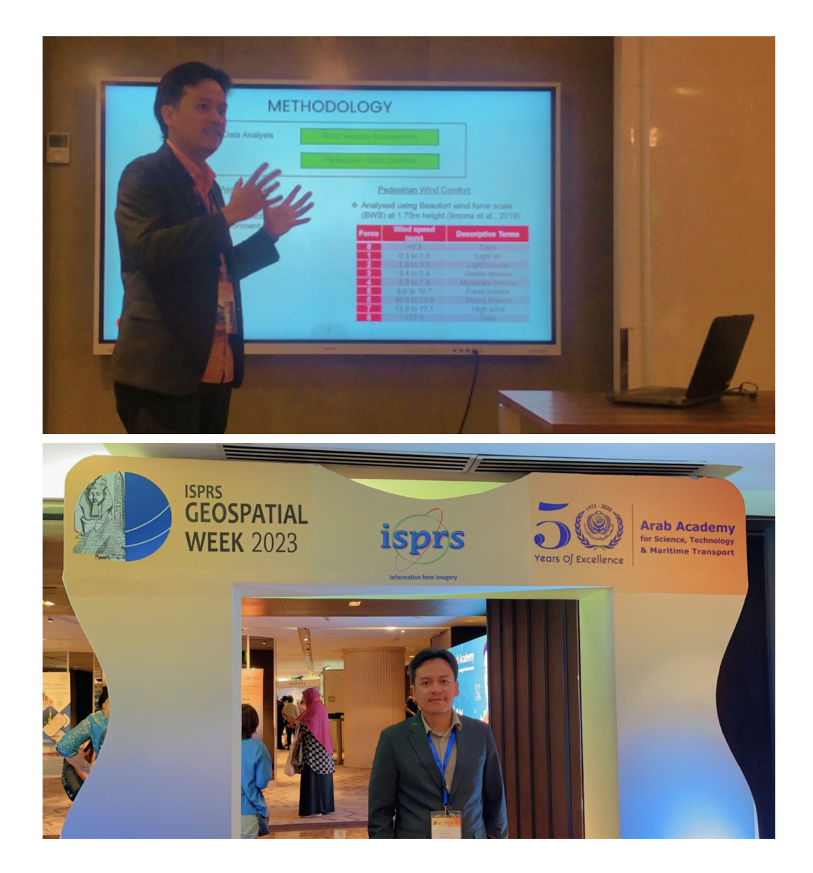
Great news! Out of more than 700 submissions, we successfully presented two papers at the recent ISPRS Geospatial Week 2023, held in Cairo, Egypt. This biennial conference brought together geospatial experts from around the globe. While the event has concluded, we’re excited to share our insights and experiences from this exceptional gathering! Stay tuned for our papers, which will soon be available online in the ISPRS publication archives. #ISPRS2023 #CairoConference #Geospatial”
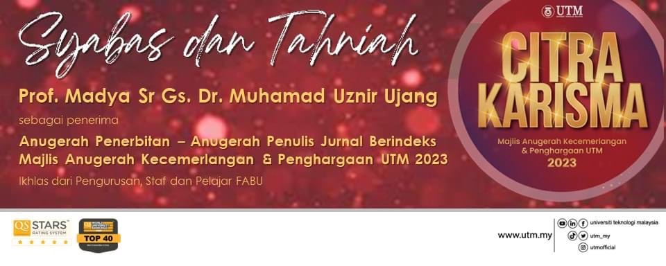
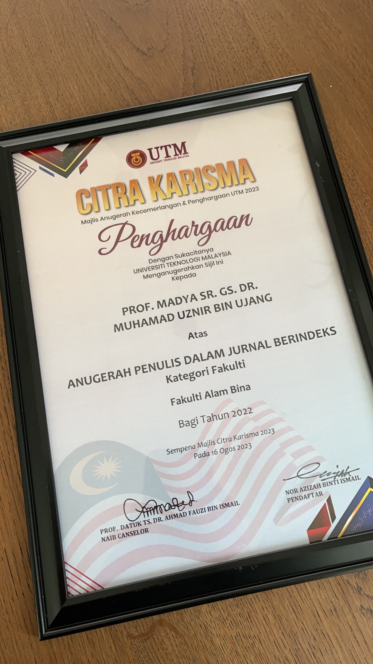
Exciting news! Just had to share the buzz from UTM’s Excellence Award Ceremony 2023 – yours truly snagged the Publication Award for Authors in Indexed Journals!
Life’s funny, huh? Big shout-out to UTM for this recognition. And major props to my fellow colleagues for always having my back.
Picture this: my name gets called out at Dewan Sultan Iskandar, UTM, but guess where I am? Yep, you got it! I’m parked in my office, knee-deep in my students’ SCA 2023 papers.
Let’s raise a virtual toast to balancing these milestones with the everyday grind – cheers to all of us rocking that academia hustle!
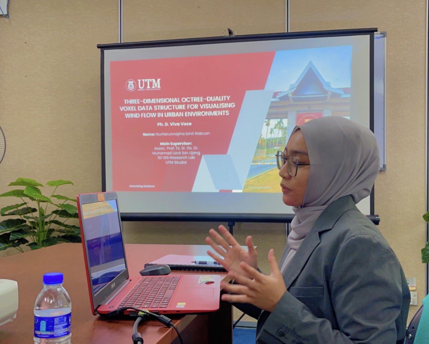
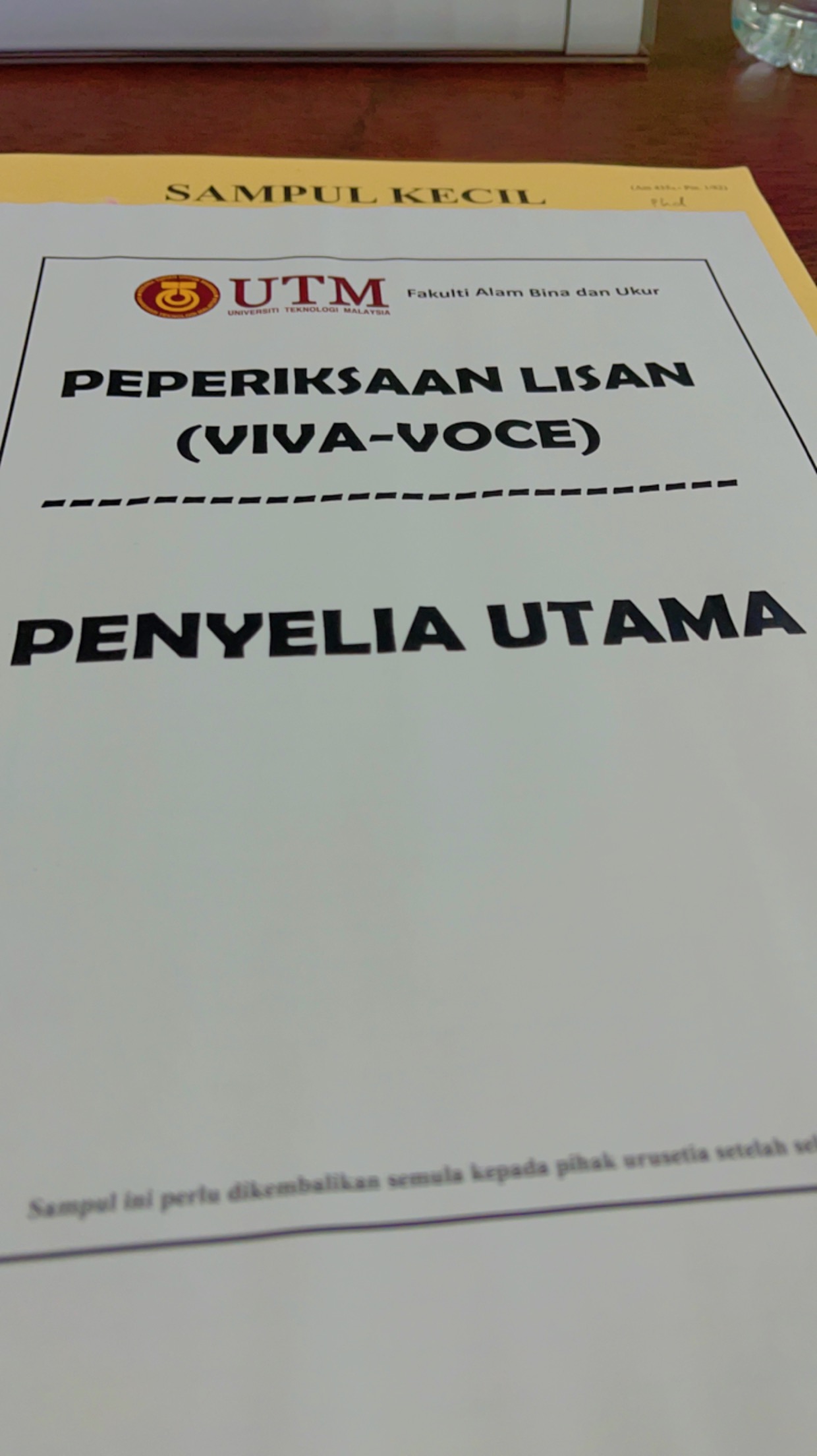
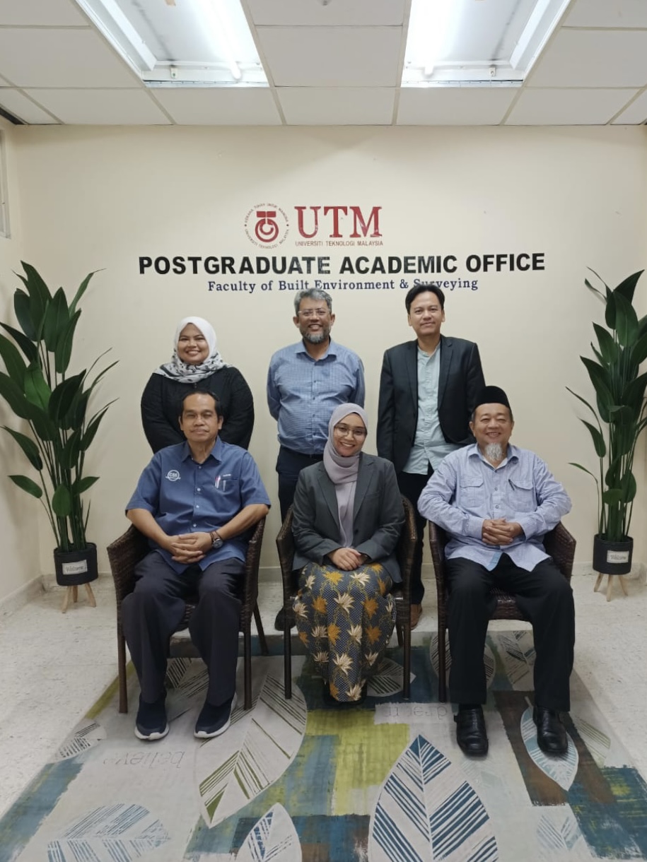
Heartfelt congratulations to my PhD student, Nurfairunnajiha Ridzuan, for acing her UTM PhD viva voce today with minor corrections! Her exceptional work has resulted in an impressive 10 publications and securing 2 copyrights.
She is part of the fast track student program, transitioning directly from BSc to PhD.
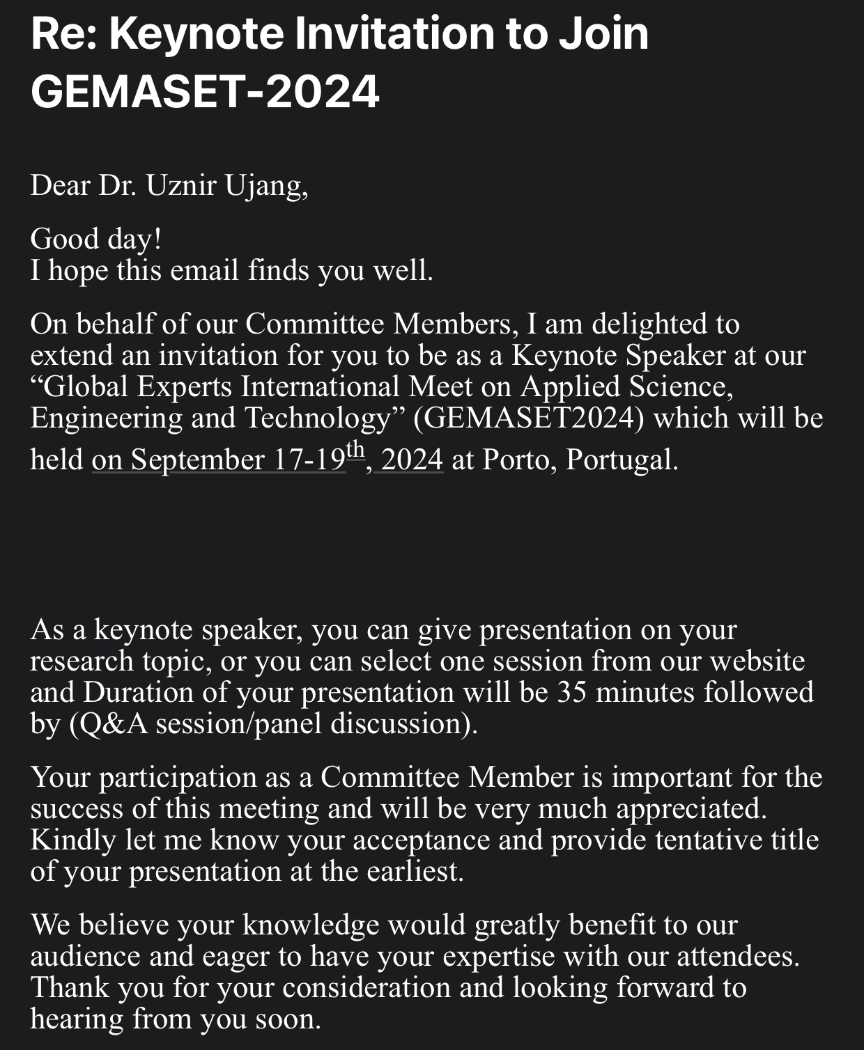
Thrilled to be Invited as Keynote Speaker at GEMASET2024 in Porto, Portugal!
Excited to receive an invitation to be a Keynote Speaker in Porto, Portugal! I’m honored to share my research and insights with a diverse audience of experts in the field.
Grateful for this opportunity and looking forward to an engaging discussion! #KeynoteSpeaker #GEMASET2024 #AppliedScience #Engineering #Technology
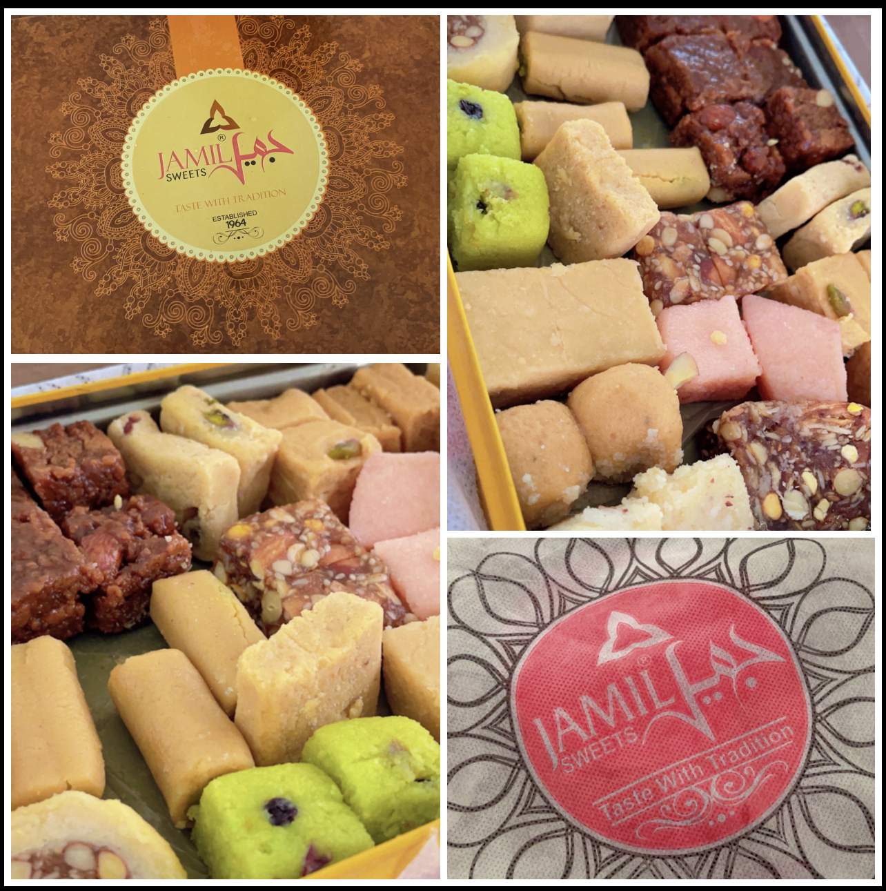
Just received a Pakistani sweets package from my PhD student Usman. It comes all the way from Pakistan! So grateful for thoughtful gestures like this that make our academic journey even sweeter! #PhDLife #Grateful #InternationalConnections
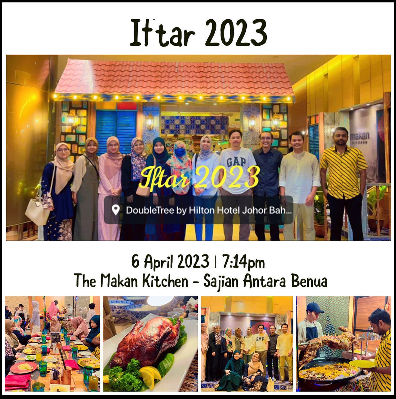
Our lab’s day out. I am happy to invite my MPhil and PhD students for an Iftar session. Sorry for my students who are in their home country, maybe next time we can have this Iftar session again. No academic research discussion today. Only food and chit chat.
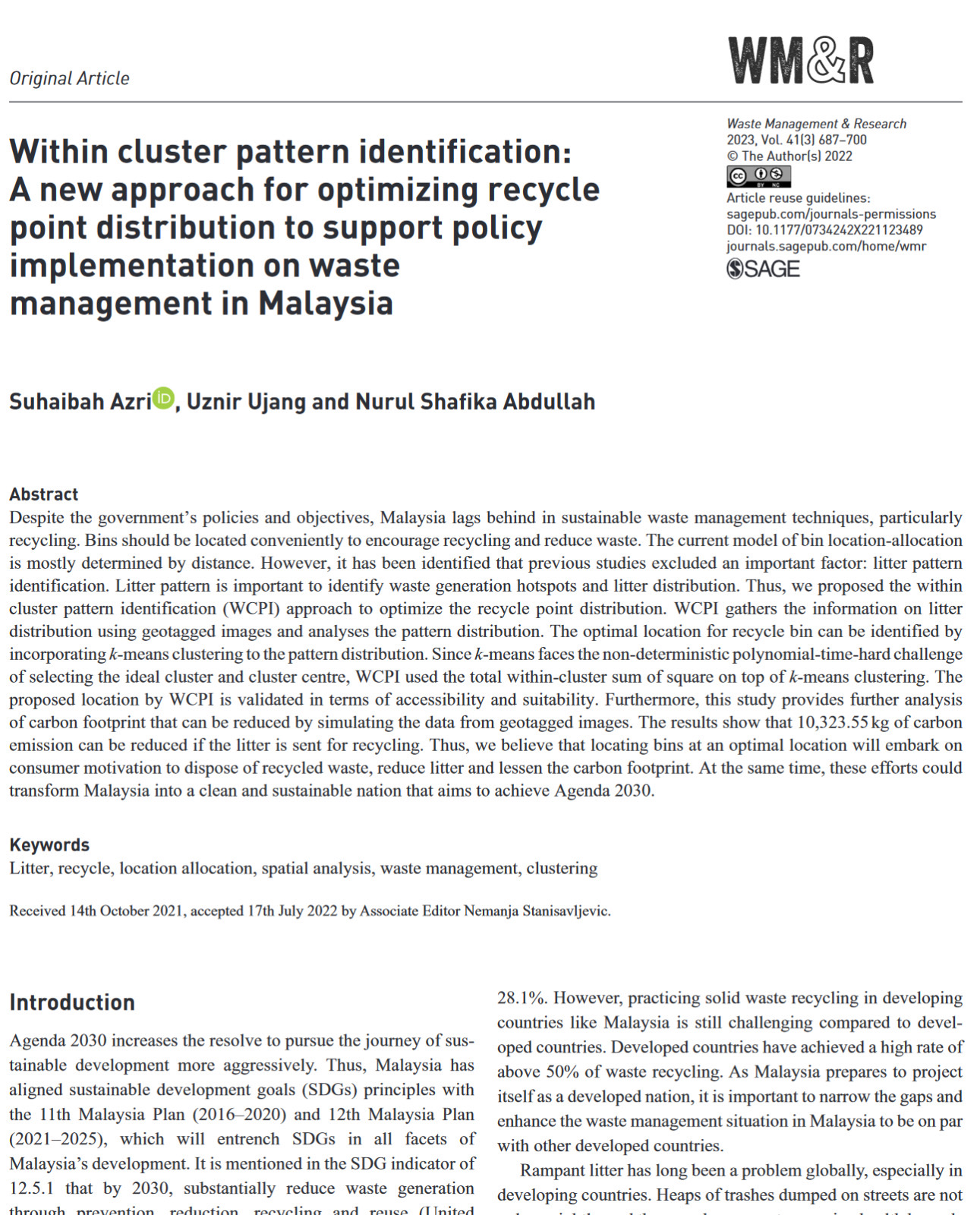
Successfully published our research paper in volume 41 for the third edition this year (2023). The interesting part of our study this time is we observe the habits of litter in the community. Quite surprised with the amount of litter we collected within our research area. With the help of geospatial analysis techniques, we can see trends.
However, research is only an instrument for studying the effects of this waste. But the most important thing is the attitude to keep our place clean. Please don’t litter everywhere, guys. We talk about the SDGs, the Sustainable City, the Green Life, etc., but it is useless if there is no right “litter” attitude. It all starts with you (and me).
Title: Within cluster pattern identification: A new approach for optimizing recycle point distribution to support policy implementation on waste management in Malaysia.