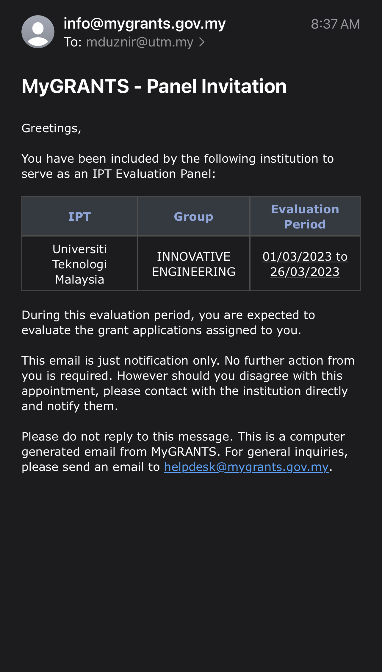
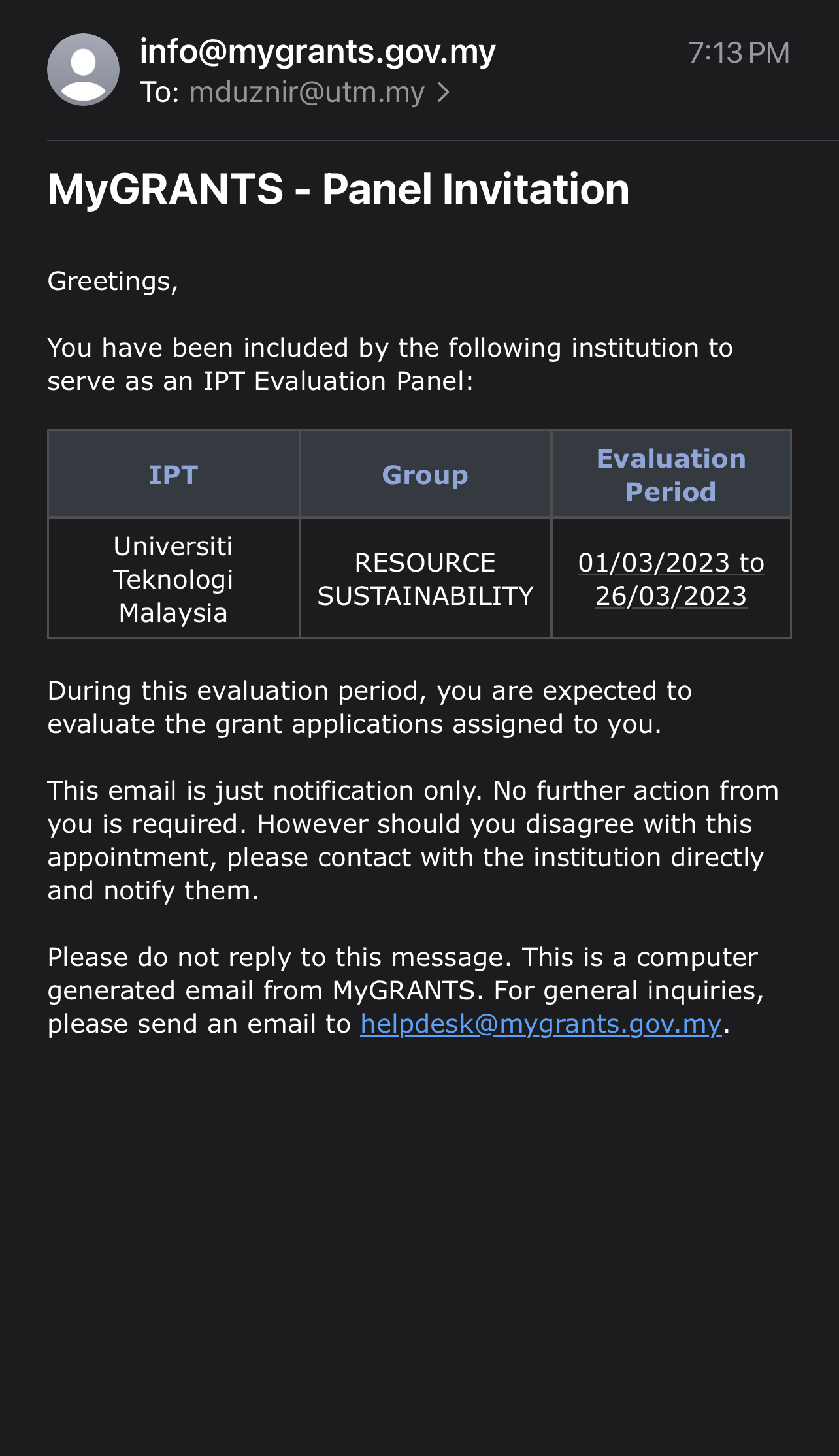
I’m honored to share that I’ve been appointed as a panel reviewer for the Fundamental Research Grant Scheme (FRGS). It’s quite a transition from being an applicant myself, but now I have the privilege of evaluating research grant proposals in the Technology and Engineering domain, as well as the Natural and Cultural Heritage domain. It’s truly rewarding to shift gears and help other applicants in their research endeavors. Looking forward to the journey ahead! #FRGS #ResearchReview #Technology #Engineering #Heritage
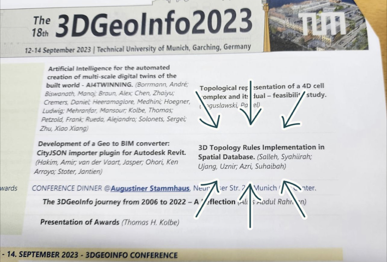
I am pleased to announce our participation in the 3D Geoinfo 2023 conference, where we will be showcasing our research in the field of 3D topology, which aligns with my area of expertise. Regrettably, due to my prior commitments as the chair of another conference this weekend, I am unable to attend the event in Technical University of Munich in person. However, we have diligently prepared a pre-recorded presentation to share our research findings. We extend our sincere gratitude to the organizers of 3D Geoinfo 2023 for this valuable opportunity.
As academics, we often face challenging decisions, and in this case, I find myself having to forgo two significant academic engagements: 3D Geoinfo 2023 in Germany and a keynote talk in Nice, Paris . If not, I can travel directly from ISPRS Geospatial Week 2023 conference in Egypt which I attended few days ago, and fly directly to Europe. Nevertheless, I recognized that unforeseen circumstances can arise, and my current focus is on the organizing conference that I am chairing on September 17th and 18th, 2023.
Today, I have a scheduled appointment with the Deputy Vice Chancellor of UTM in the afternoon for the conference officiation ceremony, and we remain dedicated to ensuring its success. We appreciate your well-wishes and support as we navigate these academic responsibilities. All the best for 3D Geoinfo 2023 conference as well!
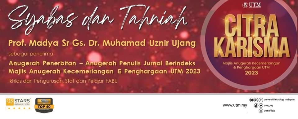
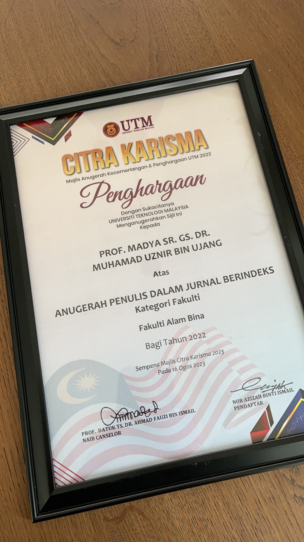
Exciting news! Just had to share the buzz from UTM’s Excellence Award Ceremony 2023 – yours truly snagged the Publication Award for Authors in Indexed Journals!
Life’s funny, huh? Big shout-out to UTM for this recognition. And major props to my fellow colleagues for always having my back.
Picture this: my name gets called out at Dewan Sultan Iskandar, UTM, but guess where I am? Yep, you got it! I’m parked in my office, knee-deep in my students’ SCA 2023 papers.
Let’s raise a virtual toast to balancing these milestones with the everyday grind – cheers to all of us rocking that academia hustle!
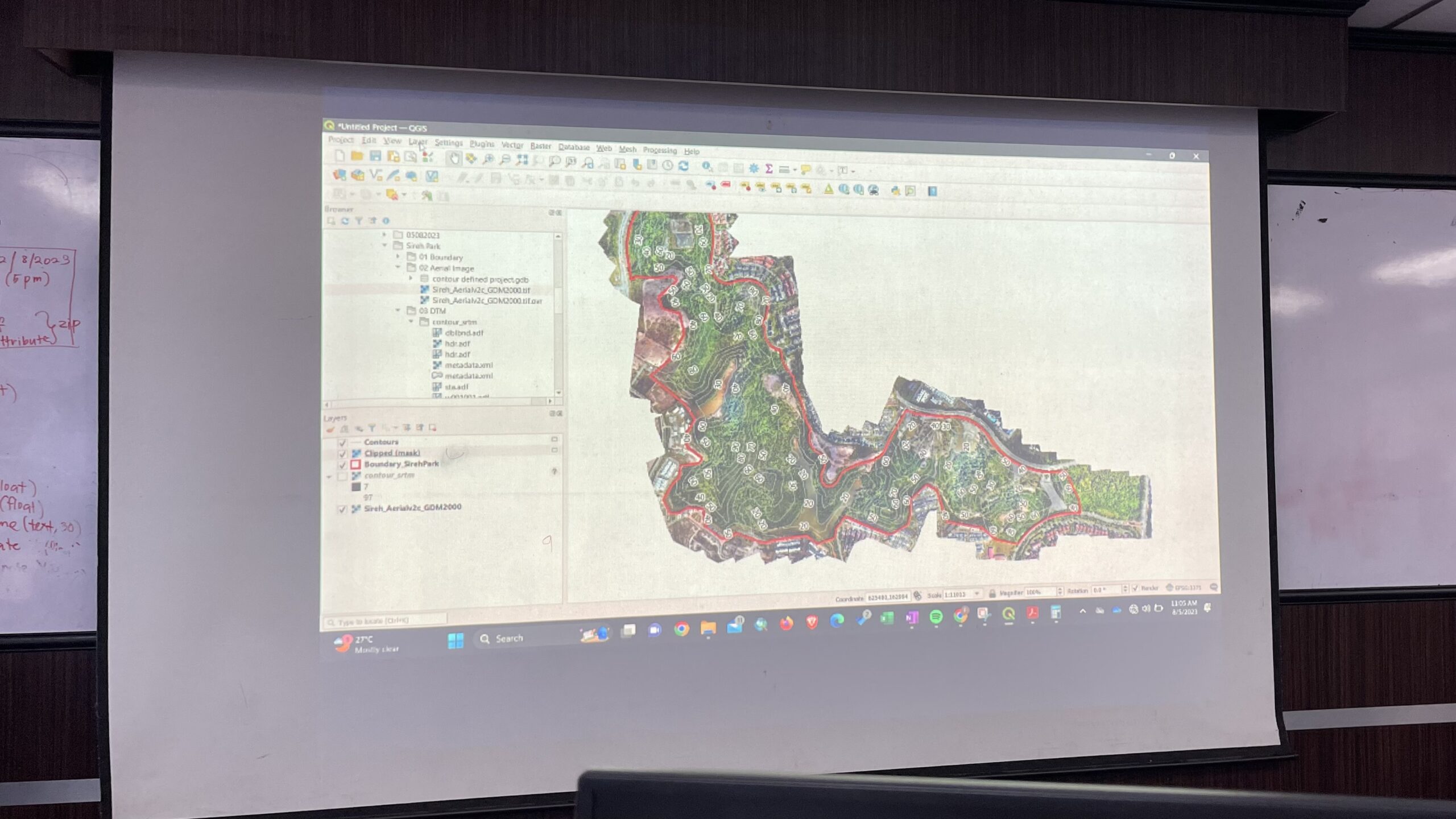
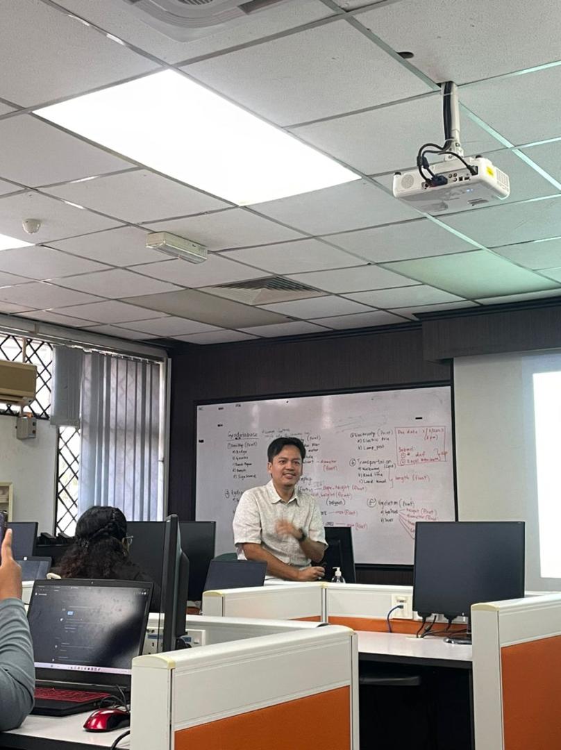
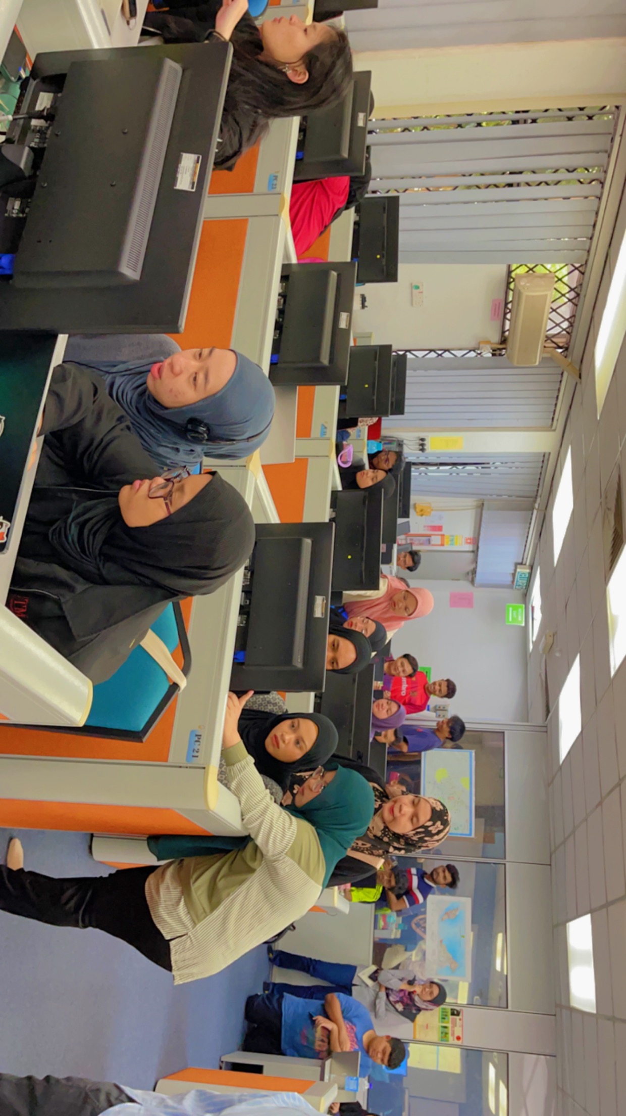
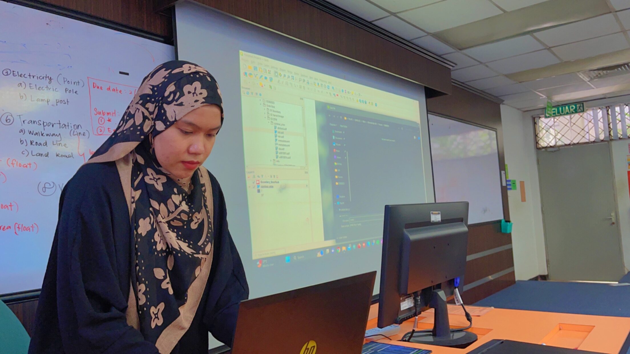
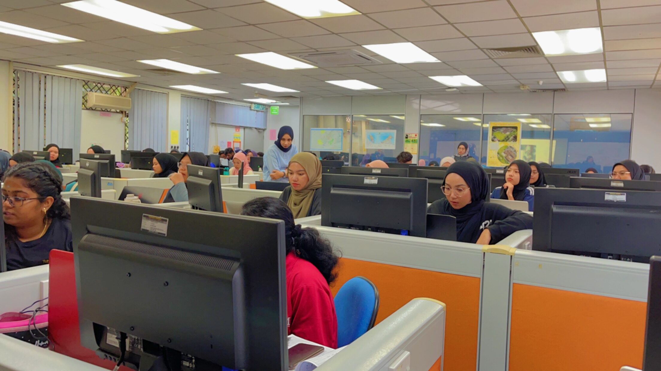
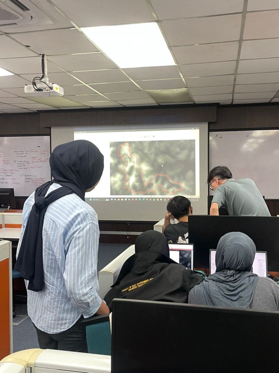
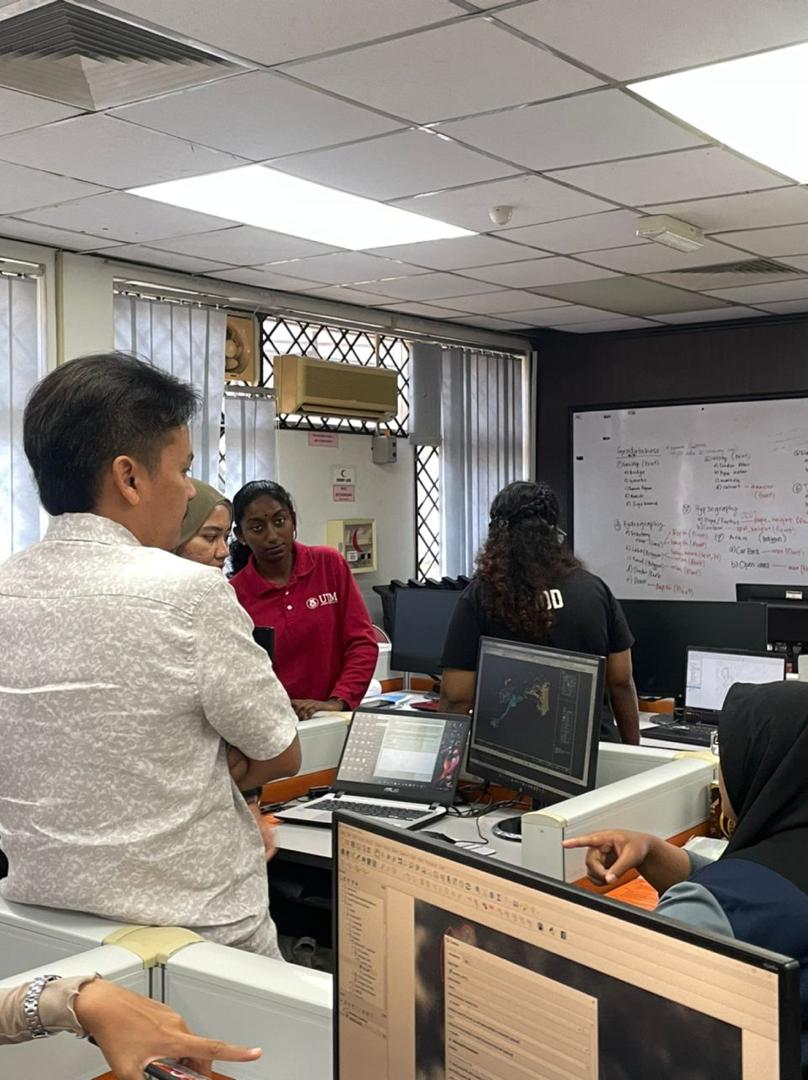
Had the privilege of teaching nearly 60 enthusiastic students the art of topographic map making using data from diverse sources for the beautiful Sireh Park, Johor Bahru.
In just a day, our students learned the skills to create impressive maps in the morning and later confidently presented their work in the afternoon.
Huge thanks to my amazing postgraduate students – Husna, Farah, and Shakirah – for their invaluable assistance in making this event a great success!
Celebrating the End of a Remarkable Research Internship!
I am thrilled to share an incredible 6-month internship journey of Aprillia Rahmi Utami from Institut Teknologi Nasional Malang (ITN Malang), Indonesia. As an intern, Aprillia came on board to UTM with zero knowledge in 3D city modeling, and it fills me with immense pride to witness her growth.
Throughout her tenure, Aprillia displayed determination and an unquenchable thirst for knowledge. She embraced challenges and continuously pushed her boundaries to learn and excel. Her dedication and hard work have yielded good results.
Aprillia has successfully created a stunning 3D LoD4 CityGML model for her Geodesy Building in ITN Malang kampus 1 and even conducted a groundbreaking 3D wind flow simulation for the ITN Malang campus.
Aprillia’s transformation from a novice to a proficient 3D city modeling student is an inspiration. It serves as a powerful reminder that determination knows no bounds when fueled by passion and a hunger for growth.
“Success is not final, failure is not fatal: It is the courage to continue that counts.” – Winston Churchill
I extend my warmest congratulations on this significant milestone, and I am confident that her future holds nothing but boundless success.
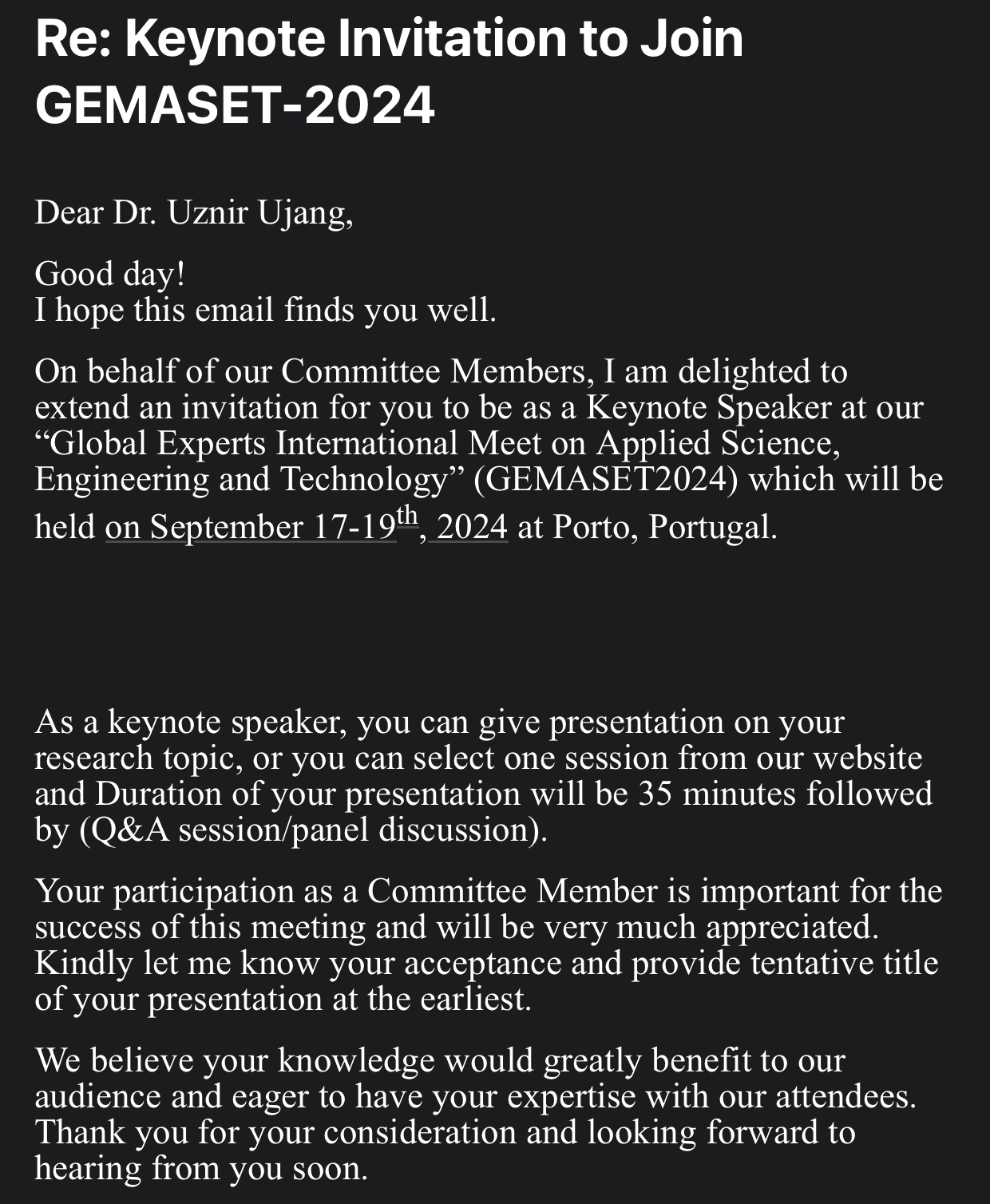
Thrilled to be Invited as Keynote Speaker at GEMASET2024 in Porto, Portugal!
Excited to receive an invitation to be a Keynote Speaker in Porto, Portugal! I’m honored to share my research and insights with a diverse audience of experts in the field.
Grateful for this opportunity and looking forward to an engaging discussion! #KeynoteSpeaker #GEMASET2024 #AppliedScience #Engineering #Technology
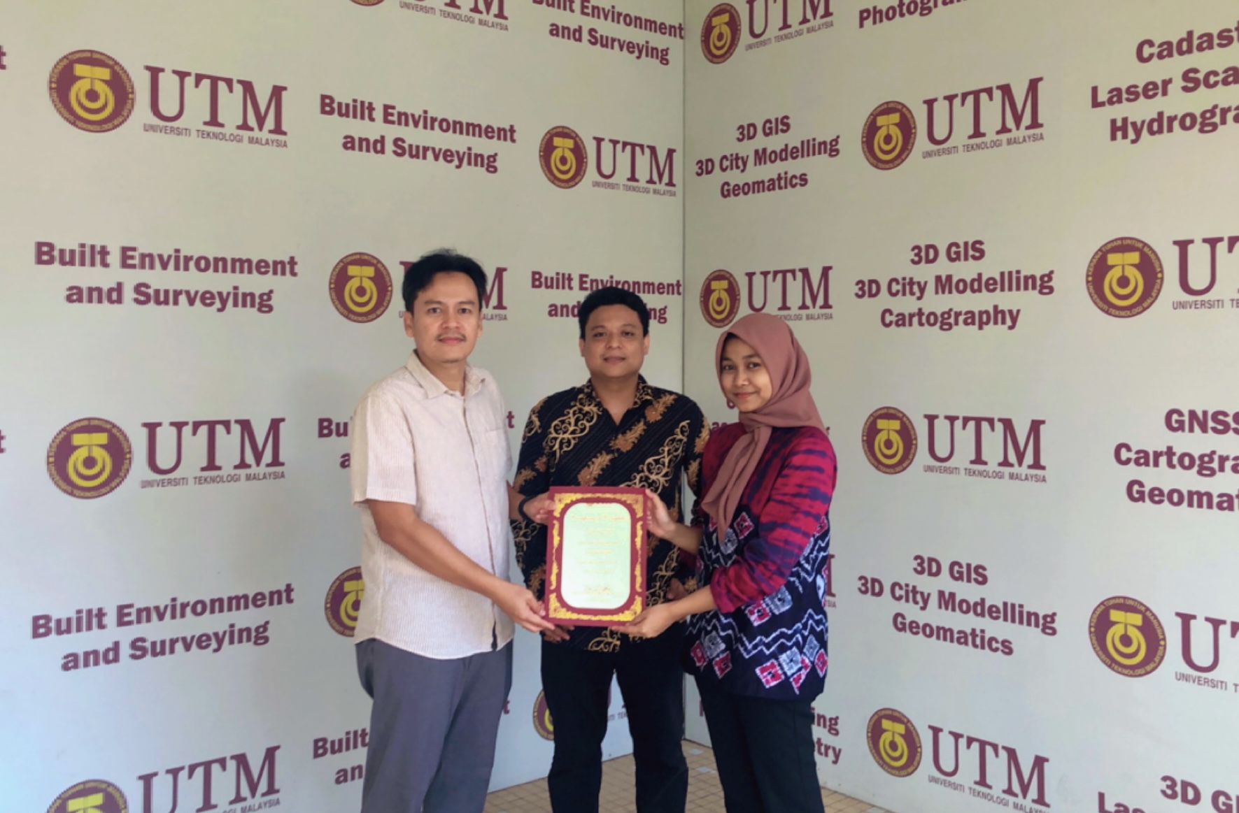
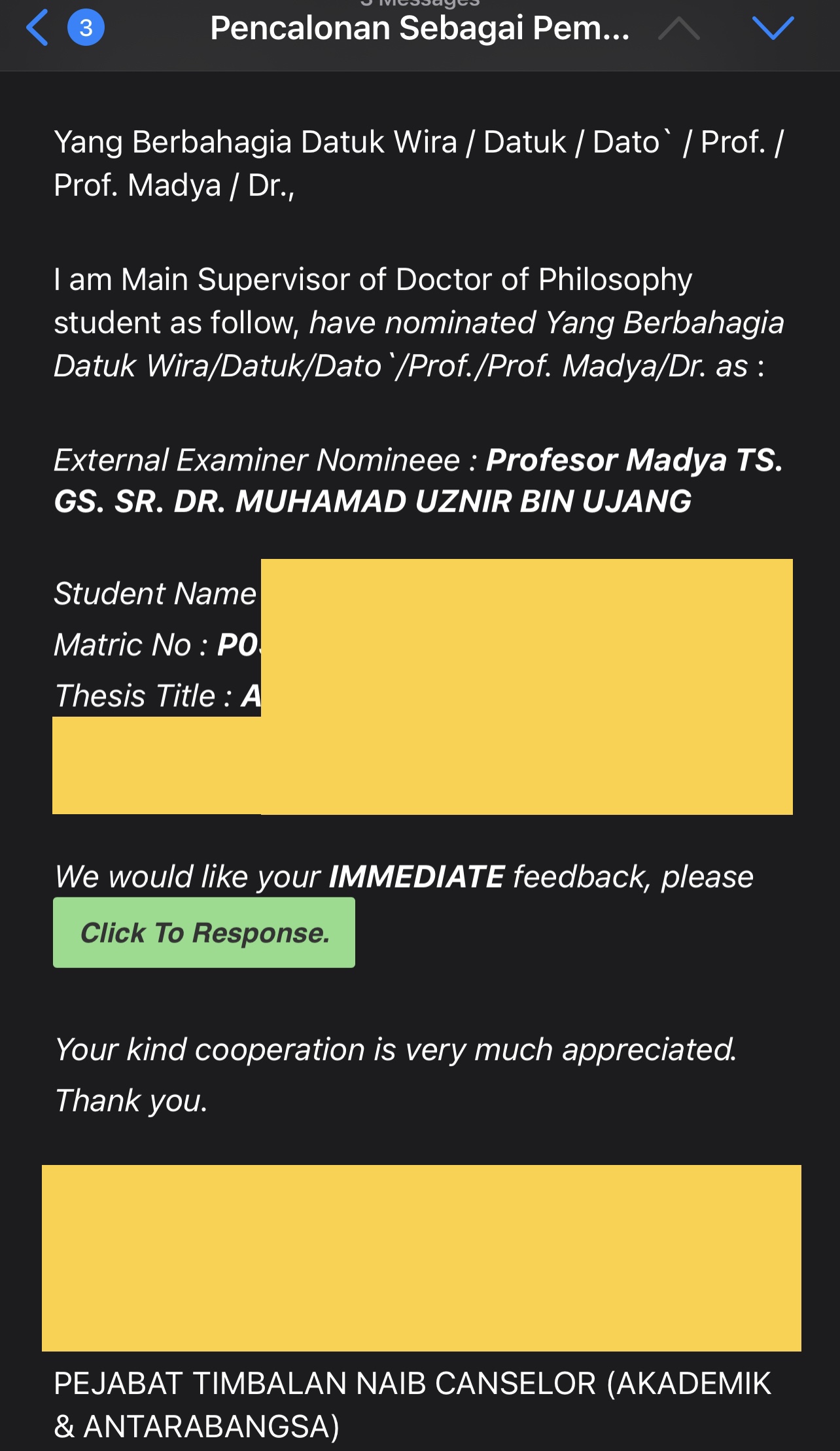
Appointed as External Examiner at UTeM: A Journey into Academic Excellence!
I’ve been appointed as an external examiner for a thesis examination at UTeM (Universiti Teknikal Melaka). A heartfelt thank you to UTeM for this incredible opportunity to contribute to the academic community. It’s an honor to collaborate with the talented students and faculty at UTeM. Looking forward to a fruitful and enriching experience! #AcademicExcellence #ThesisExamination #ProudExternalExaminer #ThankYouUTeM
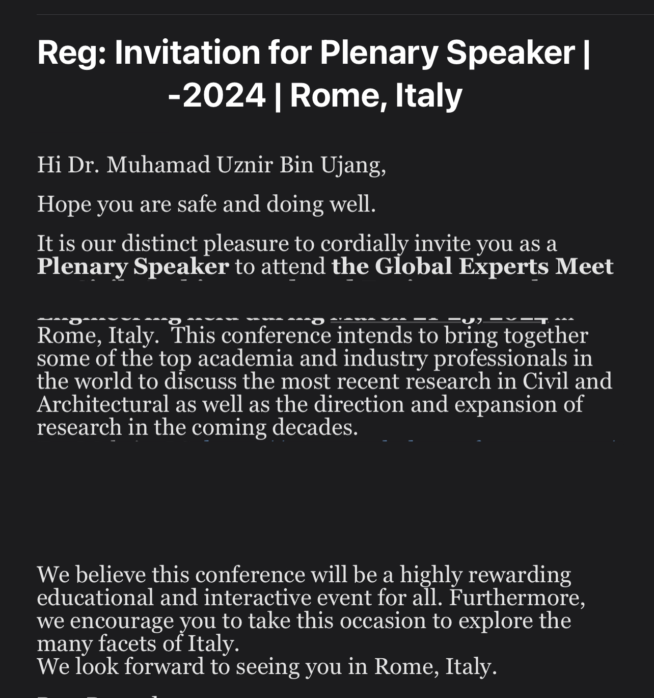
Invited as Plenary Speaker: Join Me in Rome for an Inspiring International Conference in 2024!
Thrilled to announce that I’ve been invited as a plenary speaker at an international conference in the magnificent city of Rome, Italy! Mark your calendars for March 2024, as this early bird opportunity promises to be a remarkable experience. Can’t wait to share insights, engage with experts, and explore the captivating blend of academia and culture. Stay tuned for more updates! #PlenarySpeaker #InternationalConferenc#Rome2024 #EarlyBirdOpportunity
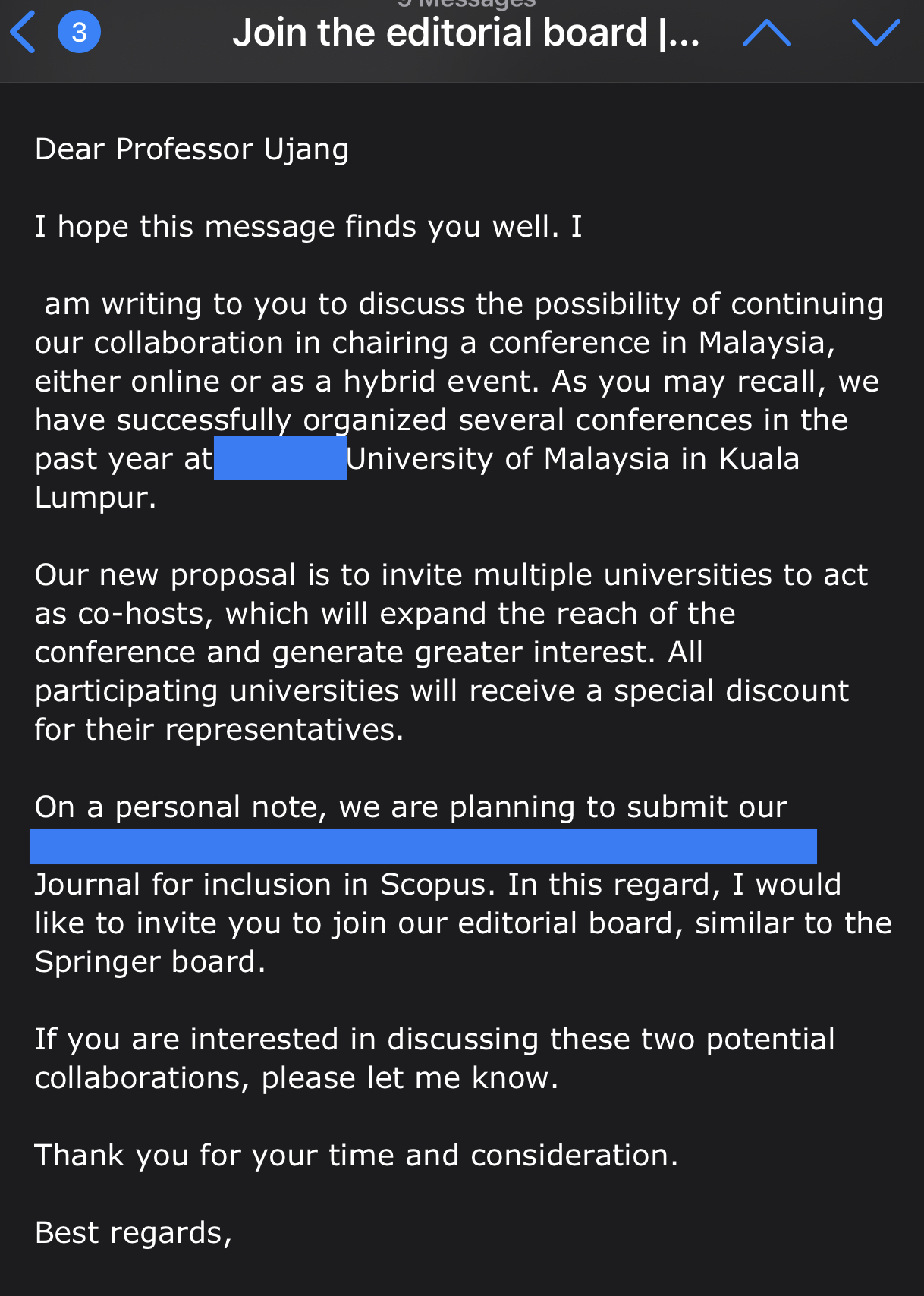
Exciting news to share! I’ve been invited to join the editorial board of a prestigious journal and at the same time, I’ve been honored to accept the role of conference chair for a major event in 2024! Grateful for these incredible opportunities to contribute to academia and foster knowledge exchange. Looking forward to collaborating with esteemed colleagues and researchers on impactful publications and organizing an engaging conference experience. #AcademicJourney #EditorialBoard #ConferenceChair #GratefulOpportunities
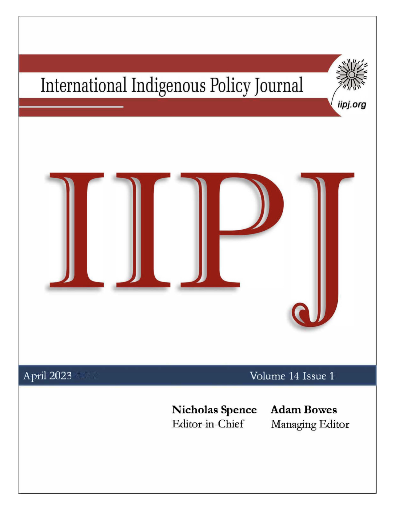
Publication Announcement: Delving into Native Land Governance in Sarawak, Malaysia
I am thrilled to share that my latest article has been published in the esteemed journal, The International Indigenous Policy Journal!
The article entitled “Towards ‘good’ native land governance: An evaluation in Sarawak, Malaysia”. It dives into the crucial topic of native land governance.
I am honored that my work featured in a Web of Science indexed journal, highlighting its significance and impact in the field. It’s a Q1 quartile journal that recognizes the importance of indigenous rights and sustainable land practices.
Stay tuned! Let’s continue working towards a more inclusive and just future.