TEN (10) RESEARCH PUBLICATIONS IN DECEMBER – YEAR 2024 IT’S A WRAP!
This month, we managed to get 10 articles published. As the year comes to a close (aka holidays), I’ll take the time to share the key insights from each paper in the near future. For now, here’s a quick overview of the contributions:
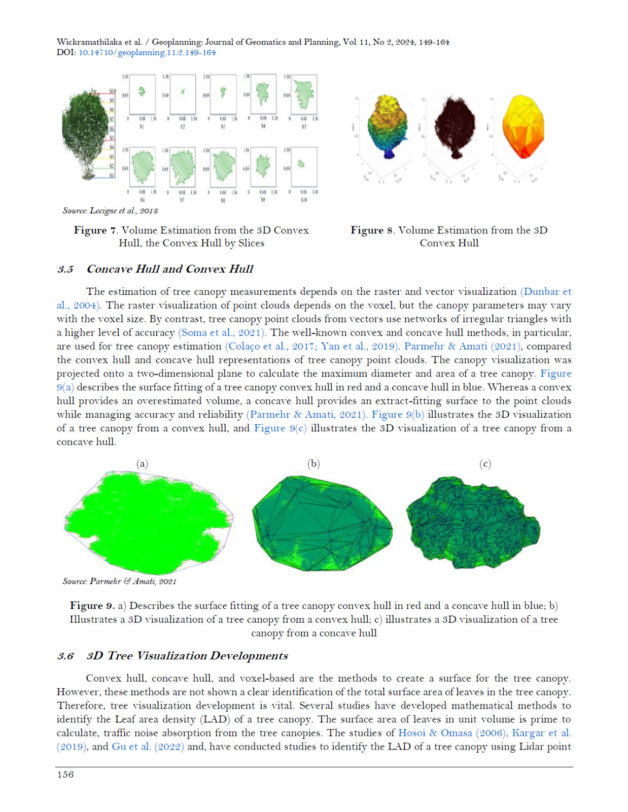
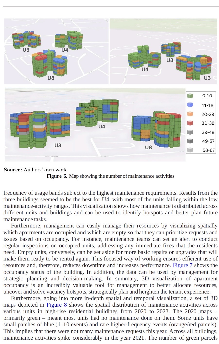
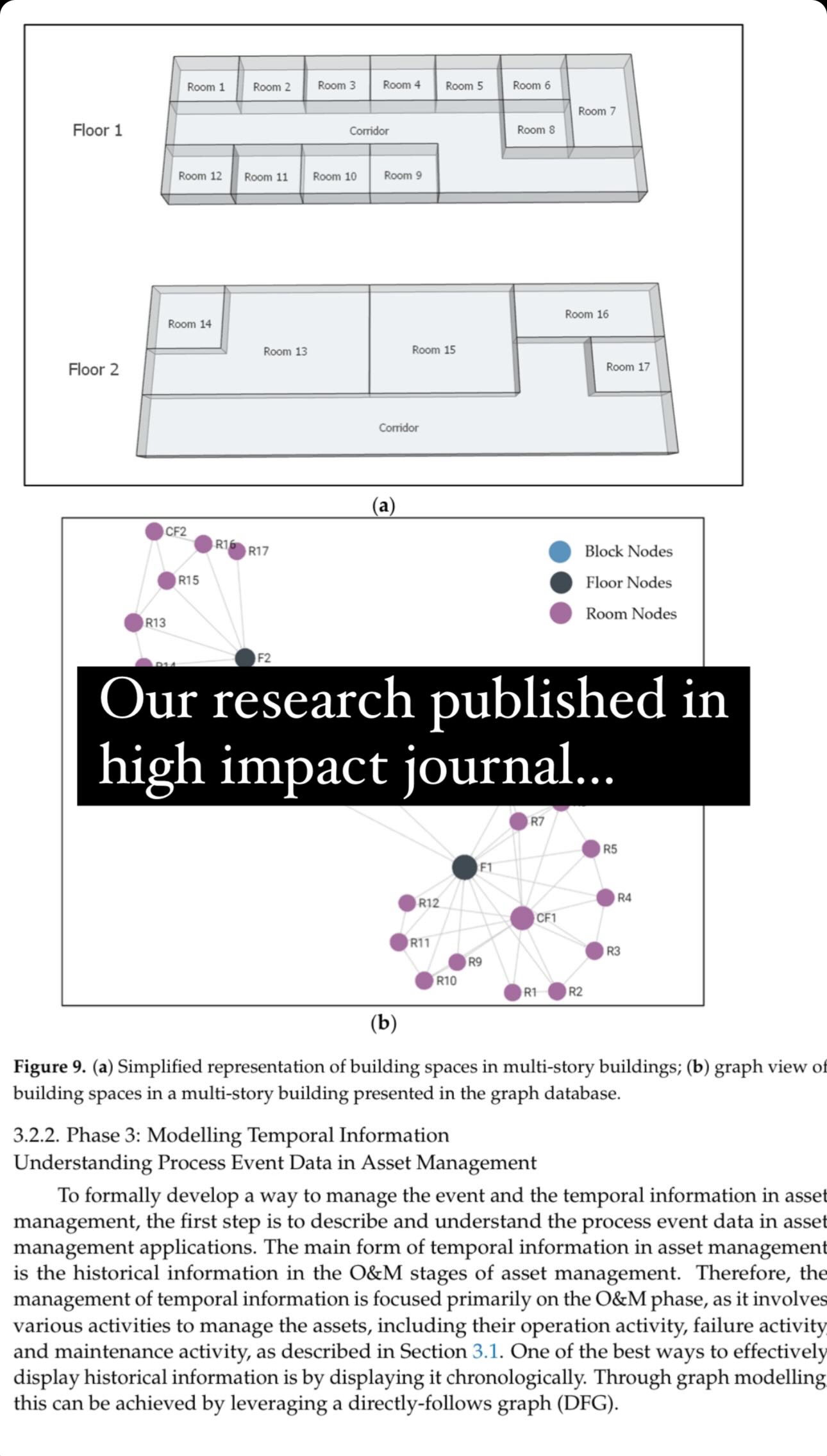
- Transforming High-Rise Residential Maintenance: A 3D Spatio-Temporal Model Utilizing Industry 4.0 and Lean Principles
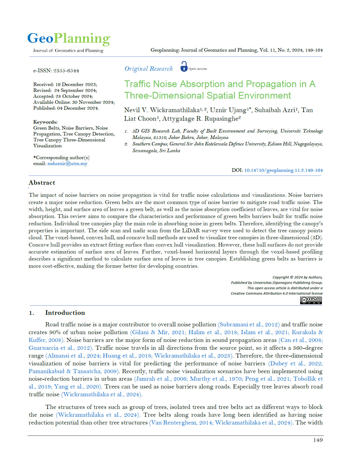
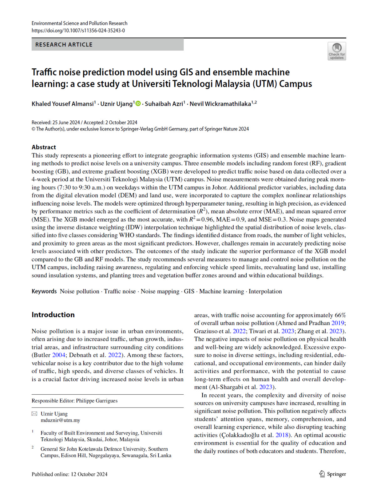
. - Traffic Noise Absorption and Propagation in a Three-Dimensional Spatial Environment
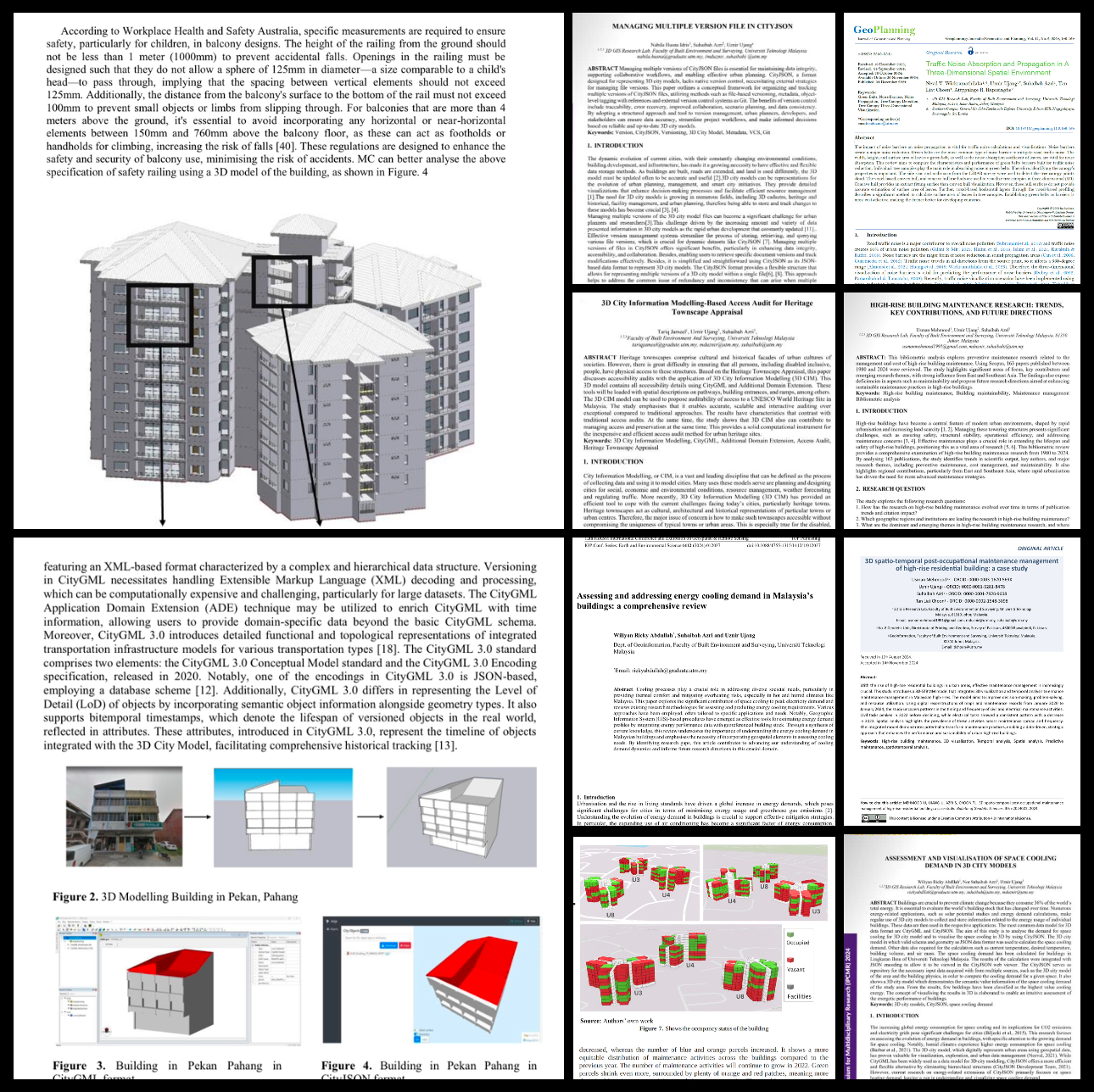
. - Managing Multiple Version Files in CityJSON
. - High-Rise Building Maintenance Research: Trends, Key Contributions, and Future Directions
. - 3D City Information Modelling-Based Access Audit for Heritage Townscape Appraisal
. - Assessment and Visualisation of Space Cooling Demand in 3D City Models
. - A Temporal Post-Occupancy Risks Management Model for High-Rise Strata via 3D City Modelling Approach
. - Reviewing the Versioning in 3D City Models to Track Building History and Progress
. - Assessing and Addressing Energy Cooling Demand in Malaysia’s Buildings: A Comprehensive Review
. - 3D Spatio-Temporal Post-Occupational Maintenance Management of High-Rise Residential Building: A Case Study