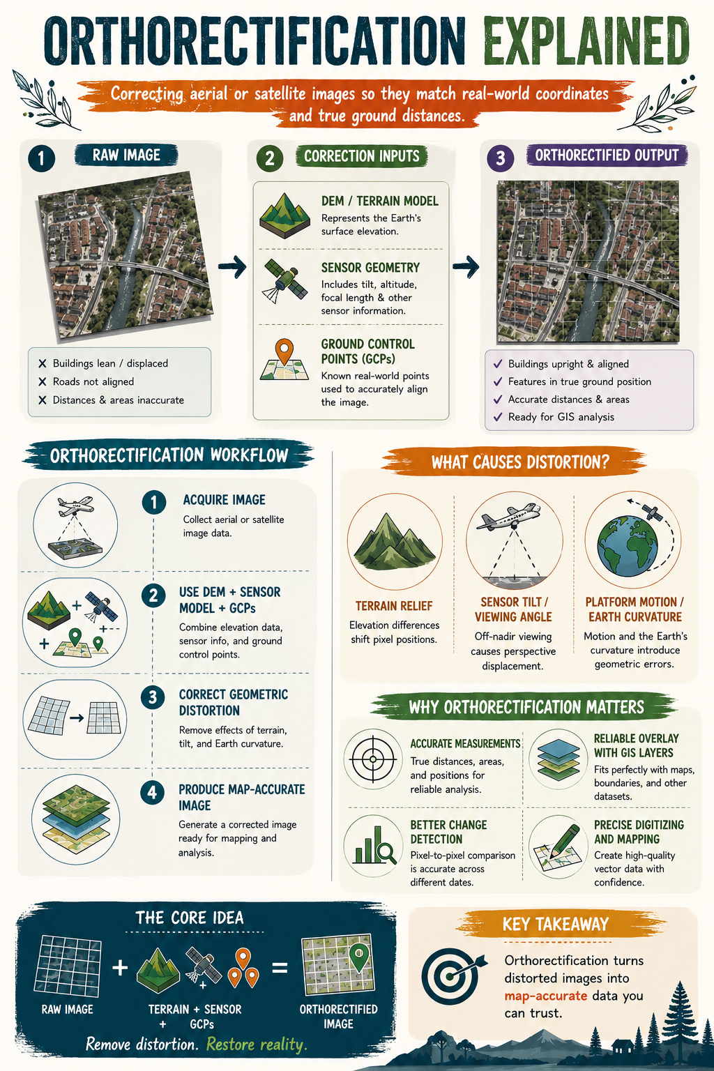
IS IT A MAP OR A PICTURE?
Have you ever looked at a drone or satellite image and noticed buildings appearing to lean, roads looking slightly misplaced, or measurements that just don’t seem right?
The image may look accurate, but appearances can be deceiving.
Raw aerial and satellite imagery often contains geometric distortions caused by terrain elevation, sensor tilt, viewing angle, aircraft movement, and even the curvature of the Earth. These distortions can affect the true position of features on the ground.
This is where orthorectification comes in.
Orthorectification is the process of correcting aerial or satellite imagery so that every pixel is placed in its true ground location. By combining elevation data, sensor information, and Ground Control Points (GCPs), distorted images are transformed into map-accurate datasets that can be trusted for analysis.
Why does this matter?
✅ Accurate distance and area measurements
✅ Reliable alignment with GIS layers
✅ Better change detection and monitoring
✅ More precise mapping and digitising
✅ Greater confidence in decision-making
A simple way to remember it:
📸 Raw Image + Terrain Data + Sensor Information + GCPs = Orthorectified Image
The next time you use drone or satellite imagery, ask yourself this question:
Am I looking at a picture, or am I looking at a map?
Because in GIS, that difference matters.
#GIS #RemoteSensing #Orthorectification #Geospatial #GISLearning