GREEN BELTS IN 3D – A NATURAL SOLUTION FOR TRAFFIC NOISE MITIGATION
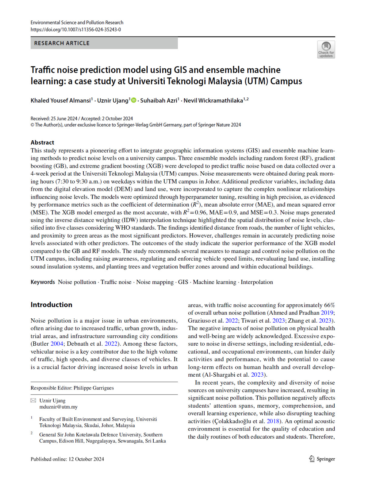
This is our latest publication titled “Traffic Noise Absorption and Propagation in a Three-Dimensional Spatial Environment” in Geoplanning: Journal of Geomatics and Planning.
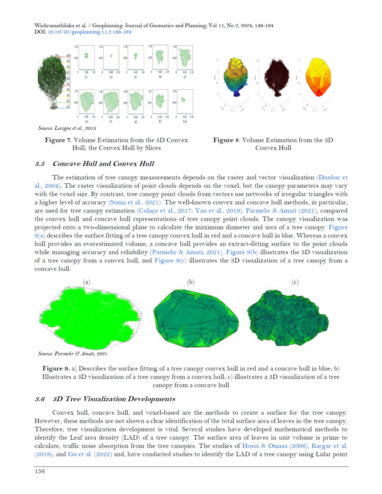
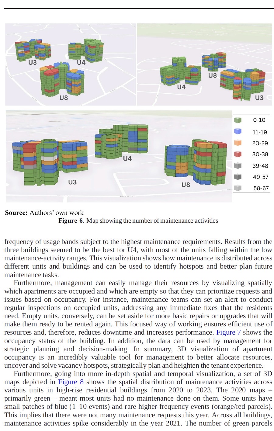
This research explores the role of tree canopies as noise barriers using advanced LiDAR-based 3D models. By visualizing tree structures in 3D, we analyzed their noise absorption performance and identified how green belts can effectively reduce traffic noise propagation.
Okay the Key Findings:
-Tree leaves play a major role in absorbing noise.
-3D Convex Hull and Concave Hull methods improve canopy surface estimation.
-Voxel-based models provide better accuracy for leaf surface area and density analysis.
The study emphasizes the potential of green belts as cost-effective and sustainable noise mitigation solutions, particularly for developing countries.
Imagine quieter roads and healthier urban environments that is powered by nature and technology.
Read the full paper here: https://ejournal.undip.ac.id/index.php/geoplanning/article/download/60822/pdf
#NoisePollution #GreenInfrastructure #3DVisualization #TrafficNoise #Sustainability #UrbanPlanning #GeospatialTech #ResearchImpact