Tag Archives: #geospatial

Student Internship Presentation

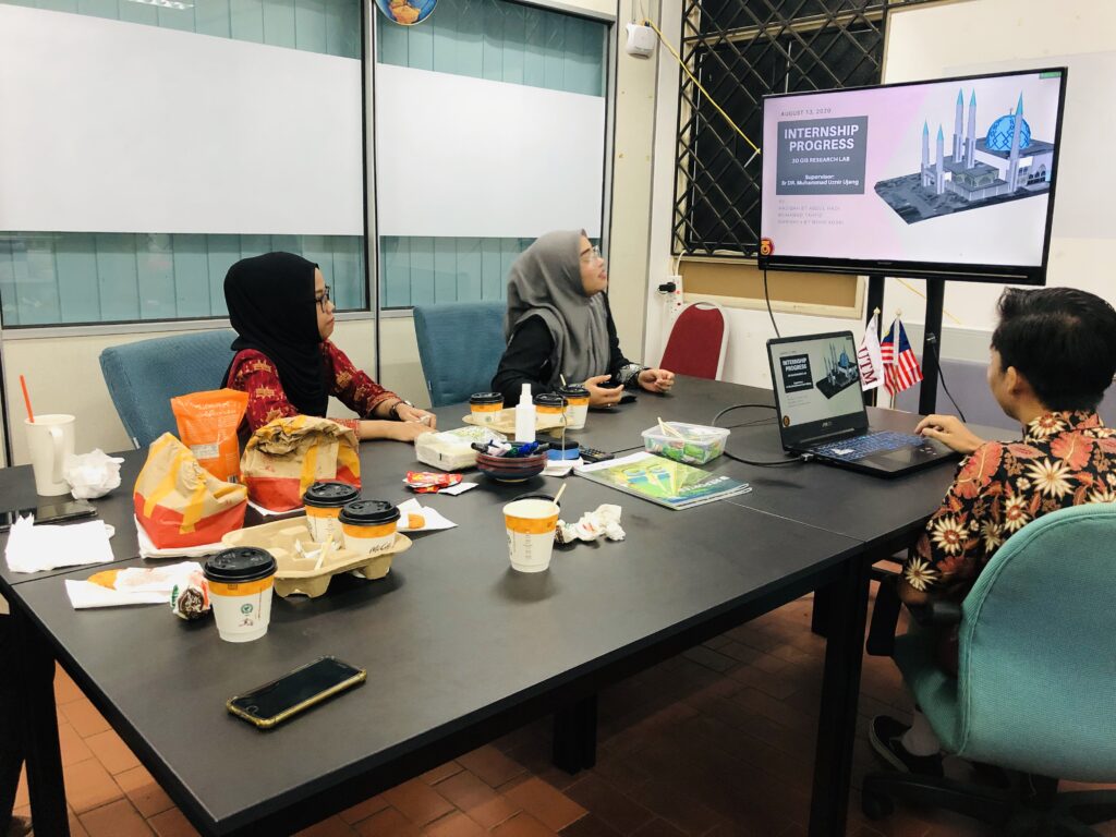
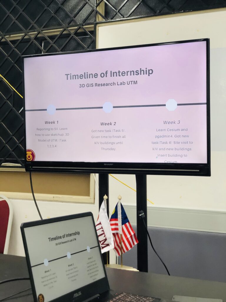
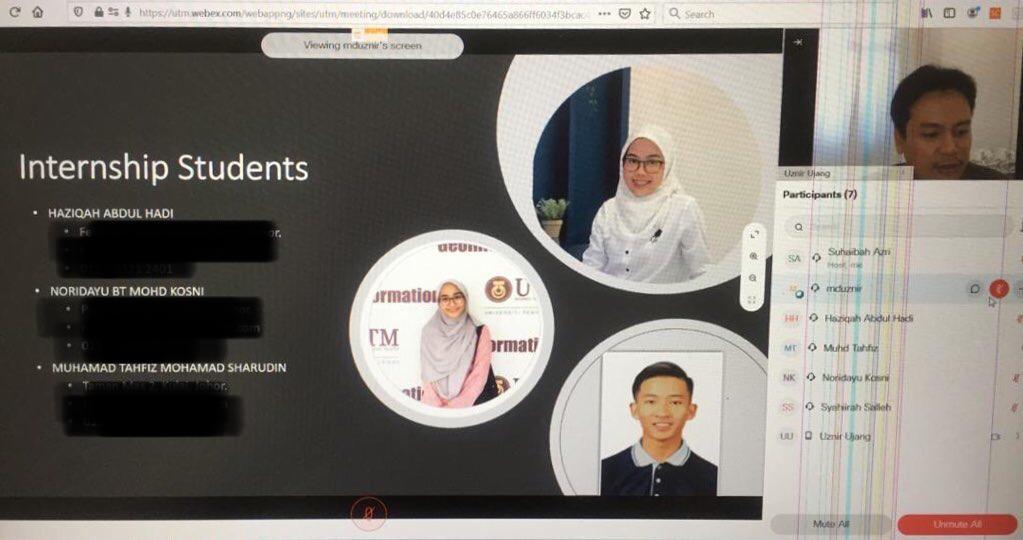
Usually it’s not a compulsory to make any presentation as an internship student. However, if you think about how important it is to make a progress presentation once a week, it will actually help students to improve their confidence and skills in communicating and presenting points to the public. Taking our little precious time to listen to this presentation may change them in the future.

I urge firms or agencies that appoint/hire internship students, educate them to be a career ready person. Don’t because they are internship students, they are only burdened with technical work without focusing on their soft skills development before getting into the industries. Do not blame the students or their institutions if they cant do the tasks. They are still in training.

I would say treat them as internships students and not as “backbenchers”.

#university #highereducation #students #graduate #studentinternship #internship #3dgis

Student Internship

STUDENT INTERNSHIP

Received three students to undergo practical training at the Universiti Teknologi Malaysia’s 3DGIS Research Lab.

Whilst ensures of the new norm, the duty-report of these internship students is made online. Our Research Officer QA41 (RO) provided an online 3D spatial modelling training on the first day of this internship.

Although these internship students receive a monthly allowance through the use of laboratory research funds, it is hoped that they will also be able to gain additional knowledge in the conduct of basic research as researchers.

Let us all pray that this pandemic will be lowered so that students can carry out research projects in the laboratory.

#studentinternship #gis #3dgis #3dmodeling #3dprinting #academicresearch #researchers #covid19research

Covid-19 Spatial Data Mining

Overwhelmed with Covid-19 spatial data mining, then I realized that the next step will going to take some time. Can you guess how long does it take to complete the geocoding process? Or do you mind to share which platform perform better? I’ve geocoded 200,000++ addresses.

3D MESH AND POINT CLOUDS (Part 2)

This post is related with my previous post regarding eyescloud3d by eCapture3D lead by Miguel González Cuétara, Guillermo De Miguel Retortillo and their team.

This time, I’m using series of 51 aerial photos taken from DJI Phantom 4 with the altitude of 150m. The images are taken at our Universiti Teknologi Malaysia (UTM) Johor Bahru campus.

In less than 30 minutes, the outputs are ready. Bare in mind that, there’s no use of mighty computing machine to process this (cloud processing), no prior knowledge needed, no Omega Phi Kappa, just photos and results. There you go. Less hassle. Interesting. Enjoy the campus view!

Royal Institution of Surveyors Malaysia (RISM) Awards

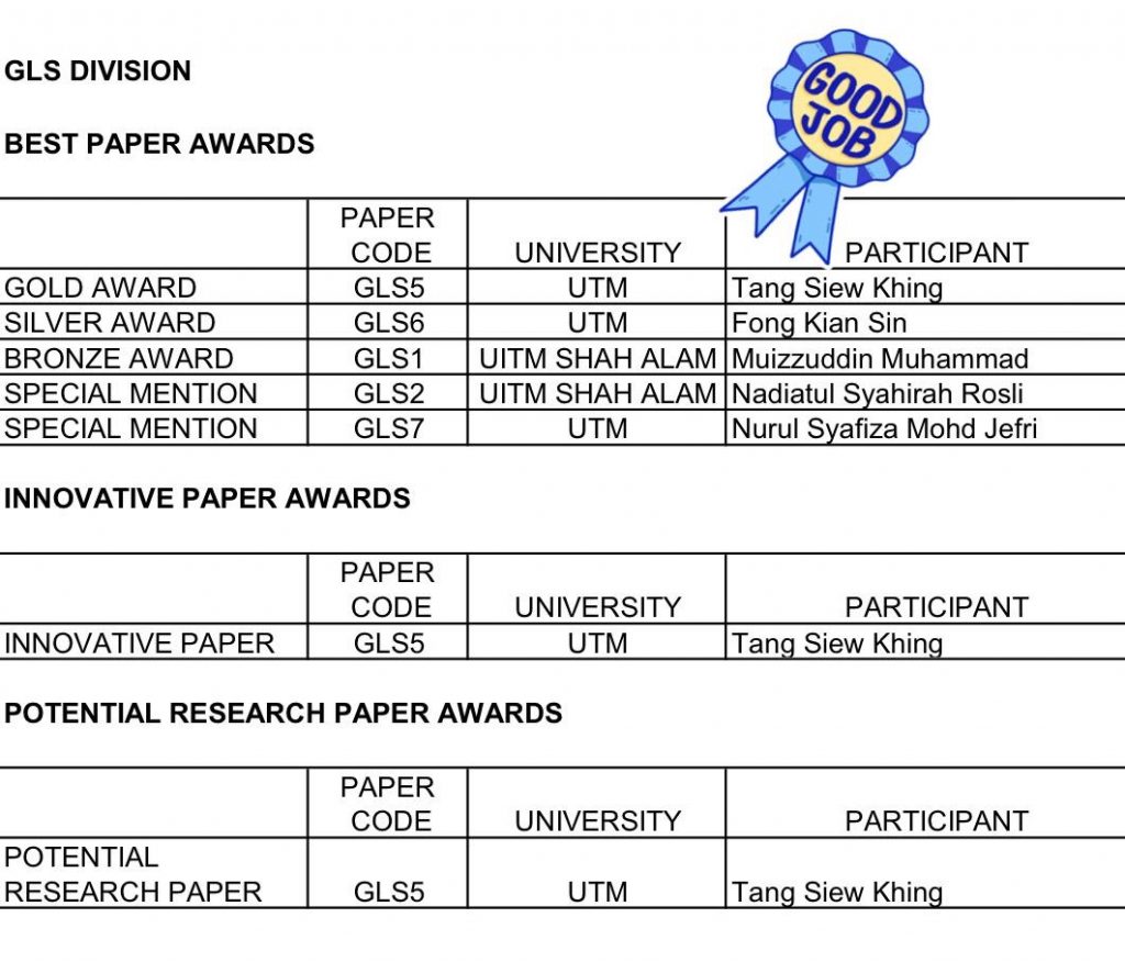
Congratulations to Tang Siew Khing in winning 3 national level awards by the Royal Institution of Surveyors Malaysia (RISM). She presented her Final Year Project (FYP) in a form of research paper last month. The awards are:

  1. Gold Award in Best Paper Category
  2. Innovative Paper Award
  3. Potential Research Paper Award

Thank you to Royal Institution of Surveyors Malaysia (RISM) Geomatic and Land Surveying (GLS) Division, anonymous Jurors, and Universiti Teknologi Malaysia (UTM). This awards means a world to my Sarawakian student in doing her FYP dissertation.

To RISM, keep it up with this good event. This will values our profession growth in the country 👍🏻

and again, Congratulations Tang!!!