WHAT IF I TOLD YOU THE MOST IMPORTANT PART OF A MAP ISN’T THE MAP ONLY?
When people think about GIS, they usually focus on the map.
The roads, buildings, rivers, land parcels, and points of interest get all the attention.
But the real power of GIS often lies somewhere else: the attribute table. 📊
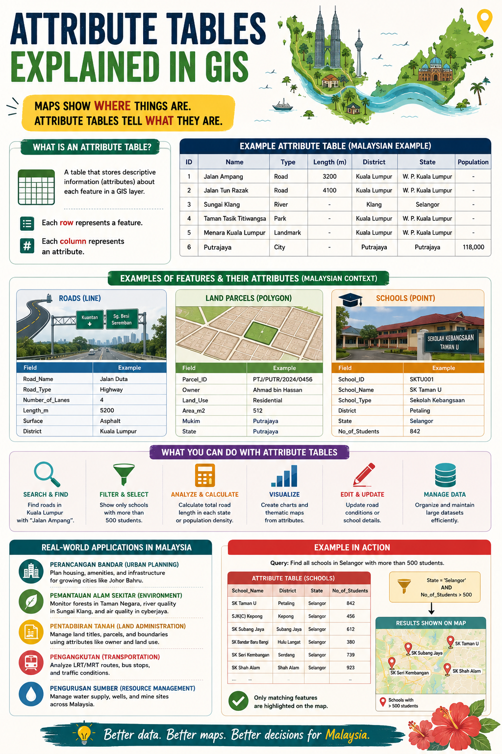
Maps show you where things are.
Attribute tables tell you what they are.
Every feature in a GIS layer has a corresponding record in an attribute table. Each row represents a feature, while each column stores information about that feature.
For example:
🛣️ A road can store its name, type, number of lanes, and length.
🏫 A school can store its name, district, school type, and student population.
🏡 A land parcel can store ownership details, land use, and area.
Without attribute tables, a map is simply a collection of shapes.
With attribute tables, those shapes become meaningful information that can be searched, analysed, filtered, updated, and visualised.
This is what makes GIS such a powerful decision-support tool.
Want to find all schools with more than 500 students?
Want to calculate the total road length in a district?
Want to identify residential parcels in a specific area?
The answers are stored in the attribute table.
A simple way to remember it:
📍 Geometry tells you where.
📊 Attributes tell you what.
The next time you open a GIS layer, don’t just look at the map. Open the attribute table and discover the story behind the data.
After all, better data leads to better maps, and better maps lead to better decisions.
#GIS #Geospatial #SpatialData #GISLearning #Mapping