Introduction
- The Survey Unit of the School of Civil Engineering, Faculty of Engineering, UTM oversees the surveying or geomatics needs of the school and faculty’s community. It is well-equipped with some of the latest state-of-the-art surveying equipment. The unit primarily provides teaching and learning, research, consultancy and practical training to students. As a way of contributing to the society, staff in the unit is also involved in rendering professional surveying services to third parties.
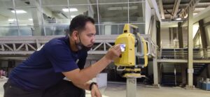
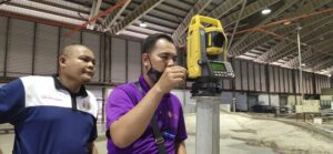
- The Survey Unit of the School of Civil Engineering, Faculty of Engineering, UTM located at Block M47 with the size of floor area is about 200 square meter. The laboratory is well equipped with modern surveying tools such as an Automatic Level, Digital Automatic Level, Digital Precise Level, Digital Theodolite, Total Station, Robotic Total Station, Terrestrial Laser Scanner, Global Navigation Satellite System (GNSS), Unmanned Aerial Vehicle (UAV), Single Beam Echo Sounder (SBES), Shallow Water Bathymetry System (SWBS), Digital Tide Level Data Logger, Mini Remote Operated Vehicle (ROV), Hand Held GPS, Disto Metre and others.
- Survey Unit is headed by a laboratory coordinator and two assistant engineers who will look after the development the technical aspects and maintenance of the equipment from time to time s related to PnP, Research and Consultancy in various field such as engineering surveying, GNSS surveying, hydrographic surveying, aerial photogrammetry, deformation and monitoring surveying, settlement monitoring and others.
- The Survey Unit also actively collaborate with various parties in carrying out various activities such as community services, short courses, teaching & learning, research & development and consultancy activities with School of Civil Engineering, Faculties and UTM Research Group, Centre of Excellent (COE), consultants, government and private agencies. The Survey Unit also provides survey equipment rental services for the use of UTM students researchers, staff and external parties.
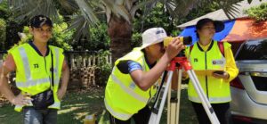
- In addition, we also provide consulting services to those who need professional services in surveying field such as levelling survey, topographic survey, detail survey, setting out, as-built survey, GNSS survey, deformation and monitoring survey, settlement survey, aerial mapping, hydrographic survey, real-time tide monitoring, volume calculation and others.
For any inquiry please contact:
- Associate Chair Facilities (ACF), SCE, FE, UTM
- Laboratory Manager, SCE, FE, UTM
- Coordinator, Survey Unit, SCE, FE, UTM