As an academician, Ahmad’s challenges have grown over the years. One of the biggest challenges he faces is securing funding for his research projects. With limited resources and increasing competition for grants, it can be difficult to secure the funding he needs to conduct the research he is passionate about.
Another challenge Ahmad faces is finding and recruiting the right team members for his research projects. With the high demand for skilled professionals in the field of GIS, it can be difficult to find individuals who have the right skills and experience to contribute to his projects.
Ahmad also faces challenges with the students he works with. Lack of good students from undergraduate to do their undergraduate project, lack of capable postgraduate students to do master and phd study. This can make it difficult for him to carry out his research and teaching responsibilities to the best of his abilities.
Despite these challenges, Ahmad remains determined to continue pursuing his passion for GIS research and education. He knows that it will take hard work, determination, and a willingness to adapt to overcome these obstacles. He also knows that by building a strong team, mentoring the next generation of GIS professionals, and staying up-to-date with the latest developments in the field, he can continue to make meaningful contributions to the field of GIS and make a positive impact on the lives of his students and colleagues.
Ahmad began to notice a change in the attitude of his students. They seemed less engaged in class, less motivated to complete their assignments, and more inclined to challenge his authority as a lecturer. He could sense a lack of respect from many of them, and it was starting to weigh on him.
He knew that the world of technology was changing rapidly, and that students were increasingly exposed to new forms of learning and new ways of interacting with information. He also realized that this was affecting the way students approached their education, and that they were no longer responding to traditional teaching methods as well as they used to.
Ahmad knew that something had to be done to address this issue. He didn’t want to be seen as an out-of-touch lecturer who couldn’t connect with his students. He knew that he needed to adapt to the changing times and find new ways to reach and engage his students.
He spent a lot of time researching new teaching methods, and experimenting with different approaches to the curriculum. He started incorporating more interactive and hands-on activities into his lessons, and he began to use technology more effectively in the classroom. He also started to give students more autonomy and choice in their learning, and he started to provide more feedback and support to help them achieve their goals.
Ahmad’s efforts paid off. His students started to respond more positively to his teaching, and he noticed an improvement in their engagement and motivation. They began to show more respect for him as a lecturer, and he could see that they were becoming more invested in their own learning. Ahmad realized that by being open to change and willing to adapt, he was able to continue to make a positive impact on his students’ lives, even in the face of the rapidly changing technological landscape.
As a senior lecturer, Ahmad became increasingly involved in departmental management and administrative tasks. While he found these responsibilities challenging and rewarding, he began to realize that they were taking up a significant portion of his time and energy, and that he was missing the aspects of his job that he loved the most: teaching, research, and development.
He missed being in the classroom, interacting with students, and sharing his passion for GIS. He missed the thrill of discovering new insights and solving problems through research. And he missed the satisfaction of developing new tools and techniques that could help people and organizations make better use of their spatial data.
Despite his busy schedule, Ahmad made a conscious effort to carve out more time for teaching, research, and development. He started to take on fewer management responsibilities, and instead focused on mentoring his students and developing new research projects. He also began to collaborate with colleagues on multidisciplinary projects that brought together his expertise in GIS with other fields such as environmental science, urban planning, and disaster management.
Through his hard work and dedication, Ahmad was able to strike a balance between his management duties and his passion for teaching, research and development. He was able to continue making a positive impact in the field of GIS and in the lives of his students. He felt fulfilled and content with his work, and was grateful for the opportunity to continue making a difference in the world.
After several years of working as a consultant, Ahmad decided to transition into an academic role at a local university. He found that he enjoyed teaching and mentoring students, and wanted to make a more lasting impact on the field of GIS. He began teaching undergraduate and postgraduate courses in GIS, and quickly established himself as a popular and effective teacher.
In addition to teaching, Ahmad also became a supervisor for Master’s and Ph.D. students. He was excited to work with the next generation of GIS professionals and help them develop their skills and knowledge. He supervised students working on a wide range of research topics, including flood modeling, postcode mapping, data conversion, and system development.
Ahmad also continued to do research and development of his own, focusing on applied GIS projects that had a direct impact on the community. He developed a flood modeling system that helped local authorities predict and prepare for floods, as well as a postcode mapping system that improved mail delivery and emergency services. He also worked on data conversion projects that helped organizations and government agencies make better use of their GIS data.
As an academician, Ahmad’s research and publications in the field of GIS have been well-received by the academic community and have been widely cited. He was also invited to speak at conferences and workshops all over the world. He had published several books and articles in various journals. He was proud of his contributions to the field of GIS and was excited to see how his research would continue to impact the community. He was also proud to see his students and supervised students had succeeded in their careers and making a positive impact in the field of GIS.
With his passion for GIS and desire to continue learning, Ahmad decided to apply for a scholarship to further his studies abroad. After much hard work and dedication, he was awarded a scholarship to complete his Master’s and Ph.D. in GIS.
During his Master’s program, Ahmad focused on developing a web map server. He wanted to create a platform that would make GIS data more accessible and user-friendly for a wider audience. He spent countless hours researching and experimenting, and finally succeeded in creating a state-of-the-art web map server.
For his Ph.D. program, Ahmad decided to focus on mobile navigation. He was fascinated by the potential of using GIS technology in mobile devices to improve navigation and location-based services. He spent several years researching and developing new algorithms for mobile navigation, and his work was well-received by the academic community.
Ahmad’s Ph.D. thesis was well-received and widely cited in the academic community. He was proud to have made a significant contribution to the field of GIS and was grateful for the opportunity to study abroad.
With his new degrees, Ahmad returned to his home country, eager to apply his new knowledge and skills to real-world projects. He continued to work as a GIS consultant, now with a renewed focus on mobile navigation and web mapping. He also planned to teach at the university, sharing his knowledge and experience with the next generation of GIS professionals.
Ahmad’s hard work and dedication had paid off and he was now recognized as a leading expert in GIS, particularly in the field of mobile navigation and web mapping. He knew that his journey in GIS was far from over and was excited to see what the future held for him and the field of GIS.
As time passed, Ahmad’s expertise in GIS grew, and he quickly climbed the ranks within his company. His colleagues and clients respected him for his thorough understanding of GIS concepts and his ability to clearly communicate his findings.
Ahmad was also active in community projects, using his skills to help with environmental conservation, sustainable urban planning and disaster management. He was particularly passionate about using GIS to help improve the lives of those in underprivileged communities.
Ahmad’s hard work and dedication did not go unnoticed and soon he was offered a senior analyst position at a global GIS consulting firm. He was thrilled at the opportunity to work on large-scale projects and make an even greater impact in the world.
From that point on, Ahmad’s career continued to soar as he worked on projects all over the world, using GIS to solve problems and improve the lives of people in various communities. His passion for GIS never waned, and he was always eager to learn about new developments in the field.
Ahmad knew that GIS was more than just a job for him, it was his calling. He was grateful for the opportunity to make a real difference in the world and was excited to see what the future held for GIS and the impact it would have on our world.
Once upon a time, there was a young man named Ahmad who was fascinated by geography and technology. He decided to study Bachelor of Science in Geoinformatics at a local university. Ahmad was determined to excel in his studies and put his knowledge and skills to good use.
After completing his studies, Ahmad began searching for a job in the field of GIS. After a few months of searching, he finally landed a job as a GIS system analyst at a private company in Kuala Lumpur.
At his new job, Ahmad was responsible for creating and analyzing maps and GIS data for various clients. He used GIS software to collect and analyze data, create maps and even make 3D visualizations. He was amazed at how much information could be gathered and analyzed using GIS technology.
One day, Ahmad was given a project to work on for a government agency. They wanted to know how they could improve the public transportation system in the city. Using GIS, Ahmad was able to analyze data on population density, current transportation routes, and even traffic patterns. He then used this information to create maps and simulations that helped the government agency make informed decisions on how to improve the transportation system.
Thanks to his skills and knowledge of GIS, Ahmad was able to make a real difference in his community. He was proud of the work he had done and knew that GIS would play a crucial role in shaping the future of our world.
And so, Ahmad’s career in GIS continued to flourish as he worked on more and more projects that helped to improve the lives of people in his community and beyond. He realized that his passion for geography and technology have led him to a meaningful career where he could make a real impact in the world.
In the sprawling city of Nusantara, there was a renowned IT company known as GeoInnovate. Specializing in Geographic Information Systems (GIS) technology and mapping solutions, GeoInnovate attracted some of the brightest minds in the industry. On a bright morning, they were preparing for a particularly important interview for a coveted position in their GIS department.
In a sleek conference room adorned with state-of-the-art mapping displays and a panel of experienced GIS experts, the door gently swung open. In walked Sarah, a young woman with a confident smile and a twinkle of mischief in her eyes.
The interview panel, consisting of the company’s top GIS specialists, greeted Sarah with a series of questions designed to assess her qualifications. But Sarah had a different plan in mind.
“So, what makes you suitable for this job?” inquired Dr. Mantoya, the head of the panel and a seasoned GIS expert.
Sarah leaned forward, her smile growing mischievous, and replied, “I navigated my way here using your company’s map and GPS coordinates, and I couldn’t resist dropping by for this interview.”
The room fell into a hushed astonishment. The interviewers exchanged puzzled glances, not sure how to react to such an unexpected statement.
Unable to contain her laughter any longer, Sarah burst into giggles. The interview panel soon joined in, realizing that they had been pranked.
Dr. Mantoya, still amused by the situation, finally spoke up, “Well, Sarah, you certainly know how to make an entrance. But let’s get down to business. Can you tell us more about your qualifications and why you believe you’re the right fit for this position?”
With her playful demeanor set aside, Sarah launched into a discussion about her expertise in GIS, her experience in cartography, and her passion for geospatial technology. She talked about her dedication to leveraging GIS to solve real-world problems, her proficiency in using GIS software, and her ability to collaborate effectively with interdisciplinary teams.
As the interview progressed, Sarah’s knowledge, enthusiasm, and professional demeanor began to shine. The interview panel was impressed, not just by her initial prank, but by her genuine qualifications and potential as a valuable asset to the company’s GIS department.
After the interview concluded, the panel members gathered to discuss their impressions of Sarah. They agreed that her unconventional introduction had left a memorable mark, but what truly mattered was her expertise and her passion for GIS.
In the end, GeoInnovate offered Sarah the position. She had shown that, in the world of GIS, a dash of humor and a touch of audacity could make an unforgettable first impression, but it was her commitment to the field and her genuine qualifications that secured her the job.
And so, Sarah became a part of GeoInnovate, contributing her expertise to the company’s GIS projects and sharing her unique story of how she playfully navigated her way into a job interview in the world of geospatial technology.
Geographic Information Systems (GIS) are a systematic collection of computer hardware, software, geographic data, and persons designed to record, store, update, manage, analyse, and present all types of geographically linked information. GIS is based on data that has a primary link to space, which includes any data about things and activities that occur in nature.
Most of the top GIS software vendors have developed cloud GIS solutions, and those that have not yet done so must do so. The GIS user community is fully aware of the benefits of cloud computing, and there are several options–for example, public vs. private clouds–from which users can pick based on their specific needs. When dealing with the local government sector, where cost is a key consideration, cloud implementation may be highly appealing since it eliminates the need for an IT infrastructure to support the growth of GIS.
Furthermore, the growth of mobile devices is having an influence on every business and application, including GIS. Advances in mobile computing and GIS technology enable organisations to take GIS to the field and engage directly with the information required to monitor, collect, update, and synchronise changes between the field and the office. The requirement to have access to geographic data at any time and from any location is present and expanding.
Users are putting GIS mapping in the hands of the field workforce using mobile devices such as smartphones and tablets, and replacing paper forms with electronic devices. Maps may be used by the field workers to validate data, record observations, and respond to occurrences. This can increase the field workforce’s efficiency and accuracy.
Common people, often, get confused with the terms Geographic(al) Information System, GIScience, Geomatics, Geoinformatics, Geoinformation Technology and Geospatial Technology. To understand the differences or similarities among them we need to fine-tune our understanding about these frequently used and interchangeable terms.
Geographic Information System (GIS) is a computer-based information system used to digitally represent and analyze the geospatial data or geographic data. The GIS has been called an ‘enabling technology’, because it offers interrelation with the wide variety of disciplines which must deal with geospatial data. Each related field provides some of the techniques which make up a GIS. Many of these related fields emphasize data collection; GIS brings them together by emphasizing integration, modelling, and analysis. GIS has many alternative names used over the years with respect to the range of applications and emphasis; e.g., land information system, AM/FM–automated mapping and facilities management, environmental information system, resources information system, planning information system, spatial data-handling system, soil information system, and so on.
However, GIS may be considered as a type of software in a computer system that allows us to handle information about the location of features or phenomena on the earth’s surface, which has all the functionalities of a conventional DBMS plus much of the functionality of a computer mapping system. But software or an information system cannot be used in a vacuum. We need proper knowledge to develop it, to use it, and to make decisions from it. From this point of view, GIS is not just an advanced type of information systems, but a combination of science and technology, which has several interrelated distinct disciplines. Some of the interrelated important disciplines are geography, cartography, remote sensing, photogrammetry, surveying, geodesy, global navigation satellite system (GNSS), statistics, operations research, computer science, mathematics, and civil engineering.
As the integrating field, GIS often claims to be a science–Geospatial Information Science or Geographic Information Science. In the strictest sense, GIS is a computer system capable of integrating, storing, editing, analyzing, sharing, and displaying geographically referenced information. In a more generic sense, GIS is a tool that allows users to create interactive queries (user defined searches), analyze the geospatial information, and edit geospatial data. Geographical Information Science (often written as GIScience) is the science underlying the applications and systems. It is closely related to GIS but is not application-specific like GIS. For instance, analysis techniques, visualisation techniques, and algorithms/scientific logics for geographical data analysis are all part of GIScience.
GIScience is very much related with the term Geoinformatics that is a shorter name for Geographic Information Technology. Geographic information (also called geoinformation) is created by manipulating geographic (or geospatial) data in a computer system. Geoinformatics is a science and technology, which develops and uses information science infrastructure to address the problems of Geosciences (another name for Earth sciences) and related branches of engineering. Prakash (2006) defined Geoinformatics as “the collection, integration, management, analysis, and presentation of geospatial data, models and knowledge that support disciplinary, multidisciplinary, interdisciplinary and transdisciplinary research and education”. The four main tasks of Geoinformatics are: (1) collection and processing of geodata (geodata is the contraction of geographic data), (2) development and management of databases of geodata, (3) analysis and modelling of geodata, and (4) development and integration of logic and computer tools and software for the first three tasks. Geoinformatics uses GeoComputation (see note below) and it is the development and use of remote sensing, GIS, and GNSS.
According to Virrantaus and Haggrén (2000) geoinformatics is a combination of remote sensing and GIS (they used the term Geoinformation Technique (GIT) instead of GIS technology). For example spatial analysis is a field in which image processing and GIS software tools are mixed and used together. It is very good experience to realize how same functionality can be achieved by using either image processing software tool or traditional GIS analysis tool within the embrace of Geoinformatics.
Geoinformatics is not only for the people from surveying or geography but recently more and more people from other disciplines like Computer Science, Civil Engineering, Architecture, Geology etc. want to study Geoinformatics as their minor or even as their major subject (Virrantaus and Haggrén 2000). For that reason it has been most important to develop the contents of Geoinformatics curriculum towards more scientific subject and less being related with traditional surveying and mapping. People who wish to apply RS and GIS in their own problems among landscape design, geology or software development do not want to get profound knowledge on field measurements or printing technology. Geoinformatics as a mathematically and computationally oriented subject concentrates on data modeling and management, analysis and visualization processes and algorithms, GeoComputation, spatial statistics and operations research applications, development of GIS, image interpretation and satellite mapping technology (Virrantaus and Haggrén 2000).
Geoinformatics is a subset of Geomatics (also called Geomatics Engineering). In addition to topics within the confines of Geoinformatics, Geomatics emphasizes traditional surveying and mapping. The term ‘Geomatics’ relates both to science and technology, and integrates the following more specific disciplines and technologies: geodesy, traditional surveying, GNSS and their augmentations, cartography, remote sensing, photogrammetry, and GIS. An alternative view is that geomatics is the measurement and survey component of the broader field of GISscience. Geomatics is the discipline of gathering, storing, processing, and delivering of geoinformation or spatially referenced information.
The term Geomatics is fairly young, apparently being coined by B. Dubuisson in 1969. Originally used in Canada, because it is similar in French and English, the term geomatics has been adopted by the International Organization for Standardization, the Royal Institution of Chartered Surveyors, and many other international authorities, although some (especially in the United States) have shown a preference for the term ‘Geospatial Technology’.
Geomatics (or Geospatial Technology) is all about geospatial data. Although, precise definition of geomatics is still in flux; a good definition can be given from the University of Calgary’s web page: “Geomatics Engineering is a modern discipline, which integrates acquisition, modelling, analysis, and management of spatially referenced data, i.e. data identified according to their locations. Based on the scientific framework of geodesy, it uses terrestrial, marine, airborne, and satellite-based sensors to acquire spatial and other data. It includes the process of transforming spatially referenced data from different sources into common information systems with well-defined accuracy characteristics”. Konecny (2002) said “Geomatics, composed of the disciplines of geopositioning, mapping and the management of spatially oriented data by means of computers, has recently evolved as a new discipline from the integration of surveys and mapping (geodetic engineering) curricula, merged with the subjects of remote sensing and GIS”. Geopositioning refers to identifying the real-world geographic position by means of GNSS or any other surveying technique.
A number of University Departments which were once titled Surveying, Survey Engineering or Topographic Science, have re-titled themselves as Geomatics or Geomatics Engineering. According to Konecny (2002), geomatics has originated from surveying, mapping, and geodesy. Earlier, in higher education, the specialization was possible in one field such as geodesy or photogrammetry, but a comprehensive orientation toward surveying and mapping was lacking. Since about 1960 a technological revolution has taken place in surveying and mapping technology: angular surveys have been augmented by electronic distance measurement, and more recently by GNSS. Digital computers were able to statistically analyze huge measurement sets. Photogrammetry has become an analytical discipline, competing in accuracy with ground surveys. Earth observation by satellites has made remote sensing an indispensable tool. Cartography relying on tedious graphic work has made way to computer graphics. GIS has permitted to organize spatially oriented data in databases for the management of global, regional and local problems. The need for sustainable development has recently made obvious, that spatially referenced data constitute a needed infrastructure (spatial data infrastructure), to which all governments subscribe. Surveying and mapping curricula have traditionally provided the vision for the provision, updating, management and dissemination of spatially referenced data. However, there was a need to upgrade the curriculum orientation to modern tools and to society’s requirements. This is the reason why many programs have changed their name to ‘Geomatics’.
NOTE GeoComputation is an emergent paradigm (class of elements with similarities) for multidisciplinary/interdisciplinary research that enables the exploration of previously insolvable, extraordinarily intricate problems in geographic context. Some people see GeoComputation as an incremental development rather than something entirely new. Several doubt that GeoComputation will make any real contribution to the sciences. Others view GeoComputation as a follow-on revolution to GIS. Openshaw (2000) argues GeoComputation is not just using computational techniques to solve spatial problems, but rather a completely new way of doing science in a geographical context.
References Konecny, G. (2002). Recent global changes in geomatics education. The International Archives of the Photogrammetry, Remote Sensing and Spatial Information Sciences, Vol. XXXIV, Part 6, pp. 9-14. Openshaw, S. (2000). GeoComputation. In: S. Openshaw and R.J. Abrahart (eds.), GeoComputation, Taylor & Francis, New York, pp. 1-31. Prakash, A. (2006). Introducing Geoinformatics for Earth System Science Education. Journal of Geoscience Education. URL: http://findarticles.com/p/articles/mi_q … _n17190422 University of Calgary’s web page: http://www.geomatics.ucalgary.ca/about/whatis Virrantaus, K. and Haggrén, H. (2000). Curriculum of Geoinformatics — Integration of Remote Sensing and Geographical Information Technology. International Archives of Photogrammetry and Remote Sensing, Vol. XXXIII, Part B6, pp. 288-294.
What exactly is a GIS? Clarke (2003) contends that there is no single good definition of GIS; there are many. Various industries might be influenced by existing definitions, but below is a brief one proposed for those who are interested in applying GIS to health projects:
“GIS is a computer-based, dynamic mapping system with spatial data processing, querying, and sharing capabilities.”
Computer-based: Clearly, GIS is a computer technology. You will be using web technologies on your computer to learn GIS. Desktop and enterprise GIS applications are used for advanced functions.
Dynamic mapping system: A GIS is not a static map or picture, but a changeable system that you control. With a GIS, you can compose, view, and share your own maps. You change colors as you desire, zoom to get details, turn parts of the map on and off, get recorded data by clicking mapped features, and so forth.
Spatial data processing: You can create points on a map, such as a patient address or a clinic location. You can symbolise map features automatically using their accompanying data values. Map layers and geospatial data can be manipulated for advanced analysis.
Data and spatial queries: You can also perform data queries. For example, you might find and highlight patients with a particular disease. In addition, you can perform spatial queries such as the number of patients within a given proximity to a health center.
Sharing capabilities: Modern GIS applications allow you to not only create your own GIS maps but also share your maps with other colleagues, teams, or the public. You can also share your maps for use in other GIS applications, including stories, dashboards, or web applications.
Clarke, Keith C. (2003). Getting Started with Geographic Information Systems, 4th ed. Upper Saddle River, New Jersey: Prentice Hall. See pp. 2–6.
Excerpt From GIS Jump Start for Health Professionals Kristen S. Kurland (2021)
4D GIS is becoming an important tool in monitoring various changes like change in weather patterns or the progress of construction work overtime. It integrates 2D,3D, and the time. For quality simulation and communication, industries are using a 4D model that illustrates changes with the use of animation tools.
Application areas of 4D GIS
Many industries are now adopting 4D GIS because of its better communication and decision-making capabilities. Government, healthcare, aerospace & defence, construction, and others can take it as input. They can use 4D to predict and display events across time. For example, knowledge of the past behaviour of any weather event could help in finding its outcomes in the current situation. Whereas other data like satellite imagery only shows the present scenario. Commonly, the time statistical probability methods are used to predict & display events across time.
Machine learning techniques like neural networks enable real-time integration of spatial and temporal data. As the flow of digital information is increasing exponentially, 4D data models are becoming crucial to capture dynamic processes.
Innovative 4D system to describe the time-event relationship
GIS technologies not only helps in visualizing space across time but also predict vulnerabilities to avoid any disaster. To gather dimensions across time, 4D GIS is an essential tool that provides a fourth dimension in the form of time. The other three dimensions of GIS represent the coordinates.
Joining spatial and temporal components of geographical data highlights the rich aspects of the event. The increase of location-based services and the emergence of technologies like big data analytics and AI are some of the key drivers of 4D GIS.
4D GIS market study 2020
“4D Geographic Information System (GIS) market” report added to ResearchAndMarket.com’s offering has covered many topics related to 4D GIS. The report describes the hardware, Software, Data, and methods as the four main components of 4D GIS. It has also marked the main 4D GIS potential regions that are North America, Europe, Asia-Pacific, and the rest of the world.
According to the report, the growing use of IoT and the concept of GIS of things, regulatory and legal issues with Geospatial technology are some of the market drivers and challenges of 4D GIS.
GIS is a mean to forecast various events, and adding a temporal dimension improves its infrastructure development ability. This new mapping concept is on the way to save time and improve human well-being. It will provide a variety of information from several fields to support multi-purpose uses of data. Time is an important dimension that fulfils long-term project goals to extend services for urban life & development.
Geographic information systems (GIS) and geospatial technology have come a long way since their launch in the 1960s. The last 20 years have witnessed tremendous growth in GIS technologies, which are no longer used just to incorporate spatial relationships but also are used to analyze and visualize space across time. 4D geographic information systems, also known as spatial-temporal GIS, have become extremely important in fields where geographic information systems are necessary for forecasting dimensions across time. GIS is now used by a number of industries and, in particular, governments worldwide, which employ the technology for urban planning and management. GIS technology is also used for accident analysis, disaster management, weather pattern visualization and more. Geospatial data collection and analysis can lead to amazing results for individuals, communities and entire nations.
GIS is a system designed to capture, analyze, manage, store, manipulate and display the geographical data related to a position on the Earth’s surface. GIS can be simply defined as any digital data that contains location-specific information, which is also called spatial data. Spatial data can be an address, latitude, and longitude coordinate, or complex three-dimensional geometry. In simple words, GIS allows users to visualize data as a map, and to view, understand, question, interpret and visualize data to reveal patterns, relationships, and trends in the form of maps, reports, and charts.
In 4D GIS, the first three dimensions represent the coordinates used to define a physical space; the fourth dimension (4D) refers to time. The change can be the position of the object from one place to another or the change in patterns in surroundings like changing weather conditions or the spread of fire in a forest. Spatial and temporal or time-dependent data such as data illustrating changing weather conditions is supported by most GIS systems through the use of animation tools. Also, it is useful in the construction industry for monitoring the progress of work overtime.
As it incorporates 2D and 3D with time, 4D GIS is becoming an essential component of GIS applications. The 4D model offers quality visualization, simulation, and communication and facilitates better decision making in rapidly changing environments. 4D GIS models help understanding project schedules and help users observe the risks involved during the execution of a project.
Python libraries are the ultimate extension in GIS because it allows you to boost its core functionality.
By using Python libraries, you can break out of the mould that is GIS and dive into some serious data science.
There are 200+ standard libraries in Python. But there are thousands of third-party libraries too. So, it’s endless how far you can take it.
Today, it’s all about Python libraries in GIS. Specifically, what are the most popular Python packages that GIS professionals use today? Let’s get started.
First, why even use Python libraries for GIS?
Have you ever noticed how GIS is missing that one capability you need it to do? Because no GIS software can do it all, Python libraries can add that extra functionality you need.
Put simply, a Python library is code someone else has written to make life easier for the rest of us. Developers have written open libraries for machine learning, reporting, graphing and almost everything in Python.
If you want this extra functionality, you can leverage those libraries by importing them in your Python script. From here, you can call functions that aren’t natively part of your core GIS software.
PRO TIP: Use pip to install and manage your packages in Python
Python Libraries for GIS
If you’re going to build an all-star team for GIS Python libraries, this would be it. They all help you go beyond the typical managing, analyzing and visualizing of spatial data. That is the true definition of a geographic information system.
1 Arcpy
If you use Esri ArcGIS, then you’re probably familiar with the ArcPy library. ArcPy is meant for geoprocessing operations. But it’s not only for spatial analysis, but it’s also for data conversion, management and map production with Esri ArcGIS.
2 Geopandas
Geopandas is like pandas meet GIS. But instead of straight-forward tabular analysis, the geopandas library adds a geographic component. For overlay operations, geopandas uses Fiona and Shapely, which are Python libraries of their own.
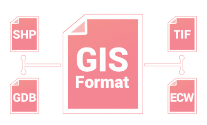
3 GDAL/OGR
The GDAL/OGR library is used for translating between GIS formats and extensions. QGIS, ArcGIS, ERDAS, ENVI and GRASS GIS and almost all GIS software use it for translation in some way. At this time, GDAL/OGR supports 97 vector and 162 raster drivers.
4 RSGISLib
The RSGISLib library is a set of remote sensing tools for raster processing and analysis. To name a few, it classifies, filters and performs statistics on imagery. My personal favourite is the module for object-based segmentation and classification (GEOBIA).
5 PyProj
The main purpose of the PyProj library is how it works with spatial referencing systems. It can project and transform coordinates with a range of geographic reference systems. PyProj can also perform geodetic calculations and distances for any given datum.
Python Libraries for Data Science
Data science extracts insights from data. It takes data and tries to make sense of it, such as by plotting it graphically or using machine learning. This list of Python libraries can do exactly this for you.
6 NumPy
Numerical Python (NumPy library) takes your attribute table and puts it in a structured array. Once it’s in a structured array, it’s much faster for any scientific computing. One of the best things about it is how you can work with other Python libraries like SciPy for heavy statistical operations.
7 Pandas
The Pandas library is immensely popular for data wrangling. It’s not only for statisticians. But it’s incredibly useful in GIS too. Computational performance is key for pandas. The success of Pandas lies in its data frame. Data frames are optimized to work with big data. They’re optimized to such a point that it’s something that Microsoft Excel wouldn’t even be able to handle.
8 Matplotlib
When you’re working with thousands of data points, sometimes the best thing to do is plot it all out. Enter matplotlib. Statisticians use the matplotlib library for visual display. Matplotlib does it all. It plots graphs, charts and maps. Even with big data, it’s decent at crunching numbers.
9 Scikit
Lately, machine learning has been all the buzz. And with good reason. Scikit is a Python library that enables machine learning. It’s built in NumPy, SciPy and matplotlib. So, if you want to do any data mining, classification or ML prediction, the Scikit library is a decent choice.
10 Re (regular expressions)
Regular expressions (Re) are the ultimate filtering tool. When there’s a specific string you want to hunt down in a table, this is your go-to library. But you can take it a bit further like detecting, extracting and replacing with pattern matching.
11 ReportLab
ReportLab is one of the most satisfying libraries in this list. I say this because GIS often lacks sufficient reporting capabilities. Especially, if you want to create a report template, this is a fabulous option. I don’t know why the ReportLab library falls a bit off the radar because it shouldn’t.
PRO TIP: If you need a quick and dirty list of functions for Python libraries, check out DataCamp’s Cheat Sheets.
Hari ini seorang bekas pelajar PSM saya, Sdri. Azne Hazira bt Sukor telah datang ke UTM Johor Bahru di atas urusan pengesahan dokumen dan mengambil kesempatan untuk menziarahi saya. Beliau sekarang bekerja di Perunding Ukur DC di Subang dan sebelum itu berkhidmat di Geoinfo Services, Taman Melawati, Kuala Lumpur selepas sahaja tamat pengajian di dalam program Sarjana Muda Sains (Geoinformatik).
Pada sesi pengajian 2018/2019 beliau telah berjaya menyiapkan sebuah thesis Projek Sarjana Muda bertajuk “Determination of Potential Water Pipeline Bursting using Stochastic Approach in Geographical Information System”. Di dalam projek PSM tersebut beliau telah mendapat kerjasama daripada Pejabat Harta Bina (PHB) bagi membekalkan data awalan dan Sekolah Kejuruteraan Awam, Fakulti Kejuruteraan bagi khidmat nasihat tentang proses pengagihan bekalan paip air di kawasan UTM.
By Elysonia Alim
Supervised by Dr. Shahabuddin Amerudin
UTM Undergraduate Thesis Year 2018
It is difficult to process GIS vector data when they are not aligned with one another. The need for different coordinate systems rose from the fact that some coordinate systems are better fitted to describe the phenomenon happening in a specific area. However, even commercial software had been proven to have questionable accuracy in coordinate system conversions. The purpose of this study is to develop a web application capable of converting the coordinate system of a GIS data format such as a shapefile for Peninsular Malaysia. The web application named Coordinate Conversion Application (CCA v1.1) was developed using Django 2.0 with Python 3.6 and is capable of 5 coordinate transformations namely WGS84 to GDM2000 (forward and backward), WGS84 to MRSO (old) (forward only), MRSO (old) to Cassini (old) (forward and backward). Results obtained were compared with existing software such as GDTS v4.01 and ArcGIS 10.3, and analysis shows that CCA v1.1 has achieved satisfactory accuracy
Do you want to choose a career that minimises your risk of being replaced by a robot? Here are five things to think about:
Study data science and/or get a job in data
Choose a job that robots still can’t do well – focus on jobs that require skills like creativity, problem-solving and connecting with people on a human level
Keep in touch with the job market to get an insight of which jobs are in demand and its average salary
Be data savvy – learn how to use data to make decisions and solve problems