Category: Public

Malaysian Coordinate Transformation & Projection
JOHOR BAHRU, 2 August 2025 – A new, powerful web-based calculator has been launched to streamline the complex process of Malaysian coordinate transformations, providing a crucial resource for s... Read More
A Review of Professional Membership in the Royal Institution of Surveyors Malaysia
Abstract Professional memberships are often regarded as strategic investments for career advancement, knowledge exchange, and professional recognition. The Royal Institution of Surveyors Malaysia... Read More
Analisis Data Hilal Syawal 1446H / 2025M dan Penentuan Tarikh 1 Syawal di Malaysia
Pengenalan Penentuan awal bulan dalam kalendar Hijri, termasuk 1 Syawal, bergantung kepada kaedah rukyah (cerapan) dan hisab (pengiraan astronomi). Bagi Malaysia, kriteria Imkanur Rukyah dig... Read More
Analisis Data Radar dan Impak Hujan Lebat Berterusan dalam Kejadian Banjir di Johor pada 20 Mac 2025
Pada 19 dan 20 Mac 2025, Negeri Johor, khususnya Johor Bahru, mengalami hujan lebat berterusan yang mengakibatkan banjir besar. Analisis data radar cuaca dan parameter meteorologi memberikan gambaran ... Read More
Singapore’s Country-Scale Digital Twin A Revolutionary Model for Smart Cities
By Shahabuddin Amerudin Introduction Singapore has been at the forefront of technological advancements in urban management and planning, with its ambitious initiative, Virtual Singapore. This project ... Read More
Anugerah Kebolehpasaran Graduan UTM Tahun 2023
Universiti Teknologi Malaysia (UTM) telah menganugerahkan Anugerah Kebolehpasaran Graduan bagi tahun 2023. Pengumuman tersebut memaparkan senarai penerima anugerah yang telah menunjukkan prestasi ceme... Read More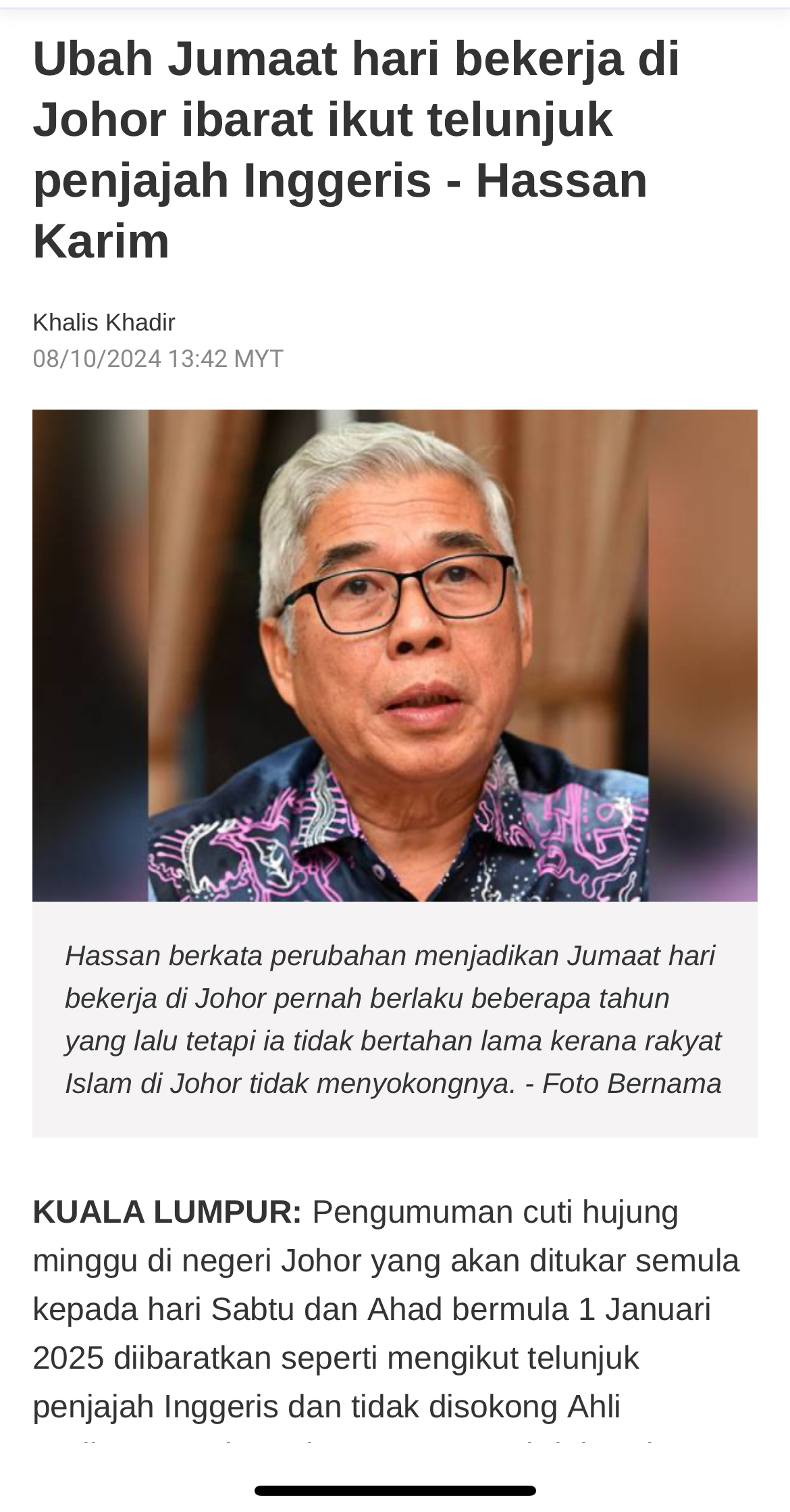
Pertukaran Cuti Hujung Minggu di Johor
Artikel ini bertujuan untuk mengulas pandangan mengenai pertukaran hari cuti hujung minggu di Johor, khususnya cadangan menjadikan hari Jumaat sebagai hari bekerja dan Ahad sebagai hari cuti rehat. Is... Read More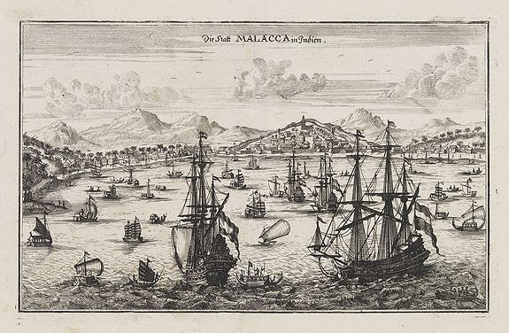
Keadaan Melaka pada Tahun 1854 dan 270 Tahun Sebelumnya
Oleh Shahabuddin Amerudin Melaka adalah sebuah wilayah yang kaya dengan sejarah serta kepentingan geostrategik. Sejak penubuhannya sebagai sebuah kesultanan Melayu pada abad ke-15, Melaka telah menari... Read More
Perjalanan dan Pendakian Gunung Ophir pada Tahun 1854
Map showing the hiking trails up Mt. Ophir. Wallace would have taken the brown route.... Read More
Melaka dan Gunung Ledang pada Tahun 1854: Penemuan dan Pengalaman Alfred Russel Wallace
Oleh Shahabuddin Amerudin Alfred Russel Wallace, seorang ahli biologi terkemuka, menghabiskan beberapa bulan di Melaka dan Gunung Ledang (Mount Ophir) dari Julai hingga September 1854. Dalam bukunya&n... Read More
The Malay Archipelago: Malacca and Mount Ophir
Terjemahan petikan dari “The Malay Archipelago” oleh Alfred Russel Wallace, pertama kali diterbitkan pada musim bunga 1869 dalam dua jilid oleh Macmillan (London). BAB 3: Melaka dan Gunung... Read More
Sejarah Aceh
Aceh, yang terletak di hujung utara Pulau Sumatera, merupakan sebuah wilayah yang kaya dengan sejarah, memainkan peranan penting dalam perkembangan politik, agama, dan ekonomi di rantau Asia Tenggara.... Read More
Peranan AI dalam Pembangunan Perisian dan Aplikasi
Oleh Shahabuddin Amerudin Kecerdasan Buatan (AI) kini menjadi salah satu teknologi teras dalam pembangunan perisian dan aplikasi, membawa revolusi dalam cara perisian dibina, diuji, dan diselenggara. ... Read More
Mengimbangi Peranan Universiti dan Industri dalam Pembangunan Teknologi
Universiti sering dianggap sebagai pusat inovasi dan pembangunan teknologi. Di sinilah teori-teori baru diasah, penyelidikan mendalam dijalankan, dan teknologi baru direka serta diuji. Dalam konteks i... Read More
Media Sosial dan GIS Untuk Pengumpulan dan Analisis Data Ruang
Oleh Shahabuddin Amerudin Pengenalan Dalam era digital ini, media sosial telah berkembang menjadi platform yang bukan sahaja digunakan untuk berinteraksi secara sosial, tetapi juga sebagai sumber da... Read More
Implementing a Comprehensive Atlas Documenting the Life of Prophet Muhammad
By Shahabuddin Amerudin Introduction The documentation of the Prophet Muhammad’s life has historically been preserved through manuscripts, biographies (Sirah), and religious texts such as Hadith... Read More
Teknologi AI dan Pembelajaran Mesin untuk Memantau dan Menyaring Kandungan Internet
Dalam era digital yang semakin maju, isu penyebaran kandungan haram seperti pornografi, perjudian, dan ekstremisme melalui laman sesawang menjadi cabaran besar kepada kerajaan dan pihak berkuasa. Lang... Read More
Datang Kosong, Pulang Pun Kosong – II
Dari sudut pandangan tasawuf atau Sufi, falsafah “Datang Kosong, Pulang Pun Kosong” mengandungi makna yang mendalam tentang hakikat kehidupan dan pencarian makna rohani yang lebih tingg... Read More