Project

The Student-Supervisor Matching Application

Developing an Automated Student-Supervisor Matching System for Academic Institutions: A Case Study

By Shahabuddin Amerudin Abstract The allocation of supervisors to students for research guidance is a critical process in academic institutions, particularly at the undergraduate level. This paper presents the development of an automated matching system designed to streamline the process of assigning students to supervisors based on their research interests and competencies. The system leverages JSON-based data storage and a weighted matching algorithm implemented in PHP, ensuring that the matching process is efficient, transparent, and data-driven. The study discusses the system’s design, implementation, and potential impact on academic administration. 1. Introduction The process of matching students with supervisors is often […]

Developing an Automated Student-Supervisor Matching System for Academic Institutions: A Case Study Read More »

PGN

Analisa dan Perbandingan Senarai Fundamental Geospatial Data (FGD) Malaysia dengan Piawaian Antarabangsa

Oleh Shahabuddin Amerudin Pengenalan Artikel ini bertujuan untuk menganalisis dan membandingkan Senarai Fundamental Geospatial Data (FGD) sehingga Januari 2023 yang diterbitkan oleh Pusat Geospatial Negara Malaysia dengan piawaian yang digunakan oleh organisasi dan badan antarabangsa seperti ISO 19115:2014, FGDC NSDI (2000), INSPIRE Directive (2007), dan UN-GGIM Strategic Framework (2018). Analisis ini akan menilai kelengkapan data geospatial yang dimiliki Malaysia dan mencadangkan penambahbaikan untuk mematuhi piawaian global yang lebih tinggi. 1. Struktur Kategori Data Senarai Fundamental Geospatial Data (FGD) Malaysia mengandungi 12 kategori utama, termasuk aeronautical, built environment, demarcation, geology, hydrography, hypsography, soil, transportation, utility, vegetation, special use, dan general. Setiap kategori ini merangkumi subkategori yang lebih terperinci, menunjukkan usaha yang signifikan

Analisa dan Perbandingan Senarai Fundamental Geospatial Data (FGD) Malaysia dengan Piawaian Antarabangsa Read More »

Flood Hotspot Identification and Implications for Flood Preparedness

By Shahabuddin Amerudin Abstract This article presents a comprehensive analysis of flood hotspots, areas highly susceptible to recurrent or severe flooding. It delves into the considerations for identifying these hotspots, focusing on the role of timeframes and frequency thresholds. The article explores various methodologies, data sources, regional variations, and the implications for flood risk mitigation and management, with a specific focus on Malaysia’s flood hotspot scenario until September 2023. Introduction Floods are complex natural phenomena with the potential for catastrophic impacts on human settlements, infrastructure, and ecosystems. Effective flood risk assessment, disaster preparedness, and mitigation strategies necessitate a deep understanding

Flood Hotspot Identification and Implications for Flood Preparedness Read More »

Geospatial Analysis and 4D-GIS in Mineral Exploration

By Shahabuddin Amerudin Abstract Mineral exploration, a complex and high-stakes endeavor rife with uncertainties, is experiencing a paradigm shift through the integration of cutting-edge geospatial analysis and the revolutionary 4D-Geographic Information System (GIS). In this review, we unravel the profound impact of these technologies on mineral exploration, shedding light on their indispensable role in mitigating risks and significantly increasing the likelihood of discovering concealed mineral deposits. Our exploration traverses a spectrum of input datasets, encompassing remote sensing, exploration geochemistry, exploration geophysics, and geological indicators. Furthermore, we delve into the pivotal stages of user-guided interpretation and predictive modeling, which play a

Geospatial Analysis and 4D-GIS in Mineral Exploration Read More »

Factors Affecting Height Accuracy in Global Navigation Satellite Systems (GNSS)

By Shahabuddin Amerudin Abstract Global Navigation Satellite Systems (GNSS), with the Global Positioning System (GPS) as the most prominent example, have transformed the field of geospatial positioning, enabling precise location determination for a multitude of applications. While GNSS provides remarkable accuracy in horizontal position measurements, the accuracy of height measurements remains subject to various influencing factors. This article conducts an in-depth and comprehensive review of the factors impacting height accuracy in GNSS measurements, along with exploring the diverse techniques and technologies deployed to enhance height precision. Additionally, this paper delves into the practical applications of high-precision height measurements in geodesy,

Factors Affecting Height Accuracy in Global Navigation Satellite Systems (GNSS) Read More »

Addressing Common Challenges in Creating Study Area Maps in Thesis Writing

By Shahabuddin Amerudin Introduction Geographic Information Systems (GIS) plays an indispensable role in various fields, including environmental science, urban planning, and public health. For GIS students at the Universiti Teknologi Malaysia (UTM), producing a high-quality study area map is a fundamental aspect of their thesis writing. However, this seemingly straightforward task can be surprisingly challenging, especially when it comes to fitting the map within the constraints of an A4 or B5 paper size. As a result, many students resort to using Google Maps as a basemap or backdrop image, rather than creating a map from scratch. In this article, we

Addressing Common Challenges in Creating Study Area Maps in Thesis Writing Read More »

A Guide for School Students Interested in Pursuing a GIS Program

By Shahabuddin Amerudin Are you a high school student with a keen interest in geography, maps, and technology? Do you find yourself drawn to the idea of using spatial data to solve real-world problems? If so, a career in Geographic Information Systems (GIS) might be the perfect fit for you. This guide is designed to help school students explore their passion for GIS and make informed decisions about pursuing a GIS program. Discovering Your Interest in GIS Before diving into the world of GIS, it’s essential to explore and understand your interests. Here are some key questions to consider: Choosing

A Guide for School Students Interested in Pursuing a GIS Program Read More »

Location Privacy: Ensuring Control and Protection in an Evolving Digital Landscape

By Shahabuddin Amerudin Abstract In today’s interconnected world, location-based services have become an integral part of our daily lives. These services, which rely on various technologies such as satellite navigation systems, mobile carrier antennas, and wireless networks, enable us to navigate, communicate, and access a wide range of information. However, the pervasive use of location data raises significant concerns regarding location privacy. This article delves into the concept of location privacy, emphasizing the importance of individuals’ ability to control the disclosure and use of their location data. It explores the methods used to determine a device’s physical location and discusses

Location Privacy: Ensuring Control and Protection in an Evolving Digital Landscape Read More »

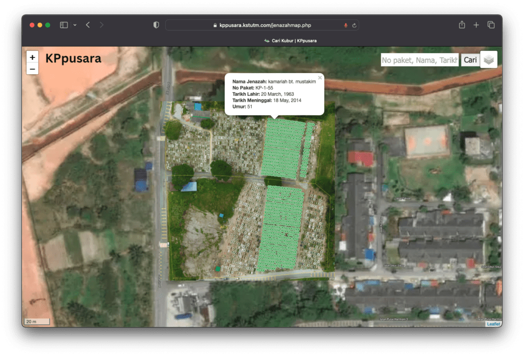
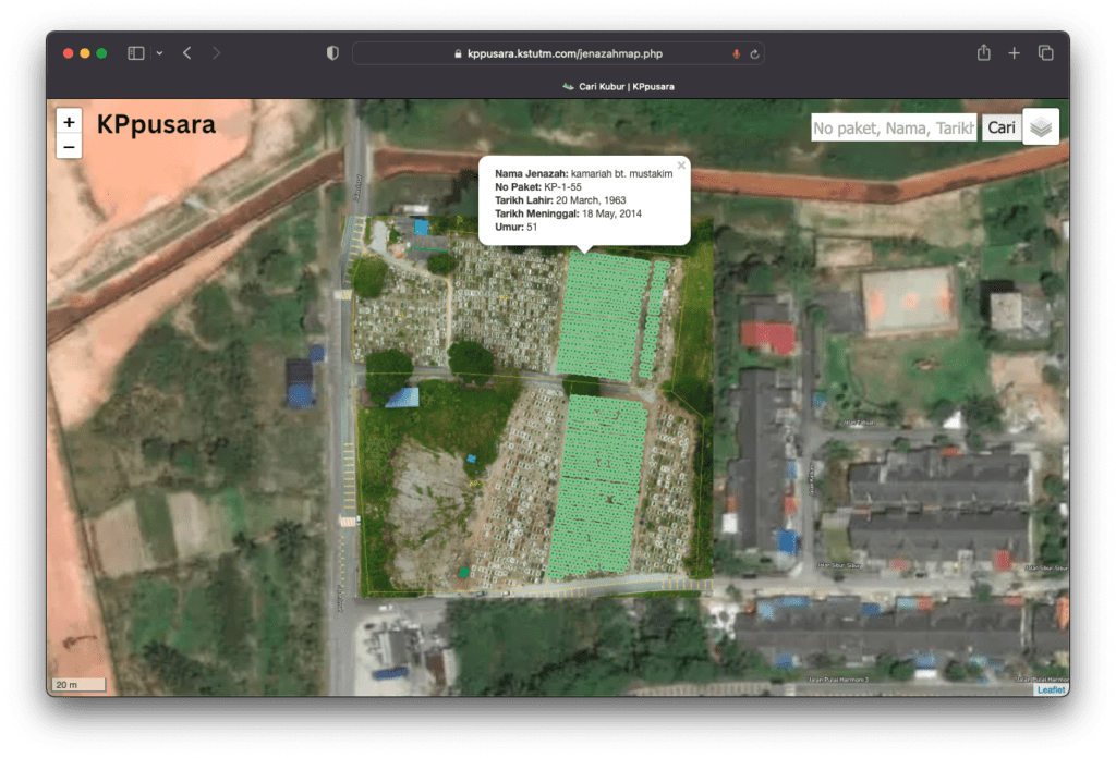
https://kppusara.kstutm.com/jenazahmap.php?query=budin

Pembangunan Sistem Pengurusan Tanah Perkuburan Berasaskan GIS

Oleh Shahabuddin Amerudin Pembangunan Laman Web Tanah Perkuburan Islam Kampung Melayu Kangkar Pulai dijalankan melalui pendekatan kitar hayat pembangunan sistem (SDLC), yang terdiri daripada lima fasa: perancangan, analisis, reka bentuk, implementasi, dan penyelenggaraan. Fasa Perancangan Pada peringkat perancangan, keperluan utama laman web ini adalah untuk memudahkan pengurusan tanah perkuburan yang cekap dan menyediakan akses mudah kepada pengguna untuk mencari kubur. Kewujudan peta interaktif yang disokong oleh teknologi GIS menjadi keutamaan dalam sistem ini. Kajian keperluan melibatkan pemahaman terhadap konsep Sistem Maklumat Geografi (GIS), sistem koordinat seperti WGS84, penggunaan peta, dan keperluan untuk menghubungkan data spatial dengan data atribut kubur. Fasa Analisis Dalam fasa ini, kajian mendalam dilakukan untuk memahami

Pembangunan Sistem Pengurusan Tanah Perkuburan Berasaskan GIS Read More »

Laman Web Tanah Perkuburan Islam Kampung Melayu Kangkar Pulai

Mengatasi Masalah Pengurusan Tanah Perkuburan melalui Inovasi Teknologi

Oleh Shahabuddin Amerudin Dalam dunia yang semakin berkembang dan penuh dengan kemajuan teknologi, pengurusan tanah perkuburan menghadapi pelbagai cabaran yang semakin rumit. Masyarakat yang berkembang pesat memerlukan pendekatan baharu untuk mengurus dan memudahkan akses kepada tanah perkuburan. Permasalahan ini menuntut penyelesaian yang inovatif dan lebih efisien. Artikel ini akan mengetengahkan kepentingan Laman Web Tanah Perkuburan Islam Kampung Melayu Kangkar Pulai (https://kppusara.kstutm.com) sebagai satu contoh inovasi yang berjaya menangani cabaran dalam pengurusan tanah perkuburan dengan pendekatan yang lebih berkesan. Cabaran dalam Pengurusan Tanah Perkuburan Pertumbuhan penduduk yang pesat telah memberi tekanan kepada penggunaan tanah, termasuklah tanah perkuburan, menjadikannya satu keperluan penting

Mengatasi Masalah Pengurusan Tanah Perkuburan melalui Inovasi Teknologi Read More »

anah Perkuburan Islam Kampung Melayu Kangkar Pulai

Laman Web Tanah Perkuburan Islam Kangkar Pulai

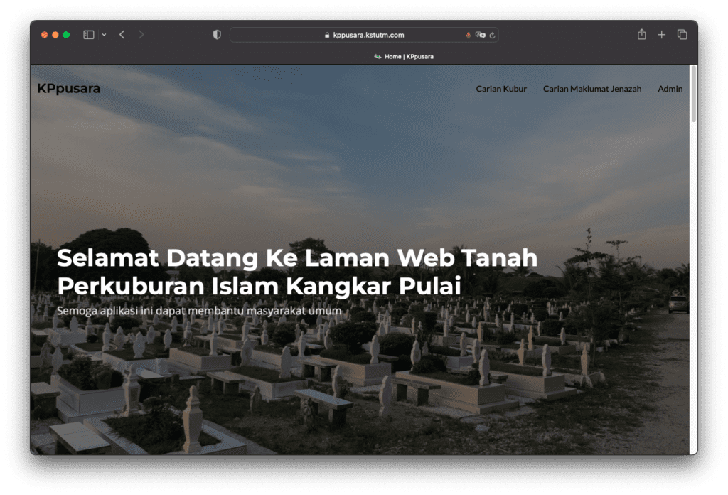
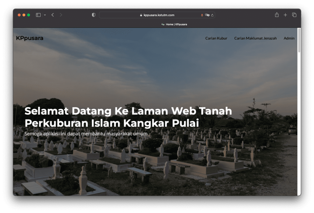
Dalam era teknologi yang semakin canggih, pengalaman interaktif memainkan peranan penting dalam mengubah perkara biasa menjadi sesuatu yang luar biasa. Itulah yang cuba dicapai oleh Laman Web Tanah Perkuburan Islam Kampung Melayu Kangkar Pulai, Johor Bahru. Dengan memanfaatkan teknologi terkini, laman web ini membolehkan pengguna menjelajahi kawasan perkuburan dengan cara yang lebih menarik dan terperinci. Hanya dengan melayari laman web di URL: https://kppusara.kstutm.com, pengguna dapat merasai pengalaman baharu. Laman web ini menyediakan peta interaktif yang bukan sahaja memaparkan lokasi kubur tetapi juga membolehkan pengguna berinteraksi dengan peta tersebut. Anda boleh menjelajah peta dengan mudah untuk mencari kubur yang diingini. Sekiranya anda

Laman Web Tanah Perkuburan Islam Kangkar Pulai Read More »

Unveiling the Power of Geospatial Artificial Intelligence (GeoAI) and its Applications

By Shahabuddin Amerudin Introduction The term Geospatial Artificial Intelligence (GeoAI) lacks a universally agreed-upon definition. Initially, GeoAI referred to the utilisation of machine learning tools within Geographic Information Systems (GISs) to predict future scenarios by classifying data. This included disaster occurrence, human health epidemiology, and ecosystem evolution, aimed at bolstering community resilience through traditional geographic information in digital cartography (Esri, 2018). A broader interpretation considers GeoAI as processing Geospatial Big Data (GBD) encompassing various sources, such as digital cartography, remote-sensing-based multidimensional data, and georeferenced texts. The focal point is the geographic dimension (Janowicz et al., 2019. Thus, GeoAI merges AI

Unveiling the Power of Geospatial Artificial Intelligence (GeoAI) and its Applications Read More »

Simplifying Automated Building Footprint Extraction with Deep Learning in GIS

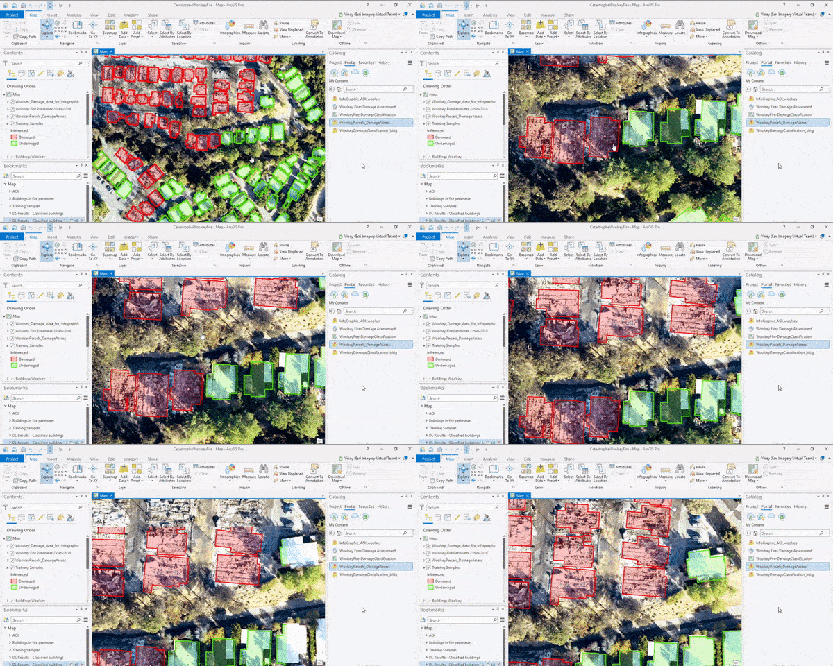
By Shahabuddin Amerudin Abstract This paper delves into the realm of geospatial data processing, highlighting the amalgamation of Python scripting and advanced deep learning techniques for object detection. The resulting synergy offers an avenue to streamline complex tasks within this domain. The focus of this work is on the automation of building footprint extraction from aerial imagery using these integrated methodologies. Automated Building Footprint Extraction via Deep Learning Techniques Consider a scenario where the conventional approach of manually delineating building footprints from newly acquired aerial imagery demands weeks of laborious effort. Conversely, a technologically empowered approach leverages Python scripting in

Simplifying Automated Building Footprint Extraction with Deep Learning in GIS Read More »

Beyond Horizons: Mapping the Future with AR, VR, and Boundless Innovation – Part 2

By Shahabuddin Amerudin In the bustling heart of Nusantara, GeoSmart Solutions had transformed into an innovation powerhouse. Ahmad, the visionary System Analyst, was leading a team that had not only revolutionised tree data collection but was now poised to redefine the very landscape of GIS technology. The success of “Geoscape Greens” had unleashed a wave of creativity, propelling the team into uncharted territory. The integration of AR, VR, XR, and MR into the application marked a turning point. As they tinkered with the potential of these technologies, the team realized they were on the cusp of something extraordinary. The world

Beyond Horizons: Mapping the Future with AR, VR, and Boundless Innovation – Part 2 Read More »

Geoscape Greens: A Journey of Innovation and Sustainability – Part 1

By Shahabuddin Amerudin In the vibrant city of Nusantara, nestled between towering skyscrapers and bustling streets, stood the headquarters of GeoSmart Solutions, a leading GIS firm. Among its talented employees was Ahmad, a brilliant System Analyst with a passion for technology, geography, and a penchant for turning ideas into reality. Ahmad was entrusted with leading a remarkable team on an ambitious project: the development of an innovative GIS application that would redefine how tree information was collected, analyzed, and utilized. This application would seamlessly integrate a cloud-based web platform with both iOS and Android mobile devices, enabling users to capture

Geoscape Greens: A Journey of Innovation and Sustainability – Part 1 Read More »

Cabaran Sikap Pelajar Universiti Terhadap Kemerosotan Pencapaian Akademik di Era Digital

Oleh Shahabuddin Amerudin Dalam era digital yang penuh dengan kemudahan dan akses kepada maklumat, sikap pelajar universiti terhadap pencapaian akademik telah menunjukkan corak yang mencabar. Walaupun pelajar kini mempunyai pelbagai kemudahan dan sokongan untuk berjaya dalam pengajian mereka, namun masih terdapat pelbagai isu yang perlu diberi perhatian bagi mengatasi kemerosotan pencapaian akademik pelajar terbabit. Artikel ini akan membincangkan beberapa isu utama yang telah dinyatakan dalam konteks sikap pelajar universiti pada masa kini terhadap pencapaian akademik mereka. Salah satu isu yang ketara adalah kurangnya usaha dan keengganan pelajar dalam melaksanakan tugasan yang diberikan oleh pensyarah. Sikap ini seringkali merumitkan proses pembelajaran

Cabaran Sikap Pelajar Universiti Terhadap Kemerosotan Pencapaian Akademik di Era Digital Read More »

Developing Web Map-Based Applications

By Shahabuddin Amerudin Introduction Web map-based applications have transformed how we interact with geographic information, enabling us to explore, analyze, and visualize data on interactive maps. The development of such applications involves a unique set of challenges and considerations, ranging from selecting mapping libraries to optimizing performance for diverse devices. This article delves into the technical intricacies of creating web map-based applications, discussing mapping libraries, geospatial data integration, user experience, and optimization techniques. Choosing Between the Libraries Selecting the right mapping library is crucial for building effective web map-based applications. Two of the most prominent options are Leaflet and Google

Developing Web Map-Based Applications Read More »

Enhancing Smartphone GNSS Accuracy with External Receivers

By Shahabuddin Amerudin In an era driven by digital navigation and geospatial accuracy, the fusion of smartphones and external GNSS receivers has revolutionized positioning capabilities. With the proliferation of location-based services, achieving sub-meter accuracy with smartphones has become a tantalizing possibility. In this article, we explore how to realize this feat, including a dive into cost-effective external receivers that can elevate your smartphone’s positioning prowess. Smartphone GNSS: The Foundation Modern smartphones are equipped with built-in GNSS modules that tap into constellations like GPS, GLONASS, Galileo, and BeiDou, providing basic positioning services. However, their inherent limitations, such as susceptibility to signal

Enhancing Smartphone GNSS Accuracy with External Receivers Read More »

Unleashing Sub-Meter Accuracy with L1 and L5 GNSS Frequencies

By Shahabuddin Amerudin Introduction In the realm of modern navigation and geospatial technology, achieving unparalleled accuracy has become a driving force. As industries and individuals seek to unlock the potential of location-based services, the fusion of advanced GNSS technology with smartphones and external receivers has become a game-changer. One of the pivotal benchmarks in this quest is the pursuit of sub-meter accuracy – a feat that was once confined to specialized equipment but is now within reach through innovative approaches. The confluence of two significant GNSS frequency bands, L1 and L5, stands as a beacon of hope for realizing sub-meter

Unleashing Sub-Meter Accuracy with L1 and L5 GNSS Frequencies Read More »

Pioneering High-Accuracy GNSS Positioning with Low-Cost Receivers and Smartphones

By Shahabuddin Amerudin Introduction In the dynamic landscape of navigation and positioning technology, a remarkable breakthrough has emerged: the accessibility of high-accuracy GNSS positioning through low-cost receivers and smartphones (Marchi et al., 2022). As we delve deeper into this realm, we uncover a transformative era of precision that was once reserved for specialized equipment. This article explores the advancements, implications, and the potential for achieving centimeter-level accuracy through these affordable solutions. Empowering Ubiquity The narrative begins with the widespread adoption of low-cost GNSS technology. This innovation is now not only accessible but also adaptable with minimal investment. The EGSA GNSS

Pioneering High-Accuracy GNSS Positioning with Low-Cost Receivers and Smartphones Read More »

Scroll to Top