By Shahabuddin Amerudin
Abstract
This article presents a comprehensive analysis of flood hotspots, areas highly susceptible to recurrent or severe flooding. It delves into the considerations for identifying these hotspots, focusing on the role of timeframes and frequency thresholds. The article explores various methodologies, data sources, regional variations, and the implications for flood risk mitigation and management, with a specific focus on Malaysia’s flood hotspot scenario until September 2023.
Introduction
Floods are complex natural phenomena with the potential for catastrophic impacts on human settlements, infrastructure, and ecosystems. Effective flood risk assessment, disaster preparedness, and mitigation strategies necessitate a deep understanding of flood-prone areas, commonly referred to as “flood hotspots.” This article delves into the concept of flood hotspots, emphasizing the importance of timeframes and frequency thresholds in their identification.
I. Identifying Flood Hotspots: A Conceptual Framework
Flood hotspots represent geographical areas exhibiting heightened susceptibility to flooding. These areas are characterized by specific factors, including topographical features, proximity to water bodies, and regional climate dynamics. Discerning these factors is essential for precise hotspot identification.
Topography plays a pivotal role in hotspot identification. Low-lying terrains and regions proximate to rivers, lakes, or coastlines are intrinsically predisposed to flooding due to their vulnerability to rising water levels. Furthermore, areas with dense urban development and impermeable surfaces experience amplified runoff, intensifying flood risks.
Climate patterns and meteorological events significantly contribute to the emergence of flood hotspots. Regions exposed to monsoons, hurricanes, or intense rainfall events exhibit heightened susceptibility to flooding. The historical climate data and patterns within these regions serve as crucial indicators for hotspot identification.
While several factors contribute to hotspot emergence, historical flood data serves as a cornerstone in the identification process. This dataset aids in recognizing regions with a history of recurrent flooding, rendering them prone to future flood events. Analyzing historical data unveils patterns and trends, including seasonal floods or recurrent flood occurrences that may not be encapsulated by traditional long-term return periods.
II. Timeframes and Frequency Thresholds in Hotspot Identification
The conventional method of identifying flood hotspots relies on the application of return periods, encompassing durations like 10-year, 25-year, or 100-year floods. These return periods represent the average likelihood of a flood of a specific magnitude transpiring within a given year. However, there are circumstances where long-term return periods inadequately depict vulnerability to frequent flooding.
In response to the necessity for more precise hotspot assessment, certain studies have explored shorter timeframes. For instance, a 3-year duration, accompanied by a prerequisite of three flood events within that period, can provide insights into areas confronted with frequent flooding. This approach acknowledges that some regions may experience multiple flood events within a concise timeframe, eluding conventional return periods.
III. Methodology and Data Sources
Robust methodology underpins the identification of flood hotspots, entailing the amalgamation of diverse data sources and tools. Geographic Information Systems (GIS) frequently serve as the nexus for assimilating topographical, hydrological, and historical flooding data. Accurate and reliable flood data are paramount and may be sourced from government agencies, research institutions, and satellite observations.
Geospatial data, including digital elevation models and hydrological information, assume critical roles in assessing topographical vulnerability. Historical flood data, featuring records of prior flood occurrences and their magnitudes, offers invaluable insights into hotspot identification. Real-time data sources, inclusive of river gauges and meteorological forecasts, contribute to early warning systems, facilitating timely responses to impending floods.
IV. Case Studies and Regional Variations
The methodologies employed for identifying flood hotspots may exhibit regional variability contingent on distinct geographical, climatic, and socioeconomic attributes. In some regions, traditional return periods align harmoniously with the frequency of flood events, rendering them a pertinent metric. Coastal regions, for instance, predominantly rely on long-term return periods owing to cyclic storm surges intertwined with substantial but infrequent events.
Conversely, regions susceptible to flash floods may derive greater benefit from shorter timeframes, engendering a more accurate depiction of recurrent flooding. Regions typified by rugged terrain, urbanization, or seasonal monsoons often confront numerous floods within abbreviated time spans. The utilization of shorter timeframes facilitates a more accurate portrayal of flood risk in these locales.
Global case studies exemplify these distinctions. Coastal regions predominantly favor traditional return periods to strategize for and mitigate the impacts of storm surges, while arid regions, confronted with infrequent yet intense rainfall events, derive substantial utility from shorter timeframes in addressing flash floods.
V. Implications for Flood Risk Mitigation and Management
The identification of flood hotspots substantiates a pivotal phase in flood risk mitigation and management. These areas necessitate specific attention and resource allocation for disaster preparedness, land-use planning, and infrastructure enhancements.
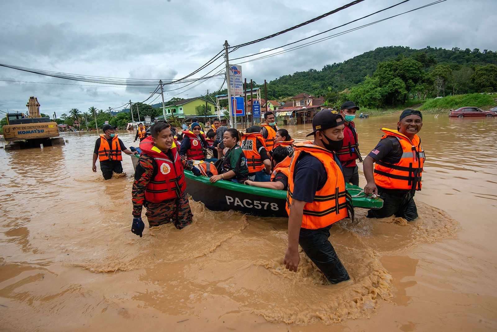
Disaster Preparedness: Early warning systems represent the bedrock of community alertness in flood-prone regions. Timely information concerning impending floods equips residents with the capacity to institute protective measures and execute evacuations when requisite. Concurrently, authorities can mobilize emergency response teams and distribute resources judiciously.
Land-Use Planning: The astute recognition of flood hotspots underpins sustainable land-use planning. Regulatory frameworks and zoning ordinances may be fine-tuned to either circumscribe or guide development in flood-prone areas. This approach curtails exposure to flood risk and minimizes prospective economic losses.
Infrastructure Improvements: The delineation of flood hotspots directly informs infrastructure investments. Regions prone to recurrent flooding may necessitate fortified flood control systems, including levees, dikes, and retention basins. Additionally, the construction of resilient and elevated infrastructure can abate the impact of flooding.
Community Resilience: Communities situated in flood-prone regions must cultivate adaptation strategies to fortify their resilience. This may entail the elevation of buildings above base flood elevations, structural fortifications, and the promotion of insurance and risk reduction awareness among residents.
VI. Flood Hotspots in Malaysia: Analysis of Flood Preparedness Until September 2023
Expanding on the broader understanding of flood hotspots and their identification, it is imperative to delve into the specific scenario in Malaysia. As of September 2023, the Department of Irrigation and Drainage Malaysia (JPS Malaysia) presents critical data regarding flood hotspots within the country.
A. Distribution of Flood Hotspots in Malaysia
According to the data provided by JPS Malaysia, the country accommodates a total of 5,648 flood hotspots. This data portrays the substantial flood risk in Malaysia, underscoring the necessity for proactive flood preparedness measures.
B. State-Wise Breakdown of Flood Hotspots
Scrutinizing the distribution of flood hotspots on a state-by-state basis furnishes crucial insights into regional disparities. The quantity of flood hotspots in each state is as follows:
- Perlis: 22 hotspots
- Kelantan: 617 hotspots
- Kedah: 260 hotspots
- Pulau Pinang: 241 hotspots
- Perak: 286 hotspots
- Selangor: 271 hotspots
- Kuala Lumpur: 73 hotspots
- Terengganu: 258 hotspots
- Pahang: 750 hotspots
- Putrajaya: 0 hotspots
- Negeri Sembilan: 120 hotspots
- Melaka: 124 hotspots
- Johor: 745 hotspots
- Sarawak: 1066 hotspots
- Labuan: 17 hotspots
- Sabah: 798 hotspots
This scrutiny elucidates significant disparities in the quantity of flood hotspots, manifesting distinct regional risks. States like Sarawak, Sabah, and Johor manifest elevated quantities of flood hotspots, denoting amplified risk levels. In contrast, other states may evidence lower risk levels, although the specter of flood risk endures throughout Malaysia.
C. Definition of Flood Hotspots in Malaysia
The definition of flood hotspots adopted from JPS Malaysia (2023) in this analysis elucidates “kawasan berisiko banjir yang mengalami kekerapan tidak kurang daripada tiga (3) kali dalam tempoh tiga (3) tahun yang terkini”. This definition underscores that these areas recurrently experience floods, warranting distinct flood preparedness and risk management measures. This delineation assumes critical importance in identifying areas necessitating specialized attention in flood preparedness planning.
D. Implications for Flood Preparedness and Management
Analyzing flood hotspots represents an initial and indispensable stride in abating flood impacts. This exercise authorizes local, state, and national authorities to channel resources and preparedness measures toward areas enduring the gravest consequences of floods. Several key implications follow:
1. Preparedness Planning: Flood preparedness necessitates augmentation in areas manifesting an abundance of flood hotspots, including Sarawak, Sabah, and Johor. This expansion incorporates the institution of early warning systems and the execution of preparedness drills.
2. Disaster Management: Effective disaster management, encapsulating the identification of provisional shelter locations and evacuation schematics, must be meticulously formulated.
3. Risk Management: Both public administration and the private sector must partake in actions to diminish flood risk within the ambit of development planning. This may entail the imposition of development constraints within flood hotspot regions.
Conclusion
In synthesis, a profound comprehension of flood hotspots and their identification is paramount in contending with the multifaceted quandaries presented by flooding. Traditional long-term return periods persist as valuable tools, but the assimilation of abbreviated timeframes and frequency thresholds avails a more granular understanding of regions perennially plagued by flooding. Acknowledging the variances in hotspot identification across regions is equally pivotal in crafting bespoke mitigation strategies. Through a multifaceted approach to hotspot identification, we engender enhanced flood resilience and curtail the repercussions of this natural calamity. The data proffered by JPS Malaysia up to September 2023 emphatically underscores the imperative nature of flood preparedness in Malaysia, spotlighting disparate risk gradients across states, rendering flood hotspot analysis an indispensable apparatus in shielding communities and resources.
References
JPS Malaysia (2023). Kesiapsiagaan Menghadapai Monsun Timur Laut – Hotspot Kawasan Banjir. JPS Malaysia.
Suggestion for Citation:
Amerudin, S. (2023). Flood Hotspot Identification and Implications for Flood Preparedness. [Online] Available at: https://people.utm.my/shahabuddin/?p=7322 (Accessed: 19 October 2023).
