Suggestion for Citation: Amerudin, S. (2023). Understanding the Ray Casting Algorithm for Point-in-Polygon Analysis. [Online] Available at: https://people.utm.my/shahabuddin/?p=6277 (Accessed: 8 April...Read More
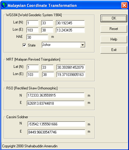
By Shahabuddin Amerudin Geographic Information System (GIS) software has significantly advanced the way we approach mapping and spatial analysis, providing essential tools for converting between vario...Read More