
Tag: GeoAI

The Future of GIS and the Evolution of Emerging Concepts and Terminology
By Shahabuddin Amerudin Introduction For decades, Geographic Information Systems (GIS) have been the cornerstone of mapping, spatial analysis, and decision-making across a multitude of industries. Tra... Read More
Choosing the Best Mac for AI/ML, GeoAI, and Local LLM Inference
By Shahabuddin Amerudin 1. Introduction Selecting the right computer for AI/ML, GeoAI development, and local LLM inference is a crucial decision that impacts long-term productivity, efficiency, and sc... Read More
Optimizing Hardware for Vector-Based GeoAI
By Shahabuddin Amerudin Introduction The growing field of Geospatial Artificial Intelligence (GeoAI) represents a fusion of spatial analysis with modern machine learning techniques. However, not all G... Read More
Investing in the Right Hardware for GeoAI
By Shahabuddin Amerudin In the rapidly evolving field of Geospatial Artificial Intelligence (GeoAI), hardware decisions can make or break a project’s feasibility and efficiency. As GeoAI applica... Read More
Choosing the Best Mac for AI/ML and GeoAI Development
By Shahabuddin Amerudin Artificial Intelligence (AI), Machine Learning (ML), and Geographic Artificial Intelligence (GeoAI) are computationally demanding fields that require high-performance hardware.... Read More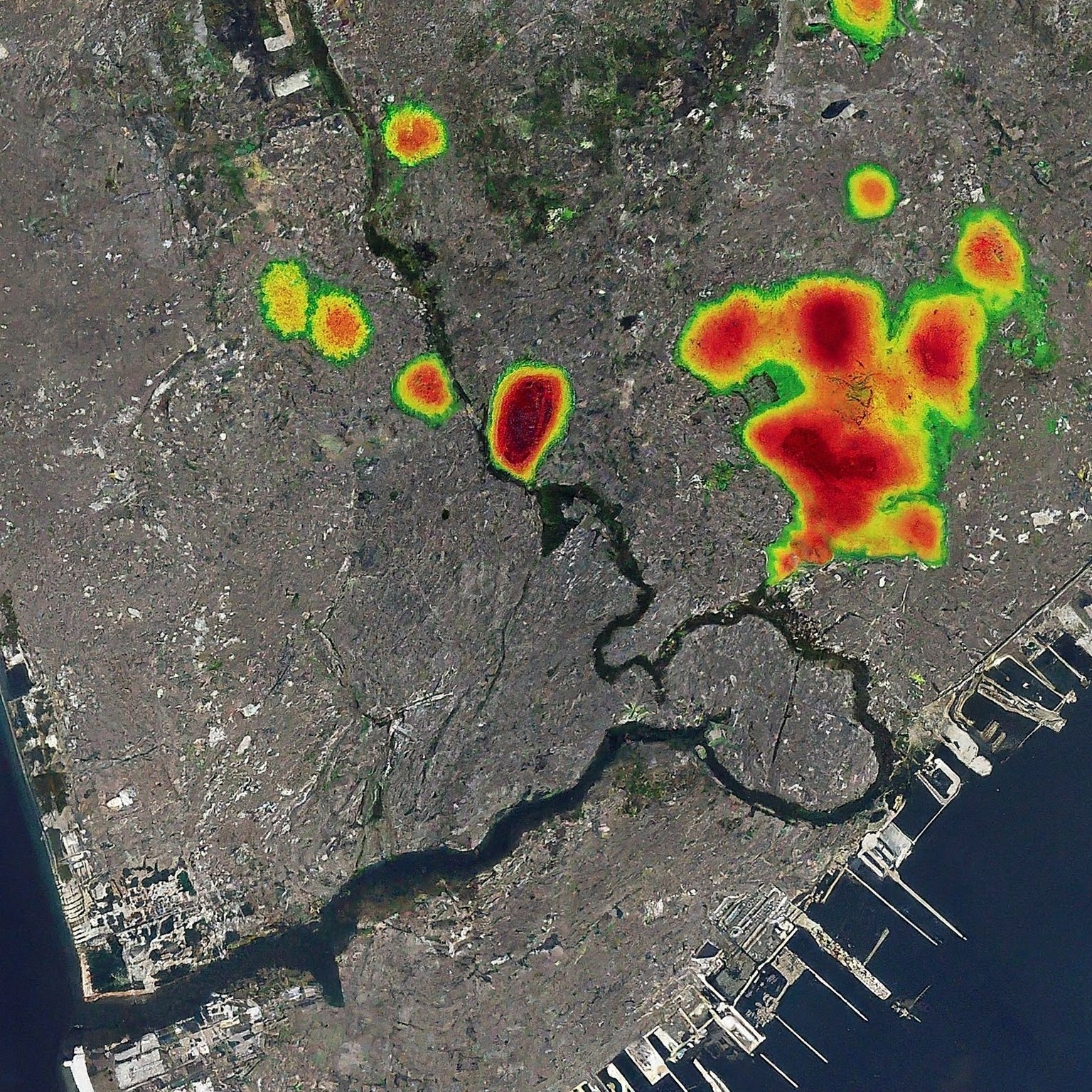
Advancing Urban Planning with GeoAI through Global Street Network Analysis
By Shahabuddin Amerudin Introduction Geographic Artificial Intelligence (GeoAI) integrates Geographic Information Systems (GIS) with artificial intelligence (AI), offering advanced capabilities for ur... Read More
Unveiling the Power of Geospatial Artificial Intelligence (GeoAI) and its Applications
By Shahabuddin Amerudin Introduction The term Geospatial Artificial Intelligence (GeoAI) lacks a universally agreed-upon definition. Initially, GeoAI referred to the utilisation of machine learning to... Read More
Simplifying Automated Building Footprint Extraction with Deep Learning in GIS
By Shahabuddin Amerudin Abstract This paper delves into the realm of geospatial data processing, highlighting the amalgamation of Python scripting and advanced deep learning techniques for object dete... Read More
GeoAI: Merging Geospatial Data and AI for Enhanced Decision-Making
By Shahabuddin Amerudin Geospatial Artificial Intelligence (GeoAI) is a specialized field that combines geospatial data, which includes geographic information such as location, coordinates, and spatia... Read More
