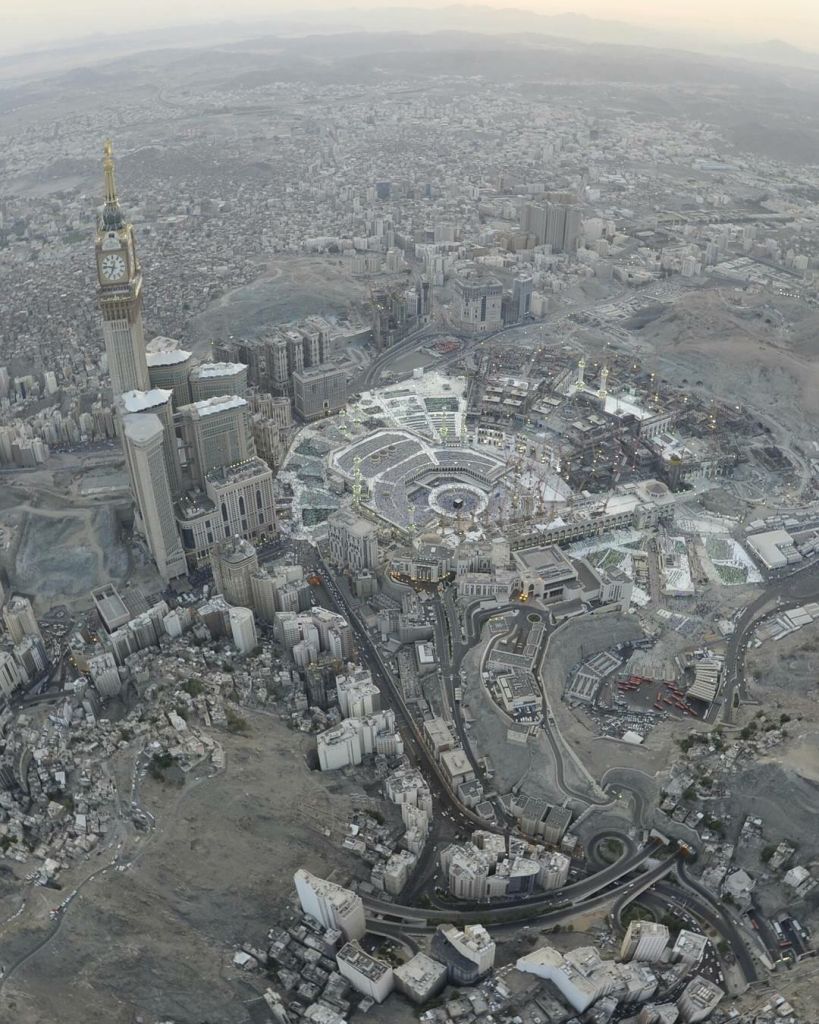
This aerial image of Mecca offers a profound reflection of the city’s historical and geographical significance within Islam. Situated in the arid mountainous region of the Hejaz in western Saudi Arabia, Mecca has been the spiritual center for Muslims for over 1,400 years. Its central location on ancient trade routes allowed it to become a thriving commercial hub long before the advent of Islam. Geographically, the city is nestled within a valley surrounded by rocky hills and mountains, making it both a challenging and a sacred site of pilgrimage. These geographical features are evident in the image, with rugged terrain and winding roads snaking through the city.
At the heart of the image is Masjid al-Haram, which houses the Kaaba, believed to have been built by the Prophet Ibrahim (Abraham) and his son Ismail (Ishmael). The Kaaba is the holiest structure in Islam, and Mecca is the destination of the Hajj pilgrimage, one of the Five Pillars of Islam, making it a historical focal point for the global Muslim community. The city has grown significantly over the centuries, transforming from a small desert settlement into a sprawling metropolis that accommodates millions of pilgrims annually.
The large Abraj Al-Bait Clock Tower visible in the image stands as a symbol of the modern urbanization that Mecca has undergone in recent decades. The city’s development, especially around the mosque, reflects the Saudi government’s efforts to enhance the infrastructure to handle the influx of pilgrims, which sometimes exceeds three million during the Hajj. Historically, the city has witnessed waves of expansion and modernization while retaining its profound religious importance.
This combination of ancient religious heritage with modern urbanization, nestled within its unique geography, makes Mecca a unique city, blending the sacred and the contemporary in one of the most spiritually significant places in the world.


