This figure provides a simple cross-sectional illustration of the kind of issues that arise. We wish to determine the distance separating points A and B. If A and B are not too far apart (e.g. less than 10 km) we could use a high precision laser rangefinder to establish the slope distance between A and B, assuming there is no atmospheric distortion. In practice, there will be some distortion and the laser wave path will need to be adjusted in order to provide an estimated slope path distance. This, in turn, will require further adjustment if it is to be referenced to a common datum or a level terrain surface. In each case, the distance recorded between A and B will be different.
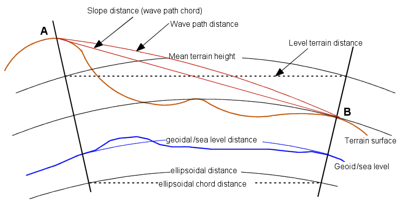
From the figure, it is clear that none of these distances corresponds to the actual distance across the terrain surface along a fixed transect, nor to a distance adjusted or computed to reflect the particular model of the Earth or region of the globe we are using. In some cases, these differences will be small, whilst in other, they may be highly significant.
Source: Smith, Goodchild and Longley (2020). Geospatial Analysis. The Winchelsea Press.
