Creating a “geopostcode” system, also known as a “plus code” system, involves assigning unique codes to individual streets, buildings, or even specific units within a building. The process of creating such a system can be complex and would involve several steps. Below is an example of the pseudocode for creating a “geopostcode” system:
-
Start by gathering data on all addresses and locations in the area to be covered by the “geopostcode” system. This data should include information on street names, building numbers, and other relevant details.
-
Use this data to create a digital map of the area, with each address and location represented by a unique point on the map.
-
Divide the area into smaller sections, such as neighborhoods or blocks. Assign a unique code to each section, based on its location on the map.
-
Within each section, assign a unique code to each street, building, or unit. This can be done by using a combination of the section code and a unique identifier for the street, building, or unit.
-
Test the “geopostcode” system by using it to locate specific addresses and ensure that the codes are accurately identifying the correct locations.
-
Implement the “geopostcode” system, and update it as necessary to reflect any changes in the area.
It’s worth noting that this is just an example of the pseudocode, and the actual implementation of a “geopostcode” system would involve more complexity, additional steps and a high level of accuracy to ensure the codes are accurate and reliable.
Converting the pseudocode for creating a “geopostcode” system into actual code would depend on the programming language and tools being used. Below is an example of how the pseudocode could be implemented in Python, using the Pandas and Geopandas library for data manipulation, and Fiona for reading/writing spatial data:
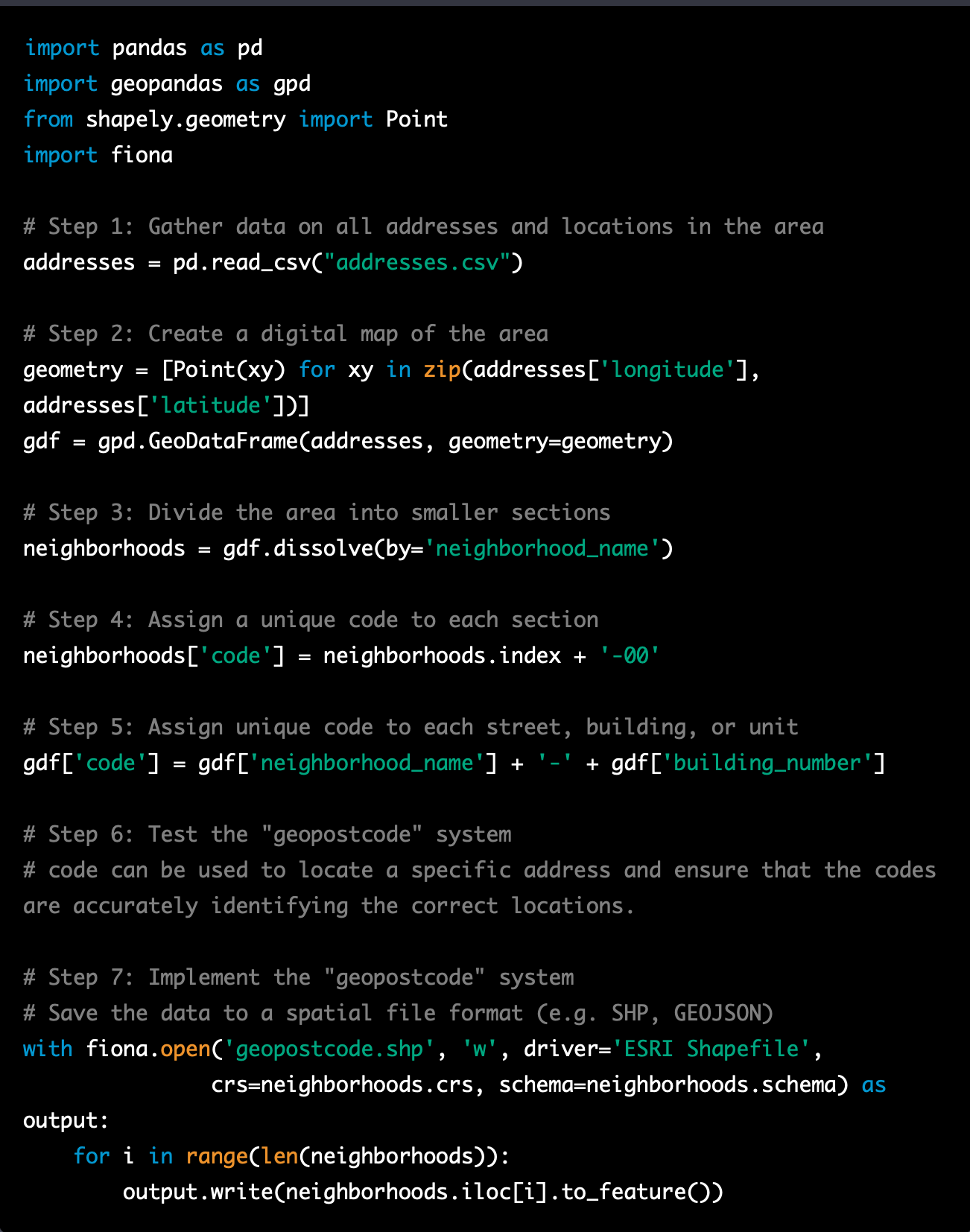
This is just an example of how the pseudocode for creating a “geopostcode” system could be implemented in Python. The actual implementation would depend on the specific requirements and constraints of the project, and would likely involve additional steps and a high level of accuracy to ensure that the codes are accurate and reliable.
It’s important to note that creating a “geopostcode” system is a complex task and it should be done by experts in GIS and data management. Additionally, it’s important to consider the legal aspects and regulations of the country where the system will be implemented.
