Reading features and coordinates from an ESRI Shapefile in Microsoft Visual Studio can be done by creating a new project and adding the necessary references to the OGR library. Here are the general steps to follow:
-
Create a new project in Microsoft Visual Studio. This can be a Console Application, Windows Forms Application, or any other type of project that suits your needs.
-
Add a reference to the OGR library. This can be done by right-clicking on the project in the Solution Explorer and selecting “Add Reference.” Then, browse to the location where the OGR library is installed and select the appropriate DLLs to add as references.
-
Use the code shown below to read in the features and coordinates from the shapefile. You will need to update the path of the shapefile to the actual path on your local machine or server.
-
Add any additional code to display the features and coordinates on a map or store them in a database. This can be done by using other libraries such as MapWinGIS or SharpMap for displaying on a map or ADO.NET for storing in a database.
-
Build and run the project to test the code and ensure that it is working correctly.
It’s worth noting that this is just a general overview of the steps involved in implementing the reading of features and coordinates from an ESRI Shapefile in Microsoft Visual Studio, and the actual implementation will depend on the specific requirements and constraints of the project. Additionally, you may need to install the GDAL library to be able to use the OGR library on your machine.
Here is an example of how to read in features and coordinates from an ESRI Shapefile using VB.net in a Windows Forms application in Microsoft Visual Studio:
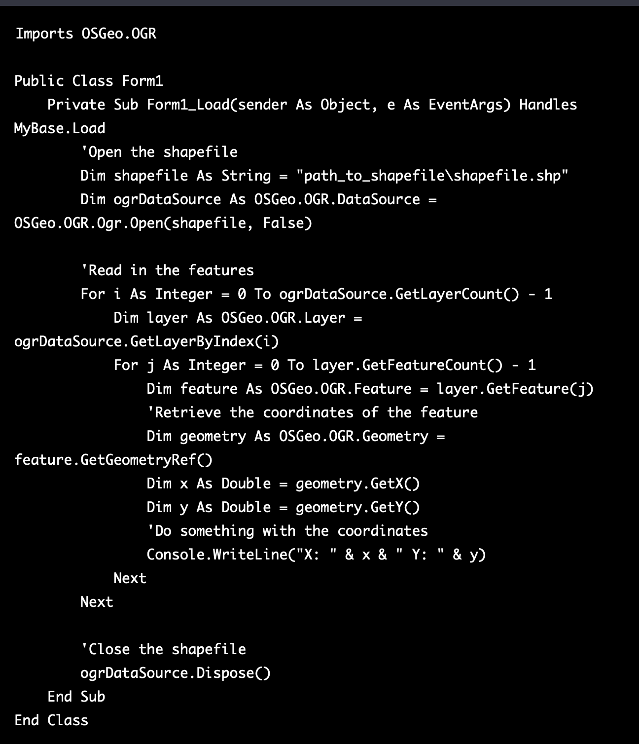
In this example, the code is placed in the Load event of the form, which will be executed when the form is loaded. You can also place this code in a button click event or any other event that suits your needs. It’s important to note that you will need to update the path of the shapefile to the actual path on your local machine or server. Also, you may need to add a reference to the OGR library, you can do this by right-clicking on the project in the Solution Explorer and selecting “Add Reference.” Then, browse to the location where the OGR library is installed and select the appropriate DLLs to add as references.
Additionally, as with any software development project, it’s important to thoroughly test your code and ensure it’s working correctly before deploying it. You can also add additional code to display the features and coordinates on a map or store them in a database, this can be done by using other libraries such as MapWinGIS or SharpMap for displaying on a map or ADO.NET for storing in a database. It’s also important to consider how you want to present the data to the user, you can use the data you get from the shapefile to create a map, a table, or any other type of visualization that fits your needs.
It’s worth noting that this is a basic example that can be extended and customized to suit the specific requirements of your project, and it’s recommended to consult the documentation of the OGR library and other related libraries to have a deeper understanding of the functionality they offer and how to use them correctly.
