
By Shahabuddin Amerudin
Introduction
Geographic Information Systems (GIS) play a pivotal role in modern spatial analysis, helping us understand and visualize complex spatial data. Among the fundamental tasks in GIS, creating a study area map is a common challenge that students often encounter. A well-designed study area map is crucial for any GIS project, as it serves as the foundation for data analysis, decision-making, and communication. In this article, we will discuss the importance of a good study area map and the criteria and strategies needed to design one effectively.
The Importance of a Good Study Area Map
A study area map is more than just a visual representation of geographical boundaries; it is a key component of a GIS project that influences the quality and credibility of the analysis. A well-designed study area map:
- Defines the Scope:
Clearly delineates the boundaries of the study area, ensuring that researchers and stakeholders understand the geographic extent of the project. - Enhances Data Selection:
Helps in selecting and collecting relevant spatial data, ensuring that only pertinent information is included. - Supports Analysis:
Provides a foundation for spatial analysis, allowing researchers to perform meaningful operations like overlay, proximity analysis, and spatial querying. - Communicates:
Findings: Acts as a visual communication tool to convey research findings, making it easier for non-GIS experts to grasp the study’s results.
Criteria for Designing a Good Study Area Map
To design an effective study area map, one must consider several criteria:
- Clarity and Simplicity:
- Keep the map simple and uncluttered, avoiding unnecessary elements that can distract from the main focus.
- Use clear and easy-to-understand symbols, colors, and labels.
- Scale and Resolution:
- Choose an appropriate scale and resolution that suit the study’s purpose. A smaller scale may be required for regional studies, while a larger scale may be needed for detailed local analysis.
- Geographic Extent:
- Clearly define the geographic extent of the study area using a well-defined boundary such as administrative borders, physical features, or coordinates.
- Data Sources and Attribution:
- Accurately cite the sources of spatial data used in the map.
- Provide attribution for third-party data if necessary, complying with copyright and licensing agreements.
- Legend and Symbols:
- Include a legend that explains the meaning of symbols, colors, and any other map elements.
- Ensure consistency in symbol usage throughout the map.
- Spatial Reference:
- Use a consistent spatial reference system (e.g., latitude and longitude or a projected coordinate system) to ensure accurate georeferencing.
- Contextual Information:
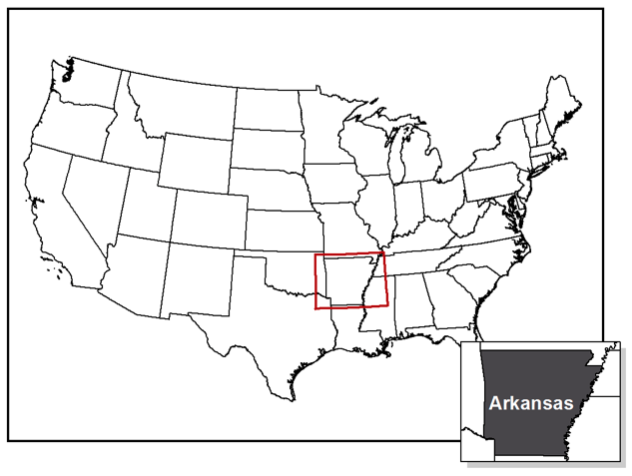
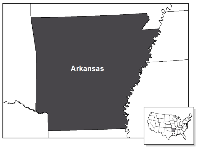
- Provide contextual information that helps viewers understand the significance of the study area, such as its geographical location, relevance, and any unique features.
- Data Quality:
- Ensure that the spatial data used is accurate, up-to-date, and relevant to the research question.
- Cartographic Design:
- Apply cartographic principles, such as balance, hierarchy, and visual hierarchy, to create an aesthetically pleasing map.
Solutions for Designing an Effective Study Area Map
- Planning and Research:
Before starting the map design, conduct thorough research to understand the study area’s characteristics, available data, and the specific requirements of your project. Planning is crucial to determine the appropriate scale, data sources, and map elements. - Data Preparation:
Ensure that all spatial data used in the map are properly prepared and georeferenced. Data preprocessing, cleaning, and transformation are essential steps to guarantee data accuracy. - Software Proficiency:
Gain proficiency in GIS software (e.g., ArcGIS, QGIS) to effectively create and manipulate spatial data. Familiarity with the software’s cartographic tools will enable you to design visually appealing maps. - Consult Cartographic Guidelines:
Consult cartographic guidelines and best practices to ensure that your map adheres to established design principles. These guidelines can help you make informed decisions about color schemes, fonts, and layout. - Iterative Design:
Map design is often an iterative process. Don’t hesitate to revise and refine your study area map as you progress through your project. Solicit feedback from peers or mentors to improve its quality. - User-Centered Approach:
Consider the needs and preferences of your target audience when designing the map. Tailor the map’s content and design to make it accessible and understandable to your intended users. - Document Your Work:
Keep a record of the data sources, software tools, and design choices you make during the map creation process. Proper documentation is essential for transparency and reproducibility.
Conclusion
Designing an effective study area map is a critical skill for GIS students and professionals alike. A well-designed map not only defines the scope of a project but also enhances data selection, supports spatial analysis, and communicates research findings effectively. By adhering to the criteria and solutions outlined in this article, GIS students can overcome the challenges associated with creating a study area map and contribute to more meaningful and impactful spatial analysis and research. Remember that practice and continuous learning are key to mastering the art and science of cartography in GIS.
Further Reading
- Longley, P. A., Goodchild, M. F., Maguire, D. J., & Rhind, D. W. (2015). Geographic Information Science and Systems. John Wiley & Sons.
- Slocum, T. A., McMaster, R. B., Kessler, F. C., & Howard, H. H. (2009). Thematic Cartography and Geovisualization (3rd ed.). Pearson Prentice Hall.
- Peterson, M. P. (2011). Interactive and Animated Cartography. Pearson Prentice Hall.
- Bolstad, P. (2019). GIS Fundamentals: A First Text on Geographic Information Systems (6th ed.). Eider Press.
- Robinson, A. H., Morrison, J. L., Muehrcke, P. C., Kimerling, A. J., & Guptill, S. C. (2015). Elements of Cartography (7th ed.). Wiley.
- Brewer, C. A. (2015). Designing Better Maps: A Guide for GIS Users. Esri Press.
- Dent, B. D., & Torguson, J. S. (2007). Cartography: Thematic Map Design (6th ed.). McGraw-Hill.
- Esri. (n.d.). ArcGIS Desktop Help. Retrieved from https://desktop.arcgis.com/en/
- QGIS Development Team. (n.d.). QGIS User Guide. Retrieved from https://docs.qgis.org/3.16/en/docs/user_manual/
Suggestion for Citation:
Amerudin, S. (2023). Creating an Effective Study Area Map in GIS. [Online] Available at: https://people.utm.my/shahabuddin/?p=7074 (Accessed: 11 September 2023).

