By Shahabuddin Amerudin
Geographic Information Systems (GIS) have become an indispensable tool in today’s data-driven world. By enabling the analysis, visualization, and interpretation of spatial data, GIS software systems are transforming how we understand and interact with our environment. From urban planning to environmental management, healthcare to agriculture, GIS is reshaping industries and driving innovation. Here’s a closer look at the current state of GIS software systems and their growing significance.
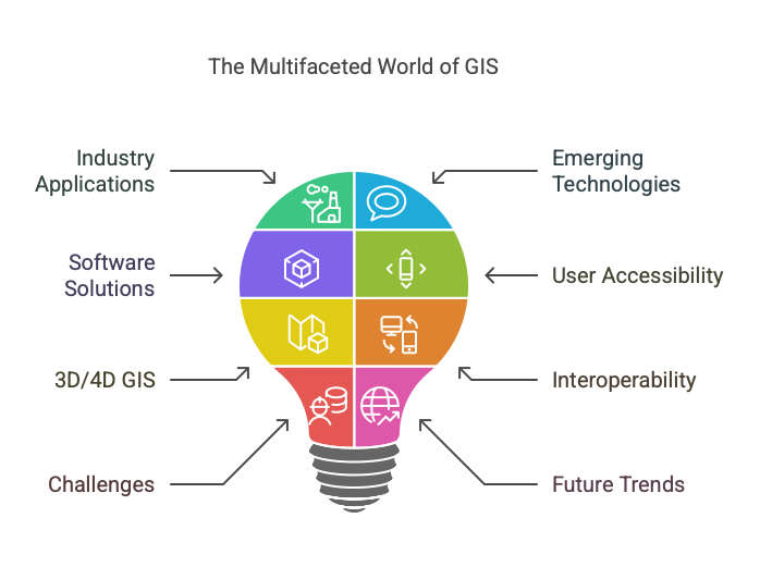
Wide Adoption Across Industries
GIS technology is no longer confined to niche applications; it has permeated nearly every sector. In urban planning and smart city development, GIS is used to optimize resource allocation, manage infrastructure, and enhance disaster preparedness. Environmental management relies on GIS to monitor climate change, track deforestation, and manage natural resources. The healthcare sector, particularly during the COVID-19 pandemic, leveraged GIS to track virus spread, allocate medical resources, and plan vaccination campaigns. In agriculture, precision farming techniques powered by GIS are revolutionizing crop monitoring, soil analysis, and yield prediction. Even transportation and logistics benefit from GIS through route optimization and fleet management, reducing costs and improving efficiency.
Integration with Emerging Technologies
One of the most exciting developments in GIS is its integration with cutting-edge technologies. Artificial Intelligence (AI) and Machine Learning (ML) are enhancing GIS capabilities, enabling advanced spatial analysis, predictive modeling, and automated data processing. The Internet of Things (IoT) is another game-changer, as GIS integrates with IoT devices to collect and analyze real-time data, making decision-making more dynamic and responsive. Cloud computing has also transformed GIS, offering scalable, collaborative platforms that allow users to access and analyze spatial data from anywhere. Additionally, GIS systems are evolving to handle big data, enabling more comprehensive and insightful analyses.
Open Source and Commercial Solutions
The GIS software landscape is diverse, with both open-source and commercial solutions catering to different needs. Open-source tools like QGIS, GRASS GIS, and PostGIS have gained popularity due to their flexibility, cost-effectiveness, and strong community support. These tools are particularly appealing to smaller organizations, researchers, and developers who value customization. On the other hand, commercial GIS platforms like Esri’s ArcGIS, Hexagon Geospatial, and Pitney Bowes dominate the market with their robust, feature-rich solutions. These platforms offer extensive support, training, and integration capabilities, making them the go-to choice for large enterprises and government agencies.
User-Friendly Interfaces and Accessibility
Gone are the days when GIS was a tool only for experts. Modern GIS software has become increasingly user-friendly, with intuitive interfaces, drag-and-drop functionalities, and mobile applications that make spatial analysis accessible to non-experts. Mobile GIS apps, in particular, have empowered field workers to collect and analyze data on the go, bridging the gap between office-based analysis and real-world applications. This democratization of GIS technology is expanding its reach and enabling more people to harness the power of spatial data.
3D and 4D GIS
The adoption of 3D GIS is on the rise, offering more realistic visualisations and analyses of spatial data. This is particularly valuable in fields like urban planning, architecture, and disaster management, where understanding the vertical dimension is crucial. Beyond 3D, 4D GIS—which incorporates the dimension of time—is gaining traction. This allows for the analysis of temporal changes, such as urban growth, environmental degradation, or the spread of diseases over time. These advancements are opening up new possibilities for understanding complex spatial phenomena.
Increased Focus on Interoperability and Standards
As GIS becomes more integrated into various workflows, interoperability between different systems has become a priority. Standards set by organisations like the Open Geospatial Consortium (OGC) are helping to ensure that GIS platforms can work seamlessly with other software systems. The adoption of open data standards and APIs is also facilitating data sharing and integration across platforms and organizations. This focus on interoperability is critical for creating a more connected and efficient ecosystem for spatial data analysis.
Challenges and Considerations
Despite its many advantages, GIS is not without challenges. Data privacy and security are growing concerns, especially as GIS systems handle increasingly sensitive information. Ensuring the accuracy and reliability of spatial data remains a challenge, particularly with the influx of data from diverse sources. Additionally, there is a growing demand for skilled GIS professionals (geospatialist), and organizations often struggle to find and retain talent. Addressing these challenges will be crucial for the continued growth and success of GIS technology.
Future Trends
Looking ahead, GIS is poised to become even more powerful and versatile. The integration of GIS with Augmented Reality (AR) and Virtual Reality (VR) technologies promises to revolutionize spatial visualization and user interaction. Autonomous vehicles will rely heavily on GIS for navigation and real-time decision-making. Furthermore, GIS will play a critical role in addressing global challenges like climate change, sustainability, and resilience planning. As these trends unfold, GIS will continue to evolve, offering new ways to understand and shape the world around us.
Conclusion
GIS software systems have come a long way, evolving from specialized tools to essential platforms that drive decision-making across industries. With advancements in AI, IoT, cloud computing, and big data, GIS is becoming more powerful, accessible, and integrated into our daily lives. While challenges like data privacy, accuracy, and skill gaps remain, the future of GIS is bright. As it continues to integrate with emerging technologies and address global challenges, GIS will undoubtedly remain at the forefront of innovation, helping us build a smarter, more sustainable world.
