By Shahabuddin Amerudin
Introduction
For decades, Geographic Information Systems (GIS) have been the cornerstone of mapping, spatial analysis, and decision-making across a multitude of industries. Traditionally, GIS has been defined as a system for capturing, storing, managing, analyzing, and visualizing geographic data. However, with the advent of artificial intelligence (AI), real-time data processing, the Internet of Things (IoT), and immersive technologies like augmented reality (AR) and virtual reality (VR), GIS is rapidly evolving beyond its conventional framework.
As these technologies continue to shape the geospatial field, new terms and concepts are emerging that could redefine how we understand GIS. In the near future, GIS may no longer be just a system for analyzing spatial data—it could evolve into a self-learning, AI-driven, real-time geospatial ecosystem that autonomously detects, analyzes, and responds to global changes. This article explores how GIS is transforming and introduces potential new terminologies that may replace or complement the traditional “GIS” label.
How GIS Has Evolved Over Time
The origins of GIS trace back to the 1960s, when Dr. Roger Tomlinson, known as the “Father of GIS,” developed the Canada Geographic Information System (CGIS). This early system was designed for storing, analyzing, and visualizing spatial data, primarily for land management purposes. Over the years, GIS expanded from a government tool used for cartography and spatial analysis into a mainstream technology used in industries such as urban planning, environmental management, transportation, and business intelligence.
By the 1990s and early 2000s, GIS had evolved with the rise of digital mapping, satellite imagery, and remote sensing technologies. Web-based GIS platforms like Google Earth and Esri’s ArcGIS Online revolutionized spatial data accessibility, making it easier for users to view and analyze geographic information in real-time. Today, the integration of AI, machine learning, big data analytics, and cloud computing is transforming GIS into an even more powerful and intelligent system, capable of processing massive datasets and making automated decisions based on spatial patterns.
Emerging Concepts That May Redefine GIS
- Spatial Intelligence Systems (SIS)
The concept of Spatial Intelligence Systems (SIS) represents the next evolution of GIS, integrating AI, machine learning, and predictive analytics to enhance spatial decision-making. Traditional GIS is primarily data-driven, requiring users to analyze spatial relationships manually. However, SIS would be an intelligent system that not only analyzes spatial data but also predicts future trends and recommends optimal solutions.
For example, an SIS used in disaster management could automatically detect early signs of flooding, assess historical flood patterns, and recommend real-time evacuation routes to emergency responders. Similarly, in urban planning, an AI-powered SIS could predict population growth patterns and suggest optimal locations for infrastructure development.
- GeoAI (Geospatial Artificial Intelligence)
As artificial intelligence becomes more integrated into spatial technologies, the term GeoAI is gaining popularity. GeoAI refers to the fusion of GIS and artificial intelligence, allowing systems to learn from spatial patterns, automate geospatial analysis, and enhance decision-making.
With GeoAI, satellite imagery can be processed automatically, identifying land cover changes, deforestation, urban expansion, or climate variations. AI-driven geospatial analytics can also detect anomalies in spatial data, such as unusual traffic congestion patterns, illegal deforestation activities, or rapid land use changes.
One example of GeoAI in action is Google’s AI-based flood forecasting system, which analyzes satellite and meteorological data to predict flood risks with higher accuracy than traditional GIS-based models.
- Digital Earth Systems (DES)
The idea of a “Digital Earth” was first introduced by former U.S. Vice President Al Gore in 1998, envisioning a real-time, interactive 3D model of Earth where users could view and analyze geographic data at any scale. Today, this concept is becoming a reality with the emergence of Digital Earth Systems (DES)—highly detailed, real-time, AI-powered simulations of Earth that integrate geospatial, environmental, and socio-economic data.
A Digital Earth System could allow global organizations to simulate climate change scenarios, analyze deforestation trends, or track global migration patterns in real-time. The ability to create interactive, data-driven Earth models would revolutionize fields such as environmental conservation, global security, and resource management.
- Spatial Computing and GeoMetaverse
Spatial computing refers to the convergence of GIS, augmented reality (AR), virtual reality (VR), and IoT, enabling users to interact with geospatial data in immersive 3D environments. A related concept, the GeoMetaverse, envisions a digital twin of the real world where users can walk through cities, interact with geospatial layers, and visualize spatial changes dynamically.
For instance, urban planners could use AR-based GIS applications to see real-time traffic flow, underground utility networks, and air pollution levels while standing on-site. Similarly, a GeoMetaverse could enable stakeholders to collaborate in virtual spaces, making spatial planning more interactive and efficient.
- Smart Geosystems (SGS) and Spatial Digital Twins (SDT)
The rapid adoption of IoT sensors and real-time data streaming has given rise to Smart Geosystems (SGS)—a fully automated GIS ecosystem where spatial data is continuously updated, analyzed, and optimized in real time. SGS would enable cities to function as dynamic, self-monitoring systems that adapt based on real-time geospatial inputs.
A closely related concept is Spatial Digital Twins (SDT), which refers to real-time, AI-driven digital replicas of real-world environments. These digital twins allow industries to simulate and test urban development projects, climate adaptation strategies, and infrastructure resilience measures before implementing them in the real world.
For example, Singapore has developed a full-scale digital twin of the city, enabling urban planners to simulate transportation flows, energy consumption, and environmental conditions before making policy decisions.
Will GIS Be Renamed in the Future?
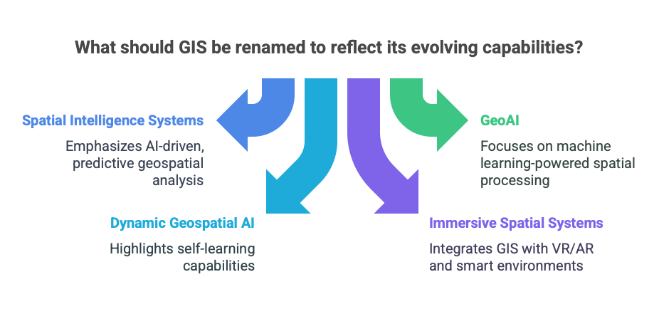
As GIS continues to evolve, its definition may expand beyond “Geographic Information Systems” to incorporate real-time intelligence, automation, and immersive spatial experiences. While GIS will remain a fundamental term, new labels such as:
- Spatial Intelligence Systems (SIS) – AI-driven, predictive geospatial analysis.
- GeoAI – Machine learning-powered spatial processing.
- Dynamic Geospatial AI (DGAI) – A self-learning GIS.
- Immersive Spatial Systems (ISS) – GIS integrated into VR/AR and smart environments.
These emerging terms highlight the shift from GIS as a mapping tool to GIS as an intelligent, predictive, and automated spatial decision-making system.
Conclusion
GIS is undergoing a profound transformation, driven by advancements in AI, big data, IoT, cloud computing, and immersive technologies. While traditional GIS has been focused on mapping and spatial analysis, the future of GIS will likely be dynamic, predictive, and self-learning. Whether through Spatial Intelligence Systems, GeoAI, Digital Earth Systems, or the GeoMetaverse, the geospatial industry is entering an era where GIS is no longer just a tool for mapping the world—but a system for shaping it.
