By Shahabuddin Amerudin
Introduction
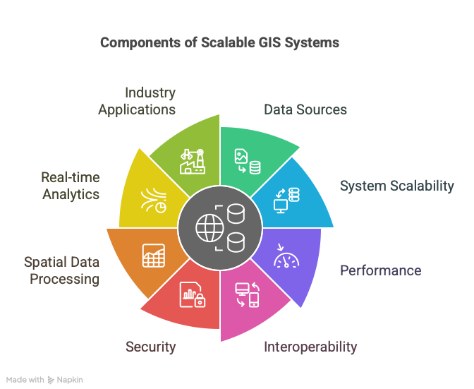
Geographic Information Systems (GIS) have undergone a profound transformation from static cartographic platforms to dynamic, high-throughput geospatial intelligence systems. This evolution is driven by the proliferation of spatial data originating from diverse sources such as satellite imagery, real-time GPS signals, Internet of Things (IoT) sensors, and drone-based observations. The scale and velocity of such data streams necessitate a rethinking of GIS system architectures to ensure scalability, performance, interoperability, and security. Modern GIS architectures are expected not only to handle complex spatial data processing and real-time analytics but also to serve interactive and intelligent applications across numerous industries. This article delves into the core components and architectural strategies of scalable GIS systems, providing a comprehensive overview of technical implementations and showcasing real-world applications in domains such as urban planning, agriculture, disaster response, and logistics.
1. Core Components of a GIS Architecture
1.1 Data Ingestion Layer
The data ingestion layer plays a foundational role in GIS architectures, tasked with acquiring, validating, transforming, and storing spatial data from diverse and often heterogeneous sources. These sources may range from remote sensing satellites and unmanned aerial vehicles (UAVs) to crowd-sourced mobile applications and IoT-based field sensors. Effective ingestion systems must accommodate various spatial data formats, particularly raster formats like GeoTIFF and NetCDF for imagery and environmental data, as well as vector formats such as GeoJSON, Shapefiles, and KML for point, line, and polygon geometries. Depending on the application’s temporal requirements, ingestion may occur in real-time—using technologies like Apache Kafka or AWS Kinesis to stream GPS and telemetry data—or in batch mode, utilizing platforms such as Apache Airflow or Safe Software’s FME for periodic processing of large datasets, including LiDAR or satellite archives. Advanced Extract, Transform, Load (ETL) operations are often performed using geospatial libraries like GDAL/OGR, enabling tasks such as projection transformation, geometric simplification, and topological correction.
1.2 Spatial Data Storage & Databases
Spatial data storage is a critical determinant of system performance, particularly for query efficiency, scalability, and data integrity. Traditional relational databases, such as PostgreSQL with the PostGIS extension, offer powerful support for spatial queries through functions like ST_Intersects, ST_DWithin, and ST_Buffer, and implement spatial indexing mechanisms such as R-Trees for rapid spatial filtering. However, for unstructured or semi-structured geospatial data, NoSQL solutions such as MongoDB and Apache Cassandra offer schema flexibility and high write throughput. Geospatial indexing in NoSQL systems often utilizes geohashing techniques for efficient location-based lookups. Cloud-native databases—such as Google BigQuery GIS and Amazon Aurora—provide horizontally scalable architectures and serverless querying capabilities, enabling petabyte-scale spatial analytics without manual infrastructure management. The selection of storage technologies should align with the access patterns, query complexity, and scalability needs of the GIS application.
1.3 Processing & Analytics Engine
The processing and analytics layer transforms raw spatial data into actionable geointelligence. Distributed computing frameworks such as Apache Spark and Dask allow parallel processing of large raster datasets, enabling operations like vegetation index computation (e.g., NDVI) or land cover classification at regional or continental scales. This layer also incorporates spatial analysis algorithms for network-based modeling (e.g., shortest path using PgRouting), surface interpolation and geostatistics (e.g., kriging for environmental sampling), and spatial clustering. Increasingly, machine learning (ML) is integrated to enhance spatial pattern recognition. For instance, convolutional neural networks (CNNs) such as YOLO or Mask R-CNN can automate object detection from high-resolution imagery, while temporal models like Facebook Prophet or Long Short-Term Memory (LSTM) networks are employed for forecasting urban expansion or environmental change. These workflows require close coupling between geospatial libraries, data science platforms, and ML frameworks.
1.4 Visualization & Frontend
The visualization layer translates complex spatial and analytical data into intuitive interfaces for stakeholders. Desktop GIS platforms such as QGIS and ArcGIS Pro remain essential for in-depth spatial analysis and cartographic design, often extended through scripting (Python plugins) or visual programming (ModelBuilder). For broader accessibility and interactivity, web mapping solutions leveraging technologies like Leaflet, Mapbox GL, and Deck.gl provide high-performance vector rendering, customizable styling, and integration with real-time data streams. Advanced applications include 3D and 4D visualizations using engines like CesiumJS, supporting digital twin representations of cities and infrastructure. Moreover, dashboards incorporating libraries such as Plotly Dash or enterprise solutions like Power BI—augmented with ArcGIS components—enable embedded spatial analytics, bridging technical outputs with decision-making environments.
2. Architectural Patterns for Scalability
2.1 Microservices vs. Monolithic GIS
Traditional GIS deployments often follow a monolithic architecture, where data ingestion, processing, and visualization components are tightly coupled within a single application stack, as exemplified by ArcGIS Enterprise. While this model offers simplicity, it poses significant challenges in scaling and maintainability. In contrast, microservices-based architectures advocate for modularization, where discrete services (e.g., data ingestion, routing engine, map rendering) are exposed through RESTful APIs and independently deployed. Frameworks such as FastAPI, along with open-source GIS servers like GeoServer and MapServer, support such modular integration. Deployment is streamlined through containerization using Docker and orchestration platforms like Kubernetes, enabling horizontal scaling, fault tolerance, and efficient resource allocation.
2.2 Hybrid Cloud Deployments
Given the varying computational, storage, and latency requirements of GIS applications, hybrid cloud architectures are increasingly adopted. Public cloud services (e.g., Amazon Web Services, Google Cloud Platform) offer scalable compute resources for data-intensive tasks such as real-time disaster mapping or national-scale environmental monitoring. Conversely, latency-sensitive or privacy-critical operations—such as drone-based asset inspections or on-premise government systems—are often hosted locally or at the network edge. Hybrid models enable seamless data interchange and workload distribution between cloud and edge environments, ensuring both performance and compliance with data sovereignty requirements.
2.3 Data Partitioning Strategies
Efficient data partitioning is key to achieving scalable spatial analytics. Spatial partitioning using geohashing allows data to be sharded based on geographic regions, facilitating localized query execution and parallel processing. This approach is particularly effective for global-scale datasets where spatial locality reduces computational overhead. Temporal partitioning—segregating data by acquisition time—is another strategy, commonly used in time-series analyses, environmental monitoring, or archiving historical climate data. These partitioning methods must be aligned with the indexing strategies and access patterns of the database systems to optimize performance.
3. Real-World Use Cases
3.1 Smart Cities & Urban Planning
In smart city initiatives, GIS plays a central role in optimizing urban operations and planning. Traffic management systems ingest GPS data from public transport, sensor data from traffic lights, and live video streams from CCTV. Real-time analytics using Spark Streaming and spatial databases like PostGIS enable dynamic congestion prediction and routing suggestions. Urban land-use optimization leverages unsupervised machine learning algorithms, such as k-means clustering or DBSCAN, to analyze zoning patterns and suggest development strategies that balance environmental sustainability and economic growth.
3.2 Precision Agriculture
Precision agriculture integrates spatial technologies to enhance crop yield, resource use, and environmental management. Satellite imagery from platforms like Sentinel-2 provides multispectral data for assessing crop health through vegetation indices such as NDVI, computed using platforms like Google Earth Engine. IoT-based soil moisture sensors feed real-time data into GIS-based irrigation systems that control water distribution through geofenced valve mechanisms. Such systems are instrumental in reducing water waste and adapting to climate variability.
3.3 Disaster Response
In disaster management, GIS supports situational awareness, risk assessment, and response coordination. For instance, wildfire tracking combines real-time satellite feeds from NOAA with UAV-mounted thermal sensors, visualized through GPU-accelerated WebGL interfaces like Deck.gl. Flood modeling integrates hydraulic simulation models such as HEC-RAS with high-resolution elevation data from LiDAR, allowing accurate floodplain delineation and evacuation planning. These applications benefit from real-time processing pipelines and cloud-based visualization for multi-agency coordination.
3.4 Logistics & Supply Chain
In logistics, GIS is employed for route optimization, facility planning, and inventory tracking. Graph-based algorithms, including Dijkstra’s and A*, enable shortest path computation for vehicle routing, implemented using extensions like PgRouting. Real-time traffic APIs inform dynamic re-routing to avoid congestion or delays. Spatial decision support tools use proximity queries (e.g., ST_Distance) to evaluate candidate sites for warehouse locations, taking into account supply-demand spatial distributions and transportation accessibility.
4. Emerging Trends & Future-Proofing
4.1 AI/ML at Scale
The integration of artificial intelligence and machine learning into GIS continues to accelerate, enabling automated feature extraction, predictive modeling, and anomaly detection. Deep learning models, particularly those using convolutional and transformer architectures, are trained to detect buildings, roads, and natural features from high-resolution imagery. Graph Neural Networks (GNNs) are emerging as powerful tools for modeling spatial relationships and detecting anomalies in infrastructure networks, such as identifying potential pipeline leaks or illegal land use.
4.2 Digital Twins
Digital twins represent an advanced application of GIS, combining real-time sensor data with 3D spatial models to simulate and monitor urban or industrial systems. At the city scale, engines such as Unity3D or Unreal Engine can be integrated with GIS datasets to create immersive environments for urban planning and public engagement. For infrastructure management, the fusion of Building Information Modeling (BIM) and GIS allows comprehensive asset tracking, maintenance scheduling, and lifecycle management.
4.3 Edge Computing
Edge computing is increasingly essential for field-based GIS applications in remote or connectivity-constrained environments. Deploying ruggedized edge servers or mobile GIS units allows for real-time data processing, anomaly detection, and decision-making without reliance on centralized cloud infrastructure. This approach is particularly valuable in domains such as environmental monitoring, military operations, and mobile surveying where immediate feedback is critical.
5. Conclusion & Recommendations
To architect scalable and future-ready GIS systems, it is imperative to adopt a modular design approach that separates data ingestion, processing, storage, and visualization layers. Leveraging elastic infrastructure—through hybrid cloud and edge deployments—ensures adaptability to variable workloads and operational contexts. Interoperability is best achieved through adherence to open standards from organizations such as the Open Geospatial Consortium (OGC). Furthermore, privacy and security considerations must be embedded by design, particularly for datasets involving personally identifiable information or sensitive environmental data.
As next steps, GIS practitioners should explore platforms like PostGIS for advanced spatial querying and Google BigQuery GIS for large-scale analytics. Streaming technologies such as Apache Flink or Spark Streaming should be evaluated for real-time geospatial pipelines. The adoption of immersive visualization tools such as CesiumJS or game engines for 3D geospatial modeling can significantly enhance stakeholder engagement and decision-making.
The future of GIS resides at the confluence of big data, artificial intelligence, and distributed computing—designing architectures today to meet the spatial challenges of tomorrow.
