JOHOR BAHRU, 2 August 2025 – A new, powerful web-based calculator has been launched to streamline the complex process of Malaysian coordinate transformations, providing a crucial resource for surveyors, engineers, GIS professionals, and students. The tool offers a user-friendly interface to perform three essential transformations with a focus on accuracy and transparency.
The newly developed application tackles some of the most common and critical calculations in Malaysian geodesy, directly addressing the needs of professionals working with local coordinate systems.
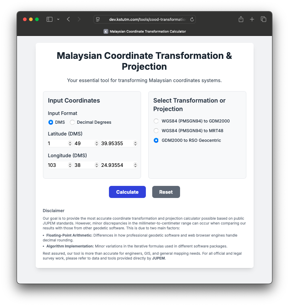
Core Features of the Transformation Tool
The calculator is equipped to handle three distinct operations:
- WGS84 (PMSGN94) to GDM2000: Transforms coordinates from the widely used World Geodetic System 1984 (as realised by the Peninsular Malaysia Geodetic Scientific Network 1994) to the modern GDM2000 standard.
- WGS84 (PMSGN94) to MRT48: Converts WGS84 coordinates to the older Malayan Revised Triangulation 1948 datum, which is vital for working with historical maps and survey data.
- GDM2000 to RSO Geocentric: Projects geographic coordinates from the Geocentric Datum of Malaysia 2000 onto the Rectified Skew Orthomorphic grid for Peninsular Malaysia, providing the essential Northing and Easting values used in most local mapping.
A Hybrid Approach to Accuracy
What sets this tool apart is its intelligent, hybrid approach to ensuring calculation integrity.
For the datum-to-datum transformations (WGS84 to GDM2000 and MRT48), the calculator uses the standard 7-parameter Helmert transformation. This method, based on the specific parameters published by the Department of Survey and Mapping Malaysia (JUPEM), provides a transparent and reliable conversion by applying precise translation, rotation, and scale adjustments.
For the notoriously complex GDM2000 to RSO projection, the application leverages proj4js, a robust and industry-standard open-source library. This ensures that the orthomorphic projection calculations are stable, accurate, and aligned with global best practices, eliminating the risk of manual implementation errors.
Transparency and User Trust
The developers have also included a detailed disclaimer that educates users on the nuances of high-precision geodetic calculations. It transparently explains why minor differences in the millimeter to centimeter range may occur when comparing results with official JUPEM software.
The note on accuracy clarifies that these small discrepancies often arise from factors like:
- Floating-Point Arithmetic: All software handles high-precision decimal numbers with finite accuracy. The difference between how a web browser’s JavaScript engine and professional desktop software perform rounding during multi-step calculations can lead to small, cumulative differences.
- Algorithm Implementation: The iterative algorithms used to convert coordinates (for example, from Cartesian XYZ back to latitude and longitude) may be implemented with slight variations in different software packages. These differences, while mathematically insignificant for most uses, can produce minutely different outputs.
This commitment to transparency helps users understand the results and use the tool appropriately.
Availability
The Malaysian Coordinate Transformation & Projection calculator is designed for ease of use, featuring a clean interface that accepts both DMS (Degrees, Minutes, Seconds) and Decimal Degree inputs. While it serves as an exceptionally accurate tool for engineers, GIS data management, and educational purposes, the developers rightly advise that all official and legal survey work must be referred to and certified by JUPEM.
Access through: https://dev.kstutm.com/tools/cood-transformation.html
