For the Muslim traveler, a journey of more than 81 kilometers is not just a change of location; it’s a transition into the state of a ‘musafir’, a traveler granted special dispensations in their prayer obligations. However, planning for these religious duties on the road can be a fragmented process, involving separate tools for distance calculation, prayer time lookups, and understanding the intricate rules of combining (jamak) and shortening (qasar) prayers.
To address this, we developed the Kalkulator Musafir & Waktu Solat, a unified, all-in-one web application designed specifically for Muslim travelers in Malaysia. This tool seamlessly integrates route planning with essential Islamic prayer information, providing clarity and confidence for any journey.
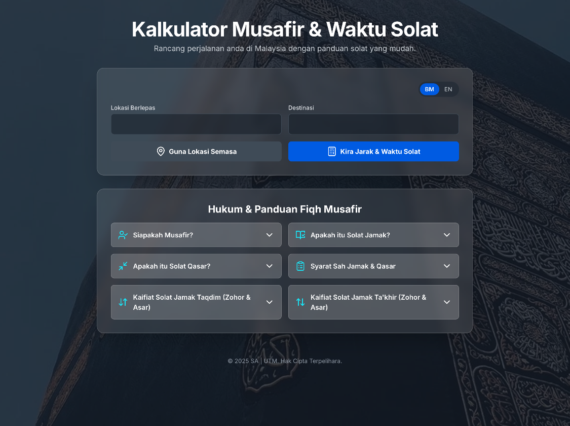
What is the “Kalkulator Musafir & Waktu Solat”?
At its core, the application is a smart travel assistant. It solves a multi-step problem with a single, intuitive interface. Users can enter their departure and destination locations, and the app instantly provides three critical pieces of information:
- Travel Distance & Musafir Status: It calculates the estimated road distance and immediately determines if the user qualifies as a ‘musafir’.
- Accurate Prayer Times: It provides location-specific prayer times for both the start and end points of the journey.
- Practical Fiqh Guidance: It offers clear, actionable suggestions for performing jamak and qasar prayers, along with a handy, accordion-style guide to the underlying Islamic jurisprudence (fiqh).
The entire experience is bilingual (Bahasa Melayu and English) and wrapped in a modern, mobile-friendly design that presents complex information in a simple and digestible format.
How It’s Used: A Traveler’s Workflow
Using the application is a straightforward process designed to deliver information quickly:
- Input Locations: The user starts by typing their departure and destination locations into the clearly labeled input fields. For added convenience, a “Use Current Location” button allows them to instantly populate the starting point using their device’s GPS.
- Calculate: With a single click on the “Kira Jarak & Waktu Solat” (Calculate Distance & Prayer Times) button, the application’s engine gets to work.
- View Results: In seconds, the results are displayed in a series of informative cards:
- First, a prominent card shows the total distance and confirms their musafir status.
- Next, an interactive map visualizes the calculated route.
- Below the map, two distinct cards display the official JAKIM prayer times for both the departure and destination locations. A subtle notification, “Menyemak data JAKIM…”, appears momentarily, informing the user that the system is fetching live, official data.
- Finally, a detailed card provides tailored suggestions for Jamak & Qasar prayers, outlining which prayers can be combined or shortened.
For those seeking deeper knowledge, a comprehensive section at the bottom explains the key rules and conditions of a musafir’s prayer, all neatly organized into expandable sections.
The Technology Behind the Tool
The application’s power lies in its intelligent integration of several modern web technologies and external APIs, all orchestrated with vanilla JavaScript. No heavy frameworks were needed, making the app lightweight and fast.
- User Interface & Styling: The front-end is built with HTML and styled using Tailwind CSS. This utility-first framework allows for rapid development of a responsive, modern interface. The “glassmorphism” effect on the cards provides a sleek, contemporary feel, while the Lucide Icons library offers clean and clear iconography.
- Geocoding & Location Services: To convert user-inputted location names (like “Johor Bahru”) into precise geographic coordinates (latitude and longitude), the application utilizes the free and open Nominatim API, which is based on OpenStreetMap data.
- Routing & Distance Calculation: The core distance calculation is powered by the Open Source Routing Machine (OSRM) API. This powerful engine computes the most efficient driving route between two coordinate points and returns not only the distance but also the geometric data needed to draw the route on a map.
- Interactive Mapping: The route visualization is handled by Leaflet.js, a lightweight and mobile-friendly open-source library for interactive maps. The map tiles themselves are from CartoDB, providing a dark, stylish theme that matches the application’s aesthetic.
- Prayer Time Engine: This is the most critical and layered component:
- Primary Source (JAKIM): The application’s first priority is to provide official data. It dynamically finds the nearest official JAKIM prayer time zone based on the location’s coordinates. It then makes an API call to the
e-solat.gov.myportal to fetch the official, authoritative prayer times for that day. - Fallback Source (Hisab): In cases where a location is outside of a defined JAKIM zone (e.g., outside Malaysia) or if the JAKIM API fails, the application uses Adhan.js. This robust JavaScript library performs astronomical calculations to determine prayer times based purely on the given latitude and longitude, serving as a reliable backup.
- Primary Source (JAKIM): The application’s first priority is to provide official data. It dynamically finds the nearest official JAKIM prayer time zone based on the location’s coordinates. It then makes an API call to the
By combining these technologies, the “Kalkulator Musafir & Waktu Solat” transforms a complex planning task into a simple, elegant, and empowering experience for the modern Muslim traveler.
https://dev.kstutm.com/musafir2
