Tag: conversion
Development of Web-Based Application for Shapefile Coordinate System Conversion for Malaysia
By Elysonia Alim and Shahabuddin Amerudin It is difficult to process GIS vector data when they are not aligned with one another. The need for different coordinate systems rose from the fact that some ... Read More
Development of Web-Based Application for Shapefile Coordinate System Conversion for Malaysia
Elysonia Alim and Shahabuddin Amerudin Department of Geoinformation, Faculty of Geoinformation and Real Estate, Universiti Teknologi Malaysia, 81310 Skudai, Johor, Malaysia Email: elysoniaalim@gmail.c... Read More
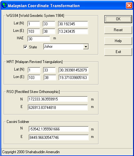
Malaysia MIF Format Coordinate Conversion Tool
By Shahabuddin Amerudin A Valuable Tool for Geospatial Data Conversion The MIF Coordinate Conversion 2001 tool has proven to be invaluable for geospatial professionals working with MapInfo data in MIF... Read More