By Shahabuddin Amerudin
A Valuable Tool for Geospatial Data Conversion
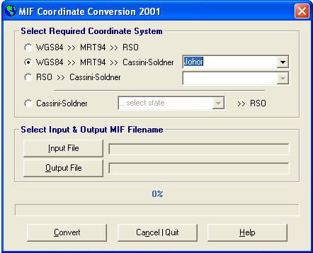
The MIF Coordinate Conversion 2001 tool has proven to be invaluable for geospatial professionals working with MapInfo data in MIF format. This application enables seamless conversion between various coordinate systems, including WGS84, RSO and State Cassini. The conversions are executed with exceptional precision, ensuring accurate and reliable results.
A History of Development and Use
Originally developed in Microsoft Visual Basic Version 6 in the late 1990s, this tool has undergone continuous improvements over the years to enhance its functionality and performance. Its significance was particularly evident during my academic pursuits at UTM, where it played a crucial role in my Final Year Project (PSM).
Application in Geospatial Research
My PSM project focused on the impact of using multi-data sources in GIS databases from different coordinate systems. Given the limitations of GPS technology at the time, including Selective Availability (SA), the collected GPS data required correction using Differential GPS (DGPS) techniques. The MIF Coordinate Conversion tool was instrumental in this process.
One of the key aspects of the project was evaluating the effectiveness of DGPS in a scenario where the GPS base station was located in Kuala Lumpur and the rover was in Johor Bahru. This study highlighted the challenges of real-time coordinate transformations in GIS software at that time. Many GIS packages struggled to perform accurate conversions due to incorrect parameter usage and unfamiliar transformation formulas.
Conclusion
The MIF Coordinate Conversion 2001 tool has been a valuable asset for geospatial professionals, especially during a time when real-time coordinate transformations were limited. Its ability to accurately convert between various coordinate systems has contributed significantly to the advancement of geospatial analysis and research.


