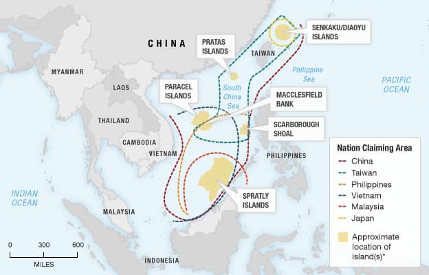
maritime

A Detailed Analysis of the Kra Canal Project

The Kra Canal Project

The proposed Kra Canal project in Southeast Asia, as depicted in the image, is a monumental undertaking that seeks to connect the Andaman Sea to the Gulf of Thailand, thereby creating a shortcut for maritime traffic between Europe and Asia. The intricate design of the canal, characterized by a channel depth of 23 meters, a width of 380 meters, and an embankment slope of 1:2.0, is intended to accommodate large vessels, including those weighing up to 150,000 tons. The project also outlines specific dimensions for various sections of the canal, such as the distance between the dumping area and the embankment. The potential advantages of the Kra Canal project are substantial. By […]

The Kra Canal Project Read More »

Thailand's Industrial Development Zones: A Potential Game-Changer for Southeast Asia

Thailand’s Industrial Development Zones: A Potential Game-Changer for Southeast Asia

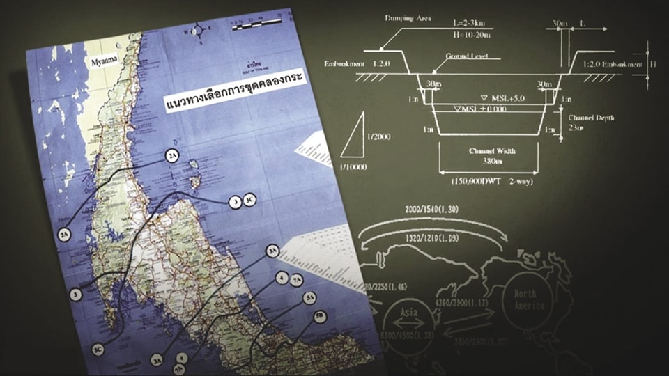
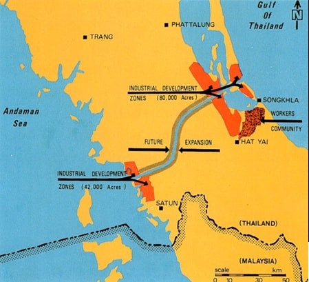
The development of industrial development zones (IDZs) in southern Thailand is poised to have a significant impact on the economic landscape of Southeast Asia, particularly for neighboring countries like Malaysia and Singapore. These zones, which are being established along the Andaman Sea coast, aim to attract foreign investment, create jobs, and stimulate economic growth in the region. The provided image depicts a proposed development plan for the southern region of Thailand, focusing on the creation of industrial development zones along the Andaman Sea coast. The map highlights two primary zones: one near Hat Yai,covering 42,000 acres, and another in the vicinity of Songkhla, spanning 80,000 acres. The plan also outlines a future

Thailand’s Industrial Development Zones: A Potential Game-Changer for Southeast Asia Read More »

The South China Sea: A Maritime Hotspot

The South China Sea: A Maritime Hotspot

The provided image vividly illustrates the complex territorial disputes surrounding the South China Sea. This region, rich in natural resources, has become a focal point of contention among several countries, including China, Taiwan, Vietnam,the Philippines, Malaysia, and Brunei. The overlapping claims, marked by dashed lines on the map, highlight the contentious nature of these territorial disputes. The image also showcases key geographical features, such as the Spratly Islands, Paracel Islands, and Scarborough Shoal,which serve as strategic locations for military and economic activities. These islands and reefs are often at the center of territorial clashes, as countries vie for control over their rich fishing grounds and potential hydrocarbon reserves. The future of the South China Sea remains

The South China Sea: A Maritime Hotspot Read More »

Scroll to Top