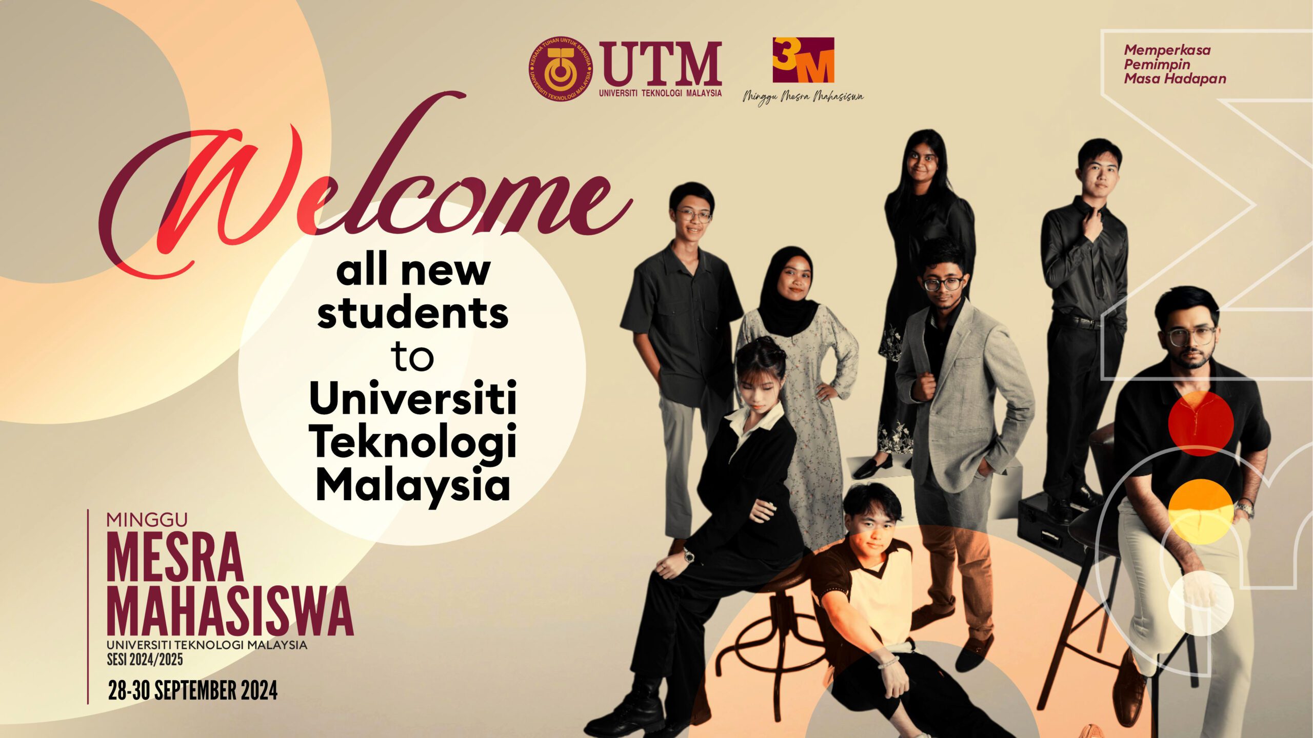
The development of the Student Absence Submission System focuses on streamlining and improving the efficiency of student absence reporting. This system is designed to provide students a simple, intuitive, and accessible platform to report their absences to the university, while offering administrative staff an organized system to manage and monitor these reports. This article provides an in-depth overview of the system, detailing its requirements, functionality, and future plans for enhancement.
1. System Overview
The Student Absence Submission System (https://absence.kstutm.com) allows students to submit their absence reports through an online form, attaching any supporting documentation such as a medical certificate or other relevant documents. The system is designed with a user-friendly interface for students, and a comprehensive admin dashboard for university staff to monitor and review submissions.
2. Features of the System
2.1 Student Absence Form
The core feature of the system is an online form where students can provide detailed information about their absence. This form includes fields such as:
Matrix Number: A unique identification number for students.
Course Code: The code of the course the student is attending.
Session and Semester: Details regarding the academic session and semester.
Type of Absence: Personal, Medical, or other specified reasons.
Duration: Number of days the student is absent.
Supporting Document Upload: Students can upload PDF or image files, such as medical certificates or formal letters.
Upon submission, the form ensures that all necessary fields are completed and allows students to upload their documents. Additionally, a confirmation message is displayed to the student once the submission is successful.
2.2 Document Management
The system stores uploaded files in a designated folder and prevents file overwriting by renaming files if they have the same name as an existing file. For example, if two students submit files named “medical_note.pdf”, the system will automatically rename the second file to avoid overwriting, ensuring that all submissions are saved correctly.
2.3 Admin Dashboard
The system includes an admin panel for university staff to view and manage student submissions. The dashboard presents the following key statistics:
Total Submissions: The number of absence reports submitted.
Submissions by Course: A breakdown of reports based on course codes.
Submissions by Session: The number of reports categorized by session.
Type of Absence: Visualization of absences categorized by their type (personal, medical, etc.).
These statistics are presented in both numerical and graphical formats for better data visualization and analysis. The admin panel also includes a sorting function, allowing staff to filter and view submissions by fields such as name, course, and session.
2.4 Data Storage
Student submissions are stored in a JSON file, which includes detailed information such as the student’s matrix number, course, reason for absence, duration, file path for supporting documents, and the exact submission time (in the format DD-MM-YYYY HH:MM).
3. Technology Stack
The system is built using a combination of web technologies that ensure responsiveness, reliability, and accessibility:
Frontend: HTML, CSS, and JavaScript are used to create an intuitive and responsive user interface.
Backend: PHP handles form submissions, file management, and the display of data in the admin panel.
Database: JSON format is used for data storage, which simplifies the system and allows for easy management of student submissions.
Responsive Design: The system is designed to be responsive, ensuring compatibility with both desktop and mobile devices, enhancing accessibility for students and staff alike.
4. Planned Future Enhancements
The system currently operates with basic features to manage student submissions. However, several improvements are planned for future iterations, including:
Matrix Number Validation: One significant enhancement will be the integration of matrix number validation. In this future version, the system will check the matrix number entered by the student against a pre-defined list of valid students. This feature will prevent submissions from unauthorized users and ensure that only students registered in the university system can report their absence.
Notification System: Future updates may also include a notification system where students, admin staff and parents receive emails upon submission or approval of absence reports.
Advanced Filtering Options: The admin dashboard could be enhanced with advanced filtering and search capabilities, allowing staff to quickly find specific reports based on various criteria.
5. Security and Data Integrity
To ensure the security of student information, the system incorporates several key features:
File Renaming: As mentioned, the system automatically renames files if a similar file name already exists in the database. This prevents overwriting and ensures that each submission is preserved uniquely.
Required Fields: All form fields are mandatory, ensuring that incomplete submissions cannot be made. This helps ensure that students provide all necessary information for their absence report.
Data Backup: The JSON file containing submission data can be easily backed up or migrated to other formats such as a relational database if the system scales in the future.
6. Conclusion
The Student Absence Submission System offers a streamlined and efficient solution for managing student absence reports at the university. With its user-friendly interface, robust admin panel, and the ability to track and store all data securely, the system is an essential tool for both students and administrators. Although the system is fully functional, future updates such as matrix number validation and enhanced filtering will improve its robustness and scalability. This system demonstrates how modern web technologies can address the administrative challenges faced by educational institutions, making processes more efficient and accessible.
UTM JOHOR BAHRU: Dengan tibanya sesi perkuliahan baru pada 6 Oktober 2024, pensyarah dan kakitangan di Fakulti Alam Bina dan Ukur, Universiti Teknologi Malaysia (UTM) bersiap sedia untuk menyambut pelajar serta memulakan semester 1 sesi 2024/2025 dengan semangat yang tinggi. Sebagai pusat pendidikan terkemuka dalam bidang Geoinformasi, Jabatan Geoinformasi sentiasa berusaha untuk menawarkan pendidikan berkualiti dan penyelidikan inovatif bagi memenuhi keperluan komuniti global yang semakin berkembang.
Satu perubahan signifikan yang berlaku di UTM adalah penstrukturan semula fakulti-fakulti yang berkuat kuasa pada 1 Oktober 2024. Dalam usaha ini, Program Geoinformasi kini dikenali sebagai Jabatan Geoinformasi. Dengan perubahan ini, jawatan Pengarah telah ditukar kepada Ketua Jabatan, menggambarkan peranan yang lebih spesifik dalam menguruskan jabatan yang berkembang pesat ini. Penjenamaan semula ini membuka ruang kepada Jabatan Geoinformasi untuk terus mengukuhkan reputasinya di peringkat nasional dan antarabangsa, sambil memastikan penawaran program yang relevan dan berkualiti.
Dalam usaha memperkasa pendidikan prasiswazah, Jabatan Geoinformasi telah berjaya menarik sejumlah besar pelajar baru. Pendaftaran pelajar prasiswazah yang berlangsung pada 28 September 2024 menyaksikan 144 orang pelajar baharu telah mendaftar bagi dua program utama. Program Sarjana Muda Kejuruteraan Geomatik dengan Kepujian (SBEUH) telah menerima 83 orang pelajar, manakala Sarjana Muda Sains Geoinformasi dengan Kepujian (SBEGH) pula mencatat 61 orang pelajar. Data pendaftaran pelajar bagi Program Kejuruteraan Geomatik menunjukkan bahawa terdapat 13 pelajar dari matrikulasi, 1 pelajar dari STPM, 4 pelajar dari asasi, dan 65 pelajar dari diploma. Bagi Program Geoinformatik, data terkini menunjukkan terdapat 52 pelajar dari STPM, matrikulasi, dan asasi, serta 10 pelajar dari diploma. Angka ini menunjukkan keyakinan yang tinggi terhadap kualiti program akademik yang telah diiktiraf kerana menggabungkan pengetahuan teori dengan kemahiran praktikal yang diperlukan dalam industri yang dinamik.
Di peringkat pascasiswazah, Jabatan Geoinformasi juga sedang menyaksikan peningkatan bilangan pelajar. Pendaftaran pelajar pascasiswazah yang bermula pada 2 Oktober 2024 masih lagi berjalan, dan setakat ini, seramai 12 pelajar telah mendaftar untuk program PhD dalam bidang Geomatik, Geoinformatik, dan Remote Sensing. Program Sarjana Falsafah telah menarik 8 pelajar, manakala 6 pelajar lagi telah mendaftar bagi Sarjana Kerja Kursus. Jabatan berharap dapat meningkatkan usaha pemasaran di peringkat antarabangsa bagi menarik lebih ramai pelajar pascasiswazah dari seluruh dunia, memandangkan bidang Geoinformasi mempunyai peranan yang semakin penting dalam menangani isu global seperti perubahan iklim, pengurusan bencana, dan pembangunan bandar pintar.
Jabatan Geoinformasi menawarkan program-program akademik yang diiktiraf dan direka untuk memenuhi kehendak industri, di samping mempersiapkan pelajar dengan pelbagai kemahiran menggunakan teknologi perolehan dan pengumpulan data geospatial, pemprosesan dan penganalisaan data geospatial, serta pembangunan aplikasi Geographic Information Systems (GIS) yang kritikal dalam membuat keputusan. Keunikan program ini terletak pada pendekatan pembelajaran berasaskan penyelidikan dan kerjasama erat dengan sektor awam dan swasta, membolehkan pelajar memperoleh pengalaman industri yang bernilai dan kompetitif.
Melalui usaha berterusan untuk meningkatkan kualiti pengajaran dan penyelidikan, Jabatan Geoinformasi sering menjemput komuniti antarabangsa untuk menyertai program-program yang dijalankan, yang telah terbukti berupaya menghasilkan graduan yang cemerlang dan kompeten dalam bidang geospatial. Bagi pelajar yang mempunyai latar belakang pendidikan yang pelbagai, Jabatan Geoinformasi menawarkan tempat untuk memperkasa ilmu mereka, sama ada melalui kemasukan prasiswazah dari matrikulasi, STPM, asasi, atau diploma, atau melalui laluan pascasiswazah untuk pengajian lanjut.
Pensyarah dan kakitangan mengalu-alukan kedatangan pelajar dan penyelidik dari seluruh dunia untuk bersama-sama dalam mengembangkan horizon baru dalam bidang Geoinformasi. Jabatan Geoinformasi UTM terus komited untuk menjadi peneraju dalam penyelidikan berimpak tinggi dan menyediakan platform pendidikan yang holistik, sejajar dengan keperluan global yang semakin mendesak.
A Final Year Project, especially in the field of Geographic Information Systems (GIS), is a crucial milestone that demands a blend of technical expertise, critical thinking, and a range of personal qualities. Success in these projects isn’t just about technical skills; it’s about how students leverage their traits and strategies to overcome challenges. In this article, we’ll explore the essential traits that GIS students need to excel in their projects, while also examining the impact of these traits through practical examples.
1. Diligence and Intelligence: Navigating Geospatial Data Wisely
Diligence is foundational in GIS, particularly when dealing with data collection, cleaning, and analysis. For instance, a student researching land use changes might need to gather satellite images, aerial photos, and historical maps. However, diligence alone is insufficient if not paired with intelligence. A smart student might use tools like Python or R to automate data cleaning, significantly reducing time and effort. They might also apply statistical analysis or machine learning techniques to identify patterns within the data, extracting insights that are both meaningful and actionable. Here, intelligence is not just about academic knowledge; it’s about working smarter, not harder.
While diligence is traditionally praised, it’s worth questioning whether the emphasis on working harder is outdated. In an era of advanced tools and automation, the ability to work smarter is becoming increasingly important. The true measure of a student’s capability might lie not in how much time they spend on a task but in how effectively they can optimize processes to achieve high-quality results.
2. Curiosity and Proactiveness: Mastering GIS’s Complex Components
GIS is a broad and complex field, encompassing spatial analysis, cartography, and 2D-3D modeling. A curious student will dive deep into understanding each component. For example, a student mapping flood risk might ask, “How can I integrate rainfall data, topography, and land use to create an accurate flood prediction model?” By proactively seeking out answers from advisors or experts, the student gains a deeper understanding of how to synthesize various types of geospatial data into a coherent model.
Curiosity is often seen as an intrinsic quality, but in an academic setting, it can be nurtured. However, it’s crucial to consider that excessive curiosity without focus can lead to scope creep in projects, where students might find themselves overwhelmed by too many questions and diverging paths. Effective guidance is necessary to ensure curiosity leads to productive inquiry rather than distraction.
3. Discipline and Time Management: Handling Complex GIS Projects
GIS projects are typically multi-phased, requiring careful planning and execution. Discipline is vital for managing these phases effectively. For instance, a student studying urban wildlife habitats must schedule data collection, GIS processing, and report writing meticulously. Good time management prevents last-minute rushes and ensures that each phase is completed to a high standard.
While discipline and time management are critical, they can sometimes stifle creativity and spontaneity. The structured nature of disciplined work might limit opportunities for exploratory analysis, which is often where innovative insights emerge. Balancing discipline with flexibility could be the key to fostering both productivity and creativity.
4. Creativity: Crafting Informative and Engaging Maps
Creativity is crucial in GIS, particularly in cartography. Students need to design maps that are not only technically accurate but also visually compelling and easy to understand. For example, in a project mapping potential mangrove reforestation sites, a student could creatively use different color palettes to represent soil types, salinity levels, and accessibility, making the map more informative. Adding interactive elements like zoom features and pop-up information using tools like Leaflet.js can further enhance the map’s utility and user engagement.
Creativity in GIS is often underappreciated, overshadowed by the technical rigor of the field. However, the value of a well-designed, intuitive map cannot be overstated. Yet, creativity should be guided by usability; overly complex or artistic maps can confuse rather than inform. The challenge lies in balancing aesthetic appeal with clarity and accuracy.
5. Adaptability: Dealing with Incomplete or Inaccurate Data
In the real world, GIS data is often incomplete or inaccurate. Students must be adaptable, adjusting their strategies when encountering these issues. For instance, if a student’s land use data is incomplete, they might need to seek alternative sources or use interpolation techniques to fill gaps. They may also need to revise their research methodology if fieldwork cannot be conducted as initially planned.
Adaptability is crucial in GIS, yet it raises questions about the reliability of student research. If students constantly adapt by using alternative methods or datasets, the consistency and comparability of their results might be compromised. It’s important to assess when adaptability improves a project and when it might detract from its scientific validity.
6. Patience and Persistence: Tackling Lengthy GIS Analyses
GIS analysis, especially with large datasets, can be time-consuming. Patience and persistence are necessary to see these processes through. For example, in a traffic congestion study using network analysis, a student may have to run simulations that take hours or even days to complete. Patience is required to wait for these results, while persistence is needed to troubleshoot and repeat the analysis if errors occur.
While patience and persistence are virtues, they also reflect a reactive approach. In an increasingly fast-paced world, these traits might need to be complemented by proactive problem-solving skills. If a process is taking too long, should students simply wait, or should they explore alternative methods or tools that could yield faster results? This balance between patience and innovation is worth considering.
7. Effective Communication: Conveying GIS Findings to Stakeholders
Effective communication is key in GIS, especially when presenting findings to non-technical stakeholders. Students must translate their technical analysis into clear, understandable terms. For example, when presenting a natural disaster risk assessment to local authorities, a student needs to explain how their GIS analysis can aid in planning and mitigation, using maps, graphs, and visuals that are both clear and compelling.
Communication skills are essential, yet often underdeveloped in technically-focused programs. The challenge lies in ensuring that students not only master the technical aspects of GIS but also learn how to convey complex ideas simply and persuasively. This dual skill set is crucial for bridging the gap between technical experts and decision-makers.
8. Teamwork: Solving GIS Problems Collaboratively
GIS projects often require interdisciplinary collaboration. Students need to work effectively with experts in other fields, such as ecologists, engineers, and urban planners. For example, in an urban ecosystem mapping project, a GIS student might collaborate with biologists to understand habitat needs or with architects to design sustainable green spaces. Teamwork enhances the quality of the project and provides valuable learning opportunities.
While teamwork is highly beneficial, it can also lead to challenges, such as conflicts or communication breakdowns. Effective collaboration requires strong interpersonal skills and clear role definitions, which are not always emphasized in technical education. It’s important to evaluate how well teamwork is facilitated and how it impacts project outcomes.
9. Resourcefulness: Optimizing the Use of GIS Data and Tools
GIS projects require students to find and manage various data sources, including geospatial data, software, and technical resources. Proactive students who can identify high-quality data and use resources efficiently will likely excel. For example, a student researching climate change impacts might need to gather satellite data, weather records, and land use information, carefully evaluating each source’s reliability and integrating them effectively into their analysis.
Resourcefulness is a valuable trait, but it raises questions about data integrity and research rigor. In their quest to be resourceful, students might inadvertently compromise on data quality or overlook ethical considerations. It’s important to assess the balance between being resourceful and maintaining high standards of research integrity.
Conclusion
Success in a GIS Final Year Project requires more than just technical skills; it’s the result of a combination of traits like diligence, intelligence, creativity, and adaptability. However, these traits should be carefully examined to ensure they are applied effectively and ethically. Practical examples from GIS highlight how these traits can be leveraged in real-world projects, but also reveal the potential pitfalls if not managed properly. Ultimately, students must strike a balance between technical proficiency, critical thinking, and the soft skills necessary to navigate the complexities of their projects and the professional world beyond.
This paper presents the development of a web-based application designed to automate the matching process between students and supervisors. The application leverages a weighted scoring algorithm to evaluate compatibility based on various academic and professional criteria. The system aims to improve the efficiency and fairness of assigning supervisors by using a data-driven approach. The implementation involves PHP for server-side logic, JavaScript for client-side interaction, and JSON for data storage. This paper provides an overview of the development process, details of the algorithm, and examples demonstrating the application’s functionality.
Introduction
The process of assigning students to supervisors in academic institutions is often subjective and time-consuming. Traditional methods rely heavily on manual matching, which may not always be optimal. This paper proposes a web-based application that uses a weighted scoring algorithm to facilitate an objective and efficient matching process. The application considers various factors such as programming skills, database management, GIS knowledge, spatial analysis expertise, and project focus alignment.
Application Architecture
The application is built using a combination of HTML, JavaScript, PHP, and JSON. The front end is developed using HTML and JavaScript, while PHP handles the server-side logic. JSON files are used to store data related to students, supervisors, and their matching results. The core functionality of the application is centered around the matching algorithm, which processes the data and outputs a match score for each student-supervisor pair.
Algorithm Description
The matching algorithm is designed to evaluate the compatibility between students and supervisors based on a weighted scoring system. The algorithm considers the following criteria:
Programming Skills
Database Management Skills
GIS Knowledge
Spatial Analysis Expertise
Management Skills
Project Focus
Each criterion is assigned a weight that reflects its importance in the overall match. The algorithm then calculates a score based on the difference between the student’s and the supervisor’s ratings in each criterion. The formula used to calculate the score for each criterion is as follows:
Score=W×(10−∣Student_Rating−Supervisor_Rating∣)
where:
WW is the weight assigned to the criterion,
Student_Rating is the student’s rating for the criterion (on a scale of 1 to 10),
Supervisor_Rating is the supervisor’s rating for the criterion (on a scale of 1 to 10).
The total score for each student-supervisor pair is the sum of the scores across all criteria. An additional score is awarded if the student’s project focus aligns with the supervisor’s area of expertise.
Example
Consider a scenario where a student named Wahida is to be matched with a supervisor. Wahida’s ratings and the ratings of three potential supervisors (ALMS, MRM, and NY) are shown below:
Criteria
Wahida’s Rating
ALMS’s Rating
MRM’s Rating
NY’s Rating
Programming
8
7
6
8
Database
7
8
7
6
GIS
6
6
8
7
Spatial Analysis
7
7
7
8
Management
5
6
5
5
Project Focus
GIS
GIS
Management
GIS
The weights for each criterion are as follows:
Programming: 1.5
Database: 1.2
GIS: 1.0
Spatial Analysis: 1.0
Management: 0.8
Project Focus: 2.0
Based on these calculations, Wahida would be matched with ALMS, who has the highest score of 48.2.
Implementation and Results
The algorithm was implemented in PHP, with the data stored in JSON format. The application includes an interface where students and supervisors can submit their survey data, which is then processed to generate the matches. The results are stored in a matches.json file and can be viewed through the application’s interface.
Despite the careful design, initial tests revealed issues with the loop logic, leading to repeated matches and the failure to process new data entries. These issues were debugged by examining the debug_students.json and debug_supervisors.json files, which were correctly updated, while the matches.json file was not. Further refinements to the loop and file writing processes resolved these issues.
Conclusion
This paper presents a systematic approach to matching students with supervisors using a weighted scoring algorithm. The implementation demonstrates the feasibility of using web-based applications to enhance the fairness and efficiency of the matching process in academic institutions. Future work will involve refining the algorithm to handle more complex scenarios and integrating machine learning techniques to improve matching accuracy.
References
Bishop, C. M. (2006). Pattern Recognition and Machine Learning. Springer. Kaltenborn, Z., & Flynn, A. (2021). Automating the Allocation of Academic Supervisors. Journal of Academic Administration, 45(3), 123-134. OpenAI. (2024). Developing Automated Systems for Academic Matching: Case Studies. OpenAI Technical Reports, 7(1), 45-67.
The allocation of supervisors to students for research guidance is a critical process in academic institutions, particularly at the undergraduate level. This paper presents the development of an automated matching system designed to streamline the process of assigning students to supervisors based on their research interests and competencies. The system leverages JSON-based data storage and a weighted matching algorithm implemented in PHP, ensuring that the matching process is efficient, transparent, and data-driven. The study discusses the system’s design, implementation, and potential impact on academic administration.
1. Introduction
The process of matching students with supervisors is often complex and time-consuming, requiring careful consideration of various factors such as research interests, expertise, and availability. Traditionally, this process has been manual, relying on subjective judgment, which can lead to inefficiencies and suboptimal matches. The advent of digital technologies and data-driven approaches offers opportunities to automate this process, thereby improving its accuracy and fairness.
This paper details the development of an automated matching system aimed at optimizing the allocation of students to supervisors within an academic setting. The system was developed using PHP, with data stored in JSON files for flexibility and ease of access. The matching algorithm employs a weighted scoring system to ensure that students are paired with the most suitable supervisors based on their competencies and research focus.
2. System Design and Architecture
2.1 Data Structure
The system relies on two primary datasets: students.json and supervisors.json. Each file contains records structured as JSON objects, where each student or supervisor is represented by a set of attributes relevant to the matching process. These attributes include areas of expertise, project focus, and competency scores in specific domains such as programming, databases, and Geographic Information Systems (GIS).
2.2 Matching Algorithm
The core of the system is a matching algorithm implemented in PHP. The algorithm computes a match score for each student-supervisor pair based on a weighted sum of differences between their competency scores and alignment in research focus. The weights assigned to each competency area reflect the relative importance of each skill in the context of the research projects.
The matching process can be summarized as follows:
Data Conversion: Competency scores stored as strings are converted to integers for numerical comparison.
Score Calculation: For each student-supervisor pair, the algorithm calculates a score based on the absolute difference in their respective competencies, adjusted by predefined weights.
Best Match Selection: The supervisor with the highest score for each student is selected as the best match, and this information is stored in matches.json.
3. Implementation
The system was developed using PHP due to its widespread use in web development and its ability to handle JSON data seamlessly. The decision to use JSON for data storage was motivated by the need for a lightweight, human-readable format that allows easy integration with other systems.
The PHP script, match_students_supervisors.php, is designed to be executed in a web server environment. It reads the data from students.json and supervisors.json, processes the matches, and outputs the results to matches.json. The script includes error handling to ensure that the process is robust against missing or malformed data.
3.1 Error Handling and Debugging
During development, several issues were encountered, such as duplicate entries and failure to update the matches.json file correctly. These issues were addressed by enhancing the script with additional checks and debugging output to ensure that data is processed correctly and that the file operations are successful.
4. Results
The system was tested using sample data representing a typical cohort of students and supervisors. The results demonstrated that the system could successfully match students with the most appropriate supervisors based on the predefined criteria. The output matches.json file provided a clear record of the matches, including the calculated scores, allowing for transparent review and further adjustments if necessary.
5. Discussion
The automated matching system represents a significant improvement over traditional manual methods. It reduces the time and effort required to allocate supervisors, minimizes the potential for bias, and ensures that matches are based on objective criteria. The use of a weighted scoring system allows for flexibility in prioritizing different competencies, making the system adaptable to different academic contexts.
However, the system’s reliance on predefined weights and competency scores means that its effectiveness depends on the accuracy and relevance of these inputs. Future work could explore the integration of machine learning techniques to dynamically adjust weights based on historical matching outcomes and student performance.
6. Conclusion
The development of an automated student-supervisor matching system demonstrates the potential of digital tools to enhance academic administration. By automating the matching process, the system ensures that students are paired with supervisors who are best suited to guide their research, thereby improving the overall quality of academic mentoring.
Future enhancements could include the integration of the system with institutional databases and the expansion of its matching criteria to include additional factors such as supervisor availability and student preferences. Such developments would further improve the system’s utility and effectiveness in supporting academic institutions.
References
Bishop, C. M. (2006). Pattern Recognition and Machine Learning. Springer.
Kaltenborn, Z., & Flynn, A. (2021). Automating the Allocation of Academic Supervisors. Journal of Academic Administration, 45(3), 123-134.
OpenAI. (2024). Developing Automated Systems for Academic Matching: Case Studies. OpenAI Technical Reports, 7(1), 45-67.
The grade distribution for the SBEG3163 System Analysis and Design course during Semester 1 of the 2022/2023 academic session, which included a total of 47 students, offers valuable insights into the overall performance of the class.
It’s notable that none of the students achieved the highest grade of A+, which could imply that the course presented significant challenges, and no one attained a perfect score. However, a noteworthy portion of the class, specifically seven students, did manage to secure an A grade, indicating excellent performance and a deep understanding of system analysis and design concepts. Moreover, a substantial number of students, precisely 16, received an A-, demonstrating that they performed well but fell slightly short of the top grade. Eight students earned a B+ and six received a B, signifying above-average and satisfactory performance, respectively. Another eight students were awarded a B-, suggesting a passable understanding of the course material but room for improvement. Additionally, only one student received a C+ grade, while another received a C, indicating below-average performance and a need for significant improvement. Remarkably, there were no students who received a C- grade, implying that those who struggled typically scored below the C level.
In conclusion, the grade distribution reveals a diverse range of performance levels within the class. While a significant portion achieved high grades (A, A-), a substantial number received B and B- grades, indicating satisfactory but not exceptional performance. The presence of C and C+ grades for a few students underscores the importance of providing additional support or intervention for those facing challenges with the course material. Overall, this distribution highlights a mix of high-performing students and those who may benefit from additional efforts to improve their grasp of system analysis and design concepts.
Are you considering a future in Geographic Information Systems (GIS) and contemplating pursuing your undergraduate studies at Universiti Teknologi Malaysia (UTM)? The GIS Interest and Qualification Quiz, hosted at https://dev.kstutm.com/ugquiz.php, offers an insightful and user-friendly way to determine your readiness and suitability for GIS undergraduate programs. Let’s take a closer look at this engaging quiz designed to guide prospective students on their academic journey.
Ease of Access
The GIS Interest and Qualification Quiz is readily accessible online, making it a convenient tool for anyone interested in GIS studies at UTM. The straightforward design ensures that users can navigate the quiz effortlessly, creating a user-friendly experience from start to finish.
Self-Assessment Made Simple
The quiz comprises ten thoughtfully crafted questions, each requiring a simple ‘Yes’ or ‘No’ response. These questions delve into various aspects of GIS and related fields, allowing respondents to self-assess their interest and qualifications. It’s an efficient and effective way to gauge your enthusiasm and readiness for GIS studies.
Tailored Recommendations
What sets this quiz apart is its ability to provide tailored recommendations based on your responses. Depending on the number of ‘Yes’ answers you provide, the quiz offers detailed justifications and suggestions for your academic and career path in GIS. It’s a personalized touch that helps individuals make informed decisions about their future studies.
A Sneak Peek into GIS
Through questions like, “Do you enjoy exploring geographic information and its applications in various fields?” and “Are you excited about the potential of GIS to contribute to sustainable development and decision-making?” the quiz gives prospective students a glimpse into the exciting world of GIS. It fosters curiosity and can inspire those who may not have considered GIS before.
Encouraging Exploration
The quiz encourages exploration, even for those who may not have initially considered GIS as their academic path. By providing recommendations for each level of interest, from “exceptional commitment” to “limited interest,” it allows users to reflect on their passions and aspirations. It’s a valuable tool for career guidance and self-discovery.
In conclusion, the GIS Interest and Qualification Quiz serves as an excellent resource for individuals contemplating their academic journey in GIS at UTM. Whether you’re already passionate about GIS or are just beginning to explore this dynamic field, this quiz offers valuable insights and personalized recommendations to help you make informed decisions about your future studies. It’s an engaging and informative tool that underscores UTM’s commitment to guiding students towards success in GIS and related disciplines.
Suggestion for Citation:
Amerudin, S. (2023). Assessing Your Readiness for GIS Undergraduate Studies: A Review of the GIS Interest and Qualification Quiz. [Online] Available at: https://people.utm.my/shahabuddin/?p=7166 (Accessed: 23 September 2023).
Are you a high school student with a keen interest in geography, maps, and technology? Do you find yourself drawn to the idea of using spatial data to solve real-world problems? If so, a career in Geographic Information Systems (GIS) might be the perfect fit for you. This guide is designed to help school students explore their passion for GIS and make informed decisions about pursuing a GIS program.
Discovering Your Interest in GIS
Before diving into the world of GIS, it’s essential to explore and understand your interests. Here are some key questions to consider:
What Sparks Your Curiosity? Reflect on what aspects of geography and maps intrigue you the most. Is it the power of location data, the art of cartography, or the potential to address global challenges through spatial analysis?
Have You Explored GIS Tools? Take the time to explore basic GIS tools and software. You can find free resources online, like QGIS, that allow you to experiment with mapping and data analysis.
Technical vs. Practical Application: What Appeals to You? Think about whether you’re more interested in the technical side of GIS, which involves data analysis and software development, or the practical applications like urban planning and environmental conservation.
Consider Industry Applications: GIS spans across various industries, from healthcare and agriculture to transportation and disaster management. Are there specific sectors that align with your interests?
Data Collection vs. Data Analysis: Determine whether you enjoy fieldwork and data collection or prefer working with existing datasets in a controlled environment.
Choosing the Right Educational Path
Once you’ve identified your interests and passion for GIS, it’s time to explore educational pathways. Here’s how to get started:
Select Your Degree: Look for academic programs that offer GIS-related degrees. Common options include a Bachelor of Science (BSc) or Bachelor of Arts (BA) in Geoinformatics, Geospatial Science, Geography, Environmental Science, or Computer Science. Your choice should align with your specific GIS interests.
Seek Specialized Training and Certifications: Consider pursuing additional training or certifications in GIS software and technologies. Certifications from organizations like Esri can enhance your skills and employability.
Exploring GIS Coursework
Once you’ve enrolled in a GIS program, be prepared to explore various courses and areas of study:
Foundational GIS Courses: Begin with introductory courses that cover the fundamentals of GIS, including cartography, spatial data analysis, and practical GIS software usage.
Programming and Software Development: If you’re interested in the technical aspects of GIS, delve into programming languages like Python and explore GIS software development.
Industry-Specific Applications: Take courses that focus on applying GIS in industries that resonate with your interests, such as urban planning, environmental management, or public health.
Hands-On Experience: Look for opportunities to gain practical experience, such as internships or research projects, where you can apply your GIS knowledge in real-world scenarios.
Building Your GIS Portfolio
Creating a portfolio of GIS projects is essential for showcasing your skills to potential colleges or employers. Your portfolio should include maps, data analysis reports, and any practical work you’ve undertaken during your coursework or internships.
Networking and Staying Informed
Stay connected with the GIS community by:
Joining Student Organizations: Seek out or create GIS-related student organizations at your school to connect with peers who share your interests.
Participating in Workshops: Attend GIS workshops or local meetups to network with professionals and gain insights into the practical applications of GIS.
Online GIS Communities: Explore online GIS communities and forums to stay updated on industry trends and seek guidance from experienced practitioners.
Consider Ethical and Privacy Concerns
As a future GIS practitioner, it’s important to be aware of the ethical and privacy implications of working with geospatial data. Ensure you are prepared to handle sensitive information responsibly and in compliance with ethical standards.
Exploring Career Opportunities
A degree in GIS opens doors to a wide range of career opportunities, including GIS analyst, developer, manager, consultant, or specialist. Think about your long-term career goals and how you can contribute to the GIS field.
Conclusion
Embarking on a journey into the world of Geographic Information Systems can be an exciting and rewarding experience. By assessing your interests, pursuing relevant education, and actively participating in the GIS community, you can lay the foundation for a fulfilling career that combines your passion for geography and technology. Keep in mind that GIS is a dynamic field, so stay curious and adaptable as you pursue your dreams in this exciting domain.
Suggestion for Citation:
Amerudin, S. (2023). A Guide for School Students Interested in Pursuing a GIS Program. [Online] Available at: https://people.utm.my/shahabuddin/?p=7051 (Accessed: 9 September 2023).
If you’re a GIS (Geographic Information Systems) student with a passion for mapping, spatial data, and problem-solving, you’ve embarked on a journey with exciting possibilities. GIS is a dynamic field offering diverse career paths, each with unique responsibilities and opportunities for growth. In this article, we’ll explore five distinct career options within GIS: GIS Analyst, GIS Developer, GIS Manager, GIS Consultant, and GIS Specialist.
1. GIS Analyst
Role: GIS Analysts are the cartographers and data experts of the GIS world. They collect, clean, analyze, and visualize geospatial data to create meaningful maps and reports. Their work aids decision-making in various fields, from urban planning to environmental conservation.
Skills: Strong analytical skills, proficiency in GIS software (e.g., ArcGIS, QGIS), data manipulation, cartography, spatial analysis, attention to detail.
Career Path: Entry-level positions as GIS technicians or junior analysts, followed by roles as GIS analysts or senior analysts. Opportunities to specialize in specific industries (e.g., environmental GIS, transportation planning).
2. GIS Developer
Role: GIS Developers are the tech-savvy problem solvers who create custom GIS applications, develop geospatial databases, and integrate GIS functionality into software. They bridge the gap between GIS and software development, enhancing GIS tools’ capabilities.
Skills: Proficiency in programming languages (e.g., Python, JavaScript), experience with GIS software and APIs, software development principles, database management.
Career Path: Begin as GIS programmers or developers, advancing to roles like GIS application developer or software engineer. Opportunities for specialization in web GIS, mobile GIS, or GIS software development.
3. GIS Manager
Role: GIS Managers oversee GIS teams and projects within organizations. They plan, coordinate, and ensure the successful execution of GIS initiatives. Leadership skills and a deep understanding of GIS technology are vital in this role.
Skills: Leadership and project management skills, GIS knowledge, budgeting, team coordination, communication, and strategic planning.
Career Path: Start as GIS coordinators or project managers, moving up to roles like GIS manager, GIS director, or GIS program manager. Opportunities to lead GIS teams in government agencies, private companies, or research institutions.
4. GIS Consultant
Role: GIS Consultants are independent experts who offer specialized advice and solutions to clients. They assess clients’ needs, design GIS projects, and provide recommendations for effective implementation. Consultants work across industries and often enjoy a variety of projects.
Skills: Expertise in GIS methodologies, communication, problem-solving, project management, and client engagement.
Career Path: Launch a career as a GIS consultant or analyst, eventually becoming a senior GIS consultant. The potential to specialize in specific consulting areas, such as environmental impact assessment or urban planning.
5. GIS Specialist
Role: GIS Specialists are subject matter experts who focus on specific aspects of GIS, such as remote sensing, spatial data modeling, or geospatial analysis. They contribute advanced knowledge to projects, enhancing their accuracy and impact.
Skills: Advanced GIS skills, specialized knowledge in a particular area (e.g., remote sensing, 3D modeling, geostatistics), data interpretation, and research.
Career Path: Start as GIS technicians or junior specialists, advancing to roles as GIS specialists or senior specialists. Opportunities to work with organizations requiring specialized expertise, such as research institutions or specialized consulting firms.
Conclusion
As a GIS student, you have a world of exciting career opportunities ahead of you. Each path—GIS Analyst, GIS Developer, GIS Manager, GIS Consultant, or GIS Specialist—offers its own unique challenges and rewards. Your choice should align with your interests, skills, and long-term goals.
Remember that the GIS field is constantly evolving, with new technologies and applications emerging regularly. Stay curious, keep learning, and consider how your career path might evolve as the GIS landscape continues to change. Whether you’re creating maps, developing GIS applications, managing GIS projects, consulting with clients, or specializing in a niche area, your contributions to the world of geospatial technology will undoubtedly make a significant impact.
Suggestion for Citation:
Amerudin, S. (2023). Navigating Your GIS Career: Paths to Becoming a GIS Analyst, Developer, Manager, Consultant, or Specialist. [Online] Available at: https://people.utm.my/shahabuddin/?p=7043 (Accessed: 9 September 2023).
This paper investigates the intriguing relationship between question difficulty and student performance in GIS Software System examinations. Utilizing data from 33 students who undertook the SBEG3583 GIS Software System course, we delve into the intricate dynamics of question difficulty, student backgrounds, teaching strategies, and study habits. Employing correlation coefficients and statistical analysis, we examine whether challenging questions are indeed correlated with higher student performance.
1. Introduction
In the realm of academia, assessments are designed to gauge a student’s understanding of a subject (Bers and Golden, 2012). They serve as a measure of a student’s grasp of the material, their analytical abilities, and problem-solving skills. However, one often-debated aspect of assessments is the difficulty level of the questions posed. Are more challenging questions correlated with higher student performance, or is it the reverse? In this article, we delve into the relationship between question difficulty and student performance, with a focus on GIS Software System examinations.
2. The Context
To explore this intricate relationship, we analyzed the performance of students enrolled in the SBEG3583 GIS Software System course. This course plays a pivotal role in preparing future GIS professionals to work proficiently with Geographic Information Systems, particularly in fields like environmental conservation and natural resource management.
2.1. Data Limitations
To assess the relationship between the final examination question difficulties and the students’ marks and performance, it would be necessary to have access to the difficulty level of each question in the final exam. Unfortunately, the data provided only includes the students’ marks in the final exam without specific information on the difficulty level of each question.
Without the difficulty level of each question, it is not possible to directly analyze the relationship between question difficulty and students’ performance. However, it is generally expected that more difficult questions may result in lower average scores and a wider distribution of scores. If the final exam contained a mix of easy, moderate, and difficult questions, the student performance might vary accordingly.
To determine the relationship between question difficulty and students’ performance, it would require analyzing the performance of each student on individual questions. This way, we could identify patterns and correlations between performance on specific questions and the overall exam marks. Additionally, other factors such as students’ preparation, study habits, and understanding of the course material may also influence their final exam marks (D’Azevedo, 1986). It is essential to consider these factors alongside question difficulty to gain a comprehensive understanding of the relationship between exam questions and student performance.
2.2. Analyzing Individual Questions
To ascertain the relationship between question difficulty and student performance, a detailed analysis of individual student performance on each question is required. This approach can reveal patterns and correlations between performance on specific questions and overall exam marks. Additionally, factors such as students’ preparation, study habits, and mastery of course material should be considered in tandem with question difficulty.
3. The Data
We collected data on the final examination scores of 33 students who undertook the GIS Software System course. Additionally, we assessed the difficulty level of each examination question (FE1A, FE1B, FE1C, FE2A, FE2B, FE2C, FE3A, FE3B, FE3C, FE4A, FE4B, FE4C, FE5A, FE5B, FE5C) to understand if there was any correlation between question difficulty and student performance (Santrock, 2019).
3.1. Calculating Mean and Standard Deviation
To determine if there is a relationship between the difficulty level of the final exam questions and the students’ marks and performance, we need to analyze the data provided. We calculated the mean and standard deviation for the marks in each question to understand the distribution of scores and the overall performance of students on each question (Banta and Palomba, 2014), as demonstrated in Table 1.
Table 1: The Calculations of Mean and Standard Deviation of Each Question
Question No
Mean
Standard Deviation
FE1A
3.5
1.562
FE1B
4.0
1.301
FE1C
4.0
2.065
FE2A
4.2
1.075
FE2B
4.8
0.734
FE2C
5.5
1.118
FE3A
3.8
1.314
FE3B
3.5
1.131
FE3C
4.1
1.691
FE4A
4.3
1.077
FE4B
3.8
1.179
FE4C
3.7
1.298
FE5A
2.5
1.581
FE5B
3.4
1.201
FE5C
4.1
1.643
4. The Findings
After a thorough analysis, the results were intriguing. We calculated correlation coefficients between question difficulty and total marks for each question, ranging from -0.318 to 0.009 (D’Azevedo, 1986). Most of the coefficients were negative, indicating a negative relationship between question difficulty and student performance., and the findings are presented in Table 2.
Table 2: Correlation Coefficients between Question Difficulty and Total Marks
Question No
Correlation Coefficients
FE1A
-0.059
FE1B
-0.318
FE1C
-0.211
FE2A
-0.171
FE2B
-0.251
FE2C
-0.243
FE3A
-0.221
FE3B
-0.031
FE3C
-0.037
FE4A
-0.239
FE4B
-0.094
FE4C
-0.102
FE5A
0.009
FE5B
-0.091
FE5C
-0.165
4.1. Interpretation
A positive correlation coefficient indicates a positive relationship between the difficulty level of the question and the students’ total marks, meaning that as the question becomes more difficult, the students’ total marks tend to increase. Conversely, a negative correlation coefficient indicates a negative relationship, where more challenging questions are associated with lower total marks (Santrock, 2019).
In this case, most of the correlation coefficients are negative, indicating that there is a weak negative relationship between the difficulty level of the questions and the students’ total marks. However, it’s important to note that the correlation coefficients are generally close to zero, indicating a very weak relationship. This suggests that the difficulty level of the questions may not have a significant impact on the students’ overall performance. Keep in mind that correlation does not imply causation, and other factors not considered in this analysis may also influence students’ performance. Additionally, the sample size is relatively small, which can affect the statistical power of the analysis. Further research and analysis with a larger sample size would provide more robust insights into the relationship between question difficulty and students’ performance (Bers and Golden, 2012).
4.2. Possible Explanations
The intriguing observation of a weak negative correlation between question difficulty and student performance in GIS Software System examinations could potentially be attributed to a variety of factors:
4.2.1. Diverse Backgrounds
It is worth noting that students enrolling in the GIS Software System course bring with them a wide array of academic backgrounds and prior knowledge. This diversity may result in varying perceptions of question difficulty (Nicol and Macfarlane-Dick, 2006). For instance, a student with a robust foundation in GIS might find certain questions less challenging than a peer who is relatively new to the subject.
4.2.2. Teaching Approach
The methodologies and strategies employed in teaching throughout the course can significantly influence how well-prepared students are to tackle challenging questions (York and Gibson, 2018). A teaching approach that systematically builds students’ analytical and problem-solving skills might help level the playing field in terms of question difficulty.
4.2.3. Study Habits
The study habits and preparation strategies adopted by individual students can be influential factors in determining their performance in examinations (Santrock, 2019). Students who dedicate more time to comprehensive study and practice, rather than solely focusing on difficult questions, may demonstrate a more thorough understanding of the subject matter.
4.2.4. Question Interpretation
Student interpretations of question difficulty can vary widely based on their personal strengths and perspectives (Banta and Palomba, 2014). Some may interpret a question as exceptionally challenging, while others might see it as an opportunity to showcase their expertise. These differing interpretations could lead to variations in the prioritization of questions during the examination.
5. Implications
The findings of this study carry significant implications for both educators and students, shedding light on the dynamic relationship between question difficulty and student performance:
5.1. Question Design
Educators must engage in thoughtful question design, ensuring alignment with the course’s learning objectives (D’Azevedo, 1986). It is imperative that question difficulty does not become an unintended barrier to accurately assessing students’ knowledge. Striking the right balance between challenging questions that encourage critical thinking and those that evaluate core concepts is essential.
5.2. Study Strategies
For students, these findings emphasize the importance of adopting effective study strategies that emphasize holistic comprehension of the subject matter (Santrock, 2019). Instead of exclusively targeting difficult questions, students should strive to grasp the entire curriculum thoroughly. This approach ensures a robust foundation, making it easier to navigate both challenging and straightforward questions.
5.3. Feedback Loop
Establishing a feedback loop between educators and students can be a valuable tool in addressing the issue of question difficulty. By actively discussing the perceived difficulty of questions, both parties can work collaboratively to improve teaching and learning approaches (Bers and Golden, 2012). This iterative process can lead to more refined assessments and enhanced student preparation.
6. Conclusion
In the sphere of GIS Software System examinations, our study suggests that question difficulty does not exhibit a strong correlation with student performance. Instead, a multitude of factors such as individual backgrounds, teaching methods, study habits, and interpretation of question difficulty appear to play pivotal roles (Nicol and Macfarlane-Dick, 2006). This finding underscores the importance of adopting a comprehensive approach to education where question difficulty serves as just one facet within the multifaceted landscape of learning and assessment. Ultimately, what holds the most significance is the depth of students’ understanding of the subject matter and their ability to apply this knowledge effectively in their future careers.
7. Future Research
While this study provides valuable insights, it is crucial to acknowledge its limitations. The relatively small sample size could affect the statistical power of our analysis. Future research with a larger and more diverse dataset could offer more robust insights into the relationship between question difficulty and student performance.
Additionally, further investigations could delve into the specific impacts of student backgrounds, teaching approaches, and study habits on question difficulty perception and overall performance. Such research could yield actionable strategies for educators to optimize assessments and enhance student learning experiences.
8. Acknowledgments
The authors would like to express their gratitude to the students who participated in the GIS Software System course and contributed valuable data for this study.
9. References
Banta, T. W., & Palomba, C. A. (2014). Assessment essentials: Planning, implementing, and improving assessment in higher education. John Wiley & Sons.
Bers, T. H., & Golden, K. J. (2012). Assessing educational leaders. Routledge.
D’Azevedo, F. (1986). Teaching-related variables affecting examination performance. Research in Higher Education, 25(3), 261-271.
Nicol, D. J., & Macfarlane-Dick, D. (2006). Formative assessment and self-regulated learning: A model and seven principles of good feedback practice. Studies in Higher Education, 31(2), 199-218.
Santrock, J. W. (2019). Educational psychology. McGraw-Hill Education.
York, T. T., & Gibson, C. (2018). Formative assessment as a vehicle for changing teachers’ practice. Action in Teacher Education, 30(4), 75-89.
Suggestion for Citation:
Amerudin, S. (2023). Exploring the Relationship Between Question Difficulty and Student Performance in GIS Software System Examinations. [Online] Available at: https://people.utm.my/shahabuddin/?p=7036 (Accessed: 7 September 2023).
Hello, exceptional students! As we reflect on Semester 2, 2022/2023 in the GIS Software System course, it’s crucial to recognize the challenges we faced and the valuable lessons we’ve learned. These challenges have provided us with insights that can guide incoming students, helping them avoid repeating the same issues in the upcoming semesters. In this article, we’ll delve into these challenges in more detail, provide concrete examples, and outline how we can share our experiences to ensure a smoother journey for future students.
1. Programming Challenges: Examples and Lessons
Let’s begin by discussing the programming challenges we encountered during our semester. We might have felt apprehensive or struggled with developing applications for various platforms, such as desktop, web, cloud, or mobile. Here’s how we can frame our experiences as lessons for incoming students:
Example: During our semester, we were tasked with creating a mobile application to display geospatial data creatively. While we excelled in designing a user-friendly interface, handling geospatial data in the code posed challenges.
Lesson: Incoming students can prepare by dedicating more time to learn programming languages and seeking assistance from lecturers, classmates, and online coding communities. Understanding that programming is a skill honed through practice can help them overcome this hurdle more effectively.
2. Time Management: Examples and Lessons
Effective time management is paramount to academic success. Late submissions and incomplete coursework were challenges we faced. Here’s how we can present our experiences as lessons:
Example: We were given two weeks to complete a GIS project involving extensive data processing. Unfortunately, some of us started working on it just a week before the deadline.
Lesson: Incoming students can benefit from our experiences by implementing better time management strategies. Setting deadlines for each phase of assignments and partnering with classmates for accountability can enhance their efficiency.
3. Discipline in Learning: Examples and Lessons
Maintaining discipline in a physical classroom environment is crucial. Challenges included getting easily distracted during in-person lectures or lab sessions. Let’s draw lessons from our experiences:
Example: During in-person lab sessions, some of us found it challenging to resist distractions like working on unrelated tasks on the computer, such as digitizing a map, instead of focusing on the lab activities.
Lesson: We can emphasize the importance of staying fully engaged and dedicated to the tasks at hand during lab sessions for incoming students. Encouraging them to prioritize lab-related activities can significantly enhance their discipline in learning.
4. Asking Questions: Importance and Sharing Our Lessons
Asking questions is fundamental to understanding complex concepts. It allows us to clarify doubts and gain deeper insights. Here’s how we can stress the significance of this practice:
Example: Some of us hesitated to ask questions when we didn’t understand a concept, fearing it might make us appear less knowledgeable.
Lesson: Incoming students should understand that there are no ‘dumb’ questions. They can learn from our experiences and actively seek clarification from professors and peers to enhance their understanding of course material.
5. Effective Digital Communication: Importance and Lessons Shared
In the digital age, effective communication is vital for staying informed and connected. Here’s how we can underscore its significance:
Example: Missing important messages, such as changes to project deadlines, due to oversight in reading emails carefully was a challenge.
Lesson: Incoming students should prioritize careful reading and prompt responses to digital messages. Our experiences can serve as a reminder to them about the importance of staying updated through effective digital communication.
6. Cultivating a Positive Attitude Towards Learning: Lessons for Growth
Our attitude towards learning can significantly impact our success in the course. Challenges, even though daunting, can be seen as opportunities for growth. Here’s how we can communicate this:
Example: Some of us encountered difficulties in managing the coursework load and felt stressed by the academic demands.
Lesson: We can encourage incoming students to embrace challenges with a positive attitude. Joining study groups, attending workshops, and seeking support can help them develop a more constructive mindset towards their studies.
7. Effective Feedback and Continuous Improvement: A Vital Lesson
One additional critical lesson we can impart to incoming students is the importance of providing feedback and actively participating in continuous improvement efforts. Our experiences can serve as a testament to the impact of constructive feedback.
Example: Throughout our semester, some of us hesitated to provide feedback on our learning experiences or suggestions for course improvement. This resulted in missed opportunities to enhance the learning environment.
Lesson: Incoming students should understand that their feedback is valuable. Encourage them to actively participate in course evaluations, surveys, and discussions. Our collective feedback can drive positive changes in the course structure and teaching methods.
8. Building a Support Network: Lessons in Collaboration
Collaboration and building a support network among peers can significantly enhance the learning experience. We can share how working together can make overcoming challenges more manageable.
Example: Some of us discovered the benefits of forming study groups and collaborating on projects after struggling to grasp complex concepts independently.
Lesson: Incoming students should be encouraged to collaborate, seek help from peers, and engage in group discussions. Our experiences highlight the advantages of learning together and leveraging collective knowledge.
9. Embracing Adaptability: A Key to Success
In the rapidly evolving field of GIS and geospatial technology, adaptability is a valuable skill. We can emphasize how adapting to change positively impacted our learning experiences.
Example: Adapting to new software or technologies introduced during the semester was challenging for some, but those who embraced change found it to be a valuable learning opportunity.
Lesson: Encourage incoming students to be open to change and to view it as an opportunity for growth. Highlight how adaptability can be a key factor in their success in this dynamic field.
A Serious Warning and a Call to Improvement
As we reflect on these challenges and the valuable lessons we’ve learned, let’s issue a serious warning and a call to improvement to incoming students:
Warning: The GIS Software System course is not without its difficulties. It will test your skills and dedication. Neglecting to address these challenges can result in missed opportunities and hinder your progress in this dynamic field.
Call to Improvement: However, these challenges are not insurmountable. By learning from our experiences and applying the lessons we’ve shared, incoming students can navigate this course more effectively. Let’s empower them to take proactive steps to ensure their success.
In Conclusion: Paying It Forward for Future Success
As we conclude our journey through Semester 2, 2022/2023, we find ourselves armed with invaluable insights for conquering challenges. By generously sharing our experiences and the lessons we’ve gathered along the way, we have the power to spare incoming students from stumbling into the same pitfalls. Let us diligently cultivate a nurturing learning environment, one where each new cohort of students takes up the mantle of knowledge passed down by their predecessors. In this collaborative cycle of wisdom, we lay the groundwork for future GIS Software System course takers to embark on their academic journeys well-prepared and poised for excellence.
Suggestion for Citation:
Amerudin, S. (2023). Overcoming Challenges in GIS Software System Course: Lessons from Semester 2, 2022/2023. [Online] Available at: https://people.utm.my/shahabuddin/?p=7030 (Accessed: 7 September 2023).
The Semester 2, 2022/2023 session of the GIS Software System course has presented both students and instructors with a unique set of challenges. While the course offers exciting opportunities to delve into the world of geospatial technology, it has become apparent that many students are grappling with several issues that extend beyond the technical aspects of the subject matter. In this article, we will explore some of the key challenges faced by students and the possible factors contributing to these difficulties.
1. The Programming Predicament
One of the foremost issues that students are contending with is programming apprehension. Students express unease when tasked with developing applications across various platforms, including desktop, web, cloud, and mobile. While they may excel in designing user interfaces, they often struggle when it comes to creating the intricate program functions that bring these interfaces to life. This hurdle raises questions about whether programming anxiety is a byproduct of the fast-evolving technological landscape or stems from previous educational experiences.
2. Time Management Trials
Another pressing issue is the struggle with time management. Many students find themselves racing against the clock, resulting in late or incomplete submissions of essential coursework, including lab reports, assignments, and project reports. Some students even fail to attend project demonstrations, leaving their peers and instructors bewildered. These challenges highlight the need for students to cultivate effective time management skills to succeed in an academic setting.
3. The Discipline Dilemma
A lack of discipline is manifesting in students’ behavior during lectures and lab sessions. Distractions abound as some students engage in unrelated tasks while class is in session. This lack of focus detracts from the learning experience not only for the distracted individuals but also for those around them. It raises questions about the role of discipline in academic success and the need for self-regulation.
4. The Silence Surrounding Questions
Shyness and unpreparedness have resulted in a reluctance among students to ask questions during lectures. Many students attend classes without adequate preparation, leaving them unsure of what to inquire about. This dynamic challenges the traditional student-lecturer interaction and emphasises the importance of creating a classroom environment that encourages active participation and questions.
5. Failure to Prepare for Future Classes
A segment of students occasionally neglects the instructor’s requests to prepare for upcoming lectures or lab sessions. For instance, they might receive instructions to download and install specific software ahead of the next class. However, when the time arrives, some students end up spending valuable class time downloading and installing large software packages, resulting in suboptimal learning experiences.
6. Missed Communication on WhatsApp
In the realm of digital communication, some students either fail to read WhatsApp messages or do so belatedly. This tendency occasionally leads to the unfortunate consequence of students missing out on crucial information shared via this platform.
7. Reluctance to Participate in Surveys
Furthermore, there exists a subset of students who exhibit reluctance when it comes to responding to surveys or questionnaires in a timely manner. Their apathy toward these feedback mechanisms raises questions about their level of engagement and their willingness to contribute to the improvement of the educational experience.
8. Student Attitude and the Post-COVID Landscape
Many of these challenges appear to be rooted in student attitudes, but it is essential to consider the broader context. The past COVID-19 pandemic and the shift from online learning have likely influenced the way students approach education. Remote learning may have unintentionally fostered habits like multitasking, reduced attentiveness, and increased digital distractions.
Conclusion
The challenges faced by students in the Semester 2, 2022/2023 session of the GIS Software System course are multi-faceted, encompassing technical, behavioral, and attitudinal aspects. Addressing these challenges requires a holistic approach that combines technical support, time management guidance, enhanced classroom engagement, and strategies for effective digital communication.
It is essential to recognize that these challenges are not insurmountable but rather opportunities for growth and improvement. By identifying these issues, the course instructors and educational institutions can implement measures to support students, foster a more conducive learning environment, and equip students with the skills and mindset necessary for success in the evolving field of geospatial technology.
Suggestion for Citation:
Amerudin, S. (2023). Challenges in the GIS Software System Course - A Semester 2, 2022/2023 Session Perspective. [Online] Available at: https://people.utm.my/shahabuddin/?p=7028 (Accessed: 7 September 2023).
This article delves into a pressing issue within the realm of Geoinformatics education at UTM, namely, the divergence between the comprehensive programming curriculum provided to undergraduate students and their challenges in applying programming skills to practical scenarios. Geoinformatics undergraduates are mandated to undertake an array of programming courses as part of their academic journey, yet they often encounter obstacles and exhibit reluctance when confronted with coding tasks. This article explores the underlying causes of this discrepancy, investigates its implications for students’ readiness in the professional workforce, and presents suggestions for curriculum refinements and support mechanisms aimed at enhancing the overall educational experience.
Introduction
Geoinformatics is an interdisciplinary field that amalgamates geography, surveying, computer science, and data analysis to address spatial challenges. A strong foundation in programming is indispensable for Geoinformatics students as it equips them with the skills required to craft desktop, web, and mobile applications for geospatial analysis and data presentation. Paradoxically, a disconcerting trend has emerged in Geoinformatics education – notwithstanding an extensive programming curriculum, students grapple with programming tasks and harbour apprehensions toward coding assignments. This article delves into the root causes of this quandary and proposes strategies to bridge the chasm between the curriculum and students’ practical programming proficiencies.
The Programming Curriculum
Our undergraduate students pursuing a Bachelor of Science in Geoinformatics at UTM are obligated to complete a series of programming courses as part of their academic journey. These courses encompass Computer Programming I (core) in Year 1, Semester 1; Computer Programming II (core) in Year 1, Semester 2; and Computer Programming III (as an elective) in Year 3, Semester 2. In addition to these programming courses, they are also enrolled in pertinent courses such as Geospatial Database (core) in Year 2, Semester 2; System Analysis and Design (core) in Year 2, Semester 1; GIS Training Camp II – database and application development (core) in Year 2, Semester 1; Database Management System (as an elective) in Year 3, Semester 2; GIS Software System (as an elective) in Year 3, Semester 2; and Web-Based GIS (as an elective) in Year 4, Semester 2.
Understanding the Dilemma
Nevertheless, despite the presence of an extensive curriculum, a considerable number of these students grapple with programming and find themselves lacking the essential skills required for crafting desktop, web, and mobile applications that involve programming or scripting. This challenge often leads them to exhibit disinterest and apprehension when confronted with such assignments, resulting in a tendency to resort to online searches for pre-existing programs and source codes rather than actively engaging in the hands-on coding process. It becomes evident that these students gravitate towards less challenging and more straightforward alternatives. This situation raises questions about the preparedness and capabilities of today’s students as they prepare to enter the professional realm upon graduation.
Upon a detailed examination of this predicament, various factors come to light, shedding light on the root causes. The sheer abundance of programming and computer science-related courses within the curriculum appears to be a pivotal issue. While a solid foundation in programming is undoubtedly essential for Geoinformatics students, the current educational structure may overwhelm them with an excessive amount of coursework in this domain, potentially resulting in burnout and a sense of hopelessness.
To further elucidate this issue, let’s consider a few illustrative examples:
Example 1:
Imagine a Geoinformatics student named Siti. She is passionate about mapping and spatial analysis but finds the programming courses daunting. When assigned a task to develop a web-based GIS application, Sarah feels overwhelmed and anxious. Instead of attempting to code the application herself, she resorts to searching online for existing solutions. As a result, she misses out on the opportunity to enhance her coding skills and gain practical experience.
Example 2:
Johan, another Geoinformatics student, is enthusiastic about the potential of geospatial databases. However, he struggles with programming assignments related to database management. Instead of seeking help or seeking out opportunities for hands-on practice, John simply skips these assignments, which ultimately hinders his ability to work with geospatial databases effectively in his future career.
In both these examples, the students’ reluctance to engage in coding tasks and their preference for easier alternatives hinder their growth and readiness for the professional world.
The prevalence of such instances highlights the need for a balanced approach in Geoinformatics education, where students are equipped with both theoretical knowledge and practical programming skills. While it is crucial to provide a robust foundation in programming, it is equally important to ensure that students can apply this knowledge effectively in real-world scenarios. By addressing these challenges and implementing the recommended strategies, educational institutions can better prepare Geoinformatics students for the demands of their future careers, nurturing their confidence and competence in programming while avoiding burnout and disillusionment. This holistic approach can lead to more capable and adaptable graduates ready to excel in the field of geoinformatics.
Upon scrutinising this dilemma, several factors surface. The prolific presence of programming and computer science-related courses in the curriculum might be a central issue. Although a robust grounding in programming is indispensable for Geoinformatics students, the current framework may inundate them with coursework in this domain, potentially resulting in burnout and despondency.
Recommendations for Improvements
To enhance programming education and in still a genuine interest in software and application development among Geoinformatics students, it is essential to delve deeper into the proposed recommendations and explore their potential impact through illustrative examples.
Curriculum Evaluation
Consider a scenario where Geoinformatics curriculum designers undertake a thorough review of their programming course offerings. They identify that several courses cover similar programming concepts without providing students with practical applications. As a result, they decide to streamline the programming curriculum. Instead of multiple courses focusing on similar topics, they introduce a well-rounded course that combines theory with hands-on projects, offering students a more balanced and meaningful learning experience. This revision not only reduces redundancy but also fosters students’ interest in programming by emphasizing its real-world relevance.
Hands-On Learning:
Imagine a Geoinformatics course where students are introduced to geospatial data analysis using a hands-on approach. In this scenario, students work on a project involving the creation of a web-based mapping application. They learn programming skills by building the application step by step, gaining practical experience along the way. This approach not only reinforces their coding skills but also kindles their interest as they witness the tangible results of their efforts. By infusing such hands-on projects into various courses, students are more likely to engage with programming concepts and develop a passion for software development.
Mentorship Programs
Consider a student named Alex, who struggles with programming assignments in his Geoinformatics program. Recognizing his difficulties, the institution pairs him with a mentor who is an experienced programmer. This mentor provides one-on-one guidance, helping Alex navigate through challenging coding tasks, and offering insights into the practical applications of programming in geospatial analysis. The mentorship not only improves Alex’s understanding but also boosts his motivation, as he begins to see the real-world value of programming skills. Such mentorship programs can be instrumental in nurturing students’ interest in programming.
Interdisciplinary Collaboration
In a hypothetical scenario, a Geoinformatics program collaborates with other departments, such as Landscape Architecture and Planning, to embark on an interdisciplinary project. Students from diverse fields work together to address a complex spatial issue that requires coding expertise. As Geoinformatics students witness how their programming skills contribute to solving real-world problems in collaboration with their peers from different backgrounds, their motivation and interest in programming soar. They recognize the broader applications of programming beyond their immediate field, making them more eager to learn and innovate.
Soft Skills Development
Imagine a series of workshops integrated into the Geoinformatics curriculum, focusing on problem-solving, teamwork, and communication skills. These workshops not only impart essential soft skills but also demonstrate their significance in the professional world. For instance, during a group project, students encounter challenges that require problem-solving and teamwork. Through these experiences, they realize the critical role these skills play in successfully executing projects. This newfound awareness motivates them to develop these competencies alongside their technical proficiency, thereby increasing their interest in programming as they see its practical relevance in the workplace.
Incorporating these recommendations into the Geoinformatics curriculum, along with practical examples, not only enriches the educational experience but also ignites students’ passion for programming and software development. By fostering a dynamic and supportive learning environment that combines theory with hands-on practice, mentorship, interdisciplinary collaboration, and the development of essential soft skills, educational institutions can empower Geoinformatics students to thrive in their future careers and embrace programming as a valuable tool in their professional toolkit.
Conclusion
Balancing the theoretical facets of Geoinformatics education with practical programming aptitude is imperative. The existing rift between the curriculum and students’ proficiency in applying programming knowledge warrants immediate attention. By implementing the suggested strategies, institutions can better equip Geoinformatics students to confront the challenges awaiting them in their careers, ensuring their success in the professional sphere. It is crucial to adapt and revamp the curriculum to stay abreast of the evolving demands of the field while nurturing students’ confidence and competence in programming.
Suggestion for Citation:
Amerudin, S. (2023). Balancing Programming Education in Geoinformatics: Striking the Right Chord for Student Success. [Online] Available at: https://people.utm.my/shahabuddin/?p=6994 (Accessed: 5 September 2023).
The pursuit of a doctoral degree has long been associated with the idea of becoming an expert in a specific field of study. While specialization is undoubtedly crucial for advancing knowledge and innovation, there is a growing concern that many doctoral programs prioritize producing narrow specialists rather than fostering critical thinkers. Gundula Bosch argues that it’s time for a shift in the approach to training PhD students – a shift that emphasizes cultivating holistic thinking and the ability to apply knowledge across disciplines. This article delves into the importance of training PhD students to be thinkers, not just specialists, and explores the ways in which doctoral curricula can be reimagined to achieve this goal.
The Predicament of Narrow Specialization
In today’s rapidly evolving world, the challenges we face are often complex and interconnected, spanning multiple fields of study. Yet, the traditional structure of many PhD programs encourages students to dive deeply into a single area of research. While this depth of knowledge is essential, it can inadvertently lead to tunnel vision – a focus so narrow that it becomes difficult to recognize the broader implications and potential applications of one’s work.
The Need for Critical Thinkers
Critical thinking is a fundamental skill that transcends disciplinary boundaries. It involves the ability to analyze, synthesize, and evaluate information objectively, enabling individuals to make informed decisions and solve problems effectively. A PhD program that prioritizes critical thinking equips students with the tools to approach complex issues from multiple angles, consider alternative perspectives, and draw connections between seemingly disparate ideas. These skills are not only valuable in academia but also in various professional settings, where the ability to adapt and think critically is highly sought after.
Interdisciplinary Collaboration and Innovation
The challenges of the modern world often require interdisciplinary collaboration to develop comprehensive solutions. Without a foundation in critical thinking and the capacity to communicate across disciplines, experts may struggle to collaborate effectively. By training PhD students to think beyond their immediate research focus, universities can foster an environment where innovation thrives. Graduates with a broader perspective are better equipped to bridge gaps between disciplines, facilitating the exchange of ideas and the emergence of innovative solutions.
Rethinking Doctoral Curricula
To transform PhD students into thinkers rather than just specialists, universities need to reconsider the structure and content of their doctoral programs. Here are a few strategies to consider:
Interdisciplinary Seminars: Introduce seminars or workshops that encourage students from diverse fields to interact, share insights, and explore collaborative opportunities.
Research Ethics and Societal Impact: Include coursework that prompts students to consider the ethical implications of their research and how it can positively influence society.
Communication Training: Provide training in effective communication, enabling students to convey complex ideas to both specialized and non-specialized audiences.
Project-Based Learning: Incorporate projects that require students to tackle real-world problems, encouraging them to apply their expertise in practical ways.
Mentorship and Guidance: Assign mentors who can guide students not only in their research but also in broadening their intellectual horizons.
Conclusion
The role of a PhD program extends beyond creating experts in a specific field – it should aim to produce well-rounded thinkers who can tackle complex challenges with insight and creativity. While specialization remains vital, the emphasis on critical thinking and interdisciplinary collaboration can transform doctoral graduates into catalysts for positive change in academia and society. By reimagining doctoral curricula and fostering an environment that values holistic thinking, universities can pave the way for a new generation of scholars who are not just specialists but also visionary thinkers.
Suggestion for Citation:
Amerudin, S. (2023). Train PhD Students to Be Thinkers, Not Just Specialists. [Online] Available at: https://people.utm.my/shahabuddin/?p=6848 (Accessed: 31 August 2023).
The SBEG3583 Course Evaluation Survey, conducted at the end of Semester 2 in the 2022/2023 academic session, yielded valuable insights from students about their experiences in the GIS Software System course. This analysis delves into the findings and provides recommendations for improving the course based on both the quantitative data and qualitative comments from respondents.
Knowledge Gained
Students’ enthusiastic acknowledgment of the specific knowledge and skills acquired during the course underscores the practical value of the curriculum. One respondent mentioned, “I know how to use some Software that I’m not familiar with before this, such as ArcGIS Pro, Mapinfo Pro.” This demonstrates the course’s effectiveness in expanding students’ technical toolkit. To further enhance this aspect, integrating more real-world scenarios in practical applications could deepen students’ practical understanding.
Teaching and Learning
Feedback regarding teaching methods offers valuable insights for improvement. Respondents’ suggestions such as “Do interactive slides and make them simpler for better understanding” and “Implement more graphics like mind maps, pictures, and figures in lecture slides” point to a desire for more engaging and visually impactful instructional materials. By implementing these suggestions, instructors can address various learning preferences and enhance content retention.
Teaching Evaluations – Assessments
Respondents’ perspectives on assessments provide useful direction for refinement. One respondent emphasized the value of solving real problems in assessments, stating “The assessment can be evaluated on solving the real problem, rather than theoretical in-lecture topic.” This underscores the importance of linking assessments to real-world applications. By aligning assessments more closely with practical challenges, the course can better prepare students for future GIS-related tasks.
Teaching Methods in Lecture, Lab, and Excursion
Respondents’ suggestions for teaching methods underscore the potential for enhancing engagement. One respondent suggested incorporating gamification elements, stating, “Incorporate elements of gamification, like GIS-related challenges or scavenger hunts, to make learning more interactive and enjoyable.” Gamification can inject enthusiasm into the learning process and promote active participation. Additionally, comments about field trips highlight the need for stable GPS accuracy and application usability, indicating areas for improvement in future excursions.
Overall Experience
Students’ overall positive experiences provide a strong foundation to build upon. Respondents’ desire for “more lab work that contributes to GIS SOFTWARE” and the suggestion to “improve the student understanding of the course” through increased industry excursions offer concrete areas for enhancement. By incorporating additional practical exercises and industry insights, the course can foster a more comprehensive and well-rounded learning experience.
Recommendations for Improvement
1. Enhanced Interactive Learning Materials: Develop interactive slide presentations and simplify them for improved clarity. Graphics like mind maps, images, and figures can be integrated to enhance visual understanding.
2. Real-World Application in Assessments: Revise assessments to focus on real-world problem-solving scenarios, allowing students to apply theoretical knowledge to practical challenges.
3. Gamification for Engagement: Incorporate gamification elements, such as challenges and quizzes, to promote interactivity and enhance student engagement.
4. Strengthen Excursions: Ensure stable GPS accuracy and usability in field trip applications, addressing the practical challenges faced during excursions.
5. Increased Practical Exposure: Integrate more lab work and industry excursions to provide hands-on experience and deeper insights into GIS applications.
6. Practical Application Emphasis: Highlight the practical applications of GIS software systems in lectures, labs, and assignments to align learning with real-world contexts.
Conclusion
The SBEG3583 Course Evaluation Survey provided valuable insights for enhancing the GIS Software System course. Respondents’ suggestions offer clear direction for improvement, including interactive learning materials, real-world assessments, gamification, strengthened excursions, increased practical exposure, and an emphasis on practical applications. By implementing these recommendations, the course can offer an enriched learning experience that equips students with both theoretical knowledge and practical skills for their future pursuits in GIS.
Suggestion for Citation:
Amerudin, S. (2023). Elevating SBEG3583 2023: Student Perspectives and Recommendations from Semester-End GIS Course Survey. [Online] Available at: https://people.utm.my/shahabuddin/?p=6790 (Accessed: 30 August 2023).
Pandemik COVID-19 telah membawa transformasi yang signifikan dalam sistem pendidikan, terutama di peringkat universiti. Era pasca-COVID-19 dan tempoh Perintah Kawalan Pergerakan (PKP) telah memberi kesan mendalam kepada sikap pelajar universiti terhadap pencapaian akademik mereka. Fenomena di mana pelajar kurang berusaha dalam melaksanakan tugasan, kurang hadir ke kuliah, dan suka menangguhkan kerja mengakibatkan kemerosotan pencapaian akademik yang mencemaskan. Terdapat beberapa faktor yang dapat dihubungkan dengan perkembangan ini. Artikel ini membincangkan fenomena kemerosotan dalam pencapaian akademik dan sikap yang kurang berusaha pelajar selepas era COVID-19 dan PKP.
Faktor-Faktor yang Mempengaruhi Sikap Pelajar
1. Masalah Kesejahteraan Emosi
Pandemik dan PKP telah mencipta gelombang tekanan emosi di kalangan pelajar, memberikan impak yang signifikan terhadap sikap dan pencapaian akademik mereka. Isolasi sosial, ketidakpastian mengenai kesihatan, dan kebimbangan tentang keselamatan diri dan keluarga telah mencipta perasaan keterasingan dan kebimbangan yang mendalam. Kehilangan interaksi langsung dengan rakan sebaya dan suasana pembelajaran universiti boleh merosakkan aspek sosial dan emosi pelajar, mengurangkan motivasi mereka untuk terlibat sepenuhnya dalam proses pembelajaran.
Keadaan emosi yang tidak stabil ini tidak hanya mempengaruhi kesejahteraan pelajar, tetapi juga kognitif dan pencapaian akademik mereka. Kehilangan tumpuan, kelesuan mental, dan kekurangan motivasi adalah beberapa hasil daripada ketidakseimbangan emosi. Inilah yang mengganggu proses pengumpulan maklumat, pemahaman konsep, dan kemampuan untuk menyelesaikan tugasan dengan efektif. Pelajar yang terlibat dalam peperiksaan dan tugasan tanpa perasaan yang seimbang boleh menghasilkan hasil yang lebih lemah dan tidak memuaskan.
2. Kurangnya Struktur dan Disiplin
Pembelajaran dalam talian, sementara menawarkan kelebihan seperti fleksibiliti, juga membawa cabaran dalam hal pengurusan diri dan pengurusan masa. Pelajar sekarang perlu mengambil alih tanggungjawab yang lebih besar dalam membangunkan jadual pembelajaran mereka, membuat keputusan mengenai waktu kerja dan rehat, serta menguruskan pengumpulan tugasan. Bagi mereka yang kurang terlatih dalam kemahiran pengurusan diri ini, pembelajaran dalam talian boleh menjadi cabaran yang besar.
Tanpa struktur dan disiplin yang kukuh, pelajar mungkin mengalami kesukaran dalam menjaga rutin pembelajaran yang teratur. Mereka cenderung menangguhkan tugasan atau mengambil sikap santai dalam hal-hal akademik. Kurangnya jadual yang teratur boleh mengakibatkan terabai dalam memenuhi tenggat masa penting, dan ini berpotensi merosakkan kualiti hasil kerja mereka.
3. Gangguan Maklumat Digital
Dalam era digital, akses kepada hiburan dan maklumat adalah lebih mudah daripada sebelumnya. Namun, ini juga membawa risiko gangguan yang besar dalam konteks pembelajaran. Pelajar yang terlibat dalam pembelajaran dalam talian boleh terdedah kepada pelbagai gangguan seperti media sosial, permainan dalam talian, dan hiburan digital lain. Kecenderungan untuk menangguhkan kerja dan menumpukan perhatian kepada aktiviti yang tidak berkaitan dengan pembelajaran boleh menjejaskan produktiviti dan fokus mereka.
Gangguan maklumat digital ini juga boleh mempengaruhi kualiti pemahaman dan penyerapan bahan pembelajaran. Pelajar mungkin cenderung untuk membaca dengan lewat atau tergesa-gesa melalui bahan pembelajaran, yang berpotensi merosakkan kefahaman mereka terhadap konsep-konsep kritikal.
Strategi untuk Mengatasi Kemerosotan Pencapaian Akademik dan Sikap Negatif
Kemerosotan dalam pencapaian akademik dan sikap negatif pelajar pasca era COVID-19 dan PKP adalah isu yang memerlukan tindakan bersepadu dan berkesan dari pihak universiti dan pensyarah. Melalui pelaksanaan strategi-strategi yang sesuai, masalah ini dapat diatasi dengan lebih berjaya:
1. Sokongan Emosi
Universiti perlu menyedarkan pentingnya kesejahteraan mental dalam pencapaian akademik. Menyediakan akses kepada perkhidmatan kaunseling yang profesional dan sumber sokongan emosi boleh membantu pelajar mengatasi tekanan emosi. Kaunseling individu atau sesi kumpulan boleh memberi peluang kepada pelajar untuk membincangkan kebimbangan dan tekanan yang mereka alami, serta mendapatkan nasihat tentang cara menguruskan emosi dalam suasana pembelajaran yang mencabar.
2. Pembelajaran Berinteraksi
Penggunaan kaedah pembelajaran dalam talian yang berinteraksi dapat mengekalkan minat dan motivasi pelajar. Pensyarah perlu memanfaatkan platform pembelajaran dalam talian yang membolehkan interaksi langsung antara pelajar dan pensyarah, seperti perbincangan dalam talian, kajian kes, dan sesi soal jawab. Ini dapat membantu mengatasi perasaan kesunyian dan isolasi yang mungkin dialami oleh pelajar dan memberikan rasa keterlibatan yang lebih mendalam dalam pembelajaran.
3. Menggalakkan Interaksi Sosial
Walaupun dalam talian, peluang untuk interaksi sosial harus dipelihara. Mencipta platform untuk perbincangan berkelompok dan projek kolaboratif dalam talian membolehkan pelajar bekerjasama dengan rakan sebaya dan mengatasi rasa kesunyian. Inisiatif ini mendorong perkongsian idea dan pembelajaran kolektif, yang dapat memperkukuhkan pemahaman konsep dan memberi pelajar pengalaman interaksi yang bermanfaat.
4. Pemberian Sokongan Pelajaran
Pensyarah boleh menyediakan sokongan tambahan dalam bentuk sesi tutorial dan bahan pembelajaran tambahan. Ini membantu pelajar yang menghadapi kesukaran dalam memahami bahan pembelajaran dan memberikan platform bagi mereka untuk bertanya soalan dan mendapatkan penjelasan yang lebih terperinci. Sesi tutorial juga membangunkan hubungan lebih dekat antara pensyarah dan pelajar, mendorong pelajar untuk terlibat dan mengambil tanggungjawab dalam pembelajaran.
5. Mengkomunikasikan Nilai Pendidikan
Universiti perlu mengkomunikasikan nilai pendidikan kepada pelajar dan mengaitkannya dengan peluang pekerjaan di masa depan. Pengenalan kepada peranan pendidikan dalam pembentukan minda dan pemahaman dunia dapat memberikan dorongan kepada pelajar untuk menghargai proses pembelajaran dan mengaitkannya dengan matlamat jangka panjang.
6. Mengajar Pengurusan Masa
Universiti dapat menyediakan panduan mengenai pengurusan masa yang baik dan efektif. Ini termasuk amalan-amalan terbaik dalam merancang jadual pembelajaran, menguruskan tenggat masa, dan memberi keutamaan kepada tugas-tugas penting. Pelatihan ini membantu pelajar membangunkan kemahiran penting yang akan bermanfaat tidak hanya dalam konteks akademik, tetapi juga dalam kehidupan masa depan.
Kesimpulan
Pandemik COVID-19 dan PKP telah memberi impak yang signifikan kepada sikap dan pencapaian akademik pelajar universiti. Kemerosotan dalam pencapaian akademik dan sikap negatif yang diperhatikan memerlukan tindakan proaktif dari universiti, pensyarah, dan pelajar sendiri. Dengan mengambil kira faktor-faktor yang mempengaruhi dan strategi untuk mengatasinya, kita dapat memastikan bahawa kualiti pendidikan tinggi tetap terjamin dalam era pasca pandemik ini.
Suggestion for Citation:
Amerudin, S. (2023). Kemerosotan Pencapaian Akademik dan Sikap Pelajar Universiti Pasca Era COVID-19 dan Perintah Kawalan Pergerakan (PKP). [Online] Available at: https://people.utm.my/shahabuddin/?p=6633 (Accessed: 16 August 2023).
The article by Justin Holman titled “Spatial Career Guide – 5 Key Skills for Future GIS Software Developers” discusses the skills that are essential for a GIS software developer. The author encourages students to continue pursuing their degree in geography and take courses from other technical departments such as computer science, physics, and math to develop skills that are crucial for a career in software development. The article emphasizes the importance of being able to write solid code, solving challenging technical and non-technical problems, effective communication skills, teamwork, and quick learning abilities.
In the current situation, GIS software development has seen a significant advancement with the development of new technologies such as cloud computing, artificial intelligence, machine learning, and big data. Therefore, developers must possess advanced technical skills to adapt to these new changes. However, the five key skills mentioned in the article remain relevant today, and GIS students must continue to develop these skills to succeed in the industry. The ability to write solid code remains critical, and GIS students should learn popular programming languages such as Python and JavaScript, which are commonly used in GIS software development. Additionally, they must possess excellent problem-solving skills, quick learning abilities, effective communication skills, and the ability to work in a team.
Overall, the article by Justin Holman remains relevant today, and GIS students must continue to develop the five key skills mentioned in the article. The author’s emphasis on the importance of pursuing courses in geography, along with other technical departments, is still valid, as GIS remains the foundation of spatial analysis. Therefore, GIS students should continue to build a strong foundation in GIS while developing advanced technical skills to succeed in the ever-evolving GIS software development industry.
Suggestion for Citation:
Amerudin, S. (2023). Spatial Career Guide - 5 Key Skills for Future GIS Software Developers - A Short Review. [Online] Available at: https://people.utm.my/shahabuddin/?p=6339 (Accessed: 12 April 2023).
Conducting a Total Cost of Ownership (TCO) analysis is another important step when considering computer specifications for GIS students. This analysis helps to estimate the total cost of owning and maintaining a computer over a certain period of time, typically several years. Here are the steps to conduct a TCO analysis:
Identify the costs: Similar to a cost-benefit analysis, the costs of owning a computer include the initial purchase price, as well as ongoing expenses such as maintenance, repairs, and upgrades. In addition, TCO analysis includes other costs such as software licenses, warranties, and energy consumption.
Estimate the timeframe: Determine the timeframe for the TCO analysis. This may be the expected lifespan of the computer or a specific period of time, such as four years, which is the typical duration of a GIS student’s program.
Calculate the initial purchase price: The initial purchase price includes the cost of the computer, as well as any necessary accessories such as a case, external hard drive, or monitor.
Estimate ongoing expenses: Estimate ongoing expenses such as maintenance, repairs, and upgrades over the chosen timeframe. This can be done by researching the typical lifespan of each component of the computer, as well as the expected cost of repairs and upgrades.
Include software licensing costs: GIS software can be expensive, so it’s important to include the cost of software licensing in the TCO analysis. Consider the cost of the necessary GIS software over the chosen timeframe.
Include energy consumption costs: Energy consumption can also be a significant cost of owning a computer. Estimate the energy consumption of the computer and the associated costs based on the current energy rates in the area.
Calculate the total cost: Add up all of the estimated costs over the chosen timeframe to calculate the total cost of ownership.
By conducting a TCO analysis, GIS students can make informed decisions when choosing a computer for their coursework. This analysis helps to estimate the total cost of owning and maintaining a computer over a certain period of time, taking into account all of the associated costs.
The examples without considering energy consumption and the cost of GIS software:
Example 1: Sara is a first-year GIS student at Universiti Teknologi Malaysia. She is considering purchasing a laptop for her coursework. The laptop she is considering has an initial purchase price of RM 3,500, and she expects to use it for four years. She estimates that she will spend RM 1,000 on repairs and upgrades over the four-year period. By adding up all of these costs, Sara estimates that the total cost of ownership of the laptop will be RM 4,500 over the four-year period.
Example 2: Johan is also a first-year GIS student, but he is considering purchasing a desktop computer instead of a laptop. The desktop he is considering has an initial purchase price of RM 5,000, but he expects it to last for six years. He estimates that he will spend RM 1,500 on repairs and upgrades over the six-year period. By adding up all of these costs, Johan estimates that the total cost of ownership of the desktop computer will be RM 6,500 over the six-year period.
While these examples are simplified, they demonstrate how TCO analysis can help GIS students make informed decisions when purchasing a computer for their coursework. By taking into account the expected lifespan of the computer and the estimated cost of repairs and upgrades, students can make a more informed decision about which computer to purchase. Additionally, by including software licensing costs and energy consumption costs in the analysis, students can get a more complete picture of the true cost of ownership over the desired time frame.
Suggestion for Citation:
Amerudin, S. (2023). Total Cost of Ownership Analysis: A Guide for GIS Students to Make Informed Computer Purchasing Decisions. [Online] Available at: https://people.utm.my/shahabuddin/?p=6316 (Accessed: 9 April 2023).
As a first-year GIS student embarking on a four-year program, choosing a computer with specifications that will remain relevant throughout your studies and beyond is crucial. However, with the rapidly changing landscape of technology, it can be challenging to know what specifications to look for and how to balance immediate needs with long-term requirements. By considering the total cost of ownership and performing a cost-benefit analysis, you can make an informed decision that will serve you well throughout your program.
One approach to choosing a computer is to consider the minimum, recommended, and high-end specifications for GIS software that are expected to remain relevant throughout your program. For example, ESRI, the leading GIS software provider, recommends at least 8GB of RAM, a 64-bit processor, and a dedicated graphics card for running their ArcGIS software. However, more demanding tasks such as 3D visualization and analysis may require higher-end specifications, such as 16GB or more of RAM, a faster processor, and a more powerful graphics card.
It is important to consider the balance between performance and cost when choosing a computer. While a higher-end computer may provide better performance, it may come at a higher cost that may not be justifiable for a first-year student. Additionally, while some lower-priced computers may meet the minimum requirements for GIS software, they may not provide enough headroom for future requirements, resulting in the need for costly upgrades or replacements.
Another consideration when choosing a computer is the total cost of ownership, which includes not only the initial purchase price but also ongoing expenses such as maintenance, upgrades, and repairs. A lower-priced computer may appear to be more cost-effective initially, but if it requires frequent repairs or upgrades, the total cost of ownership may end up being higher than that of a higher-end computer with a longer lifespan. Therefore, it is important to factor in the potential costs of maintenance and upgrades when making a decision.
To help make an informed decision, it is also important to perform a cost-benefit analysis. Consider the potential benefits of a higher-end computer, such as the ability to complete GIS tasks more quickly and efficiently, compared to the cost of purchasing and maintaining that computer over its lifespan. While a higher-end computer may have a higher initial cost, it may provide greater value over the long run if it is more durable and requires less maintenance.
Ultimately, the decision of which computer to choose depends on individual needs and circumstances. For example, if you plan to use your computer primarily for coursework and do not anticipate needing to run highly demanding GIS tasks, a mid-range computer with specifications that meet the minimum requirements may be sufficient. However, if you plan to use your computer for fieldwork or expect to engage in highly demanding GIS tasks, investing in a higher-end computer may be a better long-term solution.
To ensure that your computer meets your needs throughout your program, it is also important to stay up to date with changes in technology and software requirements. For example, as GIS technology advances, new software may require more demanding specifications. Therefore, it is important to be prepared to upgrade or replace your computer as needed to ensure that it remains capable of handling the tasks required for your coursework and future career.
In conclusion, as a first-year GIS student, choosing the right computer is essential for success throughout your program and beyond. By considering the minimum, recommended, and high-end specifications for GIS software, balancing performance and cost, factoring in the total cost of ownership, and performing a cost-benefit analysis, you can make an informed decision that meets your needs while providing a long-term solution. Stay informed about changes in technology and software requirements to ensure that your computer remains capable of handling the tasks required for your coursework and future career.
Suggestion for Citation:
Amerudin, S. (2023). Choosing the Right Computer Specifications for GIS Students. [Online] Available at: https://people.utm.my/shahabuddin/?p=6312 (Accessed: 9 April 2023).
Geographic Information Systems (GIS) have become an increasingly important tool in various fields such as environmental science, urban planning, and disaster management. As GIS technology advances, it is essential for GIS students to have a powerful computer that can handle complex spatial analysis tasks and workloads. This article will discuss the minimum, recommended, and high-end computer specifications for GIS students.
Minimum Computer Specifications for GIS Students
GIS software can be demanding on a computer’s resources, so the minimum specifications are essential for GIS students to ensure their computer can run GIS software smoothly. The minimum computer specifications for a GIS student should include:
Operating System: Windows 10 or latest version
Processor: Intel Core i5 or equivalent
RAM: 8 GB or more
Graphics Card: Dedicated graphics card with at least 2 GB of VRAM
Storage: Solid State Drive (SSD) with at least 256 GB of storage
Display: 15 inch or larger with at least 1920 x 1080 resolution
Internet Connection: Broadband internet connection with at least 10 Mbps download and upload speed
While these specifications are the minimum, students should consider investing in higher-end components if they want a smoother and faster GIS experience.
Recommended Computer Specifications for GIS Students
The recommended computer specifications for a GIS student are designed to handle more demanding GIS tasks, such as advanced spatial analysis and 3D modeling. The recommended specifications should include:
Operating System: Windows 10 Pro or latest version
Processor: Intel Core i7 or equivalent
RAM: 16 GB or more
Graphics Card: Dedicated graphics card with at least 4 GB of VRAM
Storage: Solid State Drive (SSD) with at least 512 GB of storage
Display: 15 inch or larger with at least 1920 x 1080 resolution
Internet Connection: Broadband internet connection with at least 10 Mbps download and upload speed
The recommended specifications should be considered if students plan on working with larger data sets, performing advanced analysis, or using specialized GIS software.
High-End Computer Specifications for GIS Students
A high-end computer for GIS students is essential for handling the most demanding GIS workloads. The high-end computer specifications should include:
Operating System: Windows 10 Pro or latest version
Processor: Intel Core i9 or AMD Ryzen 9
RAM: 32 GB or more
Graphics Card: Dedicated graphics card with at least 6 GB of VRAM
Storage: Solid State Drive (SSD) with at least 1 TB of storage
Display: Dual 27 inch or larger monitors with at least 2560 x 1440 resolution
Internet Connection: Broadband internet connection with at least 10 Mbps download and upload speed
A high-end computer can handle large data sets, complex spatial analysis, and advanced 3D modeling with ease. High-end components can help GIS students work more efficiently and with greater accuracy.
Specifications for Laptop for GIS Students
The specifications for desktop and laptop computers for GIS students are generally similar, but there are some differences to consider. Desktop computers typically have more space for components and cooling, which means they can have more powerful processors and graphics cards. Laptops, on the other hand, have limitations on their size and power consumption, which can make it more challenging to find components that meet the requirements of GIS software.
Additionally, laptops require a balance between performance and portability. A laptop with high-end specifications may provide powerful processing capabilities but may be heavier, bulkier, and have lower battery life, which can be a disadvantage for GIS students who require a laptop for fieldwork. On the other hand, a laptop with lower specifications may be more portable but may struggle with more demanding GIS tasks.
Therefore, when choosing a laptop for GIS work, students should consider the same minimum, recommended, and high-end specifications as for desktop computers. However, they should also take into account factors such as weight, battery life, and portability to ensure that they have a laptop that can handle their GIS coursework and fieldwork while being easy to carry around.
Conclusion
GIS students must consider investing in a computer that can handle the demands of GIS software. The minimum, recommended, and high-end computer specifications outlined in this article are essential guidelines for choosing the best computer for GIS work. Students should consider the specific GIS software they plan on using and ensure that their computer meets or exceeds the recommended specifications.
Note: These resources provide more information about GIS and its applications, as well as additional guidance on selecting a computer for GIS work. Students should also consider consulting with their lecturers or academic advisors for more information about the specific requirements of their GIS program. Ultimately, investing in a computer with sufficient specifications will help GIS students work more efficiently and effectively, resulting in better analysis and insights.
Suggestion for Citation:
Amerudin, S. (2023). Choosing the Best Computer for GIS Students: Minimum, Recommended, and High-End Specifications. [Online] Available at: https://people.utm.my/shahabuddin/?p=6307 (Accessed: 9 April 2023).