
Category: Project

Flood Hotspot Identification and Implications for Flood Preparedness
By Shahabuddin Amerudin Abstract This article presents a comprehensive analysis of flood hotspots, areas highly susceptible to recurrent or severe flooding. It delves into the considerations for ident... Read More
Geospatial Analysis and 4D-GIS in Mineral Exploration
By Shahabuddin Amerudin Abstract Mineral exploration, a complex and high-stakes endeavor rife with uncertainties, is experiencing a paradigm shift through the integration of cutting-edge geospatial an... Read More
Factors Affecting Height Accuracy in Global Navigation Satellite Systems (GNSS)
By Shahabuddin Amerudin Abstract Global Navigation Satellite Systems (GNSS), with the Global Positioning System (GPS) as the most prominent example, have transformed the field of geospatial positionin... Read More
Addressing Common Challenges in Creating Study Area Maps in Thesis Writing
By Shahabuddin Amerudin Introduction Geographic Information Systems (GIS) plays an indispensable role in various fields, including environmental science, urban planning, and public health. For GIS stu... Read More
A Guide for School Students Interested in Pursuing a GIS Program
By Shahabuddin Amerudin Are you a high school student with a keen interest in geography, maps, and technology? Do you find yourself drawn to the idea of using spatial data to solve real-world problems... Read More
Location Privacy: Ensuring Control and Protection in an Evolving Digital Landscape
By Shahabuddin Amerudin Abstract In today’s interconnected world, location-based services have become an integral part of our daily lives. These services, which rely on various technologies such... Read More
Pembangunan Sistem Pengurusan Tanah Perkuburan Berasaskan GIS
Oleh Shahabuddin Amerudin Pembangunan Laman Web Tanah Perkuburan Islam Kampung Melayu Kangkar Pulai dijalankan melalui pendekatan kitar hayat pembangunan sistem (SDLC), yang terdiri daripada lima fasa... Read More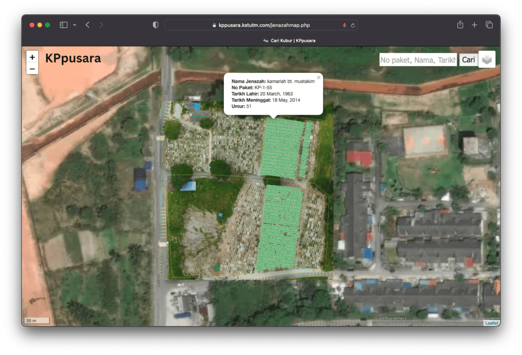
Mengatasi Masalah Pengurusan Tanah Perkuburan melalui Inovasi Teknologi
Oleh Shahabuddin Amerudin Dalam dunia yang semakin berkembang dan penuh dengan kemajuan teknologi, pengurusan tanah perkuburan menghadapi pelbagai cabaran yang semakin rumit. Masyarakat yang berkemban... Read More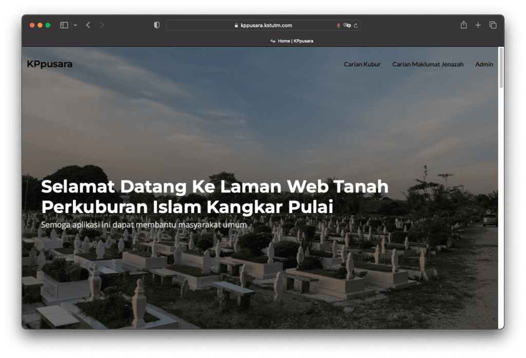
Laman Web Tanah Perkuburan Islam Kangkar Pulai
Dalam era teknologi yang semakin canggih, pengalaman interaktif memainkan peranan penting dalam mengubah perkara biasa menjadi sesuatu yang luar biasa. Itulah yang cuba dicapai oleh Laman Web Tanah Pe... Read More
Unveiling the Power of Geospatial Artificial Intelligence (GeoAI) and its Applications
By Shahabuddin Amerudin Introduction The term Geospatial Artificial Intelligence (GeoAI) lacks a universally agreed-upon definition. Initially, GeoAI referred to the utilisation of machine learning to... Read More
Simplifying Automated Building Footprint Extraction with Deep Learning in GIS
By Shahabuddin Amerudin Abstract This paper delves into the realm of geospatial data processing, highlighting the amalgamation of Python scripting and advanced deep learning techniques for object dete... Read More
Beyond Horizons: Mapping the Future with AR, VR, and Boundless Innovation – Part 2
By Shahabuddin Amerudin In the bustling heart of Nusantara, GeoSmart Solutions had transformed into an innovation powerhouse. Ahmad, the visionary System Analyst, was leading a team that had not only ... Read More
Geoscape Greens: A Journey of Innovation and Sustainability – Part 1
By Shahabuddin Amerudin In the vibrant city of Nusantara, nestled between towering skyscrapers and bustling streets, stood the headquarters of GeoSmart Solutions, a leading GIS firm. Among its talente... Read More
Cabaran Sikap Pelajar Universiti Terhadap Kemerosotan Pencapaian Akademik di Era Digital
Oleh Shahabuddin Amerudin Dalam era digital yang penuh dengan kemudahan dan akses kepada maklumat, sikap pelajar universiti terhadap pencapaian akademik telah menunjukkan corak yang mencabar. Walaupun... Read More
Developing Web Map-Based Applications
By Shahabuddin Amerudin Introduction Web map-based applications have transformed how we interact with geographic information, enabling us to explore, analyze, and visualize data on interactive maps. T... Read More
Enhancing Smartphone GNSS Accuracy with External Receivers
By Shahabuddin Amerudin In an era driven by digital navigation and geospatial accuracy, the fusion of smartphones and external GNSS receivers has revolutionized positioning capabilities. With the prol... Read More
Unleashing Sub-Meter Accuracy with L1 and L5 GNSS Frequencies
By Shahabuddin Amerudin Introduction In the realm of modern navigation and geospatial technology, achieving unparalleled accuracy has become a driving force. As industries and individuals seek to unlo... Read More
Pioneering High-Accuracy GNSS Positioning with Low-Cost Receivers and Smartphones
By Shahabuddin Amerudin Introduction In the dynamic landscape of navigation and positioning technology, a remarkable breakthrough has emerged: the accessibility of high-accuracy GNSS positioning throu... Read More
