
Category: Knowledge

Teknologi AI dan Pembelajaran Mesin untuk Memantau dan Menyaring Kandungan Internet
Dalam era digital yang semakin maju, isu penyebaran kandungan haram seperti pornografi, perjudian, dan ekstremisme melalui laman sesawang menjadi cabaran besar kepada kerajaan dan pihak berkuasa. Lang... Read More
Isu dan Cabaran dalam Sistem Alamat Nasional Malaysia
Oleh Shahabuddin Amerudin AbstrakSistem Alamat Nasional di Malaysia menghadapi beberapa isu dan cabaran yang boleh menjejaskan keberkesanannya. Artikel ini membincangkan masalah utama dalam sistem ala... Read More
Pembangunan Sistem Alamat Nasional di Malaysia
Oleh Shahabuddin Amerudin Abstrak Sistem alamat yang tersusun dan bersepadu merupakan komponen penting dalam perancangan bandar, pengurusan infrastruktur, dan pembangunan ekonomi sesebuah negara. Art... Read More
A Critical Analysis of Geospatial Intelligence in an Uncertain World
By Shahabuddin Amerudin The article titled “GEOINT in an Uncertain World Order” by Itay Bar-Lev, published in Geospatial World (April-June 2024), offers an expansive ov... Read More
Perkembangan dan Cabaran Terkini dalam Perlaksanaan Sistem Maklumat Geografi (GIS) di Malaysia: Satu Analisis dari 2015 hingga 2024
Oleh Shahabuddin Amerudin Pengenalan Sistem Maklumat Geografi (GIS) merupakan teknologi yang semakin penting dalam pelbagai sektor, termasuk perancangan bandar, pengurusan sumber alam, dan kesihatan a... Read More
Peranan dan Tanggungjawab Pusat Geospatial Negara Terhadap Kualiti dan Ketepatan Data Geospatial
Oleh Shahabuddin Amerudin Pusat Geospatial Negara (PGN) bertanggungjawab untuk memastikan data geospatial yang dikumpul dan disebarkan oleh agensi-agensi kerajaan serta swasta di Malaysia mencapai tah... Read More
The Evolution of Geographic Information Systems (GIS) and the Integration of Extended Reality (XR)
By Shahabuddin Amerudin Abstract Geographic Information Systems (GIS) have evolved dramatically from traditional cartography to sophisticated 3D and immersive environments, culminating in the integrat... Read More
Mobile GIS Software: Advancements and Applications
By Shahabuddin Amerudin Abstract Mobile Geographic Information Systems (GIS) have fundamentally transformed the approach to spatial data collection, analysis, and visualization by leveraging the capab... Read More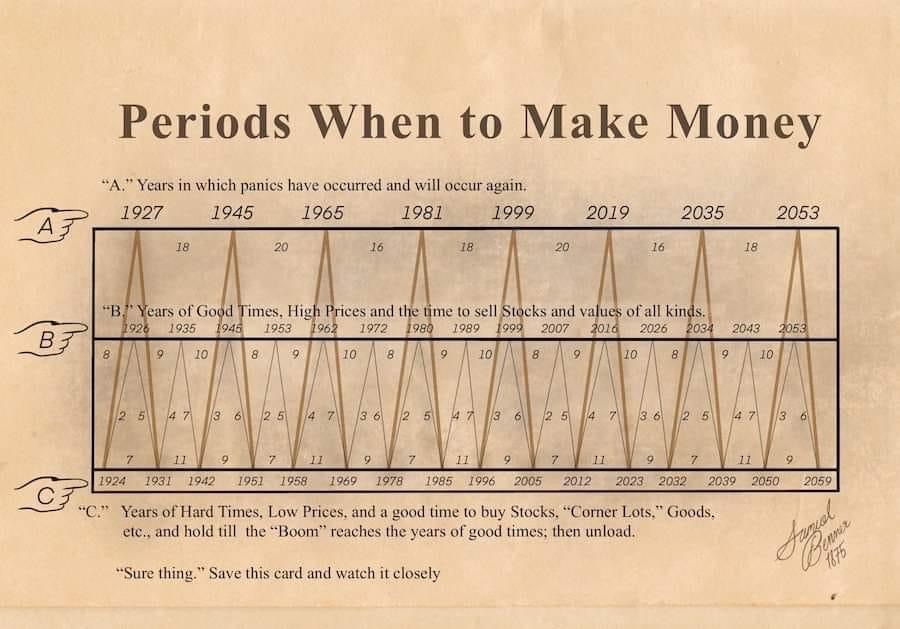
Memahami Kitaran Ekonomi dengan Benner Cycle
Benner Cycle mungkin kelihatan seperti istilah yang berkaitan dengan Profesor Bruce Banner, tetapi sebenarnya ia dicipta oleh seorang petani dan pelabur bernama Samuel T. Benner pada tahun 1875. Model... Read More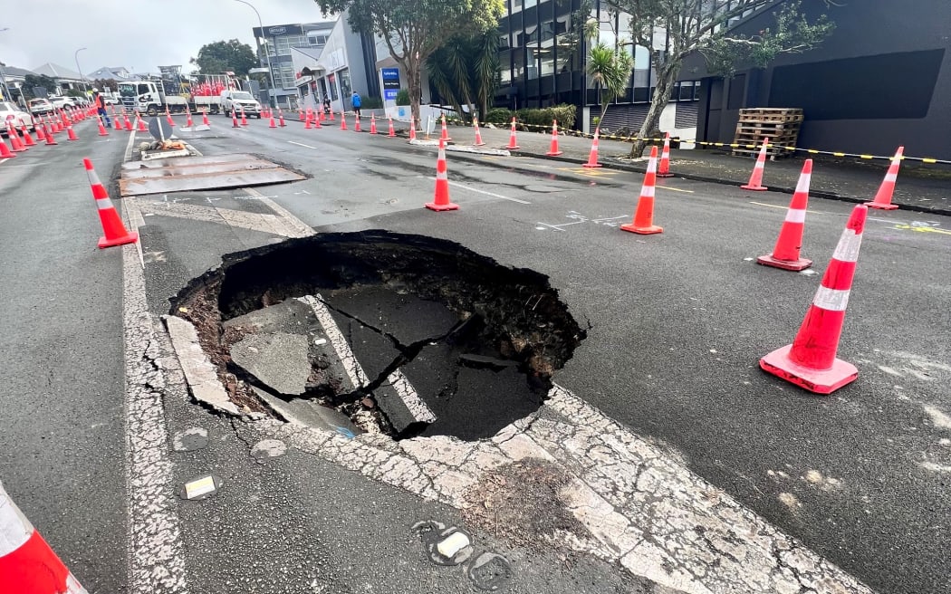
From AHP to GWR in Sinkhole Susceptibility Modeling with Advanced GIS Methods
Introduction Rosdi et al. (2017) made significant strides in understanding sinkhole susceptibility in Kuala Lumpur and Ampang Jaya by combining Geographic Information Systems (GIS) with the Analytical... Read More
Understanding Sinkhole Susceptibility in Kuala Lumpur and Ampang Jaya: A GIS and AHP-Based Approach
Introduction Sinkholes are a significant geohazard, particularly in urban areas like Kuala Lumpur and Ampang Jaya, where the increasing number of incidents has raised concerns over public safety and u... Read More
Penyesalan Terbesar Semasa Bersara
Dalam perbincangan mengenai persaraan, ramai individu cenderung memfokuskan impian mereka untuk bersara awal. Namun, terdapat aspek lain yang sering diabaikan, iaitu penyesalan yang mungkin timbul sel... Read More
Pendidikan dan Latihan sebagai Keperluan untuk Profesionalisme dalam Bidang GIS
Pindaan Rang Undang-Undang Juruukur Tanah Berlesen (Pindaan) 2024 membawa perubahan besar dalam pendidikan dan latihan dalam bidang Sistem Maklumat Geografi (GIS). Pindaan ini memperkenalkan keperluan... Read More
Kesan Pindaan Rang Undang-Undang Juruukur Tanah Berlesen (Pindaan) 2024 kepada Individu dan Organisasi Berkaitan GIS dan Geospatial
Pindaan Rang Undang-Undang Juruukur Tanah Berlesen (Pindaan) 2024 membawa beberapa perubahan penting yang tidak hanya mempengaruhi juruukur tanah berlesen, tetapi juga memberi kesan signifikan kepada ... Read More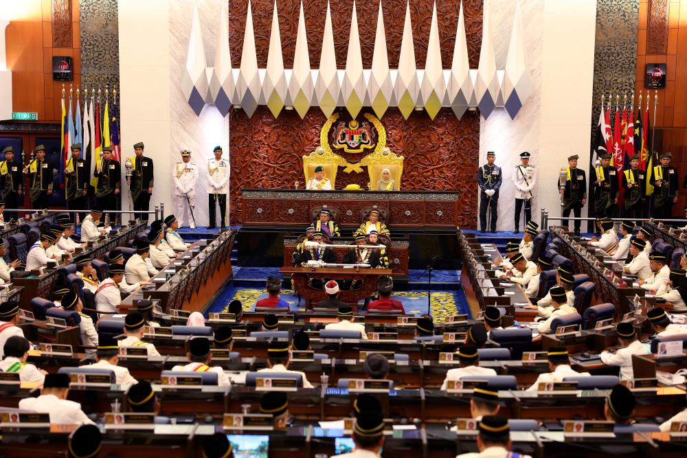
Sesi Perbahasan Rang Undang-Undang Juruukur Tanah Berlesen (Pindaan) 2024
Pengenalan Di parlimen, lima orang pembahas utama dalam perbahasan pindaan Rang Undang-undang Juruukur Tanah Berlesen (Pindaan) 2024 telah membangkitkan isu-isu penting yang berkaitan dengan pindaan t... Read More
Rang Undang-Undang Juruukur Tanah Berlesen (Pindaan) 2024: Ringkasan dan Analisis
Ringkasan RUU Juruukur Tanah Berlesen (Pindaan) 2024 Pindaan Akta ini mencerminkan usaha kerajaan untuk memastikan bidang ukur geomatik di Malaysia berkembang selari dengan perubahan teknologi dan men... Read More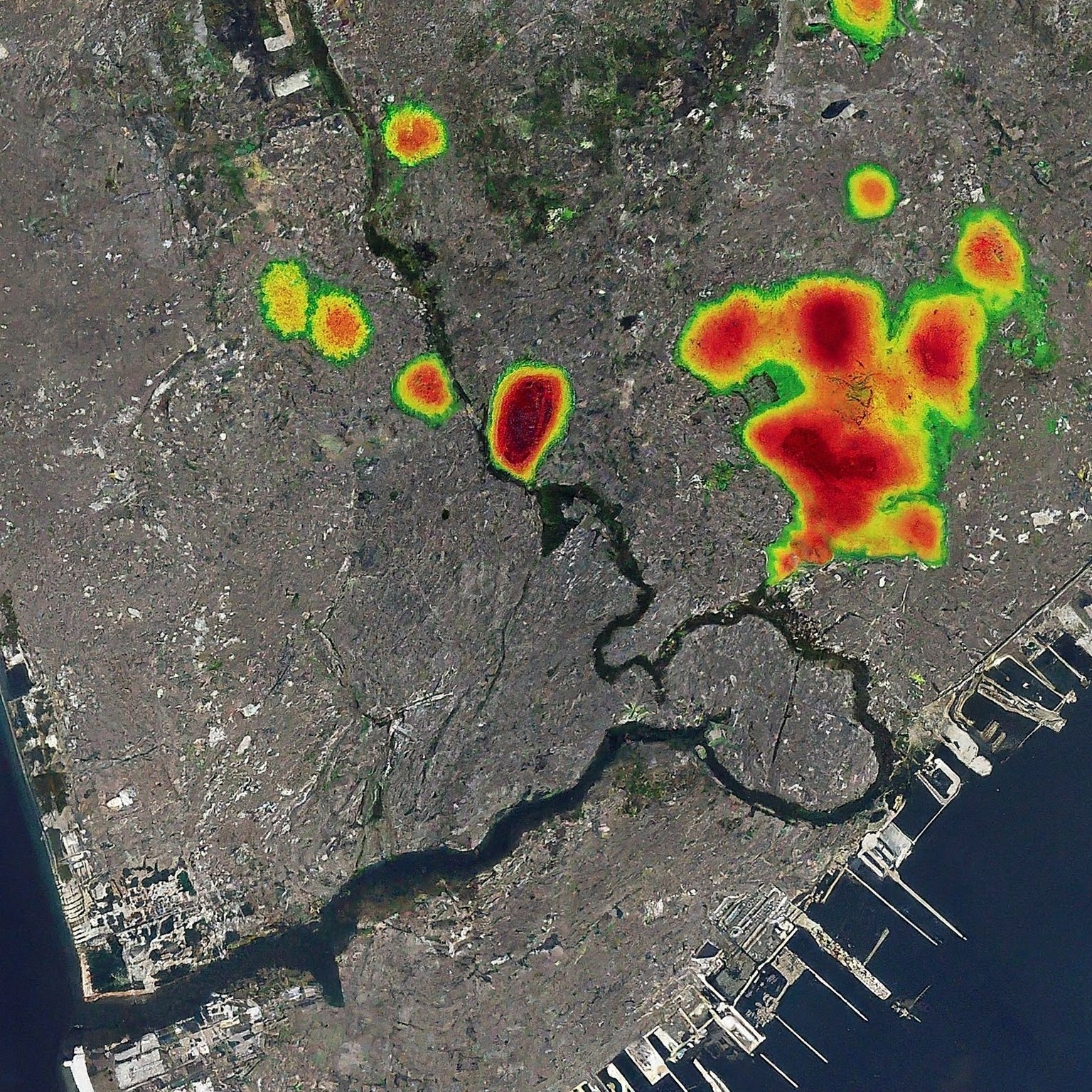
Advancing Urban Planning with GeoAI through Global Street Network Analysis
By Shahabuddin Amerudin Introduction Geographic Artificial Intelligence (GeoAI) integrates Geographic Information Systems (GIS) with artificial intelligence (AI), offering advanced capabilities for ur... Read More
Leveraging GIS for Enhanced Urban Planning Insights from Global Street Networks
By Shahabuddin Amerudin Introduction Geographic Information Systems (GIS) have become indispensable tools in urban planning, offering the capability to analyze spatial data and derive actionable insig... Read More
